Safety Score: 2,7 of 5.0 based on data from 9 authorites. Meaning we advice caution when travelling to United States.
Travel warnings are updated daily. Source: Travel Warning United States. Last Update: 2024-08-13 08:21:03
Delve into Donner
Donner in Placer County (California) is located in United States about 2,299 mi (or 3,699 km) west of Washington DC, the country's capital town.
Current time in Donner is now 01:25 PM (Thursday). The local timezone is named America / Los Angeles with an UTC offset of -8 hours. We know of 11 airports close to Donner, of which 5 are larger airports. The closest airport in United States is Reno Tahoe International Airport in a distance of 33 mi (or 53 km), North-East. Besides the airports, there are other travel options available (check left side).
Also, if you like playing golf, there are some options within driving distance. If you need a hotel, we compiled a list of available hotels close to the map centre further down the page.
While being here, you might want to pay a visit to some of the following locations: Downieville, Reno, Carson City, Minden and Virginia City. To further explore this place, just scroll down and browse the available info.
Local weather forecast
Todays Local Weather Conditions & Forecast: 2°C / 36 °F
| Morning Temperature | 2°C / 36 °F |
| Evening Temperature | 3°C / 37 °F |
| Night Temperature | 3°C / 37 °F |
| Chance of rainfall | 15% |
| Air Humidity | 102% |
| Air Pressure | 1021 hPa |
| Wind Speed | Moderate breeze with 9 km/h (6 mph) from North-East |
| Cloud Conditions | Overcast clouds, covering 100% of sky |
| General Conditions | Rain and snow |
Thursday, 21st of November 2024
2°C (36 °F)
2°C (36 °F)
Rain and snow, moderate breeze, overcast clouds.
Friday, 22nd of November 2024
-0°C (31 °F)
-7°C (20 °F)
Heavy snow, gentle breeze, overcast clouds.
Saturday, 23rd of November 2024
-1°C (30 °F)
-0°C (31 °F)
Snow, light breeze, overcast clouds.
Hotels and Places to Stay
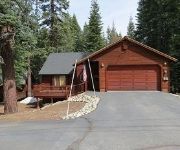
Thomas by RedAwning
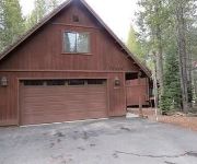
Wilson by RedAwning
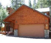
Gurnari by Red Awning
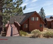
Pinnacle View by RedAwning
Donner Lake Village
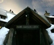
CLAIR TAPPAAN LODGE
Videos from this area
These are videos related to the place based on their proximity to this place.
V4: 2013 CYA Snow Trip
Snow trip with the College and Young Adults (CYA) from Sunset Church I'm a noob. Thanks for coming all.
UP 844 Departing From East Norden at Donner Pass
Heading into "The Big Hole" tunnel 41 through Donner Pass today. Amtrak #6 passed 844 here and then 844 followed them into Truckee.
Tahoe ski resorts are opening
Visit http://ski.travelnevada.com/ for all the best information on ski deals and conditions. Boreal is the first Lake Tahoe ski resort to open in 2008, but more are right behind.
Rock Me Baby played by Spotted Dog
"Rock Me Baby" played by Spotted Dog at Sugar Bowl in Norden CA on 3/27/10. Visit www.spotteddogmusic.com for more!
Donner Pass Snow Sheds 4 wheeling through the abandoned sheds
See link at bottom. Video shot going from the East end of the old Union Pacific snow sheds that crossed Donner Summit. This route was replaced by a tunnel called "The Big Hole" that eliminated...
Donner Ski Ranch Diamond Peak Resort Weekend Early Feb
http://www.facebook.com/12BillionYearProductions http://twitter.com/#!/twelveby Wes Ambrose DJ Howard Kevin Manchild Sinnott Izzy diamond peak park jumps boxes c-box wall ride Backcountry...
GoPro HD Sugar Bowl Part 1
Less than 24 hours after landing at San Francisco (from Tokyo), I'm snowboarding again! This time at Sugar Bowl Ski Resort, where there's an extraordinary amount of fresh powder snow! I brought...
Fun on Donner Pass
This was just PART of a truly awesome day. Check out the whole thing!!! http://www.youtube.com/watch?v=hqCB7sIWu8Q.
Videos provided by Youtube are under the copyright of their owners.
Attractions and noteworthy things
Distances are based on the centre of the city/town and sightseeing location. This list contains brief abstracts about monuments, holiday activities, national parcs, museums, organisations and more from the area as well as interesting facts about the region itself. Where available, you'll find the corresponding homepage. Otherwise the related wikipedia article.
Mount Lincoln
Sugar Bowl Ski Resort
Sugar Bowl is a ski and snowboard area in northern Placer County near Norden, California along the Donner Pass of the Sierra Nevada, approximately 46 mi west of Reno, Nevada on Interstate 80, that opened on December 15, 1939. Sugar Bowl is a medium sized ski area in the Lake Tahoe region, and is well known for its long history, significant advanced terrain, high annual snowfall and being one of the closest ski areas to the San Francisco Bay Area.
Boreal Mountain Resort
Boreal Mountain Resort is a ski area in Soda Springs, near the Lake Tahoe area of California. It has nine chair lifts and offers night skiing until 9 pm. It is owned by Powdr Corporation. Located on Highway 80, West of Truckee, California, Boreal typically is the first area to open for skiing and snowboarding in Northern California. Although it is relatively small compared to other Tahoe area resorts, Boreal hosted the US Snowboarding Grand Prix in 2009.
American River
The American River (Río de los Americanos during the Mexican-ruled period before 1846) is a California watercourse river system which runs from the crest of the Sierra Nevada mountain range to its confluence with the Sacramento River in Sacramento, California. The Sacramento River continues to eventually empty into the San Francisco Bay and the Pacific Ocean at San Francisco, California. The American River flows entirely within California.


