Safety Score: 2,7 of 5.0 based on data from 9 authorites. Meaning we advice caution when travelling to United States.
Travel warnings are updated daily. Source: Travel Warning United States. Last Update: 2024-08-13 08:21:03
Explore Gardners Trailer Park
The district Gardners Trailer Park of Santa Ana in Orange County (California) is located in United States about 2,283 mi west of Washington DC, the country's capital.
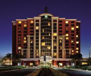
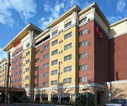
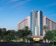
If you need a place to sleep, we compiled a list of available hotels close to the map centre further down the page.
Depending on your travel schedule, you might want to pay a visit to some of the following locations: Orange, Los Angeles, Riverside, San Bernardino and San Diego. To further explore this place, just scroll down and browse the available info.
Local weather forecast
Todays Local Weather Conditions & Forecast: 17°C / 62 °F
| Morning Temperature | 13°C / 55 °F |
| Evening Temperature | 16°C / 60 °F |
| Night Temperature | 14°C / 57 °F |
| Chance of rainfall | 0% |
| Air Humidity | 51% |
| Air Pressure | 1016 hPa |
| Wind Speed | Light breeze with 5 km/h (3 mph) from North-East |
| Cloud Conditions | Clear sky, covering 0% of sky |
| General Conditions | Sky is clear |
Tuesday, 19th of November 2024
17°C (63 °F)
15°C (59 °F)
Broken clouds, gentle breeze.
Wednesday, 20th of November 2024
18°C (65 °F)
16°C (61 °F)
Few clouds, light breeze.
Thursday, 21st of November 2024
20°C (67 °F)
16°C (61 °F)
Broken clouds, light breeze.
Hotels and Places to Stay
Embassy Suites by Hilton Anaheim South
Sheraton Garden Grove - Anaheim South Hotel
Anaheim Marriott Suites
WYNDHAM ANAHEIM GARDEN GROVE
DoubleTree by Hilton Anaheim - Orange County
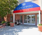
Candlewood Suites GARDEN GROVE/ANAHEIM AREA
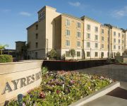
AYRES HOTEL ORANGE
Hampton Inn - Suites Anaheim-Garden Grove
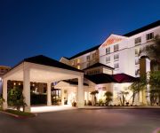
Hilton Garden Inn Anaheim-Garden Grove
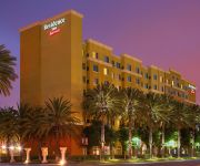
Residence Inn Anaheim Resort Area/Garden Grove
Videos from this area
These are videos related to the place based on their proximity to this place.
Police Brutality in Santa Ana, California
Police Brutality in Santa Ana, California June 19-20, 2014 No Audio.
Santa Ana High School Ghost? - SAHS [B08-CAM06]
Santa Ana High School [B08-CAM06]--3:26--[10222014] Security Cam. SAHS Hallway Ghost? ---- ---------- BromidicFilms.
Santa Ana City Council Meeting - Public Comment - Police Officer Weston Hadley - December 16, 2014
In this installment, Santa Ana Police Officer Weston Hadley speaks on a recent event where two local activists were arrested at a police checkpoint. The activists arrested were instrumental...
Santa Ana Jail Inmate Locator |Inmate Search for Santa Ana Jail
Santa Ana inmate locator information http://www.badboysbailbonds.com/ can be hard to find. Please use the Bad Boys Bail Bonds inmate search to find out what jail a person has been brought...
Smokescreen: Drinks, Dinner, and Dessert at Santa Ana's North Left
Watch drinks, dinner, and dessert prepared at Orange County restaurant North Left. Dinner: Smoked Rib-Eye Tartare Dessert: Apple Bottom Jeans Boots with the Fur.
Santa Ana River Trail - 17th Street to The Pacific Ocean
Santa Ana River Trail - 17th Street to The Pacific Ocean.
Santa Ana High 2015 NJROTC Unarmed Drill Team SAHS
Santa Ana High Pep Rally 2015 NJROTC Unarmed Drill Team Only Like Our FaceBook page:- - - http://tiny.cc/sahsvids SAHS NJROTC NJROTC - Navy Junior Reserve Officers Training Corps Unarmed ...
Santa Ana Car Accident Lawyer - (714) 549-5400 Free Consultation
Call (714) 549 5400 for a free consultation with an experienced Santa Ana Car Accident Lawyer regarding your accident. 30+ years experience. No fees unless we win your case.
714-979-2070. Santa Ana R22 air conditioner repair R-22 freon Santa Ana
http://klondikeair.com. Santa Ana Air conditioner repair for R-22 freon ac units. Klondike Heating and Cooling has the R-22 freon air conditioner units you need. Full inventory from 1.5 Tons...
Videos provided by Youtube are under the copyright of their owners.
Attractions and noteworthy things
Distances are based on the centre of the city/town and sightseeing location. This list contains brief abstracts about monuments, holiday activities, national parcs, museums, organisations and more from the area as well as interesting facts about the region itself. Where available, you'll find the corresponding homepage. Otherwise the related wikipedia article.
Santa Ana, California
Santa Ana /ˌsæntə ˈænə/ is the county seat and second most populous city in Orange County, California. With a population of 329,427, as of the 2011 census, Santa Ana is the 57th most-populous city in the United States. Founded in 1869, Santa Ana is located in Southern California adjacent to the Santa Ana River, 10 miles away from the California coast. The city is part of the Greater Los Angeles Area which, according to the U.S. Census Bureau, is the second largest metropolitan area in the U.S.
Crystal Cathedral
The Crystal Cathedral is a church building in Garden Grove, Orange County, California, in the United States. The reflective glass building, designed by American architect Philip Johnson, was completed in 1981 and seats 2,736 people. The church is known for one of the largest musical instruments in the world, the Hazel Wright Memorial organ.
The Outlets at Orange
The Outlets at Orange (formerly known as The Block at Orange from 1998 to 2011) is Orange County, California's only Outlet Shopping Center. It is an open-air shopping mall developed by The Mills Corporation and now owned jointly by The Mills, A Simon Company, and KanAm, in Orange, California, a few miles southeast of Disneyland near the heart of the Orange Crush interchange. It was built on the former site of the City Mall.
Mater Dei High School (Santa Ana, California)
Mater Dei High School is a private, Catholic, co-educational secondary school in Santa Ana, California. It is located in the Roman Catholic Diocese of Orange. With an enrollment of 2,100 students (Fall 2010) Mater Dei High School is one of the largest Catholic high schools in the United States. Mater Dei High School is known for its highly successful athletic programs, especially boys basketball, football and water polo.
Santa Ana College
Santa Ana College is a community college located in Santa Ana, California, USA.
Orange Crush interchange
The Orange Crush Interchange is a freeway interchange in the city of Orange, California, near the confluence of the cities of Orange, Santa Ana, Anaheim, and Garden Grove. The Disneyland Resort, The Outlets at Orange, St. Joseph Hospital, Children's Hospital of Orange County, the UCI Medical Center, Westfield MainPlace, Angel Stadium of Anaheim, Honda Center, and the Platinum Triangle are all located at or near the interchange.
Orange County School of the Arts
Orange County School of the Arts (OCSA), colloquially called "OH-sha", is a 7th–12th grade public charter school located in downtown Santa Ana, Orange County, California. The school caters to middle and high school students with talents in the performing, visual and literary arts. The educational program prepares students for higher education institutions or employment in the professional arts industry.
Bowers Museum
The Bowers Museum is located in Santa Ana, California, in Orange County. The museum offers exhibitions, lectures, art classes, travel programs, children's art and music education programs, and other community events. The museum's guiding philosophy is to help people learn about other cultures through their arts, and offer a greater understanding of ourselves and appreciation of the world in which we live.
UC Irvine Medical Center
The University of California, Irvine Medical Center (or UCI Medical Center) is a major research hospital located in the City of Orange. It is Orange County's central public hospital and the teaching center for the University of California, Irvine School of Medicine.
California Coast University
California Coast University (CCU) is a non-profit, private university, based in Santa Ana, California. It was established in 1973 and has national accreditation from the Distance Education and Training Council (DETC). The primary method of learning is directed independent study through their distance learning curriculum. Research, study, and testing are accomplished off-campus and traditional classroom attendance is not offered. Approximately 8,000 students are enrolled at any given time.
KEBN
KEBN 94.3 FM, Garden Grove, California, KBUE 105.5 FM, Long Beach, California and KBUA 94.3 FM, San Fernando, California are a trimulcast comprising Que Buena 105.5/94.3 FM, a Spanish language regional Mexican music station owned by Liberman Broadcasting. Main article: KBUE
Coastline Community College
Coastline Community College is a community college with three mini-campuses and an administration building in Fountain Valley, California, United States. The college offers Associate in Arts degrees, Associate in Science degrees, courses to prepare students to transfer to a 4-year college or university, and career and technical courses that can lead to career advancement and/or an occupational certificate. The college was founded in 1976, and is part of the Coast Community College District.
Middle College High School (Santa Ana)
Middle College High School @ Santa Ana College (Commonly referred to as Middle College or MCHS) is located on the campus of Santa Ana College, in Santa Ana, California. This school has about 300 students, with an average of 80 pupils in each grade level and 15-28 students per class. It includes grade levels ninth through twelve, and the school's mascot is the wizard. The school's colors are Purple and Silver
Discovery Science Center
The Discovery Science Center, formerly known as the Taco Bell Discovery Science Center, is a science museum in Santa Ana, California, with more than 100 hands-on science exhibits designed to spark children's natural curiosity. It has become a visual landmark due to its ten-story solar array cube that stands over Interstate 5.
KVNR
KVNR is a Vietnamese-language AM radio station broadcasting at a frequency of 1480 in Orange and Los Angeles counties in California. Owned by Liberman Broadcasting, it broadcasts Little Saigon Radio, which is also broadcast to the San Jose and Houston areas. The station was previously known as KWIZ, Santa Ana, with an adult contemporary format. The format includes various shows that serve the largest Vietnamese population in the United States.
California's 47th congressional district
California's 47th congressional district is a congressional district in the U.S. state of California. The district is centered in Long Beach and extends into the western Orange County cities of Garden Grove, Los Alamitos and Cypress. The 47th District encompasses conservative cities in Orange County, but its larger, more liberal Long Beach population causes this district to tilt Democratic overall. The district is represented by Democrat Alan Lowenthal.
KALI-FM
KALI-FM is a Vietnamese language radio station licensed by the Federal Communications Commission (FCC) to serve the community of Santa Ana, California, USA. KALI airs musical and entertainment shows. In addition to Vietnamese language programming, the station broadcasts a Japanese talk show during weekday mornings. 106.3 first came on the air in the early 1960s as KYMS FM (easy listening format) with studios in the Saddleback Inn, Santa Ana.
Ronald Reagan Federal Building and Courthouse (Santa Ana)
The Ronald Reagan Federal Building and Courthouse at 411 West Fourth Street in Santa Ana, California is an eleven-story courts courthouse facility on 3.94 acres that includes courtrooms, judges chambers, offices and courtroom galleries of the United States District Court for the Central District of California. Renamed for former President and California Governor Ronald Reagan in 1992, the building is owned by the General Services Administration and is 176 ft tall.
Segerstrom Fundamental High School
Segerstrom High School is a public high school in Santa Ana, California, and is part of the Santa Ana Unified School District (SAUSD). The school opened in fall of 2005 with a freshman and sophomore class. Wealthy landowner Henry Segerstrom - for whom Segerstrom High School is named - is a familiar name in Orange County. The land upon which Segerstrom High School is built was purchased from the Segerstrom family, who once grew crops on these acres.
Santa Ana Regional Transportation Center
Santa Ana Regional Transportation Center (its official name) is a passenger rail station and transportation center in Santa Ana, California. It is used by Amtrak's Pacific Surfliner and Metrolink's Orange County Line and Inland Empire-Orange County Line trains. It is also a Greyhound station and a hub for the Orange County Transportation Authority bus system as well as a terminal for several Mexican bus tour companies.
Santa Ana High School
Santa Ana High School is the oldest and largest high school in Orange County, California, United States. The school was established in 1889.
Valley High School (Santa Ana)
Valley High School, more commonly referred to Santa Ana Valley High School is located at 1801 S. Greenville St. in Santa Ana, CA 92704. Valley High was built in 1959 and recently celebrated its 50th year anniversary in 2009.
Chávez High School (Santa Ana, California)
Cesar E. Chavez High School opened its doors to the students of Delano in 2003 and serves 1,650 students in grades nine through twelve. Located at the southern part of the Central San Joaquin Valley, Delano is an agricultural community which straddles the southern end of Tulare County and northern Kern County. Cesar E. Chavez High School serves students residing in Delano as well as the surrounding rural communities and/or districts.
Rancho Santiago de Santa Ana
Rancho Santiago de Santa Ana was a 63,414-acre Spanish land concession in present day Orange County, California given by Governor José Joaquín de Arrillaga in 1810 to Jose Antonio Yorba and his nephew Pablo Peralta. The grant extended eastward from the Santa Ana River to the Santa Ana Mountains, with a length of more than 22 miles.
Crystal Cathedral Ministries
Crystal Cathedral Ministries is a congregation of the Reformed Church in America in Garden Grove, California, United States, which is named for its church building, the Crystal Cathedral. The church was founded by Robert H. Schuller in 1955 as the Garden Grove Community Church, and changed its name to its present name when it moved into the Crystal Cathedral building in 1981. On October 18, 2010, the board of Crystal Cathedral Ministries filed for bankruptcy in Santa Ana, California.






!['Santa Ana High School Ghost? - SAHS [B08-CAM06]' preview picture of video 'Santa Ana High School Ghost? - SAHS [B08-CAM06]'](https://img.youtube.com/vi/4mRJ8qzfiEk/mqdefault.jpg)


