Safety Score: 2,7 of 5.0 based on data from 9 authorites. Meaning we advice caution when travelling to United States.
Travel warnings are updated daily. Source: Travel Warning United States. Last Update: 2024-08-13 08:21:03
Delve into Villa San Juan Mobile Home Park
The district Villa San Juan Mobile Home Park of Dana Point in Orange County (California) is a subburb in United States about 2,278 mi west of Washington DC, the country's capital town.
If you need a hotel, we compiled a list of available hotels close to the map centre further down the page.
While being here, you might want to pay a visit to some of the following locations: Santa Ana, Orange, Riverside, San Bernardino and Los Angeles. To further explore this place, just scroll down and browse the available info.
Local weather forecast
Todays Local Weather Conditions & Forecast: 17°C / 63 °F
| Morning Temperature | 14°C / 57 °F |
| Evening Temperature | 15°C / 59 °F |
| Night Temperature | 14°C / 58 °F |
| Chance of rainfall | 0% |
| Air Humidity | 49% |
| Air Pressure | 1018 hPa |
| Wind Speed | Gentle Breeze with 6 km/h (4 mph) from East |
| Cloud Conditions | Overcast clouds, covering 88% of sky |
| General Conditions | Overcast clouds |
Saturday, 23rd of November 2024
16°C (61 °F)
15°C (60 °F)
Light rain, light breeze, scattered clouds.
Sunday, 24th of November 2024
15°C (60 °F)
15°C (59 °F)
Broken clouds, light breeze.
Monday, 25th of November 2024
16°C (60 °F)
16°C (60 °F)
Moderate rain, moderate breeze, overcast clouds.
Hotels and Places to Stay
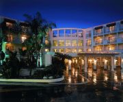
The Ritz-Carlton Laguna Niguel
Always Inn San Clemente Bed & Breakfast
DoubleTree Suites by Hilton Doheny Beach - Dana Point
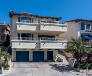
North Beach E by RedAwning
North Beach Ocean Views by RedAwning
Laguna Cliffs Marriott Resort & Spa
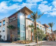
Hampton Inn - Suites Mission Viejo CA
Oceanfront Oceana Penthouse
Holiday Inn Express SAN CLEMENTE N – BEACH AREA
BEST WESTERN PLUS CASABLANCA
Videos from this area
These are videos related to the place based on their proximity to this place.
Tubin' the Salt - Dana Point
Float tubing Dana Point Harbor for Halibut. http://floattubeforum.do-talk.com.
Ultimate Whale Watching in Dana Point, Southern California
Breathtaking. There's simply no other word to describe Earth's largest creatures as they frolic in the wild, and no other location in Southern California — or the world — offers the diversity...
California Wedding Video - St.Regis Dana Point
Beautiful cinematic wedding video at the St. Regis Hotel in Dana Point California. www.brightskyweddings.com.
Dana Point Jet Ski and Kayak Center
Dana Point Jet Ski and Kayak Center proudly offers Rentals, Sales and Service for: Jet Skis, Kayaks, Stand Up Paddle Boards and Surfboard, Rentals, Sales and Service.
Waxing San Juan Capistrano Ca 949-226-9829 Waxing Laguna Niguel Ca
http://www.ocsugaring.com/ Waxing San Juan Capistrano Ca 949-226-9829 Hair removal has never been easier with OC Sugaring call now for an appointment 949-226-9839. Sugaring is a better way...
2012 NV 2500 San Juan Capistrano CA
Click here for price : http://WeselohNissanKIA.vshoc.com/b7qna3?vin=1N6AF0KY9CN110233 We have been honored to serve the San Juan Capistrano CA area , we promise that your experience at...
APEX Chiropractic & SCI Wellness Center - Short | San Juan Capistrano, CA
http://apexchirowellness.com/ - Call us today at (949) 488-0016. At APEX Chiropractic & SCI Wellness Center, we specialize in chiropractic, corrective exercises, and massage therapy. In addition...
New 2014 Honda Accord Sport in San Juan Capistrano, CA 33.4760284424 -117.675559998
Dealer Serving San Juan Capistrano and Orange County, CA | Bad Credit Bankruptcy Auto Loan Get Pre-Approved Here: http://www.oceanhondasjc.com/financing/application-short.htm Ocean Honda...
Get More For Your Trade - Ocean Nissan San Juan Capistrano | Bad Credit Bankruptcy Auto Loans
Dealer Serving Irvine CA and Los Angeles | Bad Credit Bankruptcy Auto Loan Get Pre-Approved Here: http://www.oceannissan.com/car-loans-san-juan-capistrano-ca Ocean Nissan of San Juan ...
Videos provided by Youtube are under the copyright of their owners.
Attractions and noteworthy things
Distances are based on the centre of the city/town and sightseeing location. This list contains brief abstracts about monuments, holiday activities, national parcs, museums, organisations and more from the area as well as interesting facts about the region itself. Where available, you'll find the corresponding homepage. Otherwise the related wikipedia article.
Mission San Juan Capistrano
Mission San Juan Capistrano was a Spanish mission in Southern California, located in present-day San Juan Capistrano. It was founded on All Saints' Day November 1, 1776, by Spanish Catholics of the Franciscan Order. Named for Giovanni da Capistrano, a 15th century theologian and "warrior priest" who resided in the Abruzzo region of Italy, San Juan Capistrano has the distinction of being home to the oldest building in California still in use, a chapel built in 1782.
Laguna Niguel, California
Laguna Niguel is an affluent, master planned community located in the coastal San Joaquin Hills of southern Orange County, California. The name Laguna Niguel is derived from the words "Laguna"... Spanish for "lagoon", and "Nigueli"... the name of a Juaneño Indian village once located near Aliso Creek. The population increased from 61,891 based on the year 2000 census, to 62,979 in 2010.
San Clemente, California
San Clemente is a city in Orange County, California. The population was 63,522 at the 2010 census. Located on the California Coast, midway between Los Angeles and San Diego at the southern tip of the county, it is known for its ocean, hill, and mountain views, a pleasant climate and its Spanish Colonial style architecture. San Clemente's city slogan is "Spanish Village by the Sea". The official City flower is the Bougainvillea and the official City tree is the Coral tree.
San Juan Capistrano, California
San Juan Capistrano is a city in southern Orange County, California, located approximately 23 miles southeast of Downtown Santa Ana. The current OMB metropolitan designation for San Juan Capistrano and the Orange County Area is “Santa Ana-Anaheim-Irvine, CA. ” The population was 34,593 at the 2010 census, up from 33,826 at the 2000 census. The city was created around Mission San Juan Capistrano, and many of the homes and strip malls resemble the Spanish architecture that compose the building.
USS Moray (SS-300)
USS Moray (SS-300), a Balao-class submarine, was a ship of the United States Navy named for the moray, a family of large eels found in crevices of coral reefs in tropical and subtropical oceans. Moray (SS-300) was laid down 21 April 1943 at Cramp Shipbuilding Co. , Philadelphia, Pennsylvania; launched 14 May 1944; sponsored by Mrs. Styles Bridges, wife of the New Hampshire Senator; and commissioned 26 January 1945, Comdr. Frank L. Barrows in command.
Saddleback College
Saddleback College (commonly referred to as Saddleback) is a community college in Mission Viejo, California. As a part of the California Community College system, Saddleback awards associate's degrees and academic certificates in over 100 areas of study. The college was established in 1968 and is the oldest and southern-most institution governed by the South Orange County Community College District.
Las Flores Estancia
The Las Flores Estancia (also known as Las Flores Asistencia) was established in 1823 as an estancia ("station"). It was part of the Spanish missions, asistencias, and estancias system in Las Californias—Alta California. Las Flores Estancia was situated approximately halfway between Mission San Luis Rey de Francia and Mission San Juan Capistrano.
Capistrano Beach, Dana Point, California
Capistrano Beach, also known as Capo Beach, is part of the city of Dana Point in Orange County, California. It is bordered by San Clemente to the south and Laguna Beach to the north. Capistrano Beach is one of the few remaining "beach towns" in Orange County. It has avoided much of the commercialization of the surrounding areas, and remains a unique and charming place with a "small town" atmosphere. Capistrano Beach is situated along the coast on the southern end of Dana Point.
Dana Hills High School
Dana Hills High School is a high school in Dana Point, California. It is one of the oldest high schools in South Orange County, having opened in 1973. The school's enrollment of 3,000 students is drawn from the nearby communities of Laguna Niguel, Dana Point, Capistrano Beach, and San Juan Capistrano. Dana Hills now has over 155,839 square feet in permanent buildings, yet it still struggles with overcrowding.
Coastland University
Coastland University (also known as Coastland Christian Bible College and University) began holding classes in 1999. It is a non-denominational, co-educational institution located in Southern California that uses classroom space at area churches and other venues rather than a dedicated campus.
KSBR
KSBR is a non-commercial radio station in Mission Viejo, California, broadcasting to the Orange County, California, area on 88.5 FM. KSBR airs a jazz music and smooth jazz format branded as "Jazz-FM" along with news programming.
Capistrano Valley High School
Capistrano Valley High School (often called Capo Valley High School or CVHS) is a public high school at the southern border of Mission Viejo, California, USA, that is run by the Capistrano Unified School District. It is set on a hilltop overlooking the I-5 freeway corridor and Saddleback Mountain. It is located on Via Escolar, off the Avery exit of the I-5 freeway.
San Clemente Pier (train station)
San Clemente Pier is a station on Amtrak's Pacific Surfliner passenger train route and Metrolink's Orange County Line and Inland Empire-Orange County Line located in San Clemente, California, United States. It is very lightly used and only a few trains per day stop at the station. Of the 73 California stations served by Amtrak, San Clemente Pier was the 60th-busiest in FY2010, boarding or detraining an average of approximately 25 passengers daily.
T-Street
T-Street {{#invoke:Coordinates|coord}}{{#coordinates:33|24|58|N|117|37|3|W| |primary |name= }} is a beach in San Clemente, California a short distance south of the town pier. It is a favored location of the local waterpeople for surfing and bodyboarding. T-street is a break from a small reef at the end of the stairs that cross the railroad tracks. It got its name from Trafalgar Street that runs from El Camino Real nearly all the way to the water.
San Juan Capistrano Depot
The San Juan Capistrano Depot is a train station in San Juan Capistrano, California, United States served by Amtrak, the national railroad passenger system, and Metrolink, a commuter railroad.
El Adobe de Capistrano
El Adobe de Capistrano, or simply known as El Adobe, is a restaurant located in San Juan Capistrano, California. It has been operated since 1948 and is in a building composed of two historic adobes near Mission San Juan Capistrano. It is also famous for being frequented by and being a favorite of U.S. President Richard Nixon who lived in nearby San Clemente. The adobe which comprises the northern portion of the restaurant was built as the home of Miguel Yorba in 1797.
Laguna Niguel/Mission Viejo (train station)
Laguna Niguel/Mission Viejo is a station on the Inland Empire-Orange County Line and Orange County Line of the Metrolink commuter rail system around Los Angeles, California. Originally built to serve Metrolink, the station became a stop for Amtrak's Pacific Surfliner in 2007. The station now serves as a limited Amtrak stop on the Pacific Surfliner route.
San Clemente (Metrolink station)
San Clemente is a station on the Inland Empire-Orange County and Orange County Lines of the Metrolink commuter rail system around Los Angeles, California.
Sulphur Creek Reservoir
Sulphur Creek Reservoir (also called Laguna Niguel Lake) is an artificial 44-acre fishing and recreational lake in Laguna Niguel, California. It is created by the Sulphur Creek Dam, which was completed in 1966. It is located at {{#invoke:Coordinates|coord}}{{#coordinates:33|32|59|N|117|42|22|W|type:waterbody_scale:2000_region:US-CA | |name= }} and is 190 feet above sea level. It is fed from two sources, one of which is Sulphur Creek itself and the other is a storm drain.
Ocean Institute
The Ocean Institute is an ocean education organization located in Dana Point, California. Founded as the Marine Institute in 1977, it offers ocean science and maritime history programs for K-12 students and their teachers. Over 100,000 students and 8,000 teachers from Orange County and the surrounding counties participate yearly in immersion-style programs in the Institute's oceanfront labs and abroad. The Institute is open to the general public on weekends, 10 a.m. - 3 p.m.
St. Anne School (Laguna Niguel,CA)
St. Anne School is a private and Roman Catholic school located in Laguna Niguel, California. Since 1992, St. Anne School has provided its students with "first rate academics, athletics, and spiritual growth."
Course of San Juan Creek
San Juan Creek is a creek in Orange County in the U.S. state of California. It is about 29 miles long, and along with its major tributary, Trabuco Creek, drains 133 square miles near the southernmost extent of Orange County. This article describes its course.
San Clemente State Beach
San Clemente State Beach is a beach located in the south end of the city of San Clemente, California. Located halfway between Los Angeles and San Diego, it has been the most popular beach in the state of California since 1937. Significant number of visitors are attracted to this beach due to its intense winds and dramatic location. The majority of the visitors are water sport enthusiasts and those who wish to escape from inland heat and nearby metropolitan areas for the day.
Rancho Boca de la Playa
Rancho Boca de la Playa was a 6,607-acre Mexican land grant in present day Orange County, California given in 1846 by Governor Pío Pico to Emigdio Vejar. The name refers to the wetlands estuary at the 'mouth of the beach,' or 'boca de la playa' in Spanish. This is the most southerly grant in Orange County, and extended along the Pacific coast from San Juan Creek in the south of present day San Juan Capistrano south to San Clemente.
Dana Point State Marine Conservation Area
Dana Point State Marine Conservation Area (SMCA) is one of four adjoining marine protected areas off the coast of Orange County, CA, on California’s South Coast. By itself, the SMCA measures 3.45 square miles. The SMCA protects marine life by limiting the removal of marine wildlife from within its borders, including tide pools.


