Safety Score: 2,7 of 5.0 based on data from 9 authorites. Meaning we advice caution when travelling to United States.
Travel warnings are updated daily. Source: Travel Warning United States. Last Update: 2024-08-13 08:21:03
Explore You Bet
You Bet in Nevada County (California) is a city in United States about 2,330 mi (or 3,750 km) west of Washington DC, the country's capital.
Local time in You Bet is now 04:14 PM (Thursday). The local timezone is named America / Los Angeles with an UTC offset of -8 hours. We know of 11 airports in the vicinity of You Bet, of which 5 are larger airports. The closest airport in United States is Gansner Field in a distance of 51 mi (or 82 km), North. Besides the airports, there are other travel options available (check left side).
Also, if you like golfing, there are multiple options in driving distance. If you need a place to sleep, we compiled a list of available hotels close to the map centre further down the page.
Depending on your travel schedule, you might want to pay a visit to some of the following locations: Nevada City, Downieville, Auburn, Placerville and Marysville. To further explore this place, just scroll down and browse the available info.
Local weather forecast
Todays Local Weather Conditions & Forecast: 9°C / 49 °F
| Morning Temperature | 11°C / 53 °F |
| Evening Temperature | 9°C / 48 °F |
| Night Temperature | 9°C / 48 °F |
| Chance of rainfall | 74% |
| Air Humidity | 94% |
| Air Pressure | 1016 hPa |
| Wind Speed | Moderate breeze with 13 km/h (8 mph) from North-West |
| Cloud Conditions | Overcast clouds, covering 100% of sky |
| General Conditions | Heavy intensity rain |
Friday, 22nd of November 2024
8°C (46 °F)
3°C (37 °F)
Moderate rain, gentle breeze, broken clouds.
Saturday, 23rd of November 2024
4°C (40 °F)
5°C (41 °F)
Moderate rain, light breeze, overcast clouds.
Sunday, 24th of November 2024
7°C (44 °F)
7°C (44 °F)
Moderate rain, gentle breeze, overcast clouds.
Hotels and Places to Stay
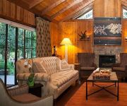
Harmony Ridge Lodge
Videos from this area
These are videos related to the place based on their proximity to this place.
Nevada City - PG&E Helicopter at The Sportsman's Club
Shortly after six this morning we were awaken by a very loud helicopter which was using the (very) nearby Sportsman's Club for a landing pad. PG&E was replacing some deep-woods power poles...
CDF Air Attack S-2 Trackers & OV-10 at Grass Valley
Cal Fire S-2 Tracker tankers 88 and 89 , and OV-10 230 returning to their base at Grass Valley.
Bear River Between Colfax and Grass Valley
Bear river bridge on hwy 174 between colfax,ca and grass valley, ca in beautiful Nevada County. The is the Bear River below Rollins Lake.
Trains at Cape Horn near Colfax, CA
Two westbound trains at Cape Horn - one on the outside track, the other through the tunnel.
Steve Jumpin' off the 'Steven's Trail'
Steve, Rob and Luna take a dip after a hike along the Steven's Trail above Colfax, CA , Aug 29, 2010. The Stevens Trail is a popular year-round hiking trail in the lower elevations of the...
North Fork American River Chamberlain Falls whitewater kayaking
Kayaking the Chamberlain Falls section of the North Fork of the American River in California at 1.85ft on the Iowa Hill gauge. Trip report available at http://www.CalKayaking.com.
Mineral bar campground (CA)
State campground Mineral bar (North Fork American River). About 5 miles from Colfax California.
Cape Horn.wmv
My first visit to the historic railroad site of Cape Horn, traveling by mountain bike from Colfax, October 18, 2009.
Corvette (C6) Makes Insane Pass on Double Yellow
Some super-hyper Vette guy can't wait to get by a dump truck. I thought everyone up here in Nevada County were "laid back." Cool car though...
UP Roseville Sub., MP 156.28, Alta with tie fire!
Caught a westbound and an eastbound train at the Alta crossing. Westbound train had plenty of brake smoke thanks to the flange greaser about 200ft before the crossing. It all started a tie...
Videos provided by Youtube are under the copyright of their owners.


