Safety Score: 2,7 of 5.0 based on data from 9 authorites. Meaning we advice caution when travelling to United States.
Travel warnings are updated daily. Source: Travel Warning United States. Last Update: 2024-08-13 08:21:03
Touring North Columbia
North Columbia in Nevada County (California) is a town located in United States about 2,332 mi (or 3,753 km) west of Washington DC, the country's capital place.
Time in North Columbia is now 04:27 PM (Thursday). The local timezone is named America / Los Angeles with an UTC offset of -8 hours. We know of 11 airports nearby North Columbia, of which 5 are larger airports. The closest airport in United States is Gansner Field in a distance of 40 mi (or 64 km), North. Besides the airports, there are other travel options available (check left side).
Also, if you like the game of golf, there are several options within driving distance. Need some hints on where to stay? We compiled a list of available hotels close to the map centre further down the page.
Being here already, you might want to pay a visit to some of the following locations: Nevada City, Downieville, Auburn, Quincy and Oroville. To further explore this place, just scroll down and browse the available info.
Local weather forecast
Todays Local Weather Conditions & Forecast: 9°C / 49 °F
| Morning Temperature | 11°C / 53 °F |
| Evening Temperature | 9°C / 48 °F |
| Night Temperature | 9°C / 48 °F |
| Chance of rainfall | 74% |
| Air Humidity | 94% |
| Air Pressure | 1016 hPa |
| Wind Speed | Moderate breeze with 13 km/h (8 mph) from North-West |
| Cloud Conditions | Overcast clouds, covering 100% of sky |
| General Conditions | Heavy intensity rain |
Friday, 22nd of November 2024
8°C (46 °F)
3°C (37 °F)
Moderate rain, gentle breeze, broken clouds.
Saturday, 23rd of November 2024
4°C (40 °F)
5°C (41 °F)
Moderate rain, light breeze, overcast clouds.
Sunday, 24th of November 2024
7°C (44 °F)
7°C (44 °F)
Moderate rain, gentle breeze, overcast clouds.
Hotels and Places to Stay
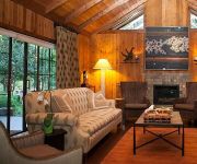
Harmony Ridge Lodge
Videos from this area
These are videos related to the place based on their proximity to this place.
Humbug Creek Waterfalls, Malakoff Diggins
Humbug Creek, which flows through Malakoff Diggins State Historic Park, has several waterfalls with unique sculpted rock from the water. This is compilation of some of the rushing water over...
Where the Pavement Ends- Dual Sport Loop Nevada City to North Bloomfield
Dual Sport loop Travelogue approx 40 miles R.T. on plated XR600- Dec 09. Temp low 40's. Canon Powershot camera.
Real Estate Virtual Tour - 15490 Lewis Rd., Nevada City, CA 95959
REALTOR: Neta Ham - 707-330-4197 RE/MAX Performance, Grass Valley, CA LISTING DETAILS: * 2260 Sq.ft., 3 Bed, 2-1/2 Bath, Built in 1980 * Spectacular Views from every room in this lovely well...
Nevada City Fire - September 7, 2014
Watching Sunday football, a low-flying CDF plane caught our attention. We stepped outside to a sky, soon to be filled with multiple planes and helicopters, fighting a vegetation fire a few...
112th Annual Independence Day Parade - Nevada City 7-4-14
The Annual Western Nevada County Independence Day Parade rolls down historic Broad street for the 112th time in a spectacular display off small town America as we celebrate the 238th birth...
Nevada City Mardi Gras Parade 2010
Ride with us in the Citroen 2cv down the 2010 Nevada City Mardi Gras Parade route and see if YOU were there.
106th Annual Nevada City 4th of July Parade 7/4/2012
Nevada City California hosts the 106th annual Independence Day Parade in 2012. A fun trip down historic Broad Street featuring a cast of hundreds of Nevada County residents and organizations....
Our Thai lunch in Nevada City, CA
This video was uploaded from an Android phone. September 5, 2013 2:03 PM.
Dead Western | Cooper's Ale Works | Nevada City, Ca | 1/31/2014
Dead Western performing, bill also included Halfpence and Haypenny and Noctooa at Cooper's in Nevada City, California.
Halfpence and Haypenny | Cooper's Ale Works | Nevada City, Ca | 1/31/2014
Halfpence and Haypenny performing, bill also included Dead Western and Noctooa at Cooper's in Nevada City, California.
Videos provided by Youtube are under the copyright of their owners.
Attractions and noteworthy things
Distances are based on the centre of the city/town and sightseeing location. This list contains brief abstracts about monuments, holiday activities, national parcs, museums, organisations and more from the area as well as interesting facts about the region itself. Where available, you'll find the corresponding homepage. Otherwise the related wikipedia article.
San Juan Ridge
The San Juan Ridge is a geographic feature extending approximately 24 miles east-northeast between the South and Middle Yuba Rivers in the foothills of the northern Sierra Nevada Mountains. The elevation is approximately 790 m (2,600 ft) above sea level.


