Safety Score: 2,7 of 5.0 based on data from 9 authorites. Meaning we advice caution when travelling to United States.
Travel warnings are updated daily. Source: Travel Warning United States. Last Update: 2024-08-13 08:21:03
Discover East Garrison
East Garrison in Monterey County (California) is a city in United States about 2,421 mi (or 3,897 km) west of Washington DC, the country's capital city.
Local time in East Garrison is now 03:33 AM (Monday). The local timezone is named America / Los Angeles with an UTC offset of -8 hours. We know of 8 airports in the vicinity of East Garrison, of which 3 are larger airports. The closest airport in United States is Marina Municipal Airport in a distance of 3 mi (or 4 km), North-West. Besides the airports, there are other travel options available (check left side).
Also, if you like golfing, there are a few options in driving distance. We discovered 4 points of interest in the vicinity of this place. Looking for a place to stay? we compiled a list of available hotels close to the map centre further down the page.
When in this area, you might want to pay a visit to some of the following locations: Salinas, Hollister, Santa Cruz, San Jose and Redwood City. To further explore this place, just scroll down and browse the available info.
Local weather forecast
Todays Local Weather Conditions & Forecast: 12°C / 54 °F
| Morning Temperature | 8°C / 47 °F |
| Evening Temperature | 11°C / 51 °F |
| Night Temperature | 8°C / 47 °F |
| Chance of rainfall | 0% |
| Air Humidity | 54% |
| Air Pressure | 1022 hPa |
| Wind Speed | Fresh Breeze with 13 km/h (8 mph) from South-East |
| Cloud Conditions | Broken clouds, covering 55% of sky |
| General Conditions | Broken clouds |
Monday, 18th of November 2024
13°C (56 °F)
10°C (50 °F)
Overcast clouds, light breeze.
Tuesday, 19th of November 2024
14°C (58 °F)
10°C (51 °F)
Overcast clouds, gentle breeze.
Wednesday, 20th of November 2024
15°C (59 °F)
11°C (52 °F)
Scattered clouds, light breeze.
Hotels and Places to Stay
SpringHill Suites The Dunes On Monterey Bay
Holiday Inn Express & Suites MARINA - STATE BEACH AREA
Courtyard Salinas Monterey
Residence Inn Salinas Monterey
Laguna Lodge
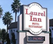
LAUREL INN AND CONFERENCE CTR
BEST WESTERN BEACH DUNES INN
Monterey Beach Dunes Inn
Wagon Wheel Motel
Traveler's Hotel
Videos from this area
These are videos related to the place based on their proximity to this place.
Marina Downtown Economic Development ~ Bruce Delgado for Mayor
A peice of Bruce Delgado's vision to revitalize Marina's downtown. Be a part of the campaign, place a yard sign, volunteer, or donate to the Bruce Delgado for Mayor campaign in Marina....
Grant at Marina Skatepark (CASL)
Grant's contest run at the final CASL stop at the Marina Skate park. Luckily this part of the contest got in before the rain.
Kickflip
Kickflip Filmed at Marina Skatepark in Marina, CA (USA). Credits: JOKER Rodriguez (Skater). (Submitted using the media mapping mobile app for skateboarding, Skate It All, by Stalefish Labs....
Skydiving from 18000ft, California. Just shut up and jump !
This was in January 2012, Marina airport, CA, USA. Apparently the highest tandem jump in the world (their claim) is from 18000ft. Incredible experience !! Checkout http://www.skydivemontereybay.com.
How To Build Your MLM Downline
When building your downline in Global Domains International and other MLM programs, it's important to focuson WHO you attract rather than simply how many. Tired of building your MLM downline...
Amtrak 14 with AMTK 184 passes San Jon Road, Salinas, CA
Amtrak 184, back in Starlight pool, leads the northbound Coast Starlight past San Jon Road on the outskirts of Salinas, CA on 5/21/13.
Toro Park Pipeline Trail Monterey CA
Ride up Toyo Ridge to Pipeline Trail. Toro Park Monterey, ca My first GoPro HD Hero 2 video. Full 1080p 60fps I will definately do a remake once I have better footage. The camera angle...
Videos provided by Youtube are under the copyright of their owners.
Attractions and noteworthy things
Distances are based on the centre of the city/town and sightseeing location. This list contains brief abstracts about monuments, holiday activities, national parcs, museums, organisations and more from the area as well as interesting facts about the region itself. Where available, you'll find the corresponding homepage. Otherwise the related wikipedia article.
Fort Ord
Fort Ord was a U.S. Army post on Monterey Bay in California. It was established in 1917 as a maneuver area and field artillery target range and was closed in September 1994. Fort Ord was one of the most attractive locations of any U.S. Army post, because of its proximity to the beach and California weather. The 7th Infantry Division was its main resident for many years.
Marina Municipal Airport
Marina Municipal Airport is a public airport located two miles (3 km) east of the central business district of Marina, a city in Monterey County, California, United States. It is owned by the City of Marina. The airport is on the former site of the Fritzsche Army Air Field, built in the early 1960s at Fort Ord, which closed in 1994.
Rancho Chamisal
Rancho Chamisal was a 2,737-acre Mexican land grant in the Salinas Valley, in present day Monterey County, California given in 1835 by Governor José Castro to Felipe Vasquez. The grant was located east of Monterey and extended along Pilarcitos Canyon, south of the Salinas River . The grant was bounded by Rancho El Toro on the east.


