Safety Score: 2,7 of 5.0 based on data from 9 authorites. Meaning we advice caution when travelling to United States.
Travel warnings are updated daily. Source: Travel Warning United States. Last Update: 2024-08-13 08:21:03
Explore Del Monte Forest
Del Monte Forest in Monterey County (California) with it's 4,514 inhabitants is a city in United States about 2,434 mi (or 3,917 km) west of Washington DC, the country's capital.
Local time in Del Monte Forest is now 04:31 AM (Monday). The local timezone is named America / Los Angeles with an UTC offset of -8 hours. We know of 8 airports in the vicinity of Del Monte Forest, of which 3 are larger airports. The closest airport in United States is Monterey Peninsula Airport in a distance of 6 mi (or 9 km), East. Besides the airports, there are other travel options available (check left side).
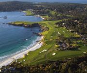
Also, if you like golfing, there are multiple options in driving distance. We found 4 points of interest in the vicinity of this place. If you need a place to sleep, we compiled a list of available hotels close to the map centre further down the page.
Depending on your travel schedule, you might want to pay a visit to some of the following locations: Salinas, Santa Cruz, Hollister, San Jose and Redwood City. To further explore this place, just scroll down and browse the available info.
Local weather forecast
Todays Local Weather Conditions & Forecast: 12°C / 53 °F
| Morning Temperature | 10°C / 51 °F |
| Evening Temperature | 11°C / 52 °F |
| Night Temperature | 10°C / 51 °F |
| Chance of rainfall | 0% |
| Air Humidity | 60% |
| Air Pressure | 1022 hPa |
| Wind Speed | Fresh Breeze with 17 km/h (11 mph) from South-East |
| Cloud Conditions | Scattered clouds, covering 26% of sky |
| General Conditions | Scattered clouds |
Monday, 18th of November 2024
12°C (53 °F)
12°C (53 °F)
Overcast clouds, gentle breeze.
Tuesday, 19th of November 2024
13°C (56 °F)
12°C (54 °F)
Overcast clouds, moderate breeze.
Wednesday, 20th of November 2024
13°C (56 °F)
13°C (55 °F)
Few clouds, gentle breeze.
Hotels and Places to Stay
The Lodge at Pebble Beach LEG
The Vagabond's House
Cypress Inn
HOFSAS HOUSE HOTEL
THE LA PLAYA CARMEL
Carmel Green Lantern Inn
PINE INN
Briarwood Inn
TALLY HO INN
BEST WESTERN PLUS CARMEL BAY
Videos from this area
These are videos related to the place based on their proximity to this place.
Soledad High School vs. Pacific Grove High School: 2013 High School Football (10/11/13)
MCAET presents Soledad High School vs. Pacific Grove High School: 2013 High School Football. Recorded at Breaker Stadium in Pacific Grove, California on Friday, October 11, 2013.
Carmel, Pacific Grove and the Monterey Peninsula
A glorious meeting of land, sea and sky, the Monterey Peninsula comprises the cities of Monterey, Carmel-by-the-Sea, and Pacific Grove. The largest natural Monterey Pine forest in the world...
Pebble Beach Real Estate 831.238.7449 for Real Estate Pebble Beach
Pebble Beach Real Estate http://www.estatesofcarmel.com/pebble-beach/ Call 831.622.4807 today! A drive through the private enclave community of Pebble Beach Real Estate and the Del Monte ...
Horseback Riding Pebble Beach, California
Join Travel Writer Nancy D. Brown as she goes horseback riding with Pebble Beach Equestrian Center. Ride on the Monterey Peninsula to the Pacific Ocean, by Cypress Point Golf Course, 17 Mile...
Sara Stamm Handstand at Bird Rock
Sara doing a handstand at Bird Rock on the 17 Mile Drive in Del Monte Forest in Pebble Beach.
Aerial Fly In 11 La Playa Monterey, CA 93940
Enter the gates of this conveniently located beach front community to find a well maintained corner unit with attached, extra deep 1 car garage, comfortable ...
Aerial Fly In 3009 Lausen Drive Carmel, CA 93923
A true jewel in California's Mission Trail necklace, San Carlos Borroméo del río Carmelo is the historic centerpiece of Carmel Point and astonishingly, just ...
Aerial Fly In Casanova 2 SE of 10th Carmel by the Sea, CA 93921
Unique remodeled Carmel home in the center of the Golden Rectangle.This 2 bed 2 bath 2300+/-sf home includes stunning cherry floors,large foyer,spacious livi...
Videos provided by Youtube are under the copyright of their owners.
Attractions and noteworthy things
Distances are based on the centre of the city/town and sightseeing location. This list contains brief abstracts about monuments, holiday activities, national parcs, museums, organisations and more from the area as well as interesting facts about the region itself. Where available, you'll find the corresponding homepage. Otherwise the related wikipedia article.
Spyglass Hill Golf Course
The Spyglass Hill Golf Course, is a golf course located on the Monterey Peninsula in California, United States. The course is part of the Pebble Beach Company, which also owns the Pebble Beach Golf Links, The Links at Spanish Bay, and the Del Monte Golf Course. Spyglass Hill was designed by Robert Trent Jones, Sr. , and opened on March 11, 1966, after six years of planning, design, and construction.
Poppy Hills Golf Course
The Poppy Hills Golf Course is a golf course in Pebble Beach, California, on the Monterey Peninsula just outside of Monterey, California. It was designed by Robert Trent Jones, Jr. and it opened in 1986. Along with the Pebble Beach Golf Links and the Spyglass Hill Golf Course, Poppy Hills co-hosted the PGA Tour's AT&T Pebble Beach National Pro-Am golf tournament from 1991 to 2009, being replaced in the 2010 rotation by the Monterey Peninsula Country Club.
Pebble Beach Golf Links
Pebble Beach Golf Links is a golf course located in Pebble Beach, California, on the west coast of the United States. Pebble Beach is widely regarded as one of the most beautiful courses in the world. It hugs the rugged coastline and has wide open views of Carmel Bay, opening to the Pacific Ocean, on the south side of the Monterey Peninsula. In 2001 it became the first public course (i.e. , open to the general public for play) to be selected as the No.1 Golf Course in America by Golf Digest.
Pebble Beach Road Races
The "Del Monte Trophy" was held on the twisty, leafy, and very narrow town roads in Pebble Beach, California from 1950 through 1956. The races were managed under the auspices of the SCCA (Sports Car Club of America), as were most races from that day to this. The route was originally 1.8 miles long, but was lengthened from 1951 onwards to 2.1 miles . The search for an appropriate route for the race began at the famous 17 Mile Drive but that later proved unsuitable.
Cypress Point Club
Cypress Point Club is a private golf club in California. The club has a single 18-hole course, one of eight on the Monterey peninsula near Monterey, California. The course is well known around the world for its series of three dramatic holes that play along the Pacific Ocean: the 15th, 16th and 17th, which are regularly rated among the best golf holes in the world. The 16th is a long par three that actually plays over the ocean.
Monterey Peninsula Country Club
The Monterey Peninsula Country Club is a golf club located in Pebble Beach, California. Monterey Peninsula Country Club originally opened in July 1926, with the Dunes Course, a vision of Pebble Beach founder, Samuel F. B. Morse. The club properties account for roughly four hundred acres of land in the central region of the Monterey Peninsula. The Shore Course was designed by Robert E. Baldock and Jack Neville in 1959 after the members purchased the club from Del Monte Properties.
Rancho Pescadero (Barreto)
Rancho Pescadero (also called "Punta del Cipreses") was a 4,426-acre Mexican land grant in present day Monterey County, California given in 1836 by Governor Nicolás Gutiérrez to Fabián Barreto. Pescadero means fishing place in Spanish. The grant extended along the Pacific coast from Rancho Punta de Pinos and Seal Rocks south to Carmel by the Sea and encompassed present day Pebble Beach, California.
Monterey Peninsula
The Monterey Peninsula is located on the central California coast and comprises the cities of Monterey, Carmel, and Pacific Grove, and unincorporated areas of Monterey County including the resort and community of Pebble Beach.


