Safety Score: 2,7 of 5.0 based on data from 9 authorites. Meaning we advice caution when travelling to United States.
Travel warnings are updated daily. Source: Travel Warning United States. Last Update: 2024-08-13 08:21:03
Explore Carmel Highlands
Carmel Highlands in Monterey County (California) is located in United States about 2,435 mi (or 3,919 km) west of Washington DC, the country's capital.
Local time in Carmel Highlands is now 04:17 AM (Monday). The local timezone is named America / Los Angeles with an UTC offset of -8 hours. We know of 8 airports in the wider vicinity of Carmel Highlands, of which 3 are larger airports. The closest airport in United States is Monterey Peninsula Airport in a distance of 8 mi (or 12 km), North-East. Besides the airports, there are other travel options available (check left side).
Also, if you like golfing, there are multiple options in driving distance. We found 4 points of interest in the vicinity of this place. If you need a place to sleep, we compiled a list of available hotels close to the map centre further down the page.
Depending on your travel schedule, you might want to pay a visit to some of the following locations: Salinas, Santa Cruz, Hollister, San Jose and Redwood City. To further explore this place, just scroll down and browse the available info.
Local weather forecast
Todays Local Weather Conditions & Forecast: 12°C / 53 °F
| Morning Temperature | 10°C / 49 °F |
| Evening Temperature | 11°C / 51 °F |
| Night Temperature | 10°C / 49 °F |
| Chance of rainfall | 0% |
| Air Humidity | 59% |
| Air Pressure | 1022 hPa |
| Wind Speed | Fresh Breeze with 15 km/h (9 mph) from South-East |
| Cloud Conditions | Scattered clouds, covering 38% of sky |
| General Conditions | Scattered clouds |
Monday, 18th of November 2024
13°C (55 °F)
11°C (52 °F)
Overcast clouds, gentle breeze.
Tuesday, 19th of November 2024
14°C (57 °F)
12°C (53 °F)
Overcast clouds, gentle breeze.
Wednesday, 20th of November 2024
14°C (58 °F)
12°C (54 °F)
Few clouds, gentle breeze.
Hotels and Places to Stay
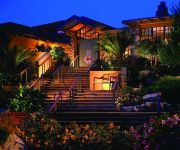
Hyatt Carmel Highlands
Wayside Inn
SVENDSGAARDS INN
CARMEL VILLAGE INN
Carriage House Inn
TALLY HO INN
PINE INN
Cypress Inn
Carmel Green Lantern Inn
THE LA PLAYA CARMEL
Videos from this area
These are videos related to the place based on their proximity to this place.
Ocean Views in the Carmel Highlands at 29190 FERN CANYON RD
Mesmerizing Ocean Views on One Acre Lot. Ocean and canyon views - see Point Lobos! 3 bedroom, 3bath and sleeping lofts plus bonus rooms, extra storage, amazing outside deck with outside ...
Carmel Highlands Rescue Boat 7362
Rescue Boat 7362 out of Whaler's Cove, Point Lobos State Reserve, provides water rescue and assistance to the enormous amount of people who use the Carmel Bay, Pebble Beach and coastal ...
The Last Resort, Carmel Highlands, California Vacation Rental (#3123)
http://www.sanctuaryvacationrentals.com/vacation-rentals/the-last-resort Sanctuary Vacation Rentals Welcomes You! We provide all the amenities and services of a 5-star resort with all the...
Carmel Highlands Roofing Contractor | 831-204-9500 | Roofing Company in Carmel Highlands CA | 93924
http://www.burkleoroofing.mobi For a Carmel Highlands Roofing Contractor call 831-204-9500 today! Burkleo Roofing Inc.- For residential and commercial roofing repairs and installations in...
Scuba Diver Girls Dive Point Lobos in Carmel California
http://www.scubadivergirls.com/ Point Lobos State Reserve is an amazing place to visit but even more amazing is to dive there! In this video our friend Ed Bierman an Instructor in Monterey...
Exploring Don Smith's Photography
http://www.carmelmissioninn.com/ We explore just a few of the many astounding photographs taken along the Central Coast of California by master photographer, Don Smith. Join us as we explore...
Seal Hugs Scuba Diver - Playing with a Baby Seal @ Point Lobos, Carmel, CA
Seals are amazing creatures, supper inquisitive and playful - essentially giant golden retriever puppies that love life. We swam about 1.2 miles under water through a some incredible kelp forests...
Point Lobos State Natural Reserve, Carmel, CA
A relaxing hiking through Point Lobos State Natural Reserve, Carmel, California. ************************************************************ **** Copyright 2010 © CCDVProductions.com.
Videos provided by Youtube are under the copyright of their owners.
Attractions and noteworthy things
Distances are based on the centre of the city/town and sightseeing location. This list contains brief abstracts about monuments, holiday activities, national parcs, museums, organisations and more from the area as well as interesting facts about the region itself. Where available, you'll find the corresponding homepage. Otherwise the related wikipedia article.
Big Sur International Marathon
The Big Sur International Marathon is an annual marathon held in California, USA along the Pacific coast. The marathon was established in 1986 and attracts about 4,500 participants annually. In addition to the marathon, the event usually includes a 21-mile race, a relay, a 5km run and various walks. Runners in the marathon have 6 hours in which to complete it. Since the marathon was first run, over $2m in grants has been disbursed to charities.
Carmel River School
Carmel River School is one of three elementary schools in the Carmel Unified School District in Carmel-by-the-Sea, California. It is a public school with about 430 students as of 8/06 in kindergarten through fifth grade. As of 2005, Jay Marden is the principal of Carmel River School.
Garrapata State Park
Garrapata State Park is a state park of California, USA, located on Highway 1 6.7 miles south of Carmel and 18 miles north of Big Sur on the Monterey coast. It is marked only with one sign on the west side of the road. Numbered turnouts mark each parking area. The 2,939-acre park was established in 1979. Garrapata State Park has 2 miles of beachfront, with coastal hiking and a 50-foot climb to a view of the Pacific.
Tor House and Hawk Tower
Tor House and Hawk Tower are buildings in Carmel-by-the-Sea, California, built by poet Robinson Jeffers.
KRML
KRML is an American radio station licensed to serve Carmel, California. The station, established in 1957 as KTEE, is currently owned and operated by Scot McKay. The station's broadcast license is held by CVAC, Inc. KRML was the setting for the 1971 Clint Eastwood film Play Misty For Me.
Rancho San Jose y Sur Chiquito
Rancho San Jose y Sur Chiquito was a 8,876-acre Mexican land grant in present day Monterey County, California given in 1839 by Governor Juan Alvarado to Marcelino Escobar. The grant extended along the Pacific coast from the Carmel River on the north, past Soberanes Point to Palo Colorado Canyon on the south.
Malpaso Creek
Mal Paso Creek ("bad step", or "bad crossing") is a small, coastal stream 5 miles south of Carmel in Monterey County, California, USA. It is the northern border of Big Sur in central coastal California. It also defines the northern border of Garrapata State Park. The mouth of the creek is located at Little Mal Paso Beach where there is a small white sandy beach, tide pools, and a narrow cave.
Carmel Bay
Carmel Bay is a bay of the Pacific Ocean, along the central coast of California in Monterey County. The bay is 4 miles long and 2 miles wide with its mouth about three miles across, between Point Carmel to the south and Point Cypress to the north; Monterey Bay is about four coastline miles north, with Point Pinos intervening. The bay's coastline includes Carmel City Beach and Carmel River State Beach, with wildlife largely protected by the 'Carmel Bay Ecological Reserve'.


