Safety Score: 2,7 of 5.0 based on data from 9 authorites. Meaning we advice caution when travelling to United States.
Travel warnings are updated daily. Source: Travel Warning United States. Last Update: 2024-08-13 08:21:03
Touring Sunny Slopes
Sunny Slopes in Mono County (California) with it's 182 residents is a town located in United States about 2,242 mi (or 3,608 km) west of Washington DC, the country's capital place.
Time in Sunny Slopes is now 07:40 PM (Thursday). The local timezone is named America / Los Angeles with an UTC offset of -8 hours. We know of 8 airports nearby Sunny Slopes, of which one is a larger airport. The closest airport in United States is Fresno Yosemite International Airport in a distance of 79 mi (or 128 km), South-West. Besides the airports, there are other travel options available (check left side).
There is one Unesco world heritage site nearby. It's Yosemite National Park in a distance of 19 mi (or 31 km), North-East. Also, if you like the game of golf, there are several options within driving distance. Need some hints on where to stay? We compiled a list of available hotels close to the map centre further down the page.
Being here already, you might want to pay a visit to some of the following locations: Bridgeport, Hawthorne, Mariposa, Fresno and Visalia. To further explore this place, just scroll down and browse the available info.
Local weather forecast
Todays Local Weather Conditions & Forecast: 8°C / 47 °F
| Morning Temperature | -2°C / 29 °F |
| Evening Temperature | 1°C / 33 °F |
| Night Temperature | -2°C / 28 °F |
| Chance of rainfall | 5% |
| Air Humidity | 28% |
| Air Pressure | 1016 hPa |
| Wind Speed | Fresh Breeze with 14 km/h (8 mph) from North-East |
| Cloud Conditions | Overcast clouds, covering 100% of sky |
| General Conditions | Snow |
Friday, 22nd of November 2024
0°C (33 °F)
-5°C (23 °F)
Snow, moderate breeze, overcast clouds.
Saturday, 23rd of November 2024
-2°C (28 °F)
-2°C (28 °F)
Snow, gentle breeze, broken clouds.
Sunday, 24th of November 2024
-0°C (31 °F)
-5°C (24 °F)
Snow, moderate breeze, overcast clouds.
Hotels and Places to Stay
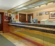
MAMMOTH LAKES TRAVELODGE
Videos from this area
These are videos related to the place based on their proximity to this place.
Owens River at Benton Crossing
February 12th, 2011 Benton Crossing over the Owens River. I headed down the hill from Mammoth to check out the trout fishing in the winter. Here is the view 360 degrees.
High Sierra Fall Century Bike Ride: Q_Benton Crossing Road at Owens River Bridge
The High Sierra Fall Century bike ride website is new this year and we don't have any rider video, but we drove around the course and wanted to show you some highlights from the car! Check...
High Sierra Fall Century Bike Ride: R_Benton Crossing Road at Owens River to Finish Area
The High Sierra Fall Century bike ride website is new this year and we don't have any rider video, but we drove around the course and wanted to show you some highlights from the car! Check...
Fly Fishing Crowley Lake - Eastern Sierras 2008
Rich & Garth's Stillwater Adventures - Crowley Lake 2008. Our annual October trip with my new Olympus 1030 SW camera and my very first video editing effort. The Eastern Sierras are always so...
Camping Rock Creek 2013
A quick view/description of camping at East Fork Campground on Rock Creek, Ca. For more information, visit us at www.campingandfishingcalifornia.com or just leave a comment down below.
Crowley Lake Rainbow Trout Fall Fishing
This is the first time out to try the used boat I bought and we had a great time on Crowley Lake. The rainbow trout were biting great on small crankbaits and the action was pretty much non...
The Tire Spin
My younger brothers and I spinning our buddy, Jarrod, in a giant tire! Good things happen when you mix boys, booze, fishing trips, and of course...very large tires!
Rock Creek: Choice of Weapons (V4)
Bouldering Location: Campground Boulder, Big Meadow Campground, Bishop/Mammoth Lakes Area, CA. #bouldering #rockclimbing #climbing.
Rock Creek: Arete to Arete (V4)
Bouldering Location: Campground Boulder, Big Meadow Campground, Bishop/Mammoth Lakes Area, CA. #bouldering #rockclimbing #climbing.
Videos provided by Youtube are under the copyright of their owners.
Attractions and noteworthy things
Distances are based on the centre of the city/town and sightseeing location. This list contains brief abstracts about monuments, holiday activities, national parcs, museums, organisations and more from the area as well as interesting facts about the region itself. Where available, you'll find the corresponding homepage. Otherwise the related wikipedia article.
Wheeler Crest
The Wheeler Crest or Wheeler Ridge is a ridge in Mono and Inyo Counties, California. The crest is 8 miles long, and partially lies in the John Muir Wilderness. The ridge is bound on the west by Rock Creek, on the north by the community of Toms Place, on the east by Round Valley, on the southeast by Gable Creek, and on the southwest by Morgan Creek.


