Safety Score: 2,7 of 5.0 based on data from 9 authorites. Meaning we advice caution when travelling to United States.
Travel warnings are updated daily. Source: Travel Warning United States. Last Update: 2024-08-13 08:21:03
Explore Curry Village
Curry Village in Mariposa County (California) is located in United States about 2,286 mi (or 3,679 km) west of Washington DC, the country's capital.
Local time in Curry Village is now 04:27 AM (Monday). The local timezone is named America / Los Angeles with an UTC offset of -8 hours. We know of 10 airports in the wider vicinity of Curry Village, of which 3 are larger airports. The closest airport in United States is Merced Regional Macready Field in a distance of 60 mi (or 97 km), South-West. Besides the airports, there are other travel options available (check left side).
There is one Unesco world heritage site nearby. It's Yosemite National Park in a distance of 64 mi (or 103 km), East. Also, if you like golfing, there are multiple options in driving distance. We found 1 points of interest in the vicinity of this place. If you need a place to sleep, we compiled a list of available hotels close to the map centre further down the page.
Depending on your travel schedule, you might want to pay a visit to some of the following locations: Mariposa, Bridgeport, Sonora, Madera and Merced. To further explore this place, just scroll down and browse the available info.
Local weather forecast
Todays Local Weather Conditions & Forecast: 12°C / 54 °F
| Morning Temperature | 8°C / 46 °F |
| Evening Temperature | 9°C / 49 °F |
| Night Temperature | 5°C / 41 °F |
| Chance of rainfall | 0% |
| Air Humidity | 51% |
| Air Pressure | 1019 hPa |
| Wind Speed | Moderate breeze with 9 km/h (6 mph) from East |
| Cloud Conditions | Few clouds, covering 18% of sky |
| General Conditions | Few clouds |
Monday, 18th of November 2024
11°C (52 °F)
9°C (48 °F)
Overcast clouds, light breeze.
Tuesday, 19th of November 2024
16°C (61 °F)
11°C (52 °F)
Overcast clouds, gentle breeze.
Wednesday, 20th of November 2024
20°C (68 °F)
12°C (54 °F)
Sky is clear, light breeze, clear sky.
Hotels and Places to Stay
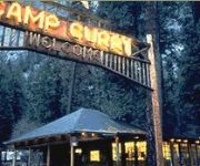
CURRY VILLAGE
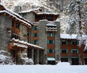
THE AHWAHNEE
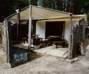
HOUSEKEEPING CAMP
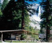
YOSEMITE LODGE
Videos from this area
These are videos related to the place based on their proximity to this place.
Yosemite Valley Tram Tour HD
With an interpretive national park ranger as your tour guide, Yosemite's open air tram tours are one of the best ways to experience the sights and sounds of Yosemite National Park. Yosemite...
Yosemite Valley - Chapel - Yosemite National Park
The Yosemite Chapel, a New England style church, is the oldest structure in Yosemite Valley. It was designed by San Francisco Architect Charles Geddes and was built in 1879. The Chapel seats...
Funny Squirrel Close up #01 - at Vernal Fall, Yosemite Valley - GoPro Hero2 Full HD
Squirrel Close Up at Vernal Fall, Yosemite Valley, Yosemite National Park, California, USA, 2012 GoPro Hero2 Full HD GoPro Hero GoPro Hero2 GoPro Hero3 GoPro Hero4.
Yosemite Mule Ride to Clarks Point / Nevada Falls (Full HD)
Mule ride from Yosemite Valley Stables to Clarks Point view of Nevada Falls. The ride starts in relatively level terrain but rapidly advances to steeper and more rugged terrain. Some trailside...
Yosemite Valley Shuttle Bus
This is the free shuttle bus that runs all year throughout the eastern end of the valley. It is traveling on a loop road that is closed to any public vehicle traffic, on the way to the Mirror...
Run With Us Yosemite Valley Part 1
The Sandals: http://shammasandals.com/store/barefoot-running-sandals/super-cruisers-black-and-tan-buy-running-sandals About Shamma: http://shammasandals.com/barefoot-running-sandals In this.
Davi Marski (Yosemite Valley, EUA)
Memórias de uma viagem à Califórnia em Maio de 2013. Davi e eu passamos duas semanas entre São Francisco, Santa Cruz e o Yosemite Valley com os amigos Bruce, Lucia e Josef.
Views of Yosemite Valley from Stoneman Meadow near Curry Village
This video was taken on the drive out of Curry Village and back to Yosemite Village. We happened upon this big meadow and couldn't pass up the opportunity to take in the views.
Entering Yosemite Valley
CSUF Adventure club members visiting Yosemite Valley, CA. (Video taken by a GoPro camera)
Videos provided by Youtube are under the copyright of their owners.
Attractions and noteworthy things
Distances are based on the centre of the city/town and sightseeing location. This list contains brief abstracts about monuments, holiday activities, national parcs, museums, organisations and more from the area as well as interesting facts about the region itself. Where available, you'll find the corresponding homepage. Otherwise the related wikipedia article.
Yosemite Valley, California
Yosemite Valley is a census-designated place (CDP) in Mariposa County, California, United States. It consists of Yosemite Village and the other areas of the Yosemite Valley in Yosemite National Park. The population was 1,035 at the 2010 census, up from 265 at the 2000 census.
John Muir Trail
The John Muir Trail (JMT) is a long-distance trail in the Sierra Nevada mountain range of California, passing through Yosemite, Kings Canyon and Sequoia National Parks. From the northern terminus at Happy Isles in Yosemite Valley and the southern terminus located on the summit of Mount Whitney, the Trail's official length is 210.4 miles . For almost all of its length, the trail is in the High Sierra backcountry and wilderness areas.
Happy Isles
Happy Isles is a group of small isles in the Merced River in Yosemite National Park, California, USA. They are located at the easternmost end of the Yosemite Valley floor. This scenic spot is the starting point for the Mist Trail, and is also the northern trailhead for the John Muir Trail. Happy Isles is located where the slope of the Merced River changes from the much steeper upper main stem to the essentially flat Valley floor. At Happy Isles, the river gradient is approximately 2%.
Glacier Point
Glacier Point is a viewpoint above Yosemite Valley, in California, USA. It is located on the south wall of Yosemite Valley at an elevation of 7,214 feet, 3,200 feet above Curry Village. The point offers a superb view of Yosemite National Park's Yosemite Valley, including Yosemite Falls, Half Dome, Vernal Fall, Nevada Fall, and Clouds Rest.
Ahwahnee Heritage Days
Ahwahnee Heritage Days is a festival held in Yosemite Valley, in Yosemite National Park, every February or March annually. The Ahwahnee Hotel celebrates the Roaring Twenties, and the '1930s and '40s - with music performances, as well as cultural and history events. Ahwahnee Heritage Days was originally held to celebrate the 75th anniversary of the Ahwahnee Hotel in 2002, and is brought back every year under various names.
Royal Arch Cascade
Royal Arch Cascade is a waterfall located on the north wall of Yosemite Valley and the Yosemite National Park, USA, within walking distance from the Ahwahnee Hotel. The falls are 1,250 feet high and are usually dry by June. The waterfall gets its name from its location immediately adjacent to the Royal Arches, which are a series of concentric semicircular setbacks in the cliff face directly opposite Glacier Point.
Staircase Falls
Staircase Falls is a series of waterfalls located on Gossamer Creek in Yosemite National Park, California. The falls descend a total of 1,300 feet into Yosemite Valley over a series of steps. Staircase Falls is relatively ephemeral and only flows after rainfall. It is usually dry by May. The falls are located immediately behind Camp Curry on cliffs below Glacier Point.
Housekeeping Camp
Located in the Yosemite Valley, Housekeeping Camp is a cheaper lodging option (After tax around $100.90 a night for up to 4 people) for visitors to Yosemite National Park. The lodging is somewhere between camping and staying in a hotel where there are 3 concrete walls enclosing beds covered by canvas rooftops and one curtain wall. Outside there is a table and lounge area all covered by the rooftop. There are 266 total units that can sleep up to 6 people. Each unit is equipped with electricity.
Royal Arches Route (Yosemite)
The Royal Arches Route is a technical climbing route in California's Yosemite Valley on the Royal Arches wall. The route is recognized in the historic climbing text Fifty Classic Climbs of North America.
Royal Arches (Yosemite)
The Royal Arches refers to a cliff containing natural occurring exfoliation granite arches located below North Dome in California's Yosemite Valley . The arches are located on the north side of the valley, northeast of the Ahwahnee Hotel. Adjacent to the Royal Arches is the Royal Arch Cascade. The Royal Arches, like much of Yosemite feature a great deal of rock climbing. The "Royal Arches" climbing area spans from the Church Bowl to Washington Column.
1996 Yosemite Valley landslide
The 1996 Yosemite Valley landslide occurred on July 10, 1996 near the Happy Isles trailhead in Yosemite Valley, Yosemite National Park, Mariposa County, California. 162,000 tons of rocks and other debris fell to the ground at over 160 miles per hour. Of 12 campers/hikers involved in the incident, one was killed. The landslide competes with the January 1997 Merced River flood for the designation of the worst natural disaster in Yosemite to date.
Glacier Point Hotel


