Safety Score: 2,7 of 5.0 based on data from 9 authorites. Meaning we advice caution when travelling to United States.
Travel warnings are updated daily. Source: Travel Warning United States. Last Update: 2024-08-13 08:21:03
Delve into Fallon
Fallon in Marin County (California) is a town located in United States about 2,451 mi (or 3,944 km) west of Washington DC, the country's capital town.
Time in Fallon is now 04:37 AM (Monday). The local timezone is named America / Los Angeles with an UTC offset of -8 hours. We know of 8 airports closer to Fallon, of which 4 are larger airports. The closest airport in United States is Metropolitan Oakland International Airport in a distance of 53 mi (or 86 km), South-East. Besides the airports, there are other travel options available (check left side).
Also, if you like the game of golf, there are some options within driving distance. We saw 5 points of interest near this location. In need of a room? We compiled a list of available hotels close to the map centre further down the page.
Since you are here already, you might want to pay a visit to some of the following locations: Santa Rosa, San Rafael, Napa, San Francisco and Lakeport. To further explore this place, just scroll down and browse the available info.
Local weather forecast
Todays Local Weather Conditions & Forecast: 13°C / 55 °F
| Morning Temperature | 5°C / 41 °F |
| Evening Temperature | 10°C / 49 °F |
| Night Temperature | 5°C / 40 °F |
| Chance of rainfall | 0% |
| Air Humidity | 39% |
| Air Pressure | 1022 hPa |
| Wind Speed | Gentle Breeze with 8 km/h (5 mph) from South-East |
| Cloud Conditions | Few clouds, covering 16% of sky |
| General Conditions | Few clouds |
Monday, 18th of November 2024
13°C (55 °F)
11°C (52 °F)
Overcast clouds, gentle breeze.
Tuesday, 19th of November 2024
12°C (54 °F)
12°C (54 °F)
Moderate rain, moderate breeze, overcast clouds.
Wednesday, 20th of November 2024
13°C (56 °F)
14°C (57 °F)
Moderate rain, moderate breeze, overcast clouds.
Hotels and Places to Stay
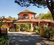
Sonoma Coast Villa Inn and Spa
Valley Ford Hotel
Videos from this area
These are videos related to the place based on their proximity to this place.
Dillon Beach Ranch
Nestled on California's North coast between Bodega Head and Point Reyes National Seashore, and next to the charming beachfront town of Dillon Beach lies a rare offering of 466 acres with...
LABRADOR RETRIEVER at DILLON BEACH CALIFORNIA
LABRADOR RETRIEVER: RUSTY and LUCKY AT DILLON BEACH, CA www.dillonbeach.com.
QAV540G Dillon Beach February 14, 2015
Flying around Dillon Beach on a beautiful February day! Enjoy the ride!
Videos provided by Youtube are under the copyright of their owners.
Attractions and noteworthy things
Distances are based on the centre of the city/town and sightseeing location. This list contains brief abstracts about monuments, holiday activities, national parcs, museums, organisations and more from the area as well as interesting facts about the region itself. Where available, you'll find the corresponding homepage. Otherwise the related wikipedia article.
Tomales High School
About Tomales High[edit] {{#invoke:Coordinates|coord}}{{#coordinates:38|14|51|N|122|53|43|W|type:edu_region:US-CA_source:gnis |primary |name= }} 50x40pxThis article needs additional citations for verification. Please help improve this article by adding citations to reliable sources. Unsourced material may be challenged and removed. Tomales High School is located in the town of Tomales, California. It is the comprehensive high school for the Shoreline Unified School District.
Rancho Blucher
Rancho Blucher was a 26,759-acre Mexican land grant in present day Marin and Sonoma County, California given in 1844 by Governor Manuel Micheltorena to Jean Jacques Vioget. The rancho is named for the Prussian field marshal Gebhard Leberecht von Blücher. The grant extended along the coast from Estero Americano on the north and to Estero de San Antonio on the south.
Rancho Bolsa de Tomales
Rancho Bolsa de Tomales was a Mexican land grant in present day Marin County and Sonoma County, California given in 1846 by Governor Pío Pico to Juan Nepomuceno Padilla. The name means "the Pool of the Tomales Indians," which referred to Burbank’s Lake. The grant extended along the Pacific coast from Estero de San Antonio south to Walker Creek, and encompassed present day Tomales. Stemple Creek tranversed the property. The land claim was rejected as fraudulent by the US Supreme Court.


