Safety Score: 2,7 of 5.0 based on data from 9 authorites. Meaning we advice caution when travelling to United States.
Travel warnings are updated daily. Source: Travel Warning United States. Last Update: 2024-08-13 08:21:03
Discover Silver Lake
The district Silver Lake of in Los Angeles County (California) with it's 32,890 citizens Silver Lake is a district in United States about 2,295 mi west of Washington DC, the country's capital city.
Looking for a place to stay? we compiled a list of available hotels close to the map centre further down the page.
When in this area, you might want to pay a visit to some of the following locations: Los Angeles, Orange, Santa Ana, Riverside and San Bernardino. To further explore this place, just scroll down and browse the available info.
Local weather forecast
Todays Local Weather Conditions & Forecast: 19°C / 66 °F
| Morning Temperature | 14°C / 57 °F |
| Evening Temperature | 18°C / 64 °F |
| Night Temperature | 16°C / 60 °F |
| Chance of rainfall | 0% |
| Air Humidity | 34% |
| Air Pressure | 1019 hPa |
| Wind Speed | Light breeze with 4 km/h (3 mph) from North-East |
| Cloud Conditions | Overcast clouds, covering 100% of sky |
| General Conditions | Overcast clouds |
Wednesday, 4th of December 2024
19°C (66 °F)
16°C (60 °F)
Sky is clear, light breeze, clear sky.
Thursday, 5th of December 2024
20°C (67 °F)
17°C (62 °F)
Overcast clouds, light breeze.
Friday, 6th of December 2024
21°C (70 °F)
19°C (67 °F)
Sky is clear, light breeze, clear sky.
Hotels and Places to Stay
Ginosi Wilshire Apartel
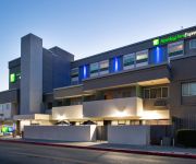
Holiday Inn Express & Suites LOS ANGELES DOWNTOWN WEST
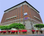
The Mayfair Hotel
Hollywood The Hotel of Hollywood near Universal Studios
OAKWOOD AT 1111 WILSHIRE
Downtown LA Corporate Apartments
Tripbz Vermont Apartments
Hollywood Inn Express North
Americas Best Value Inn
Stuart Hotel
Videos from this area
These are videos related to the place based on their proximity to this place.
Hit & Run Accident in Echo Park, CA on 02.26.13
At approx. 05:20 PM PST on February 26th, 2013, a white sedan traveling Eastbound on Montana in Echo Park was T-boned by Speedy Driver who ran a red light, also driving a white sedan.
PL3031 - Private Bungalow House, 1 Bed + 1 Bath, For Rent!
Pacific Listings is proud to present this newly restored 1 Bed + 1 Bath private bungalow style house, located in Echo Park, Near Silverlake. This home features real hardwood flooring, washer...
March 2nd & 9th, 2013 Ri-Ettes v Charm City & March Radness
The LA Derby Dolls Ri-Ettes vs. Charm City Roller Girls on March 2nd, 2013 at the Doll Factory in Los Angeles. March Radness camp bout featuring skaters from across the country on March 9,...
Metal Detecting Silver Lake Park in Los Angeles, California
This is the first time I metal detected in the city of Los Angeles, CA.
The Rental Girl Los Feliz | Duplex For Rent | Beautifully Classic 1920’s Bungalow
For property information & showing instructions please visit: http://www.therentalgirl.com/agent/ellie/listing/2336 Located in Silver Lake: On Hoover near Manzanita, 90029 This precious upper...
The Rental Girl Los Feliz | Home For Rent | Beautiful Remodel by Sunset Junction
For property information, showing instructions and to view other properties in this area, please visit my website: http://www.therentalgirl.com/ellie Located in Los Feliz: 1424 Hoover St ...
Silver Lake Real Estate:1511 Benton Way Silver Lake Ca 90026
http://www.1511bentonway.com Located in Silver Lake, CA with spectacular views of Downtown LA and a quick stroll to LA Mill, L&E Oyster Bar, the dog park, and the Reservoir, this Silver Lake...
Kill Em All - The Title Trackers
The Title Trackers perform a Lost Title Track that answers the question - what might it have sounded like if Metallica had written a title track for their debut album "Kill Em All" and then...
Pukes show June 9 part two.wmv
First part of The Pukes show at The Satellite in Silver Lake, California on June 9, 2012. The Pukes are a country/ western Misfits cover band and have Noah H...
Pukes Show june 9 part three.wmv
First part of The Pukes show at The Satellite in Silver Lake, California on June 9, 2012. The Pukes are a country/ western Misfits cover band and have Noah H...
Videos provided by Youtube are under the copyright of their owners.
Attractions and noteworthy things
Distances are based on the centre of the city/town and sightseeing location. This list contains brief abstracts about monuments, holiday activities, national parcs, museums, organisations and more from the area as well as interesting facts about the region itself. Where available, you'll find the corresponding homepage. Otherwise the related wikipedia article.
The Music Box
The Music Box is a Laurel and Hardy short film comedy released in 1932. It was directed by James Parrott, produced by Hal Roach and distributed by Metro-Goldwyn-Mayer. The film, which depicts the pair attempting to move a piano up a large flight of steps, won the first Academy Award for Live Action Short Film (Comedy) in 1932.
Dream Center
The Dream Center is a Pentecostal Christian Church mission located at 2301 Bellevue Avenue in the Echo Park neighborhood of Los Angeles, California, two blocks west of Alvarado Street on the north side of the 101 Freeway. It is two miles from Downtown Los Angeles and a little over two miles from Hollywood.
Echo Park, Los Angeles
Echo Park is a neighborhood in Los Angeles, California, northwest of Downtown Los Angeles and southeast of Hollywood.
Keystone Studios
Keystone Studios was an early movie studio founded in Edendale, California in 1912 as the Keystone Pictures Studio by Mack Sennett with backing from Adam Kessel and Charles O. Baumann, owners of the New York Motion Picture Company. The company filmed in and around Glendale and Silver Lake for several years, and its films were distributed by the Mutual Film Corporation between 1912 and 1915.
Original Tommy's
Original Tommy's is a hamburger restaurant chain in Southern California, United States. It is known for its chili burgers.
East Hollywood, Los Angeles
East Hollywood is the eastern portion of the Hollywood district in the City of Los Angeles, California.
Children's Hospital Los Angeles
Children's Hospital Los Angeles, formerly Childrens Hospital Society, is a private, non-profit teaching hospital in Los Angeles. The hospital provides multidisciplinary care to over 93,000 children each year, with physician expertise in over 100 pediatric specialties and subspecialties. The hospital has been included in the Best Children's Hospitals Honor Roll for 2012-2013 by the U.S.
Virgil Village, Los Angeles
Virgil Village is centered on Virgil Avenue, east of Vermont Ave. , south of Silver Lake, and north of MacArthur Park, in Los Angeles, CA. Los Angeles City College is on the northwest side of Virgil Village. The name originated in the late 1990s; Virgil Village is considered part of East Hollywood along with Little Armenia and Thai Town. Virgil Avenue is lined with flowering trees, and the neighborhood is in bloom from March to May.
John Marshall High School (Los Angeles)
John Marshall High School is a high school located in the Los Feliz district of the City of Los Angeles at 3939 Tracy Street, in Los Angeles, USA. Marshall, which serves grades 9 through 12, is a part of the Los Angeles Unified School District. Marshall is named after jurist John Marshall, who served as the fourth Chief Justice of the United States for three decades.
Historic Filipinotown, Los Angeles
Historic Filipinotown is a district of the city of Los Angeles, California, that makes up the southwest portion of Echo Park. It was created by a resolution proposed by city council member Eric Garcetti on August 2, 2002. The district is bounded by the Hoover Street on the west to Glendale Boulevard on the east, Temple Street on the north, Beverly Boulevard on the south side.
The Prospect Studios
The Prospect Studios (also known as ABC Television Center) is a lot containing several television studios located at 4151 Prospect Avenue in the Los Feliz neighborhood of Los Angeles, at the corner of Prospect and Talmadge Avenues (named in honor of silent screen star Norma Talmadge), just east of Hollywood.
Cathedral Center of St. Paul, Los Angeles
The Cathedral Center of St. Paul is the administrative and ministry hub of the six-county Episcopal Diocese of Los Angeles.
The Echo (venue)
The Echo is an American music venue and nightclub, located in the Echo Park neighborhood of Los Angeles, California.
KBLA
KBLA (1580 AM) is a radio station licensed in Santa Monica, California, with a Spanish religious radio format. It broadcasts at 1580 kHz with 50,000 watts day and night. Most of this station's signal is dumped over the Pacific Ocean to avoid interference with KMIK (Ex. KNIX) 1580 in Phoenix Arizona, which is also a (Clear Channel) station and operates 50,000 D/N as authorized by the FCC. Consequently, the station is heard on a regular basis in Hawaii, via AM nighttime skip.
Edendale, Los Angeles
Edendale is a historical name for a district in Los Angeles, California, northwest of Downtown Los Angeles, in what is known today as Echo Park, Los Feliz and Silver Lake. In the opening decades of the 20th century, in the era of silent movies, Edendale was widely known as the home of most major movie studios on the West Coast.
Elysian Heights, Los Angeles
Elysian Heights is a neighborhood within Echo Park in Los Angeles, California, in the United States. It is part of the Echo Park - Elysian Park area. Before the Glendale Freeway was built, it was also part of the neighborhood known as Edendale. Elysian Heights is served by Elysian Heights Elementary school. The author Beverly Mason was principal there for many years, and Toshi Ito, the mother of noted judge Lance Ito, taught kindergarten and 1st grade there for many years as well.
Franklin Hills, Los Angeles
Franklin Hills is a small community in the City of Los Angeles, California. It is part of the Los Feliz district.
Shakespeare Bridge
The Shakespeare Bridge in the Franklin Hills section of Los Angeles, California was built in 1926. It is made of concrete and decorated in a Gothic style. It was named after famous playwright William Shakespeare and was designated a Los Angeles Historic-Cultural Monument #126 in 1974. The bridge was rebuilt in 1998 after the Northridge earthquake due to concerns that the structure would not be stable in an earthquake.
Hollywood Presbyterian Medical Center
Hollywood Presbyterian Medical Center, formerly known as Queen of Angels-Hollywood Presbyterian Medical Center, is a private hospital located at 1300 North Vermont Avenue in Los Angeles, California. The hospital has 434 beds.
Black Cat Tavern
The Black Cat Tavern was an LGBT bar formerly located at 3909 W. Sunset Blvd. in the Silverlake section of Los Angeles, California.
Echoplex (venue)
Echoplex is a live music venue located in the Echo Park neighborhood of Los Angeles, California. It is owned and operated by the same people as The Echo, and the two are considered sister venues. It is located and commonly described as being "below The Echo," leading some to erroneously believe that its official title is "Echoplex Below The Echo. " Along with The Echo, Echoplex is affiliated with Spaceland in the Silver Lake neighborhood of Los Angeles.
Cabaret Concert Theatre
The Cabaret Concert Theatre was a small cellar café/cabaret, located in the Silverlake section of West Los Angeles, California, that operated between 1950 and 1961.
Silver Lake Reservoir
The Silver Lake Reservoirs comprise two concrete-lined basins, Ivanhoe Reservoir and Silver Lake, divided by a spillway, in the Silver Lake community of Los Angeles, California.
Fargo Street
Fargo Street is in Los Angeles, California and is thought to be the steepest street in Los Angeles, and perhaps in all of California. Bottom of the hill is {{#invoke:Coordinates|coord}}{{#coordinates:34.09145|-118.25753||||||| | |name= }}.
Los Angeles City Oil Field
The Los Angeles City Oil Field is a large oil field north of Downtown Los Angeles. Long and narrow, it extends from immediately south of Dodger Stadium west to Vermont Avenue, encompassing an area of about four miles (6 km) long by a quarter-mile across. Its former productive area amounts to 780 acres .


