Safety Score: 2,7 of 5.0 based on data from 9 authorites. Meaning we advice caution when travelling to United States.
Travel warnings are updated daily. Source: Travel Warning United States. Last Update: 2024-08-13 08:21:03
Touring Melaga Cove
The district Melaga Cove of in Los Angeles County (California) is a subburb located in United States about 2,309 mi west of Washington DC, the country's capital place.
Need some hints on where to stay? We compiled a list of available hotels close to the map centre further down the page.
Being here already, you might want to pay a visit to some of the following locations: Los Angeles, Santa Ana, Orange, Ventura and Riverside. To further explore this place, just scroll down and browse the available info.
Local weather forecast
Todays Local Weather Conditions & Forecast: 17°C / 63 °F
| Morning Temperature | 15°C / 60 °F |
| Evening Temperature | 15°C / 60 °F |
| Night Temperature | 16°C / 60 °F |
| Chance of rainfall | 0% |
| Air Humidity | 42% |
| Air Pressure | 1021 hPa |
| Wind Speed | Gentle Breeze with 9 km/h (5 mph) from East |
| Cloud Conditions | Clear sky, covering 0% of sky |
| General Conditions | Sky is clear |
Friday, 22nd of November 2024
16°C (61 °F)
15°C (60 °F)
Sky is clear, moderate breeze, clear sky.
Saturday, 23rd of November 2024
15°C (60 °F)
15°C (60 °F)
Light rain, gentle breeze, broken clouds.
Sunday, 24th of November 2024
15°C (60 °F)
14°C (58 °F)
Heavy intensity rain, moderate breeze, overcast clouds.
Hotels and Places to Stay
BEACH HOUSE AT HERMOSA
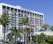
DoubleTree by Hilton Torrance - South Bay
Crowne Plaza REDONDO BEACH AND MARINA
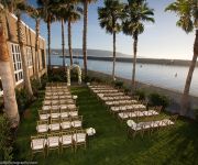
The Portofino Hotel and Marina
Torrance Marriott Redondo Beach
BEST WESTERN PLUS AVITA SUITES
Redondo Beach Hotel
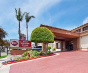
BEST WESTERN PLUS REDONDO BCH
Residence Inn Los Angeles Torrance/Redondo Beach
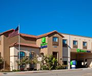
Holiday Inn Express & Suites HERMOSA BEACH
Videos from this area
These are videos related to the place based on their proximity to this place.
617 Paseo De La Playa, Redondo Beach Offered by Rami & Gary Elminoufi | Beach City Brokers
617 Paseo De La Playa, Redondo Beach, CA 90277 Offered by Rami & Gary Elminoufi | Beach City Brokers Panoramic, unobstructed ocean views. You can watch sunsets from spa tub in the bathroom.
Suzzie's Porcelain Veneers Experience Redondo Beach - Michael Fulbright, D.D.S.
http://www.fulbrightdental.com/cosmetic/porcelain-veneers-redondo-beach-ca In this video from the Redondo Beach cosmetic dentistry practice of Dr. Michael Fulbright, follow Suzzie on her smile...
Rancho Palos Verdes Homes Vista Grande School
Rancho Palos Verdes Homes Vista Grande School http://www.bestpalosverdeshomes.com/rancho-palos-verdes-homes-vista-grande-school/ Check back here often for updates. Beautifully upgraded...
28040 Ella Road, Rancho Palos Verdes Offered by Aaron Klapper | The Klapper Group
Aaron Klapper | Klapper Group | Shorewood Realtors 28040 Ella Road, Rancho Palos Verdes, CA 90275 Fully remodeled down to the studs, this elegant 1690 sq. ft. single story home sits atop...
Marymount California University - campus visit with American College Strategies, Rancho PV.
Thinking about applying to Marymount California University? Independent Educational Consultant Kathleen Griffin of American College Strategies provides insights after touring the campus in...
Rancho Palos Verdes Homes Vista Grande School
Rancho Palos Verdes Homes Vista Grande School - New Listing! http://www.bestpalosverdeshomes.com/rancho-palos-verdes-homes-vista-grande-school/ Check back here often for updates.
7022 Cherty Drive Rancho Palos Verdes CA 90275 - George Fotion - Call Realty
http://homesite.obeo.com/viewer/default.aspx?tourid=939307&refURL=youtube Contact: George Fotion Call Realty 424-226-2147 george.fotion@homeispalosverdes.com ...
Rancho Palos Verdes Homes Near Vista Grande School
http://www.homeispalosverdes.com/rancho-palos-verdes-homes-near-vista-grande-school/ Have you ever driven up to a house and got that bright welcome feeling? Here's a home in the Vista Grande...
most expensive palos verdes estates homes
Have you ever wondered about the most expensive Palos Verdes Estates home prices? What do these homes look like? What are the supply and demand trends? Are prices going up for this category...
Lunada Bay Homes Palos Verdes Estates 1512 PVDW
http://www.homeispalosverdes.com/lunada-bay-homes-1512-palos-verdes-drive-west/ Lunada Bay homes :: For the Family that likes to have an indoor outdoor living setting, this is the home! 1512...
Videos provided by Youtube are under the copyright of their owners.
Attractions and noteworthy things
Distances are based on the centre of the city/town and sightseeing location. This list contains brief abstracts about monuments, holiday activities, national parcs, museums, organisations and more from the area as well as interesting facts about the region itself. Where available, you'll find the corresponding homepage. Otherwise the related wikipedia article.
Palos Verdes Estates, California
Palos Verdes Estates is a city in Los Angeles County, California, United States, situated on the Palos Verdes Peninsula. The city was masterplanned by the noted American landscape architect and planner Frederick Law Olmsted, Jr. The population was 13,438 at the 2010 census, up from 13,340 in the 2000 census. According to the 2000 U.S. Census, Palos Verdes Estates is the 81st richest place in the United States with at least 1,000 households.
Rancho Palos Verdes, California
Rancho Palos Verdes (sometimes abbreviated RPV) is a city in Los Angeles County, California, that was incorporated on September 7, 1973. The population was 41,643 at the 2010 census. Rancho Palos Verdes translates from Spanish as Green Mast Farm or Green Pole Farm, referring to the North American tree species Parkinsonia florida (blue palo verde). Rancho Palos Verdes is an affluent suburb of Los Angeles.
Rolling Hills Estates, California
Rolling Hills Estates is a city in Los Angeles County, California, United States. The population was 8,067 at the 2010 census, up from 7,676 at the 2000 census. On the northern side of the Palos Verdes Peninsula, facing Torrance, Rolling Hills Estates is mostly residential. Incorporated in 1957, Rolling Hills Estates tries to maintain a fairly bucolic character with a large number of horse paths.
Marineland of the Pacific
Marineland of the Pacific was a public oceanarium and tourist attraction located on the Palos Verdes Peninsula coast in Los Angeles County, California, USA. Architect William Pereira designed the main structure. It was also known as Hanna-Barbera's Marineland during the late 1970s and early 1980s. Marineland operated from 1954 until 1987, when it was purchased by the owners of SeaWorld San Diego.
Portuguese Bend
The Portuguese Bend region is the largest area of natural vegetation remaining on the Palos Verdes Peninsula, in Los Angeles County, California. Though once slated for development (and in fact the projected route of Crenshaw Boulevard through the area still shows on many maps), the area is geologically unstable and is unsuitable for building.
Palos Verdes Peninsula High School
Palos Verdes Peninsula High School (also known as Peninsula High, Pen High, or PVPHS) is one of three public high schools on the Palos Verdes Peninsula in Los Angeles County, California, USA,. Located at the corner of Hawthorne Boulevard and Silver Spur Road, Peninsula High serves the communities of Rolling Hills Estates, Rolling Hills, Rancho Palos Verdes and Palos Verdes Estates. PVPHS has been ranked 15th in the nation by Newsweek and 89th by U.S. News & World Report.
Del Amo Fashion Center
Del Amo Fashion Center is a two-level regional shopping mall in Torrance, California, USA. It is currently managed and co-owned by Simon Property Group. With a current gross leasable area (GLA) of 2.2 million ft², it is one of the largest shopping malls in the United States.
South Coast Botanic Garden
The South Coast Botanic Garden is a 35 hectare (87 acre) garden in the Palos Verdes Hills, in Palos Verdes, California, USA, about 16 km (10 miles) south of Los Angeles International Airport. It has over 150,000 landscaped plants and trees from approximately 140 families, 700 genera, and 2,000 different species, including flowering fruit trees, Coast Redwoods, Ginkgos and Pittosporum. It is particularly rich in plants from Australia and South Africa.
Bishop Montgomery High School
Bishop Montgomery High School (commonly referred to as "BMHS" or simply "Bishop" by students) is a Catholic high school serving twenty-five parishes in the Roman Catholic Archdiocese of Los Angeles. BMHS was founded in 1957, and staffed by the Sisters of St. Joseph of Carondelet, Conventual Franciscans, and lay faculty. The 24-acre campus is located in Torrance, California, in southwest Los Angeles County, one mile (1.6 km) from the Pacific Ocean and the Del Amo Mall.
Redondo Union High School
Redondo Union High School is a public high school in Redondo Beach, California. Redondo Union High School is a part of the Redondo Beach Unified School District. All residents of Redondo Beach are zoned to Redondo Union. In addition, residents of Hermosa Beach may choose to attend Redondo Union or the Mira Costa High School of the Manhattan Beach Unified School District.
Palos Verdes Library District
The Palos Verdes Library District (PVLD) is an independent special-purpose library district serving the 69,843 residents of the Palos Verdes Peninsula in Southern California. PVLD is governed by an elected Board of Library Trustees that consists of five members who voluntarily serve without monetary compensation.
South High School (Torrance)
South High School is a public high school in Torrance, California. It is one of five high schools in the Torrance Unified School District.
SS Dominator
SS Dominator, a Greek freighter, ran ashore on the Palos Verdes Peninsula in the South Bay area of California in 1961 due to a navigational error while lost in fog. Its remains can still be seen today, and serves as a point of interest for hikers and kayakers.
Point Vicente Light
Point Vicente Lighthouse is a lighthouse in California, United States, in Palos Verdes, north of Los Angeles Harbor, California. It is between Point Loma Lighthouse to the south and Point Conception Lighthouse to the north. The lighthouse is listed on the National Register of Historic Places.
Tulita Elementary School
Tulita Elementary School is located in Redondo Beach, California, United States. It's one of 8 elementary schools in the Redondo Beach Unified School District. Students attend Kindergarten through 5th grade (as of 2010) and then typically go on to Parras Middle School, and then to Redondo Union High School.
Del Cerro Park
Del Cerro Park is a public park located in Rancho Palos Verdes, Los Angeles County, California. The park is situated high atop a bluff at the southern-most end of Crenshaw Boulevard. Del Cerro Park is noted for its sweeping views of the Pacific Ocean and Catalina Island.
Palos Verdes High School
Palos Verdes High School (PVHS) is one of three public high schools on the Palos Verdes Peninsula in Southern California, USA. Located by the ocean in Palos Verdes Estates, the school is part of the Palos Verdes Peninsula Unified School District.
Walteria, California
Walteria is a region of the city of Torrance in southern California. It is south of the Pacific Coast Highway. The local Zip code is 90505.
Creators Syndicate
Creators Syndicate (a.k.a. Creators) is an American independent distributor of comic strips and syndicated columns to daily newspapers. When founded in 1987, Creators Syndicate was the second major independent syndicate founded since the 1930s and was among several syndicates to allow its clients to maintain creative control over their material. Creators Syndicate is based in Hermosa Beach, California.
Torrance Memorial Medical Center
Torrance Memorial Medical Center is a private hospital located in Torrance, California. Torrance Memorial Medical Center is a Magnet designated facility recognized by the American Nurse Credentialing Center (ANCC) for quality patient care, nursing excellence and innovations in professional nursing practice. Torrance Memorial was founded by the estate of Mateo Morales and Sidney Torrance in 1925, and merged with the smaller Riviera Community Hospital in 1967.
Lighthouse Café
The Lighthouse Café is a nightclub located at 30 Pier Avenue in Hermosa Beach, California. It has been active as a jazz showcase since 1949 and, under the name "The Lighthouse", was one of the central West Coast jazz clubs from the 1950s through the late 1970s.
Beach Cities Health District
Beach Cities Health District (BCHD) is a government agency dedicated to providing preventive health services to the community. Formed in 1955, it is the special-purpose district responsible for the improving the health of the citizens of Hermosa Beach, Manhattan Beach, and Redondo Beach. The main office of the BCHD is located in the city of Redondo Beach, California; its primary youth fitness facility is located in the city of Manhattan Beach.
Rolling Hills Country Day School
Rolling Hills Country Day School is a nonsectarian independent Kindergarten to Grade 8 school located on the Palos Verdes Peninsula in Los Angeles County, California. More specifically it is located in the area of Palos Verdes known as Rolling Hills Estates
Abalone Cove State Marine Conservation Area and Point Vicente State Marine Reserve
Abalone Cove State Marine Conservation Area (SMCA) and Point Vicente State Marine Reserve (SMR) are two adjoining marine protected areas that extend offshore in Los Angeles County on California's south coast. The two marine protected areas cover 19.87 square miles. The marine protected areas protect natural habitats and marine life by protecting or limiting removal of wildlife from within their boundaries. Point Vicente SMR, prohibits all take of living marine resources.
Richardson Middle School
Richardson Middle School is a public Middle School located in Torrance, CA. This school is very well known due to its many Anti-Bullying projects. The school is also known for the many affluent students they attend to.


