Safety Score: 2,7 of 5.0 based on data from 9 authorites. Meaning we advice caution when travelling to United States.
Travel warnings are updated daily. Source: Travel Warning United States. Last Update: 2024-08-13 08:21:03
Explore Newton Park
The district Newton Park of Los Angeles in Los Angeles County (California) is located in United States about 2,290 mi west of Washington DC, the country's capital.
If you need a place to sleep, we compiled a list of available hotels close to the map centre further down the page.
Depending on your travel schedule, you might want to pay a visit to some of the following locations: Orange, Santa Ana, Riverside, San Bernardino and Ventura. To further explore this place, just scroll down and browse the available info.
Local weather forecast
Todays Local Weather Conditions & Forecast: 16°C / 61 °F
| Morning Temperature | 11°C / 52 °F |
| Evening Temperature | 15°C / 58 °F |
| Night Temperature | 13°C / 55 °F |
| Chance of rainfall | 0% |
| Air Humidity | 41% |
| Air Pressure | 1015 hPa |
| Wind Speed | Gentle Breeze with 6 km/h (3 mph) from North-East |
| Cloud Conditions | Clear sky, covering 0% of sky |
| General Conditions | Sky is clear |
Tuesday, 19th of November 2024
17°C (63 °F)
14°C (57 °F)
Overcast clouds, light breeze.
Wednesday, 20th of November 2024
19°C (66 °F)
16°C (60 °F)
Scattered clouds, light breeze.
Thursday, 21st of November 2024
21°C (70 °F)
17°C (63 °F)
Broken clouds, light breeze.
Hotels and Places to Stay
Pasadena The Langham
Arroyo Vista Inn
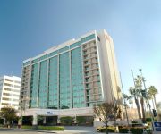
Hilton Pasadena
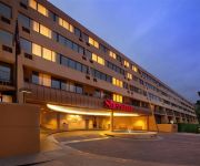
Sheraton Pasadena Hotel
BW PLUS DRAGON GATE INN
Residence Inn Los Angeles Pasadena/Old Town
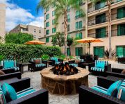
Courtyard Los Angeles Pasadena/Old Town
Comfort Inn Near Old Town Pasadena in Eagle Rock
Stay on the View
Titta Inn
Videos from this area
These are videos related to the place based on their proximity to this place.
2014 XC - Rio Hondo League Meet 1 - Girls Varsity
Rio Hondo League Meet #1 Girl's Varsity 3 Mile race held September 25, 2014 at Lacy Park in San Marino, CA. Conditions - temperatures high 80s, thick grass course.
2014 XC - League Meet #2 (all 5 races)
Video contains all 5 races from the second Rio Hondo League meet held at Hahamongna Park in La Canada on October 16, 2014. San Marino won the men's varsity while La Canada took the women's.
2014 XC - Rio Hondo League Meet #1 Men's Varsity
Rio Hondo League Meet #1 Men's Varsity 3 Mile race held September 25, 2014 at Lacy Park in San Marino, CA. Conditions - temperatures high 80s, thick grass course.
2014 XC - Rio Hondo League Meet 1 Girls JV
Rio Hondo League Meet #1 Girl's JV 3 Mile race held September 25, 2014 at Lacy Park in San Marino, CA. Conditions - temperatures high 80s, thick grass course.
XC 2014 - Rio Hondo League Meet 1 - JV Boys
Rio Hondo League Meet #1 Junior Varsity Boys 3 Mile race held September 25, 2014 at Lacy Park in San Marino, CA. Conditions - temperatures high 80s, thick grass course.
2014 XC - Rio Hondo League Finals - Varsity Girls
The Varsity girls from the 6 teams in the Rio Hondo League race for the 2014 cross country championship on Nov 6 at Lacy Park in San Marino. Includes the awards ceremony at the end.
Wild Parrots in South Pasadena Holiday Season
Two days after Christmas, the palm trees of this peaceful South Pasadena neighborhood are crowded with beautiful but chatty parrots! Would love to see these colorful birds join the Rose Parade...
MLS 22166495 - 1678 Via Del Rey, South Pasadena, CA
1678 Via Del Rey, South Pasadena http://www.coldwellbanker.com/property?action=detail&brandType=CB&propertyId=263099158.
2015 TF - Monrovia vs South Pas Girls F-S 4 x 100 Relay
Monrovia High versus South Pasadena High dual track meet held at SPHS on March 25, 2015. This is the Frosh-Soph Girls 4 x 100 meter relay. A complete list of videos as well as results for...
Videos provided by Youtube are under the copyright of their owners.
Attractions and noteworthy things
Distances are based on the centre of the city/town and sightseeing location. This list contains brief abstracts about monuments, holiday activities, national parcs, museums, organisations and more from the area as well as interesting facts about the region itself. Where available, you'll find the corresponding homepage. Otherwise the related wikipedia article.
California State University, Los Angeles
California State University, Los Angeles (also known as Cal State L.A. , CSULA, or CSLA) is a public comprehensive university, part of the California State University (CSU) system. The campus is located in the eastern region of Los Angeles, California, United States, in the University Hills district, facing the San Gabriel Mountains, at the center of Los Angeles metropolitan area just five miles (8 km) east of Downtown Los Angeles.
Highland Park, Los Angeles
Highland Park is a historic neighborhood in Northeast Los Angeles. It is inhabited by a variety of ethnic and socioeconomic groups.
University Hills, Los Angeles
University Hills is a district on the East Side of Los Angeles, California. It is the site of California State University, Los Angeles.
KMPC
KMPC (1540 AM, "Radio Korea", 라디오코리아) is a radio station based in Los Angeles, California and is owned by P&Y Broadcasting Licensee, LLC. Radio Korea is a division of the [Radio Korea Media Group. The station airs Korean-language programming. It broadcasts news, information, and entertainment for the largest Korean-American community in the United States, and the largest Korean community outside of Korea.
KFWB
KFWB is a Los Angeles, California AM radio station operating on 980 kHz with 5,000 watts of power from a transmitter site near Lincoln Park (East Los Angeles). The station had a mostly all-news format from 1968 until September 8, 2009, after which it converted to a news-talk format. KFWB is operated by the KFWB Asset Trust.
El Sereno, Los Angeles
El Sereno is a community in Eastern Los Angeles, California. El Sereno sits atop the Monterey Hills that separate the Los Angeles Basin from the San Gabriel Valley, and is the easternmost district in the city of Los Angeles. It is bordered by Monterey Hills and South Pasadena on the north, Alhambra on the east, University Hills on the southeast, City Terrace on the south, Boyle Heights on the southwest, Lincoln Heights on the west, and Montecito Heights on the northwest.
Southwest Museum of the American Indian
The Southwest Museum of the American Indian is a museum, library, and archive located in the Mt. Washington area of Los Angeles, California. It is part of the Autry National Center. Its collections deal mainly with the American Indian. However, it also has an extensive collection of pre-Hispanic, Spanish colonial, Latino, and Western American art and artifacts.
Los Angeles County Department of Public Works
The Los Angeles County Department of Public Works (LACDPW) is responsible for the construction and operation of Los Angeles County's roads, building safety, sewerage, and flood control.
Monterey Hills, Los Angeles
Monterey Hills is a small, diverse, middle-class community within the city of Los Angeles, California located about 4 miles ENE of downtown Los Angeles and about 3 miles from Pasadena off of the 110 Freeway. It is surrounded by El Sereno to the southeast, Hermon to the east, Montecito Heights to the southwest and the independent city of South Pasadena to the northeast. Monterey Hills is part of the Arroyo Seco Neighborhood Council (ASNC).
Montecito Heights, Los Angeles
Montecito Heights is a small district in Northeast Los Angeles formerly known as an original East Los Angeles area of Los Angeles, California. The 2000 population is estimated at 16,768.
Alliant International University
Alliant International University is a private, non-profit higher education institution based in San Diego, California. The university is also known synonymously as Alliant. It offers programs in six California campuses and three international campuses in. Its enrollment is approximately 4000 students, of whom 95% are post-graduate.
KLAC
KLAC AM 570 is a radio station serving the Los Angeles metropolitan area. KLAC is one of eight Los Angeles radio stations owned by San Antonio-based Clear Channel Communications. The station is co-located with its sister stations in suburban Burbank, and its transmitter is located on a site in the Lincoln Heights neighborhood of Los Angeles, east of downtown.
Arroyo Seco bicycle path
The Arroyo Seco bicycle path is an approximately 2 miles long Class I bicycle path in Los Angeles, California. The path connects Montecito Heights Recreation Center, Ernest E. Debs Regional Park, and Hermon Park in the Highland Park district, and runs parallel to State Route 110, and ends at San Pascual Stables in South Pasadena.
Hermon, Los Angeles
Hermon is a small district in the city of Los Angeles, California. It is situated in a half square-mile valley bordered by the Arroyo Seco and the historic 110 freeway to the west, Monterey Hills to the south, and South Pasadena to the north and east. The community has been part of Los Angeles since 1912, but has retained its own unique identity.
Los Angeles County High School for the Arts
Los Angeles County High School for the Arts is a Visual and Performing Arts high school located on the campus of California State University, Los Angeles in Los Angeles, California, United States. Founded in 1984, the public, tuition-free school offers both college preparatory courses and conservatory style training. Though it shares facilities with the university, the two schools' activities are usually separate. It is operated by the Los Angeles County Office of Education.
Cal State LA Studios
Cal State LA Studios is the production area of the Department of Television, Film, and Media Studies at California State University, Los Angeles, the only CSU campus in the Los Angeles basin. Bachelor of Arts degrees are offered in Telecommunications and Film, Broadcast Journalism and Animation.
Old LA (Highland Park) Farmers Market
The Old LA Certified Farmers Market (OLACFM) operates in the Highland Park neighborhood of Los Angeles, CA. The farmers market is open every Tuesday from 3PM to dusk year round. One of the newest certified farmers markets in the Los Angeles area, the market opened in April 2006 and serves Highland Park and other neighborhoods in Northeast Los Angeles, including Mt. Washington, Eagle Rock,(Glassel Park, Los Angeles) and Montecito Heights.
Cal State LA (train station)
Cal State LA (officially Cal State Los Angeles) is a Metrolink station serving the San Bernardino Line and also the El Monte Busway for the Metro Silver Line and other bus rapid transit services. Local bus services operate from outside the station. The Silver Line station is heavy used by Cal State LA students.
Garvanza, Los Angeles
Garvanza is a neighborhood in northeast Los Angeles. It is generally considered a subdistrict of Highland Park. It is named for the garbanzo beans that once flourished there. Garvanza was annexed by the city in 1899. The two bridges which connect Los Angeles to South Pasadena originate in Garvanza.
Rancho Rosa Castilla
Rancho Rosa Castilla was a 3,283-acre Mexican land grant in present day Los Angeles County, California given to Juan Ballesteros in 1831 by Governor Manuel Victoria. The land grant failed to receive confirmation from the Public Land Commission.
Heritage Square Museum
Heritage Square Museum is a living history and open air architecture museum located beside the Arroyo Seco Parkway in the Montecito Heights neighborhood of Los Angeles, California, in the southern Arroyo Seco area. The living history museum shows the story of development in Southern California through historical architectural examples. The museum focuses on interpreting the years 1850 to 1950, a century of unprecedented growth in Los Angeles.
Cawston Ostrich Farm
Cawston Ostrich Farm, located in South Pasadena, California, United States was opened in 1886 by Edwin Cawston. It was America's first ostrich farm and was located in the Arroyo Seco Valley just three miles (5 km) north of downtown Los Angeles and occupied nine acres.
Eagle's Nest Arena
Eagle's Nest Arena is an indoor arena located on the California State University, Los Angeles campus. It plays host to the basketball and volleyball teams for the Golden Eagles, is 94 feet long, 80 feet wide, and can handle two basketball and three volleyball courts. Seating 3,200 at full capacity, it hosted the judo competitions for the 1984 Summer Olympics.
Los Angeles International Charter High School
Los Angeles International Charter High School is a charter school in Hermon, Los Angeles, California, near Highland Park. It occupies the campus of the former Pacific Christian High School.
Rose Hill Park, Los Angeles
Rose Hill Park is the name of a park and a playground in the community of El Sereno. It is also used to refer to the neighborhood surrounding the park and playground. The area is in ZIP code 90032.


