Safety Score: 2,7 of 5.0 based on data from 9 authorites. Meaning we advice caution when travelling to United States.
Travel warnings are updated daily. Source: Travel Warning United States. Last Update: 2024-08-13 08:21:03
Discover New Chinatown
The district New Chinatown of Los Angeles in Los Angeles County (California) is a subburb in United States about 2,294 mi west of Washington DC, the country's capital city.
If you need a hotel, we compiled a list of available hotels close to the map centre further down the page.
While being here, you might want to pay a visit to some of the following locations: Orange, Santa Ana, Riverside, San Bernardino and Ventura. To further explore this place, just scroll down and browse the available info.
Local weather forecast
Todays Local Weather Conditions & Forecast: 16°C / 61 °F
| Morning Temperature | 13°C / 55 °F |
| Evening Temperature | 15°C / 59 °F |
| Night Temperature | 14°C / 57 °F |
| Chance of rainfall | 0% |
| Air Humidity | 44% |
| Air Pressure | 1016 hPa |
| Wind Speed | Gentle Breeze with 7 km/h (4 mph) from North-East |
| Cloud Conditions | Clear sky, covering 0% of sky |
| General Conditions | Sky is clear |
Tuesday, 19th of November 2024
16°C (62 °F)
15°C (58 °F)
Overcast clouds, gentle breeze.
Wednesday, 20th of November 2024
18°C (65 °F)
16°C (61 °F)
Scattered clouds, light breeze.
Thursday, 21st of November 2024
20°C (67 °F)
17°C (63 °F)
Overcast clouds, light breeze.
Hotels and Places to Stay
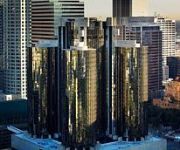
Los Angeles The Westin Bonaventure Hotel & Suites
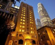
Hilton Checkers Los Angeles
DoubleTree by Hilton Los Angeles Downtown
Freehand Los Angeles
Omni LA at California Plaza
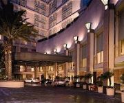
Sheraton Grand Los Angeles
THE LA HOTEL DOWNTOWN
MILLENNIUM BILTMORE HOTEL LAX
Tuck Hotel
Sunshine Suites at 616 St. Paul
Videos from this area
These are videos related to the place based on their proximity to this place.
Tioga Pass Trip : Ride from Los Angeles to Fullerton HD
Watch in High Definition! Here's the first part of the ride on the Tioga Pass Private Rail car coupled to Train 572. For those who haven't seen the preview or forgot, here's a refresher:...
Chinatown Los Angeles
SUBSCRIBE! http://tinyurl.com/p2fveuj California travel expert Veronica Hill of http://www.CaliforniaTravelExpert.com tours Chinatown Los Angeles in this episode of "California Travel Tips."...
2013 CHSSC Golden Spike Award Recipient: Milton Quon
Artist Milton Quon accepts the Chinese Historical Society of Southern California 2013 Golden Spike Award. 99 year old Quon salutes 102 year old Tyrus Wong, talks about his opportunity to pursue...
Apartment Building Broker Los Angeles -Chinatown
http://www.select-realestate.com is pleased to bring to the market 433 Cottage Home St. Los Angeles CA 90012. It is a 16 Unit Apartment Building with a great unit mix. The area is up and...
Golden Dragon Parade - 2014
The 115th Annual Golden Dragon Parade in Chinatown (Los Angeles), celebrating the Chinese New Year. This is video 4 of 4.
Poly (Paul) the Parrot - At Philippe The Original restaurant in Los Angeles
This is Paul aka Poly (Pauly) the Parrot. I shot this video at Philipps the Original restaurant (at Ord and Alemeda st.) near Union Station in Downtown Los Angeles.
Los Angeles Union Station Grand Opening 1939
Los Angeles Union Station Grand Opening 1939 Original footage taken by Ward Kimball, donated to the Academy of Motion Picture Arts and Sciences. See the original at ...
20140301 - Los Angeles Lantern Festival
Immortals Lion Dance troupe for the Los Angeles Lantern Festival of 2014. Held in the Pico House @ El Pueblo Historical Monument.
Videos provided by Youtube are under the copyright of their owners.
Attractions and noteworthy things
Distances are based on the centre of the city/town and sightseeing location. This list contains brief abstracts about monuments, holiday activities, national parcs, museums, organisations and more from the area as well as interesting facts about the region itself. Where available, you'll find the corresponding homepage. Otherwise the related wikipedia article.
Chinatown, Los Angeles
Chinatown in Los Angeles, California (Chinese: 洛杉磯唐人街; Mandarin Pinyin: luò shān jī táng rén jiē; Jyutping: lok saam gei tong jan gaai) is located in the city's downtown area. Built in 1938, it is the second Chinatown to be constructed in Los Angeles. The original historic Chinatown was founded in the late 19th century, but was demolished to make room for Union Station, the city's major rail depot, leaving its residents and businesses displaced.
Los Angeles Music Center
The Music Center (officially named the Performing Arts Center of Los Angeles County) is one of the three largest performing arts centers in the United States. Located in downtown Los Angeles, the Music Center is home to the Dorothy Chandler Pavilion, Ahmanson Theater, Mark Taper Forum and Walt Disney Concert Hall.
Twin Towers Correctional Facility
The Twin Towers Correctional Facility, also referred to in the media as Twin Towers Jail, is a complex erected in Los Angeles, California. The facility is located at 450 Bauchet Street, in Los Angeles, California and is operated by the Los Angeles County Sheriff's Department. The facility consists of two towers, a medical services building, and the Los Angeles County Medical Center Jail Ward.
Hall of Justice
A Hall of Justice is an occasional term for a city's police headquarters, and exists in cities across the United States. In some cases, the facility may also house courts as well as jails. In some US cities, the Hall of Justice is called the Justice Center.
Olvera Street
Olvera Street is in the oldest part of Downtown Los Angeles, California, and is part of the El Pueblo de Los Angeles Historic Monument. Many Latinos refer to it as "La Placita Olvera. " Since 1911 it was described as Sonora Town. Having started as a short lane, Wine Street, it was extended and renamed in honor of Agustín Olvera, a prominent local judge, in 1877. There are 27 historic buildings lining Olvera Street, including the Avila Adobe, the Pelanconi House and the Sepulveda House.
Union Station (Los Angeles)
Los Angeles Union Station (or LAUS) is the main railway station in Los Angeles, California. In recent years the station has become a major transportation hub for Southern California serving 60,000 passengers a day as they access Amtrak long distance trains, Amtrak California regional trains, Metrolink commuter trains and several Metro Rail subway and light rail lines.
Philippe's
Philippe's, or "Phillippe the Original", historically /fɪˈliːps/ fil-LEEPS is a restaurant located in downtown Los Angeles, California. The restaurant is well known for continuously operating since 1908, making it one of the oldest restaurants in Los Angeles. It is also renowned for claiming to be the inventor of the French Dip sandwich. The restaurant has been located at 1001 N.
Los Angeles County Board of Supervisors
The Los Angeles County Board of Supervisors (LAC BOS) is the five-member nonpartisan governing board of Los Angeles County, California. Members of the board of supervisors are elected by district. They were as of December 2, 2008: District 1: Gloria Molina District 2: Mark Ridley-Thomas District 3: Zev Yaroslavsky District 4: Don Knabe District 5: Michael D. Antonovich
Cathedral of Our Lady of the Angels
The Cathedral of Our Lady of the Angels, informally known as COLA or the Los Angeles Cathedral is a Latin-rite cathedral of the Roman Catholic Church in Los Angeles, California, United States of America. Opened in 2002, the cathedral serves as the mother church for the Archdiocese of Los Angeles. It is also the cathedra seat of Archbishop José Horacio Gómez. The structure was meant to replace the Cathedral of Saint Vibiana, which was severely damaged in the 1994 Northridge earthquake.
Los Angeles High School
Los Angeles High School is the oldest public high school in the Southern California Region and in the Los Angeles Unified School District. Its colors are royal blue and white and the teams are called the Romans. Los Angeles High School is a public secondary high school, enrolling an estimated 2,000 students in grades 9-12 and after operating on a year-round basis consisting of three tracks for ten years, was restored to a traditional calendar in 2010.
Los Angeles County Assessor
The Los Angeles County Assessor is the assessor and officer of the government of Los Angeles County responsible for discovering all taxable property in Los Angeles County, except for state-assessed property, to inventory and list all the taxable property, to value the property, and to enroll the property on the local assessment roll.
Cathedral High School (Los Angeles)
Cathedral High School is a private, college preparatory Catholic all-boys school in Los Angeles, California.
Chinese American Museum
The Chinese American Museum is a museum located in Downtown Los Angeles as a part of the El Pueblo de Los Angeles Historic Monument. It is dedicated to the history and experience of Chinese Americans in the state of California, first such museum in Southern California. It presents exhibits of fine art by Chinese American artists as well as historical exhibits. Planning for the museum began in October 1984, with the grand opening taking place on December 18, 2003.
Triforium (Los Angeles)
The Triforium is the name of a six story 60 ton public sculpture in the Los Angeles Mall Civic Center complex, located at the intersection of Temple and Main Streets in Downtown Los Angeles.
Ahmanson Theatre
The Ahmanson Theatre is one of the four main venues that comprise the Los Angeles Music Center. Through the generosity of philanthropist Howard F. Ahmanson, Sr. , construction began on March 9, 1962. The theatre opened on April 12, 1967 with a production of More Stately Mansions starring Ingrid Bergman, Arthur Hill, and Colleen Dewhurst.
Thien Hau Temple, Los Angeles
Thien Hau Temple, also known as Chùa Bà Thiên Hậu in Vietnamese and as Tiān Hòu Gōng (天后宫) in Chinese, is a Taoist temple in Los Angeles Chinatown. It is one of the more popular areas for worship and tourism in the Los Angeles area.
Los Angeles County Chief Executive Office
The Los Angeles County Chief Executive Office, known as the Chief Administrative Office from 1938 to 2007, assists the Board of Supervisors of Los Angeles County, California with administrating the county. The chief executive officer (CEO) supervises 31 out of the 39 departments of the County, and works closely with the remaining eight.
Broadway Tunnel (Los Angeles)
The Broadway Tunnel was a tunnel under Fort Moore Hill in Los Angeles, California, downtown, extending North Broadway (formerly Fort Street), at Sand Street (later California Street), one block north of Temple Street, northeast to the intersection of Bellevue Avenue, to Buena Vista Street (now North Broadway).
Mission Junction, Los Angeles
Mission Junction is an industrial neighborhood in Los Angeles, California. The area's name refers to one of several railroad junctions located within the district. It is also referred to as Naud Junction. There are a few residents in the area, who are mostly Hispanic. It is east of Chinatown bordered by the Los Angeles River to the east, Downtown Los Angeles to the southwest, and the Pasadena Freeway to he northwest.
United States Court House (Los Angeles, 1940)
The United States Court House in Downtown Los Angeles is a Moderne style building that originally served as both a post office and a courthouse. The building was designed by Gilbert Stanley Underwood and Louis A. Simon, and construction was completed in 1940. The United States Court House initially housed court facilities for the United States District Court for the Southern District of California, until the District was redrawn in 1966.
International Savings & Exchange Bank Building
The International Savings & Exchange Bank Building (also known as the International Savings Building), was built in the Spring Street Financial District of Los Angeles in 1907. Standing ten floors, it was designed in the Renaissance Revival and Italianate styles by architect H. Alban Reaves (some sources spell Reeves), who had previously designed several structures in New York, including what is now the south building of the historic Schuyler Arms.
Hong Kong Café
The Hong Kong Café was a Los Angeles music venue and part of the Los Angeles punk rock scene during the late 1970s and early 1980s. Located at 425 Gin Ling Way in the Chinatown district of Downtown Los Angeles, California and across the way from sometimes rival Esther Wong’s Madame Wong′s, the former Chinese restaurant was open to audiences of all ages.
William Mead Homes
William Mead Homes, nicknamed Dogtown, is a public housing development in the industrial neighborhood of Mission Junction, Los Angeles, California, USA, near Twin Towers Correctional Facility and Union Station. It is operated by the Housing Authority of the City of Los Angeles.
Men's Central Jail
Men's Central Jail is a Los Angeles County Sheriff's Department County Jail for men in Los Angeles, Los Angeles County, California, United States. Built in 1963, it is one of the oldest County Prisons in California. The Men's Central Jail is located at 441 Bauchet St. , Los Angeles 90012.
Metropolitan Detention Center, Los Angeles
The Metropolitan Detention Center, Los Angeles (MDC Los Angeles) is a United States federal prison in downtown Los Angeles, California which holds male and female inmates prior to and during court proceedings, as well an inmates serving short sentences. It is operated by the Federal Bureau of Prisons, a division of the United States Department of Justice.


