Safety Score: 2,7 of 5.0 based on data from 9 authorites. Meaning we advice caution when travelling to United States.
Travel warnings are updated daily. Source: Travel Warning United States. Last Update: 2024-08-13 08:21:03
Discover Highway Highlands
The district Highway Highlands of Los Angeles in Los Angeles County (California) is a district in United States about 2,291 mi west of Washington DC, the country's capital city.
Looking for a place to stay? we compiled a list of available hotels close to the map centre further down the page.
When in this area, you might want to pay a visit to some of the following locations: Orange, Santa Ana, Riverside, San Bernardino and Ventura. To further explore this place, just scroll down and browse the available info.
Local weather forecast
Todays Local Weather Conditions & Forecast: 14°C / 57 °F
| Morning Temperature | 9°C / 48 °F |
| Evening Temperature | 12°C / 54 °F |
| Night Temperature | 10°C / 49 °F |
| Chance of rainfall | 0% |
| Air Humidity | 41% |
| Air Pressure | 1015 hPa |
| Wind Speed | Gentle Breeze with 6 km/h (4 mph) from South |
| Cloud Conditions | Clear sky, covering 0% of sky |
| General Conditions | Sky is clear |
Tuesday, 19th of November 2024
15°C (59 °F)
12°C (53 °F)
Overcast clouds, light breeze.
Wednesday, 20th of November 2024
18°C (64 °F)
13°C (56 °F)
Scattered clouds, light breeze.
Thursday, 21st of November 2024
20°C (68 °F)
15°C (59 °F)
Broken clouds, light breeze.
Hotels and Places to Stay
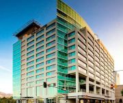
Embassy Suites by Hilton Los Angeles Glendale
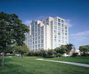
Hilton Los Angeles North-Glendale - Executive Meeting Center
BRANDWOOD HOTEL
THE COAST ANABELLE HOTEL
Courtyard Los Angeles Burbank Airport
Hotel Brandwood
OAKWOOD AT AMLI LEX ON ORANGE
Oakwood at Avalon Burbank
BURBANK INN AND SUITES
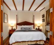
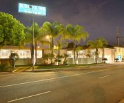
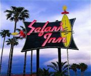
THE SAFARI INN. A COAST HOTEL
Videos from this area
These are videos related to the place based on their proximity to this place.
Burbank Downhill
Single track in Verdugo Mountains above Burbank and Glendale in the San Fernando Valley, on the Bell Golf Course Side... It's steep, loose, fast, and fun. My wide angle camera makes it look...
Burroughs High - Little Town of Bethlehem and Mary Did You Know
Starring Keaton Savage, Noel Escobar, Tyler Mann, Andrew Orbison, Eric Parker and Dylan Tuomy-Wilhoit. From Burroughs High School's Holiday Spectacular Pop Snow 2, 2008 in Burbank, ...
Tongva Peak - Hiking Los Angeles (HD)
Beaudry Motorway Loop to Tongva Peak. I have done this hike many times and this will always hold a special place in my heart. This was the first major hike I did that wasn't Eaton Canyon. This...
93 Jeep Grand Cherokee 450 shot of NOS
A Jeep Grand Cherokee i hooked up a massive bottle of NOS, faaaaaaaaaast!
La Crescenta Montrose Block Wall Retaining Wall Repair Shafran Masonry Construction 818-735-0509
Web site: www.shafranconstruction.com Email: shafranconst@gmail.com Phone: 818-735-0509 Choose the #1 Company in Los Angeles and Ventura County for your next construction or remodeling ...
La Crescenta Appraiser - 818-384-6869 - Home Appraisal in La Crescenta, CA
http://www.TurnersAppraisals.com Real Estate Appraiser helping people make informed property valuation decisions by providing comprehensive yet easy to understand real estate appraisal reports...
Sheriff harasses me in La Crescenta again
Excuse the shaky-cam. Emotions make for a poor camera man.
Beautiful Sunset on 12/28/10 in Southern CA
READ THIS FIRST!!!!!! On Tuesday December 28, 2010, when I was visiting my grandparents' house in the southern California city of La Crescenta, the most beau...
PL2130 - La Crescenta Apartment for Rent
Pacific Listings is Proud to Present this La Crescenta Property for Rent. Upper Level 1 Bedroom + 1 Bathroom. Lovely Surrounding Landscape, Front Patio Area, 1 Reserved Parking Space, Classic...
Videos provided by Youtube are under the copyright of their owners.
Attractions and noteworthy things
Distances are based on the centre of the city/town and sightseeing location. This list contains brief abstracts about monuments, holiday activities, national parcs, museums, organisations and more from the area as well as interesting facts about the region itself. Where available, you'll find the corresponding homepage. Otherwise the related wikipedia article.
Cartoon Network Studios
Cartoon Network Studios is an American animation studio. A subsidiary of the Turner Broadcasting System, Cartoon Network Studios focuses on producing and developing animated programs for Cartoon Network.
La Cañada Flintridge, California
La Cañada Flintridge is a small and affluent city in Los Angeles County, California, United States whose population at the 2010 census was 20,246, down from 20,318 at the 2000 census. According to Forbes, as of 2010, La Cañada Flintridge ranks as the 143rd most expensive U.S. city to live in, with a median home price of $1,321,367.
Descanso Gardens
Descanso Gardens, located in La Cañada Flintridge, Los Angeles County, California, is a 150 acres botanical garden. At one time, this property belonged to newspaper magnate E. Manchester Boddy, who owned the Los Angeles Daily News. He ran a commercial camellia garden at the location, supplying prom boutonnières, for example, until he ceded the site to Los Angeles County in 1953.
Walt Disney Imagineering
Walt Disney Imagineering (also known as WDI or simply Imagineering) is the design and development arm of the Walt Disney Company, responsible for the creation and construction of Disney theme parks worldwide. Founded by Walt Disney in 1952 to oversee the production of Disneyland Park, it was originally known as WED Enterprises, from the initials meaning "Walter Elias Disney", the company founder's full name.
Glendale Community College (California)
Not to be confused with Glendale University College of Law Glendale Community College (aka GCC) is a community college in Glendale, California, USA. It was founded to serve the needs of the people in the Glendale Union High School District which at the time included La Crescenta, Glendale, and Tujunga.
KABC-TV
KABC-TV is the ABC owned-and-operated television station in Los Angeles, California. It broadcasts a high definition digital signal on VHF channel 7 from a transmitter atop Mount Wilson. Owned by the Disney-ABC Television Group subsidiary of the Walt Disney Company, KABC maintains offices on Circle Seven Drive in Glendale. In the few areas of the western United States where an ABC station is not receivable over-the-air, KABC-TV is available on satellite television through DirecTV.
KXOL-FM
KXOL-FM (96.3, "Latino 96.3"), is a Latin leaning Rhythmic music radio station in the Los Angeles area.
Crescenta Valley
The Crescenta Valley is a small inland valley in Los Angeles County, California lying between the San Gabriel Mountains on the northeast and the Verdugo Mountains and San Rafael Hills on the southwest. It opens into the San Fernando Valley at the northwest and the San Gabriel Valley at the southeast. It is nearly bisected by the Verdugo Wash, a smaller valley separating the Verdugo Mountains from the San Rafael Hills. Most of the valley lies at an elevation of over 1,500 feet (450 m).
Verdugo Mountains
The Verdugo Mountains are a small, rugged mountain range of the Transverse Ranges system, located just south of the western San Gabriel Mountains in Los Angeles County, Southern California. The range is sometimes known as the Verdugo Hills or simply the Verdugos. Surrounded entirely by urban development, they represent an isolated wildlife island and are in large part under public ownership in the form of undeveloped parkland.
Coast Line (UP)
The Coast Line is a railroad line from Burbank, California {{#invoke:Coordinates|coord}}{{#coordinates:34.1861|-118.321||||||| | |name= }} north to the San Francisco Bay Area, roughly along the Pacific Coast. It is the shortest rail route from Los Angeles to the Bay Area. The first version of the Coast line, via Saugus and Santa Paula, was completed by the Southern Pacific Railroad on December 31, 1900; the line via Santa Susana opened in 1904 and thereafter was the main line.
Burbank High School (Burbank, California)
Burbank High School is a public high school located in Burbank, California, USA. It opened on September 14, 1908, and its inaugural class had 334 students. The area had previously been served by the Glendale Union High School District. Burbank High began an extensive facility update in 2003, and its first phase of reconstruction was a building housing new classrooms for the entire school.
Woodbury University
Woodbury University, founded as "Woodbury Business College", is a private, non-profit, coeducational, nonsectarian university located in Burbank, California.
Glendale University College of Law
Glendale University College of Law (GUCL) is a private, non-profit law school in Glendale, California. Founded in 1967 as Glendale College of Law, the institution renamed itself Glendale University College of Law in 1975. The University confers an undergraduate degree, that is a Bachelor of Science in Law. The University's College of Law confers a professional doctorate, that is the Juris Doctor.
Starlight Bowl (Burbank)
The Starlight Bowl is an amphitheater located in Burbank, California. Originally built in 1950, today it seats 3,000 in chairback seating and 2,000 more on the lawn for a total capacity of 5,000.
Downtown Burbank (Metrolink station)
The Burbank Metrolink Station, sometimes referred to as the Burbank Transportation Center, is a Metrolink rail station near downtown Burbank, California. It is served by Metrolink's Antelope Valley Line to Lancaster and Ventura County Line to East Ventura with both terminating at Los Angeles Union Station. Amtrak trains do not stop at this station; rather, Amtrak trains stop at the Burbank Airport station, adjacent to Bob Hope Airport, several miles to the northwest of downtown Burbank.
Bellarmine-Jefferson High School
Bellarmine-Jefferson High School is a private, Roman Catholic high school in Burbank, California. It is located in the Roman Catholic Archdiocese of Los Angeles.
Rancho La Cañada
Rancho La Cañada was a 5,832-acre Mexican land grant in present day Los Angeles County, California given in 1843 by Governor Manuel Micheltorena to a Mexican schoolteacher from Los Angeles, Ygnacio Coronel. The name means "ranch of the canyon". The rancho included the current day cities of La Canada, La Crescenta and Flintridge.
Grand Central Airport (United States)
Grand Central Airport, Glendale, California, also known as Grand Central Air Terminal (GCAT), was an important facility for the growing Los Angeles suburb of Glendale in the 1920s. It was also a key element in the development of United States aviation. The terminal, located at 1310 Air Way, was built in 1928 and is still there.
KROQ-FM
KROQ-FM — branded 106.7 KROQ — is a commercial modern rock radio station licensed to Pasadena, California serving the Greater Los Angeles area. The call sign is pronounced "kay rock. " It is the flagship station of Loveline hosted by Dr. Drew Pinsky, and The Kevin and Bean Morning Show.
KWO37
KWO37 (sometimes referred to as Los Angeles All Hazards) is a NOAA Weather Radio station that is programmed from the National Weather Service forecast office in Los Angeles/Oxnard, California with its transmitter located in Mount Lukens in the San Gabriel Mountains.
Rancho Tujunga
Rancho Tujunga was a 6,661-acre Mexican land grant in present day Los Angeles County, California given in 1840 by Mexican governor Juan Alvarado to Francisco Lopez and Pedro Lopez. The rancho lands included the present day Los Angeles communities of Lake View Terrace, Sunland, Tujunga.
Burbank Western Channel
Burbank Western Channel (also known as Burbank Western Wash) is a 6.3-mile-long tributary of the Los Angeles River in the eastern San Fernando Valley of Los Angeles County, California. The stream begins at the confluence of Hansen Heights Channel and La Tuna Canyon Lateral in Sun Valley. It runs adjacent to Interstate 5 for most of its length and is entirely encased in a concrete flood control channel.
Sunland-Tujunga, Los Angeles
Sunland-Tujunga is nestled in the Foothills of the San Gabriel Mountains and is a community served by two post offices in the northeasternmost corner of Los Angeles. Though Sunland and Tujunga began as separate settlements, they are today linked through a single police station, branch library, neighborhood council. chamber of commerce, City Council district, high school and various civic organizations. As an example, the Little Landers Historical Society studies the history of the entire area.
DreamWorks
DreamWorks Studios, officially DW II Distribution Co. , LLC, also known as DreamWorks, LLC, DreamWorks SKG, DW Studios, LLC, or simply DreamWorks, is a California film studio which develops, produces, and distributes films, video games and television programming. It has produced or distributed more than ten films with box-office grosses totaling more than $100 million each. Today, most of DreamWorks' films are marketed and distributed by The Walt Disney Studios.
Monte Vista Hotel
Not to be confused with the Hotel Monte Vista in Flagstaff, Arizona. Los Angeles County's fashionable Monte Vista Hotel was situated at today's Fenwick Street and Floralita Avenue in Sunland, California, a district of Los Angeles, between 1887, when it was built, and 1964, when it was demolished. In its early years it was used as an "elegant retreat for wealthy Los Angeles area sportsmen," who make their way to Glendale, California, and then take a stage to Tujunga and the lodge.


