Safety Score: 2,7 of 5.0 based on data from 9 authorites. Meaning we advice caution when travelling to United States.
Travel warnings are updated daily. Source: Travel Warning United States. Last Update: 2024-08-13 08:21:03
Discover La Verne
La Verne in Los Angeles County (California) with it's 32,681 citizens is a place in United States about 2,267 mi (or 3,649 km) west of Washington DC, the country's capital city.
Current time in La Verne is now 02:12 AM (Sunday). The local timezone is named America / Los Angeles with an UTC offset of -8 hours. We know of 8 airports near La Verne, of which 3 are larger airports. The closest airport in United States is Ontario International Airport in a distance of 10 mi (or 16 km), East. Besides the airports, there are other travel options available (check left side).
Also, if you like playing golf, there are a few options in driving distance. We encountered 3 points of interest in the vicinity of this place. If you need a hotel, we compiled a list of available hotels close to the map centre further down the page.
While being here, you might want to pay a visit to some of the following locations: Orange, Santa Ana, Riverside, Los Angeles and San Bernardino. To further explore this place, just scroll down and browse the available info.
Local weather forecast
Todays Local Weather Conditions & Forecast: 15°C / 59 °F
| Morning Temperature | 13°C / 55 °F |
| Evening Temperature | 15°C / 58 °F |
| Night Temperature | 13°C / 55 °F |
| Chance of rainfall | 0% |
| Air Humidity | 65% |
| Air Pressure | 1018 hPa |
| Wind Speed | Gentle Breeze with 6 km/h (4 mph) from North-East |
| Cloud Conditions | Scattered clouds, covering 39% of sky |
| General Conditions | Scattered clouds |
Sunday, 24th of November 2024
18°C (64 °F)
16°C (60 °F)
Overcast clouds, light breeze.
Monday, 25th of November 2024
15°C (60 °F)
15°C (59 °F)
Light rain, calm, overcast clouds.
Tuesday, 26th of November 2024
15°C (59 °F)
14°C (57 °F)
Light rain, light breeze, overcast clouds.
Hotels and Places to Stay
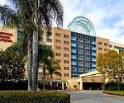
Sheraton Fairplex Hotel & Conference Center
DoubleTree by Hilton Pomona
Holiday Inn Express & Suites SAN DIMAS
BEST WESTERN SAN DIMAS HOTEL
BEST WESTERN DIAMOND BAR HOTEL AND SUITE
La Quinta Inn and Suites Pomona
Lemon Tree Inn
Royla Motel
BEST WESTERN PINE TREE MOTEL
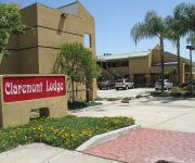
CLAREMONT LODGE
Videos from this area
These are videos related to the place based on their proximity to this place.
City of La Verne 4th of July Parade 2013 - Full Coverage
Full coverage of the 2013 Fourth of July Parade and Festivities in the City of La Verne.
University of La Verne | Leopard Volleyball Earns NCAA Tournament Bid
For the first time in three seasons, the University of La Verne will be represented in the NCAA Volleyball Championship Tournament. La Verne (21-5) received an at-large bid to the tournament...
The La Verne Project ICTCM 2014
This video is a documentary of the La Verne project. A journey from paper and pencil classroom to flipped hybrids with emporium component along with all the steps and results in between. The...
Goodyear Blimp Landing at Brackett Field, La Verne
The Goodyear blimp did a touch and go at Brackett field today. I don't know why because I did not have my radio with me.
Spooked mule deer doe near La Verne CA. Muley
Spooked mule deer doe near La Verne CA. This doe came blasting out by me from the right. I had seen real fresh cougar tracks on the way in so I'm guessing the big cat was stalking the doe....
Bb Mobile Learn at La Verne - long
Full length version of the Blackboard Mobile Learn promotional video for Fall 2012. Produced by the Center for Teaching and Learning at the University of La Verne.
University of La Verne Leopards Vs. Whitworth Highlights
Highlights from the September 15 football game between the University of La Verne and Whitworth. Learn more about University of La Verne Sports at: http://leopardathletics.com/
Mallard & Gadwall ducks feeding in duckweed La Verne CA. Waterfowl, bird, nature
Mallards & Gadwall ducks feeding in duckweed La Verne CA. Anas platyrhynchos & Anas strepera. http://en.wikipedia.org/wiki/Mallard http://en.wikipedia.org/wiki/Gadwall.
La Verne Insurance from Heaton Insurance Services
As a locally owned and operated insurance company Heaton Insurance Services has delivered quality insurance solutions to individuals in CA, specializing in Homeowners and Auto insurance ...
Videos provided by Youtube are under the copyright of their owners.
Attractions and noteworthy things
Distances are based on the centre of the city/town and sightseeing location. This list contains brief abstracts about monuments, holiday activities, national parcs, museums, organisations and more from the area as well as interesting facts about the region itself. Where available, you'll find the corresponding homepage. Otherwise the related wikipedia article.
University of La Verne
The University of La Verne is a private research university located in La Verne, California, United States, about 35 miles east of Los Angeles. Founded in 1891, the university is composed of the College of Arts & Sciences, College of Business & Public Management, College of Education and Organizational Leadership, College of Law, and a Regional Campus Administration that oversees seven regional campuses. It awards both undergraduate and graduate degrees.
L.A. County Fair
The inaugural Los Angeles County Fair, now known as the L.A. County Fair, opened Oct. 17, 1922, and ran for five days through October 21, 1922, in a former beet field in Pomona, California. Highlights of the Fair’s first year were harness racing, chariot races and an airplane wing-walking exhibition. Now in its 91st year, the Fair is the largest county fairs in the U.S.
Fairplex
Fairplex, formerly known as the Los Angeles County Fairgrounds, has been since 1922 the home of the L.A. County Fair. It is located in the city of Pomona, California. The L.A. County Fair is now held during the month of September, but the facility is used year-round to host a variety of educational, commercial, and entertainment such as trade and consumer shows, conventions, and sporting events.
Brackett Field
Brackett Field is a public airport located one mile (2 km) southwest of La Verne, in Los Angeles County, California, USA. It was named after Dr. Frank Parkhurst Brackett (1865–1951).
Damien High School
Damien High School is an all-male Roman Catholic high school in La Verne, California named for Saint Damien of Molokai. The school had its first graduating class in 1963. Each of Damien's freshmen classes draws from an average of over 75 different elementary and junior high schools for youths from Los Angeles and San Bernardino counties. It is located in the Roman Catholic Archdiocese of Los Angeles.
Auto Club Raceway at Pomona
Auto Club Raceway at Pomona, formerly known as Pomona Raceway, is a racing facility located in Pomona, California that features a quarter-mile dragstrip. The dragstrip is most famous for hosting the NHRA's Winternationals event since 1961, the traditional season opener, as well as the seasons last race, the NHRA Finals. The facility has a seating capacity of 40,000 spectators. It is one of the most famous, well known dragstrips in North America.
Pomona (North)
Pomona (North) Station is located at 205 Santa Fe Street in Pomona, California. It is located just west of Garey Avenue and south of Bonita Avenue, and has 225 free parking spaces, which are accessible from either Santa Fe Street or Fulton Road. (Fulton and Santa Fe do not intersect. ) The north Pomona station serves the San Bernardino Line.
North Pomona, Pomona, California
North Pomona is a neighborhood within the city limits of Pomona, California, United States. The ZIP codes for the community are 91767 and 91768.


