Safety Score: 2,7 of 5.0 based on data from 9 authorites. Meaning we advice caution when travelling to United States.
Travel warnings are updated daily. Source: Travel Warning United States. Last Update: 2024-08-13 08:21:03
Delve into La Fetra
La Fetra in Los Angeles County (California) is a city located in United States about 2,273 mi (or 3,657 km) west of Washington DC, the country's capital town.
Current time in La Fetra is now 02:04 PM (Sunday). The local timezone is named America / Los Angeles with an UTC offset of -8 hours. We know of 8 airports closer to La Fetra, of which 3 are larger airports. The closest airport in United States is Ontario International Airport in a distance of 17 mi (or 27 km), East. Besides the airports, there are other travel options available (check left side).
Also, if you like playing golf, there are some options within driving distance. We saw 3 points of interest near this location. In need of a room? We compiled a list of available hotels close to the map centre further down the page.
Since you are here already, you might want to pay a visit to some of the following locations: Orange, Los Angeles, Santa Ana, Riverside and San Bernardino. To further explore this place, just scroll down and browse the available info.
Local weather forecast
Todays Local Weather Conditions & Forecast: 14°C / 57 °F
| Morning Temperature | 13°C / 55 °F |
| Evening Temperature | 13°C / 55 °F |
| Night Temperature | 11°C / 51 °F |
| Chance of rainfall | 0% |
| Air Humidity | 72% |
| Air Pressure | 1019 hPa |
| Wind Speed | Light breeze with 5 km/h (3 mph) from North-East |
| Cloud Conditions | Broken clouds, covering 69% of sky |
| General Conditions | Broken clouds |
Sunday, 24th of November 2024
17°C (62 °F)
14°C (56 °F)
Overcast clouds, light breeze.
Monday, 25th of November 2024
15°C (59 °F)
15°C (59 °F)
Light rain, calm, overcast clouds.
Tuesday, 26th of November 2024
16°C (61 °F)
15°C (58 °F)
Light rain, light breeze, overcast clouds.
Hotels and Places to Stay
DAYS INN OF WEST COVINA
Courtyard Los Angeles Baldwin Park
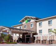
Holiday Inn Express & Suites SAN DIMAS
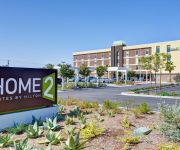
Home2 Suites Azusa
Fairfield Inn & Suites Los Angeles West Covina
Hampton Inn Los Angeles-West Covina
BEST WESTERN SAN DIMAS HOTEL
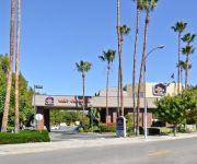
BEST WESTERN PLUS WEST COVINA
Walnut Inn & Suites
Stardust Motel Azusa
Videos from this area
These are videos related to the place based on their proximity to this place.
2012 HS Football: Rancho Cucamonga Cougars vs. Glendora Tartans
GLENDORA, CA - Highlights from Week 8 of the HS Football Season in SoCal featuring the Rancho Cucamonga Cougars (4-2/0-1) and the host Glendora Tartans (3-4/1-1). Reginald Miller reports.
Back Pain Check Out Chiropractor in Glendora ca | Chiropractors Glendora (909) 528 4079
Back Pain Check Out Chiropractor in Glendora ca | Chiropractors Glendora Review s http://tinyurl.com/chiropractorinGlendoraca Click Here! {Chiropractor in Glendora Ca } posture for better...
Glendora Chiropractic - Short | Glendora, CA 91741
http://www.GlendoraChiropractic.com - Call us today at 626-914-5881. At Glendora Chiropractic, we are committed to providing the best quality patient care available. We specialize in Chiropractic,...
GMR Glendora Mountain Road Descent 2
Full Descent of Glendora Mountain Road (GMR) filmed with GoPro HD mounted to front quick release. I got stuck behind a harley a couple times. Power/stats incorporated from my Garmin 305/iBike...
A good workout for BJJ and Glendora Fitness Enthusiasts
http://www.GlendoraBodyweightFitness.com A good workout for BJJ and Glendora Fitness Enthusiasts. Anyone Can benefit from this quick workout that you can do anywhere anytime because it is...
Los Angeles County Fire Engine 151 (Glendora) Responding
Los Angeles County Fire Department engine number 151 responds to a brush fire and clears a four way intersection with Federal Signal Q-Siren, lights and horn. The brush fire that this engine...
Glendora Mountain Road 12/14/2014 w/ HTC Re camera
Chain came off cassette during descent. Had to stop for repair.
Los Angeles County Fire Engine 32 (Glendora)
Los Angeles County Fire Department engine number 32's crew checks a water main during the Glendora South Hills Brush Fire @ 210 Freeway in Glendora, California. LACoFD Engine 32 is seen ...
FAST Tax Preparation Glendora CA, CALL (626) 208-9438 Companies|Income|Professionals|Services
FAST Tax Preparation Glendora CA, CALL (626) 208-9438 Companies|Income|Professionals|Services http://youtu.be/v2VNJT7bPNI Our Services If you are searching for a CPA in California that...
LA County Fire Firehawk and LA City Fire Bell 412 Bomb Fire
A Los Angeles County Fire Department helicopter and a Los Angeles City Fire Department helicopter are seen flying over and bombing a brush fire in the LA suburbs. These emergency service ...
Videos provided by Youtube are under the copyright of their owners.
Attractions and noteworthy things
Distances are based on the centre of the city/town and sightseeing location. This list contains brief abstracts about monuments, holiday activities, national parcs, museums, organisations and more from the area as well as interesting facts about the region itself. Where available, you'll find the corresponding homepage. Otherwise the related wikipedia article.
Citrus, California
Citrus is a census-designated place (CDP) in Los Angeles County, California, United States. It is located in the San Gabriel Valley between Azusa, Glendora, and Covina adjacent to another census-designated place, Charter Oak. Generally, this is referred to by locals as "unincorporated Covina" or "unincorporated Azusa". The population was 10,866 at the 2010 census, up from 10,581 at the 2000 census.
Azusa Pacific University
Azusa Pacific University is a private, inter-denominational, evangelical Christian university located near Los Angeles in suburban Azusa, California. It was founded in 1899, with classes opening on March 3, 1900 in Whittier, California. It began offering degrees in 1939. APU holds regional accreditation by the Western Association of Schools and Colleges (WASC). While officially inter-denominational, the university has ties with several evangelical denominations.
Citrus College
Citrus College is a community college located in the Los Angeles suburb of Glendora, California;; the Citrus Community College District which supports the school includes the communities of Glendora, Azusa, Charter Oak, Claremont, Monrovia, and Duarte. The school is the oldest public community college in Los Angeles County, California; it was founded in 1915 by educator Floyd S. Hayden. Until 1961 the school was operated by the Citrus Union High School District.
Felix Events Center
The Felix Events Center is a 3,500-seat multi-purpose arena in Azusa, California, USA. It hosts locals sporting events and concerts. It is home of the Azusa Pacific University Cougars basketball teams and was the former home of the SoCal Legends when they played in the American Basketball Association. In 2006, it will be the new home of the Beijing Aoshen Olympian, who played their first season in nearby Maywood. The arena opened in 2001.
Citrus Stadium
Citrus Stadium is a 10,000-capacity multi-use stadium located in Glendora, California. The stadium, which features a running track, serves as home to American football, athletics, and soccer for Citrus College and the USL Premier Development League side Los Angeles Storm. It is also the home stadium for several area High Schools, including Gladstone HS (Covina), Azusa HS (Azusa), and Glendora HS (Glendora).
Haugh Performing Arts Center
The Robert Haugh Performing Arts Center (HPAC) is a 1440-seat Theater located on the campus of Citrus College.
St. Lucy's Priory High School
St. Lucy's Priory High School is a private, Roman Catholic, all-girls high school in Glendora, California built in 1963. It is located in the Roman Catholic Archdiocese of Los Angeles.
Rancho Azusa de Dalton
Rancho Azusa de Dalton was a 4,431-acre Mexican land grant in present day Los Angeles County, California given in 1841 by Governor Juan Alvarado to Luis Arenas. Arenas sold his holdings three years later to Henry Dalton (1803 - 1884), a wealthy merchant from Los Angeles. Dalton named his holding Rancho Azusa de Dalton. Cities that have been established on the Rancho lands originally granted to Henry Dalton include Azusa, Arcadia, Monrovia, Irwindale and Baldwin Park.


