Safety Score: 2,7 of 5.0 based on data from 9 authorites. Meaning we advice caution when travelling to United States.
Travel warnings are updated daily. Source: Travel Warning United States. Last Update: 2024-08-13 08:21:03
Touring Hobart
Hobart in Los Angeles County (California) is a town located in United States about 2,293 mi (or 3,690 km) west of Washington DC, the country's capital place.
Time in Hobart is now 07:22 PM (Saturday). The local timezone is named America / Los Angeles with an UTC offset of -8 hours. We know of 9 airports nearby Hobart, of which 4 are larger airports. The closest airport in United States is Los Angeles International Airport in a distance of 13 mi (or 20 km), South-West. Besides the airports, there are other travel options available (check left side).
Also, if you like the game of golf, there are several options within driving distance. We collected 10 points of interest near this location. Need some hints on where to stay? We compiled a list of available hotels close to the map centre further down the page.
Being here already, you might want to pay a visit to some of the following locations: Los Angeles, Orange, Santa Ana, Riverside and San Bernardino. To further explore this place, just scroll down and browse the available info.
Local weather forecast
Todays Local Weather Conditions & Forecast: 17°C / 63 °F
| Morning Temperature | 14°C / 58 °F |
| Evening Temperature | 17°C / 62 °F |
| Night Temperature | 15°C / 59 °F |
| Chance of rainfall | 0% |
| Air Humidity | 51% |
| Air Pressure | 1018 hPa |
| Wind Speed | Gentle Breeze with 7 km/h (4 mph) from North-East |
| Cloud Conditions | Overcast clouds, covering 100% of sky |
| General Conditions | Overcast clouds |
Sunday, 24th of November 2024
17°C (63 °F)
18°C (64 °F)
Overcast clouds, light breeze.
Monday, 25th of November 2024
17°C (63 °F)
17°C (62 °F)
Light rain, light breeze, overcast clouds.
Tuesday, 26th of November 2024
17°C (63 °F)
16°C (62 °F)
Light rain, light breeze, overcast clouds.
Hotels and Places to Stay
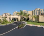
DoubleTree by Hilton Los Angeles Commerce
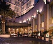
Omni LA at California Plaza
Crowne Plaza LOS ANGELES-COMMERCE CASINO
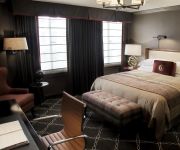
Ace Hotel Downtown Los Angeles
DoubleTree by Hilton Los Angeles Downtown
LOS ANGELES ATHLETIC CLUB
OAKWOOD AT METRO 417
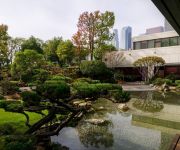
MIYAKO HOTEL LOS ANGELES
KAWADA HOTEL
Tuck Hotel
Videos from this area
These are videos related to the place based on their proximity to this place.
LAFD / East L.A. / Boyle Heights Wood Shop Fire / Major Emergency
11-6-2014 Boyle Heights, California / It took over 100 Los Angeles Firefighters over two hours to knock down an intense blaze that gutted a wood working shop at 3724 East Whittier Boulevard...
L.A. city garbage truck peterbilt/sanitation (2)
i was sick today so i did not go to school. so i decided to pop out the camera and film the garbage truck. this peterbilt is a 2003 model. i can tell because of the body, frame, and sownd....
LAX approach Los Angeles City Skyline V16774
Generic description: This is a full-length clip in lowered resolution for this YouTube upload, providing content audition and evaluation. The actual resolution, clip-specific details and original...
My Venice Vacation
The city has canals but it's not in Italy. These are images of my trip to Venice, a community that was annexed by Los Angeles in the late 1920s but has retai...
Malcolm Smith
Vice president for business development of the U.S. Travel Association & General manager for the international area of the POW WOW makes a review of the 2012 edition.
March 26 2014
Michael's Journey Michael Ash is a 60-year-old homeless gay man living in a transitional shelter in Los Angeles County. The circumstances that brought Michael to this point started a few...
IRISH GUYS DO THE 15 WEIRD QUESTIONS TAG
Hi I'm Joey AKA ThatJoeyFella. I'm an Irish YouTuber living in Dublin city. I vlog about my life and things that are happening in Ireland and the rest of world. Myself and Ronan decided to...
let's play ac2 another age part 2; the Texas adventure!
i came back from my trip just a few hours before i made this video.me and my bro left on our own to texas to see my sister for a week. the weather is bad but the houses are big and inexpensive....
215 S Lorena St, Los Angeles, CA 90063
http://215slorenast.epropertysites.com?rs=youtube Triplex 2 units 2 bed/ 1 bath, one unit 1-1. New exterior paint and interior paint. New carpet on top unit. Bottom unit has new tile floor,...
Videos provided by Youtube are under the copyright of their owners.
Attractions and noteworthy things
Distances are based on the centre of the city/town and sightseeing location. This list contains brief abstracts about monuments, holiday activities, national parcs, museums, organisations and more from the area as well as interesting facts about the region itself. Where available, you'll find the corresponding homepage. Otherwise the related wikipedia article.
Vernon, California
Vernon is a city five miles (8.0 km) south of downtown Los Angeles, California. The population was 112 at the 2010 United States Census, the smallest of any incorporated city in the state. The city is primarily composed of industrial areas and touts itself as "Exclusively Industrial. " Meatpacking plants and warehouses are common. As of 2006, there were no parks. Vernon has a history of political problems, and was fighting disincorporation after city-government corruption was discovered.
Boyle Heights, Los Angeles
Boyle Heights is a neighborhood east of Downtown Los Angeles on the East Side of Los Angeles. For much of the twentieth century, Boyle Heights was a gateway for new immigrants. This resulted in diverse demographics, including Jewish American, Japanese American and Mexican American populations, as well as Russian American and Yugoslav populations. Today, the neighborhood is populated mostly by working class Latinos.
East Los Angeles Interchange
The East Los Angeles Interchange complex is the busiest freeway interchange in the world, with its southern portion handling over 550,000 vehicles per day (2008 AADT). The northern portion, called the San Bernardino Split, is often considered a separate interchange. The interchange was named the Eugene A. Obregon Memorial Interchange, to honor U.S. Marine Corps Medal of Honor recipient Eugene A. Obregon.
Estrada Courts
Estrada Courts is a low-income housing project in the Boyle Heights area of Los Angeles, California.
Salesian High School (Los Angeles)
Salesian High School is an all-male Roman Catholic high school located in the Boyle Heights community of Los Angeles, California. The school mascot is the Mustangs. It was named after Francisco Mora y Borrell, Bishop of the former Monterey-Los Angeles Diocese. Salesian is also named after St. Francis de Sales. The high school is operated by the Roman Catholic Archdiocese of Los Angeles and associated with the Salesian Society.
Huntington Park High School
Huntington Park High School is a public high school in Huntington Park, California, part of the Los Angeles Unified School District.
Hollenbeck Middle School
Hollenbeck Middle School (HMS) is located in East Los Angeles, California, in one of the poorest sections of Los Angeles, Boyle Heights. This section with an estimated 35 to 50 percent high school drop-out rate is in the country’s second largest school district, Los Angeles Unified School District. HMS has earned status as a School for Advanced Studies. The school maintains its rating after LAUSD's recent re-evaluation. The percentage of teachers with a Ph.D.
Redondo Junction train wreck
The Redondo Junction train wreck occurred at 17:42 on the evening of January 22, 1956, on the Santa Fe Railroad in Los Angeles. The accident happened at Redondo Junction, just southwest of Boyle Heights near Washington Boulevard and the Los Angeles River; it killed 30 people and injured 117 more. It was the first major disaster in the LA area covered on live television, and the worst train wreck in the city's history.


