Safety Score: 2,7 of 5.0 based on data from 9 authorites. Meaning we advice caution when travelling to United States.
Travel warnings are updated daily. Source: Travel Warning United States. Last Update: 2024-08-13 08:21:03
Discover Walong
Walong in Kern County (California) is a city in United States about 2,283 mi (or 3,674 km) west of Washington DC, the country's capital city.
Local time in Walong is now 08:51 AM (Monday). The local timezone is named America / Los Angeles with an UTC offset of -8 hours. We know of 10 airports in the vicinity of Walong, of which 4 are larger airports. The closest airport in United States is Meadows Field in a distance of 34 mi (or 54 km), North-West. Besides the airports, there are other travel options available (check left side).
Also, if you like golfing, there are a few options in driving distance. Looking for a place to stay? we compiled a list of available hotels close to the map centre further down the page.
When in this area, you might want to pay a visit to some of the following locations: Bakersfield, Los Angeles, Ventura, Visalia and Santa Barbara. To further explore this place, just scroll down and browse the available info.
Local weather forecast
Todays Local Weather Conditions & Forecast: 4°C / 39 °F
| Morning Temperature | 2°C / 35 °F |
| Evening Temperature | 2°C / 36 °F |
| Night Temperature | -0°C / 31 °F |
| Chance of rainfall | 0% |
| Air Humidity | 79% |
| Air Pressure | 1018 hPa |
| Wind Speed | Fresh Breeze with 16 km/h (10 mph) from East |
| Cloud Conditions | Broken clouds, covering 62% of sky |
| General Conditions | Broken clouds |
Monday, 18th of November 2024
8°C (47 °F)
5°C (41 °F)
Overcast clouds, gentle breeze.
Tuesday, 19th of November 2024
14°C (57 °F)
8°C (47 °F)
Sky is clear, gentle breeze, clear sky.
Wednesday, 20th of November 2024
15°C (60 °F)
10°C (50 °F)
Few clouds, light breeze.
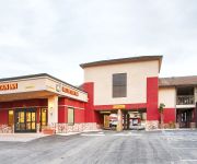
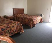
Hotels and Places to Stay
Fairfield Inn & Suites Tehachapi
SureStay Hotel by Best Western Tehachapi
Golden Hills Motel
BEST WESTERN PLUS COUNTRY PARK
Videos from this area
These are videos related to the place based on their proximity to this place.
Railfanning the Tehachapi Loop Part 1 HD
Watch in High Definition! On the second day of our trip, we headed out to railfan after breakfast. Our first stop was the world famous Tehachapi Loop. Included in the video are pictures...
Railfanning the Tehachapi Loop Part 2 HD
Watch in High Definition! Here's part two of railfanning at the World Famous Tehachapi Loop. We saw three more trains, all southbounds, at the Tehachapi Loop before we decided to move on....
BNSF at Tehachapi
AT&SF/BNSF CW44-9 702, BNSF CW44-9 4981 and 2 CW40-8s are northbound around the loop at Walong, CA 4/4/99.
UP mixed power in Tehachapi Loop
UP CW41-8 9558, SD60M 6092, SD60 5994, SP SD45T-2 9383, EMD SD70M 7016, GATX SD40-2 eb at Walong, CA 4/4/99.
UP's Mojave Subdivision -Tehachapi, CA - 08/28/2014
BNSF 4844 leads a double stack unit train northbound through the Tehachapi Loop.
Eastbound BNSF manifest negotiates Tehachapi Loop. 31 July 2014
Eastbound BNSF manifest negotiates Tehachapi Loop. 31 July 2014. i had no tripod for the small Canon SX50 I shot this video with. I balanced the camera on my baseball cap on a rock...that...
Tehachapi Loop
A World-Famous Railroad Construction Achievement of the 19th Century Located about eight miles west of Tehachapi, California, near Highway 58 http://www.tehachapi.com/loop/
Wonderful Walong
Three movements across the Tehachapi Loop at Walong, California in Summer, 1993 and Spring, 1994. The quality isn't that great. But the ATSF and SP no longer run on these rails!
BNSF 7422 doublestack intermodal east [XQ]
On Fri 20 Jul 2012, an eastbound BNSF stack train enters Tunnel 9 at Walong CA at 2:27 PM and circles over itself on the Tehachapi Loop.
Videos provided by Youtube are under the copyright of their owners.
Attractions and noteworthy things
Distances are based on the centre of the city/town and sightseeing location. This list contains brief abstracts about monuments, holiday activities, national parcs, museums, organisations and more from the area as well as interesting facts about the region itself. Where available, you'll find the corresponding homepage. Otherwise the related wikipedia article.
Keene, California
Keene (formerly, Wells) is a census-designated place (CDP) in Kern County, California in the foothills of the Tehachapi Mountains at the southern extreme of the San Joaquin Valley. Keene is located 8.5 miles northwest of Tehachapi, at an elevation of 2602 feet (793 m). The population was 431 at the 2010 census, up from 339 at the 2000 census.
Tehachapi Loop
The Tehachapi Loop is a .73-mile long 'spiral', or helix, on the Union Pacific Railroad line through Tehachapi Pass, of the Tehachapi Mountains in Kern County, south-central California. The line connects Bakersfield and the San Joaquin Valley to Mojave in the Mojave Desert.


!['BNSF 7422 doublestack intermodal east [XQ]' preview picture of video 'BNSF 7422 doublestack intermodal east [XQ]'](https://img.youtube.com/vi/ku0FmUkCp-c/mqdefault.jpg)