Safety Score: 2,7 of 5.0 based on data from 9 authorites. Meaning we advice caution when travelling to United States.
Travel warnings are updated daily. Source: Travel Warning United States. Last Update: 2024-08-13 08:21:03
Delve into Spellacy
Spellacy in Kern County (California) is located in United States about 2,335 mi (or 3,758 km) west of Washington DC, the country's capital town.
Current time in Spellacy is now 06:28 AM (Monday). The local timezone is named America / Los Angeles with an UTC offset of -8 hours. We know of 13 airports close to Spellacy, of which 5 are larger airports. The closest airport in United States is Meadows Field in a distance of 32 mi (or 52 km), North-East. Besides the airports, there are other travel options available (check left side).
Also, if you like playing golf, there are some options within driving distance. If you need a hotel, we compiled a list of available hotels close to the map centre further down the page.
While being here, you might want to pay a visit to some of the following locations: Bakersfield, Santa Barbara, Ventura, San Luis Obispo and Hanford. To further explore this place, just scroll down and browse the available info.
Local weather forecast
Todays Local Weather Conditions & Forecast: 10°C / 49 °F
| Morning Temperature | 10°C / 50 °F |
| Evening Temperature | 10°C / 50 °F |
| Night Temperature | 8°C / 46 °F |
| Chance of rainfall | 0% |
| Air Humidity | 56% |
| Air Pressure | 1021 hPa |
| Wind Speed | Moderate breeze with 9 km/h (6 mph) from South |
| Cloud Conditions | Overcast clouds, covering 98% of sky |
| General Conditions | Overcast clouds |
Monday, 18th of November 2024
9°C (49 °F)
9°C (48 °F)
Overcast clouds, calm.
Tuesday, 19th of November 2024
17°C (62 °F)
11°C (52 °F)
Broken clouds, light breeze.
Wednesday, 20th of November 2024
18°C (64 °F)
12°C (54 °F)
Broken clouds, light breeze.
Hotels and Places to Stay
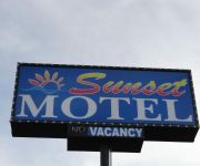
Sunset Motel
Caprice Motel
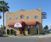
Holland Inn and Suites
Motel 8
BEST WESTERN PLUS TAFT INN
Videos from this area
These are videos related to the place based on their proximity to this place.
Save The Penguins Draw A Stickman Epic - Christmas Special
1.) Facebook Page : https://www.facebook.com/pages/Shadowshine51-Gaming/1439856329570568 2.) Twitter Page : https://twitter.com/ShadowShine51 3.) Check out SilentNight98 ...
UPS, Gotta a Package - Lost The Lights Ep.08
1.) Facebook Page : https://www.facebook.com/pages/Shadowshine51-Gaming/1439856329570568 2.) Twitter Page : https://twitter.com/ShadowShine51 3.) Check out SilentNight98 ...
Taft Bike Fest 2012
http://www.BikerSpots.com - The Social Network FOR Bikers presents: 2nd Annual Taft Bike Fest in Taft, CA (2012) Evil and Blossom attented the Taft Bike Fest in Taft, CA. The rally was held...
West Kern Oil Museum - Taft, CA
It's a Southern California Road Trip to the West Kern Oil Museum in Taft California May 18th 2013. Don and Debbie Hirlinger visit Taft California going to the Taft Prospector Club membership...
West Kern Oil Museum - Taft California
It's a Southern California Road Trip to the West Kern Oil Museum in Taft California May 18th 2013. Don and Debbie Hirlinger visit Taft California going to the Taft Prospector Club membership...
Occidental Storage Facility Taft
This is a FLIR video taken on December 17, 2014, showing emissions at an Occidental Storage Facility in Taft, California. This video was taken by an Infrared Training Center (ITC) certified...
Photography Services Taft CA KC Photography & Framing
KC Photography & Framing specializes in all of the creative aspects of photography. Our unique photography services cover everything from taking the photos to presenting them in a one-of-a-kind...
AFF & Then Some
Amber Bishop's AFF levels and Jumps 1 - 14 at Skydive Taft with Instructors Yong, Claudia Blank, Lelo Mras, Adam Bishop, and Travis O'Neal.
Videos provided by Youtube are under the copyright of their owners.
Attractions and noteworthy things
Distances are based on the centre of the city/town and sightseeing location. This list contains brief abstracts about monuments, holiday activities, national parcs, museums, organisations and more from the area as well as interesting facts about the region itself. Where available, you'll find the corresponding homepage. Otherwise the related wikipedia article.
South Taft, California
South Taft is a census-designated place (CDP) in Kern County, California, United States. South Taft is located 0.5 miles south of Taft, at an elevation of 1017 feet (310 m). The population was 2,169 at the 2010 census, up from 1,898 at the time of the 2000 census.
Taft Heights, California
Taft Heights (formerly, Boust City) is a census-designated place (CDP) in Kern County, California, United States. Taft Heights is located 1 mile west-southwest of Taft, at an elevation of 1178 feet (359 m). The population was 1,949 at the 2010 census, up from 1,865 at the 2000 census.
KBDS
KBDS is a radio station licensed to serve Taft, California. The station is owned by Radio Campensina Bakersfield, Inc. , which is itself owned by the United Farm Workers. While the station normally broadcasts to the Kern County, California, area, as of November 14, 2008, it is temporarily off the air. Before the station was silenced on November 14, 2008, it broadcast a Rhythmic Top 40 music format. Branded as "Play 103.9", the station's slogan was "Blazin' Hip Hop Y Mas."
Taft Airport
Taft Airport, also known as Taft-Kern County Airport, is a public airport located one mile (1.6 km) east of Taft, serving Kern County, California, USA. This general aviation airport covers 71 acres and has one runway.
Taft Union High School
Taft Union High School is located in Taft in Kern County, California, in the United States. Taft High was founded in 1912. Taft is a small city and the school also serves the surrounding rural area, with a total population of about 20,000. The school was featured in the movie "The Best of Times" with Robin Williams and Kurt Russell. Taft was also in the 1996 movie For My Daughter's Honor, with the name changed to Tate Union High School. Parts of the movie Frog-g-g! were filmed at TUHS as well.
Midway-Sunset Oil Field
The Midway-Sunset Oil Field is a large oil field in Kern County, San Joaquin Valley, California in the United States. It is the largest in California and the third largest in the United States. The field was discovered in 1894, and through the end of 2006 had produced close to 3 billion barrels of oil. At the end of 2008 its estimated reserves amounted to approximately 532 million barrels .
KEAL
KEAL is a radio station broadcasting a Spanish radio format. Licensed to Taft, California, USA. The station is currently owned by Lazer Licenses, LLC.
KXTT
KXTT is a radio station licensed to Maricopa, California, USA, the station serves the Bakersfield area. The station is currently owned by Lazer Licenses, LLC.


