Safety Score: 2,7 of 5.0 based on data from 9 authorites. Meaning we advice caution when travelling to United States.
Travel warnings are updated daily. Source: Travel Warning United States. Last Update: 2024-08-13 08:21:03
Explore Oildale
Oildale in Kern County (California) with it's 32,684 inhabitants is located in United States about 2,304 mi (or 3,708 km) west of Washington DC, the country's capital.
Local time in Oildale is now 01:28 AM (Monday). The local timezone is named America / Los Angeles with an UTC offset of -8 hours. We know of 11 airports in the wider vicinity of Oildale, of which 3 are larger airports. The closest airport in United States is Meadows Field in a distance of 2 mi (or 4 km), North-West. Besides the airports, there are other travel options available (check left side).
Also, if you like golfing, there are multiple options in driving distance. If you need a place to sleep, we compiled a list of available hotels close to the map centre further down the page.
Depending on your travel schedule, you might want to pay a visit to some of the following locations: Bakersfield, Visalia, Hanford, Ventura and Santa Barbara. To further explore this place, just scroll down and browse the available info.
Local weather forecast
Todays Local Weather Conditions & Forecast: 11°C / 51 °F
| Morning Temperature | 9°C / 48 °F |
| Evening Temperature | 11°C / 52 °F |
| Night Temperature | 12°C / 53 °F |
| Chance of rainfall | 2% |
| Air Humidity | 57% |
| Air Pressure | 1023 hPa |
| Wind Speed | Gentle Breeze with 6 km/h (4 mph) from South-East |
| Cloud Conditions | Overcast clouds, covering 100% of sky |
| General Conditions | Light rain |
Monday, 25th of November 2024
13°C (56 °F)
12°C (54 °F)
Moderate rain, gentle breeze, overcast clouds.
Tuesday, 26th of November 2024
12°C (53 °F)
12°C (54 °F)
Moderate rain, light breeze, overcast clouds.
Wednesday, 27th of November 2024
13°C (56 °F)
13°C (55 °F)
Overcast clouds, light breeze.
Hotels and Places to Stay
Bakersfield Marriott at the Convention Center
THE PADRE HOTEL
DoubleTree by Hilton Bakersfield
Whispering Meadows Apartments
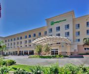
Holiday Inn & Suites BAKERSFIELD
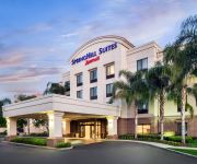
SpringHill Suites Bakersfield
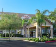
Hilton Garden Inn Bakersfield
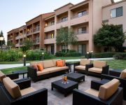
Courtyard Bakersfield
BEST WESTERN PLUS HILL HOUSE
Clarion Hotel Bakersfield
Videos from this area
These are videos related to the place based on their proximity to this place.
Cosmetic Dentist Bakersfield - Wadid Fattouch
Wadid Fattouch - Bakersfield Cosmetic Dentist 661-322-7696 - Wadid Fattouch DDS 3809 San Dimas St., #A, Bakersfield, CA 93301 http://www.wadidfattouch.com On behalf of myself and our entire...
Porcelain Bridges Bakersfield - Wadid Fattouch DDS
Wadid Fattouch - Bakersfield Porcelain Bridges 661-322-7696 - Wadid Fattouch DDS 3809 San Dimas St., #A, Bakersfield, CA 93301 http://www.wadidfattouch.com On behalf of myself and our entire...
12/30/2010 Bakersfield Police and Kern County Sherriff's Deputies @ Garces Circle
No idea what was going on, but everybody with a badge seemed to be there.
First Power Knee in Kern County
New prosthetic knee is making strides thanks to new technology.The power knee is a motorized prosthetic knee. Valley Institute of Prosthetics and Orthotics is proud to have been the first...
Hollywood's Video By Diamond J
See http://equinenow.com/680049 Here at Diamond J we are dedicated to matching families with the right horses and ponies. We have an intensive training program geared toward turning out great...
FLIP THAT HOUSE..OILDALE REDNECK STYLE
I'm sure you've heard that flipping houses is one of the best ways to make money out there but it's also one of the best ways to tear a house down..get er done lol!!
Standard JHS Christmas Parade 2007
The Standard Junior High Band from Oildale marches in the N.O.R. Children's Christmas Parade in Oildale, California. December 8, 2007.
Local church helping the needy
For the last 10 years, a sign has hung outside of the Riverview Assembly of God Church in Oildale offering food those in need. But recently, the sign attracted a different kind of group looking...
Hall Launch
Hall Ambulance launches Medivac One to a downed fighter jet in California City....Piolt Steven and flight nurse Jag along with flight paramedic Chris come to the rescue....
Emerson Middle School Christmas parade
The Emerson Middle School Band from Bakersfield marches in the N.O.R. Children's Christmas Parade in Oildale, California. December 8, 2007.
Videos provided by Youtube are under the copyright of their owners.
Attractions and noteworthy things
Distances are based on the centre of the city/town and sightseeing location. This list contains brief abstracts about monuments, holiday activities, national parcs, museums, organisations and more from the area as well as interesting facts about the region itself. Where available, you'll find the corresponding homepage. Otherwise the related wikipedia article.
Garces Memorial High School
Garces Memorial High School, commonly shortened to Garces High School, is a Catholic high school in Bakersfield, California. Founded in 1947, the school is named after Father Francisco Garcés, a Spanish Franciscan friar and missionary who explored much of the southwestern part of North America, including what is now the Bakersfield region.
North High School (Bakersfield, California)
North High School (abbr. NHS) is an American senior high school set in Bakersfield, California. The school is part of the Kern High School District. Its campus is located on Galaxy Avenue.
Sam Lynn Ballpark
Sam Lynn Ballpark (also known as "Historic" Sam Lynn Ballpark) is a baseball venue located in Bakersfield, California (4009 Chester Avenue Bakersfield, CA 93301) and is the oldest ballpark of the Class-A Advanced California League. It was built in 1941 for the Bakersfield Badgers who began that season as a charter member of the California League. The current tenant is called the Bakersfield Blaze and is affiliated with the National League's Cincinnati Reds.
KLLY
KLLY (95.3 FM "Kelly 95.3") is a commercial radio station licensed to the community of Oildale, California, and serving the Bakersfield, California, area. The station is owned by Buckley Broadcasting. It airs a contemporary hit radio music format. The station was assigned the KLLY call letters by the Federal Communications Commission on February 23, 1984. It was known throughout much of the 1980s and 90's as Bakersfield's soft rock leader. The station has carried a "Hot A/C" format since 1997.
KKBB
KKBB (99.3 FM, "Groove 99-3") is a commercial radio station located in Bakersfield, California. The station is owned by Buckley Broadcasting and licensed to Buckley Communications, Inc. KKBB airs a rhythmic oldies music format. The station was assigned the KKBB call letters by the Federal Communications Commission on December 9, 1994.
KSMJ
KSMJ is a commercial radio station located in Shafter, California, broadcasting to the Bakersfield, California, area. The station is owned by Buckley Broadcasting and licensed to Buckley Broadcasting of California, LLC. KSMJ airs a News/Talk format simulcasting sister station KNZR. The station was assigned the KSMJ call letters by the Federal Communications Commission on February 6, 2001.
KWAC (AM)
KWAC (1490 AM, "ESPN Deportes 1490") is a Spanish language sports radio station serving the Bakersfield, California, area as an ESPN Deportes affiliate. This station is under ownership of Lotus Communications Corporation.
Beardsley Canal
Beardsley Canal is an irrigation canal in Kern County, California. It originates for the Kern River, east of Gordon's Ferry and just west of the First Point of Measurement. It is the first diversion from the river in the San Joaquin Valley for agriculture irrigation (Hart Park has two canals, but are used exclusively for aesthetics and reconnect to the river). It terminates at reservoirs located in Famoso, just east of SR 99 (Golden State Freeway).


