Safety Score: 2,7 of 5.0 based on data from 9 authorites. Meaning we advice caution when travelling to United States.
Travel warnings are updated daily. Source: Travel Warning United States. Last Update: 2024-08-13 08:21:03
Discover Quailwood
The district Quailwood of Kern City in Kern County (California) is a subburb in United States about 2,309 mi west of Washington DC, the country's capital city.
If you need a hotel, we compiled a list of available hotels close to the map centre further down the page.
While being here, you might want to pay a visit to some of the following locations: Bakersfield, Visalia, Ventura, Santa Barbara and Hanford. To further explore this place, just scroll down and browse the available info.
Local weather forecast
Todays Local Weather Conditions & Forecast: 12°C / 53 °F
| Morning Temperature | 9°C / 49 °F |
| Evening Temperature | 12°C / 53 °F |
| Night Temperature | 7°C / 44 °F |
| Chance of rainfall | 0% |
| Air Humidity | 43% |
| Air Pressure | 1020 hPa |
| Wind Speed | Moderate breeze with 11 km/h (7 mph) from South |
| Cloud Conditions | Overcast clouds, covering 100% of sky |
| General Conditions | Overcast clouds |
Tuesday, 19th of November 2024
12°C (53 °F)
7°C (45 °F)
Overcast clouds, light breeze.
Wednesday, 20th of November 2024
15°C (59 °F)
11°C (52 °F)
Overcast clouds, light breeze.
Thursday, 21st of November 2024
17°C (62 °F)
12°C (54 °F)
Broken clouds, light breeze.
Hotels and Places to Stay
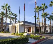
DoubleTree by Hilton Bakersfield
Homewood Suites by Hilton Bakersfield
SpringHill Suites Bakersfield
Hampton Inn Bakersfield-Central
TRAVELODGE BAKERSFIELD
Courtyard Bakersfield
Four Points by Sheraton Bakersfield
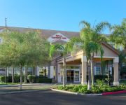
Hilton Garden Inn Bakersfield
TownePlace Suites Bakersfield West
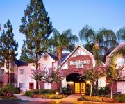
Residence Inn Bakersfield
Videos from this area
These are videos related to the place based on their proximity to this place.
Salon San Marcos en Bakersfield ca
Elegante y perfecto sal�n para todo tipo de eventos: bodas, quincea�era,reuniones, convensiones. Tambien ofrecemos jumpers brinca brinca. Llamar al 661-817-7203 o al 661-900-0253.
Thunderstorm in Bakersfield California
thunderstorm in Bakersfield California on May 6th 2013. This thunderstorm spawned an EF 0 tornado as well.
Bakersfield Police Department DUI Checkpoint, Part 2
March 25, 2011 - Filming a checkpoint's operation will get you passed the "specified neutral criteria established by supervisory law enforcement personnel" which directs everyone into the...
Stanton Optical – Bakersfield, CA | Eyeglasses, Contacts, FREE Eye Exam | {City} Optometrist
Shopping for glasses can be very expensive, but at Stanton Optical in Bakersfield, CA you can get 2 pairs of eyeglasses for $69 PLUS a FREE Eye Exam. With the money I saved at Stanton Optical...
The Famous Milt's neon sign on Hwy 99 in Bakersfield
Milt's Coffee Shop in Bakersfield, California. This famous Milt's neon sign has been a happy sight for locals and tourists who travel the busy Hwy 99 through the great city of Bakersfield....
Via Venezia Guide Part 1
Beginners guide to using the Via Venezia Espresso machine, and espresso in general. **PLEASE NOTE!!** I recorded this video for my mom who lives in a different city, it's "Wordy" for a reason....
Super 8 Hotel Bakersfield / Central CA
Visit : http://www.super8bakersfield.com If you are looking for affordable rooms at Hotel near Bakersfield Convention Center CA then go for Super 8 Bakersfield, California Hotel. Hotel features...
Explosion in Bakersfield (Rosedale Hwy & Coffee Road) 2
Around 3:30am this morning our power went out and then heard a series of explosions. Drove down Rosedale Highway and there was a huge fire at the intersection of Coffee Road and Rosedale...
Why Choose Coldwell Banker Preferred? Bakersfield Real Estate.
Coldwell Banker Preferred's NEW 30 sec commercial spot. Bakersfield Real Estate is a great investment. Bakersfield Real Estate is a great investment.
Videos provided by Youtube are under the copyright of their owners.
Attractions and noteworthy things
Distances are based on the centre of the city/town and sightseeing location. This list contains brief abstracts about monuments, holiday activities, national parcs, museums, organisations and more from the area as well as interesting facts about the region itself. Where available, you'll find the corresponding homepage. Otherwise the related wikipedia article.
California State University, Bakersfield
California State University, Bakersfield (often abbreviated CSUB or shortened to CSU Bakersfield or Cal State Bakersfield) is a public university located in Bakersfield, California, United States which was founded in 1965. CSUB opened in 1970 on a 375-acre campus, becoming the 19th school in the California State University system. The university offers 91 different Bachelor's degrees, 30 types of Master's degrees, and 12 teaching credentials. The university does not confer Doctoral degrees.
Bakersfield High School
Bakersfield High School (BHS) is a high school located in Bakersfield, California, USA. Institutional names and dates of operation: Kern County High School 1893-1915 Kern County Union High School 1915-1945 Bakersfield High School 1945–present Bakersfield Junior College 1913-1956 Bakersfield Adult (Night) School 1917-1985 It was the only high school in Bakersfield until 1937, when East Bakersfield High School was opened.
Stockdale High School (Bakersfield, California)
Stockdale High School is an American senior high school located in Bakersfield, California. Its athletics teams are known as the Stockdale Mustangs and the school colors are black and silver. Stockdale High School first opened in 1991. Now in its 22nd year, with approximately 2,556 students enrolled, has an API of 831, and Stockdale has earned a reputation in the community and around the state as a school that meets the needs of all students.
Fruitvale Junior High
Fruitvale Junior High is a middle school located on the west side of Bakersfield, California, at 2114 Calloway Drive. It is part of the Fruitvale School District. Fruitvale Jr. High has received the Federal Excellence in Education Award in 1990 and was a recipient of the California Distinguished School Award in 1986, 1990, 1994, and 1999.
KNZR
KNZR is a news/talk radio station based in Bakersfield, California, USA. The station broadcasts at 25,000 watts of power daytime and 10,000 watts nighttime, and can be heard in most of California and other Western states every night. KNZR is designated by the FCC as a "clear channel" radio station. It is owned by Buckley Broadcasting. The station was assigned the KNZR call letters by the Federal Communications Commission on September 21, 1990.
Bakersfield Christian High School
|}
KWAC (AM)
KWAC (1490 AM, "ESPN Deportes 1490") is a Spanish language sports radio station serving the Bakersfield, California, area as an ESPN Deportes affiliate. This station is under ownership of Lotus Communications Corporation.
Santa Maria High School
Santa Maria High School is one of the 4 primary high schools in the city of Santa Maria, California, the United States. Located in the heart of the city, Santa Maria High School is the oldest school in the Santa Maria Valley and is part of the oldest high school district in California. The Santa Maria Joint Union High School District was founded on June 6, 1893.
Liberty High School (Bakersfield, California)
Liberty High School is a public co-educational high school located in Bakersfield, California. Its athletics teams are known as the Liberty Patriots and the school colors are navy, red, and silver. Liberty High School opened its doors in 1999. Liberty High School is currently the most populated high school in the Kern High School District with a student body of 2,801
West High School (Bakersfield, California)
West High School is a Public school high school located in Bakersfield, California. The school serves about 2500 students in grades 9 to 12 in the Kern High School District. Total student enrollment is 2,525.
Fruitvale Oil Field
The Fruitvale Oil Field is a large oil and gas field in the southern San Joaquin Valley, California, within and just northwest of the city of Bakersfield, along and north of the Kern River. It is one of the few oil fields in the California Central Valley which is mostly surrounded by a heavily populated area.
Centennial High School (Bakersfield, California)
Centennial High School is a public high school located in Bakersfield, California. Its opening in 1993 marked the 100 year anniversary of the Kern High School District. Centennial is the home of many nationally recognized extra-curricular academic programs, including Virtual Business and We The People, both of which have finished ranked in the top 5 nationally in the school's history.
Icardo Center
Icardo Center is a 3,800-seat multi-purpose arena in Bakersfield, California. It is home to the California State University, Bakersfield, men's basketball (although some games are played in nearby Rabobank Arena), women's basketball, women's volleyball and wrestling teams.
Hardt Field
Hardt Field, also known in development as the Roadrunner Baseball Complex, is a baseball stadium in Bakersfield, California, United States. It is the home field of the Cal State Bakersfield Roadrunners baseball team. The stadium is located in the south-west section of the campus of Cal State Bakersfield.
Mira Monte High School
Mira Monte is a high school located at 1800 South Fairfax Road in southeast Bakersfield, California. It opened for the school year of 2008-2009. It is in the Kern High School District.
Rio Bravo (former settlement), California
Rio Bravo (also, Panama and Old Panama) is a former settlement in Kern County, California. It was located on the railroad 2 miles north of Panama. Rio Bravo was a Mexican settlement established in 1849. It took its name from the Spanish name for the Kern River Rio Bravo de San Felipe. Later Rio Bravo was called Panama, and after that name was applied to the current place, as Old Panama. The application of the name Panama was descriptive of the location as low, swampy, and plagued by mosquitos.
Valley Plaza Mall
The Valley Plaza Mall is a major retail shopping mall in Bakersfield, California. It is the largest mall in the San Joaquin Valley. The mall is owned by General Growth Properties, a real estate development of over 200 regional shopping malls around the United States. Valley Plaza Mall has 5 anchor stores and over 140 specialty stores. The mall is situated near SR 99 freeway, the city's main north/south freeway.
Bakersfield Heart Hospital
Bakersfield Heart Hospital is a hospital in Bakersfield, California, United States, specializing in cardiovascular emergencies.
Stockdale Country Club
Stockdale Country Club is an 18-hole private golf course located on a plot of unincorporated Kern County land that is surrounded by Bakersfield, California. The course is 6,410 yards on flat terrain, designed by Lloyd Tevis. It opened in 1925. The club has reciprocating privileges to all private clubs in the Greater Bakersfield area.
The Links at Riverlakes Ranch
The Links at Riverlakes Ranch is a public golf course in Bakersfield, California. The course is 6,800 yards on hilly terrain, designed by Ronald Fream. The course was inspired by Scottish golf courses. The golf course is the centerpiece of the Riverlakes Ranch neighborhood in the northwest.
Sundale Country Club
Sundale Country Club is an 18-hole private golf course located in southwest Bakersfield, California. The course is 6,801 yards on flat terrain. It was opened in 1962. The course has full reciprocating privileges to all private golf courses in the Greater Bakersfield area. The golf course is a part of Kern City, a planned retirement community founded in 1961. It was originally a part of the county, but was later incorporated into the city. It is located in the Southwest.
Kern River Parkway
The Kern River Parkway is primarily a natural preserve in Bakersfield, California. It runs the length of the Kern River from the mouth of the Kern Canyon to Interstate 5. At 6,000 acres, it is the largest municipal park in the county. The parkway was created in 1976 when the city purchased all assets related to the Kern River from Tenneco West.
Seven Oaks Country Club
Seven Oaks Country Club is a private golf course in Bakersfield, California. The course has 27 holes (three 9-hole courses), with a total length of 10,592. The golf course was designed by Robert Muir Graves, and is a championship course. Between 1992 and 1993, the golf course hosted the Bakersfield Open, a PGA national tournament. The golf course opened in 1991 with 18 holes. It was the center of the Seven Oaks residential development.
Carrier Canal
Carrier Canal is an irrigation canal in Kern County, California. It originates from a common diversion at Manor Street in Bakersfield, which also supplies the Kern Island Canal and Eastside Canal. The common diversion originates from the Kern River about 1 mile south of Gordon's Ferry. There are additional diversions from the Kern River at Golden State Highway and Coffee Road. The canal terminates at the Kern River, near Enos Lane west of Bakersfield.
West Bakersfield Interchange
The West Bakersfield Interchange is a freeway interchange in Bakersfield, California, west of downtown. It connects State Route 99 (Golden State Freeway) with SR 58 (Mojave Freeway). These routes represent the heart of the Bakersfield freeway network. They connect the city with commercial centers in the San Joaquin Valley, ports in Los Angeles, and major Interstate freeways serving southern and eastern America. The original interchange plan was more elaborate.


