Safety Score: 2,7 of 5.0 based on data from 9 authorites. Meaning we advice caution when travelling to United States.
Travel warnings are updated daily. Source: Travel Warning United States. Last Update: 2024-08-13 08:21:03
Explore Kern City
Kern City in Kern County (California) is located in United States about 2,308 mi (or 3,715 km) west of Washington DC, the country's capital.
Local time in Kern City is now 12:39 AM (Monday). The local timezone is named America / Los Angeles with an UTC offset of -8 hours. We know of 11 airports in the wider vicinity of Kern City, of which 3 are larger airports. The closest airport in United States is Meadows Field in a distance of 6 mi (or 9 km), North. Besides the airports, there are other travel options available (check left side).
Also, if you like golfing, there are multiple options in driving distance. If you need a place to sleep, we compiled a list of available hotels close to the map centre further down the page.
Depending on your travel schedule, you might want to pay a visit to some of the following locations: Bakersfield, Visalia, Ventura, Santa Barbara and Hanford. To further explore this place, just scroll down and browse the available info.
Local weather forecast
Todays Local Weather Conditions & Forecast: 12°C / 53 °F
| Morning Temperature | 9°C / 49 °F |
| Evening Temperature | 12°C / 53 °F |
| Night Temperature | 7°C / 44 °F |
| Chance of rainfall | 0% |
| Air Humidity | 43% |
| Air Pressure | 1020 hPa |
| Wind Speed | Moderate breeze with 11 km/h (7 mph) from South |
| Cloud Conditions | Overcast clouds, covering 100% of sky |
| General Conditions | Overcast clouds |
Monday, 18th of November 2024
12°C (53 °F)
7°C (45 °F)
Overcast clouds, light breeze.
Tuesday, 19th of November 2024
15°C (59 °F)
11°C (52 °F)
Overcast clouds, light breeze.
Wednesday, 20th of November 2024
17°C (62 °F)
12°C (54 °F)
Broken clouds, light breeze.
Hotels and Places to Stay
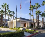
Four Points by Sheraton Bakersfield
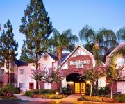
Residence Inn Bakersfield
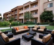
Courtyard Bakersfield
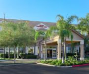
Hilton Garden Inn Bakersfield
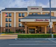
Hampton Inn Bakersfield-Central
TRAVELODGE BAKERSFIELD
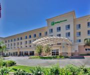
Holiday Inn & Suites BAKERSFIELD
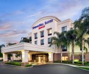
SpringHill Suites Bakersfield
Homewood Suites by Hilton Bakersfield
Motel 6 Bakersfield CA
Videos from this area
These are videos related to the place based on their proximity to this place.
Bakersfield Salvation Army Doing the most Good
Video produced by BobWestVideo.com , Hosted by Don Clark. Visit with Bakersfield Salvation Army Majors Daniel & Carole Abella as they describe some of the programs serving Bakersfield. For...
Salon San Marcos en Bakersfield ca
Elegante y perfecto sal�n para todo tipo de eventos: bodas, quincea�era,reuniones, convensiones. Tambien ofrecemos jumpers brinca brinca. Llamar al 661-817-7203 o al 661-900-0253.
Thunderstorm in Bakersfield California
thunderstorm in Bakersfield California on May 6th 2013. This thunderstorm spawned an EF 0 tornado as well.
Bakersfield Police Department DUI Checkpoint, Part 2
March 25, 2011 - Filming a checkpoint's operation will get you passed the "specified neutral criteria established by supervisory law enforcement personnel" which directs everyone into the...
Stanton Optical – Bakersfield, CA | Eyeglasses, Contacts, FREE Eye Exam | {City} Optometrist
Shopping for glasses can be very expensive, but at Stanton Optical in Bakersfield, CA you can get 2 pairs of eyeglasses for $69 PLUS a FREE Eye Exam. With the money I saved at Stanton Optical...
The Famous Milt's neon sign on Hwy 99 in Bakersfield
Milt's Coffee Shop in Bakersfield, California. This famous Milt's neon sign has been a happy sight for locals and tourists who travel the busy Hwy 99 through the great city of Bakersfield....
Via Venezia Guide Part 1
Beginners guide to using the Via Venezia Espresso machine, and espresso in general. **PLEASE NOTE!!** I recorded this video for my mom who lives in a different city, it's "Wordy" for a reason....
Super 8 Hotel Bakersfield / Central CA
Visit : http://www.super8bakersfield.com If you are looking for affordable rooms at Hotel near Bakersfield Convention Center CA then go for Super 8 Bakersfield, California Hotel. Hotel features...
One Day Without Shoes Promo - California State University, Bakersfield
www.onedaywithoutshoes.com www.toms.com "With every pair you purchase, TOMS will give a pair of new shoes to a child in need. One for One." Join us on Tuesday, April 5, 2011 as we walk...
Explosion in Bakersfield (Rosedale Hwy & Coffee Road) 2
Around 3:30am this morning our power went out and then heard a series of explosions. Drove down Rosedale Highway and there was a huge fire at the intersection of Coffee Road and Rosedale...
Videos provided by Youtube are under the copyright of their owners.
Attractions and noteworthy things
Distances are based on the centre of the city/town and sightseeing location. This list contains brief abstracts about monuments, holiday activities, national parcs, museums, organisations and more from the area as well as interesting facts about the region itself. Where available, you'll find the corresponding homepage. Otherwise the related wikipedia article.
California State University, Bakersfield
California State University, Bakersfield (often abbreviated CSUB or shortened to CSU Bakersfield or Cal State Bakersfield) is a public university located in Bakersfield, California, United States which was founded in 1965. CSUB opened in 1970 on a 375-acre campus, becoming the 19th school in the California State University system. The university offers 91 different Bachelor's degrees, 30 types of Master's degrees, and 12 teaching credentials. The university does not confer Doctoral degrees.
West High School (Bakersfield, California)
West High School is a Public school high school located in Bakersfield, California. The school serves about 2500 students in grades 9 to 12 in the Kern High School District. Total student enrollment is 2,525.
Icardo Center
Icardo Center is a 3,800-seat multi-purpose arena in Bakersfield, California. It is home to the California State University, Bakersfield, men's basketball (although some games are played in nearby Rabobank Arena), women's basketball, women's volleyball and wrestling teams.
Stockdale Country Club
Stockdale Country Club is an 18-hole private golf course located on a plot of unincorporated Kern County land that is surrounded by Bakersfield, California. The course is 6,410 yards on flat terrain, designed by Lloyd Tevis. It opened in 1925. The club has reciprocating privileges to all private clubs in the Greater Bakersfield area.
Sundale Country Club
Sundale Country Club is an 18-hole private golf course located in southwest Bakersfield, California. The course is 6,801 yards on flat terrain. It was opened in 1962. The course has full reciprocating privileges to all private golf courses in the Greater Bakersfield area. The golf course is a part of Kern City, a planned retirement community founded in 1961. It was originally a part of the county, but was later incorporated into the city. It is located in the Southwest.
Kern River Parkway
The Kern River Parkway is primarily a natural preserve in Bakersfield, California. It runs the length of the Kern River from the mouth of the Kern Canyon to Interstate 5. At 6,000 acres, it is the largest municipal park in the county. The parkway was created in 1976 when the city purchased all assets related to the Kern River from Tenneco West.
Carrier Canal
Carrier Canal is an irrigation canal in Kern County, California. It originates from a common diversion at Manor Street in Bakersfield, which also supplies the Kern Island Canal and Eastside Canal. The common diversion originates from the Kern River about 1 mile south of Gordon's Ferry. There are additional diversions from the Kern River at Golden State Highway and Coffee Road. The canal terminates at the Kern River, near Enos Lane west of Bakersfield.
West Bakersfield Interchange
The West Bakersfield Interchange is a freeway interchange in Bakersfield, California, west of downtown. It connects State Route 99 (Golden State Freeway) with SR 58 (Mojave Freeway). These routes represent the heart of the Bakersfield freeway network. They connect the city with commercial centers in the San Joaquin Valley, ports in Los Angeles, and major Interstate freeways serving southern and eastern America. The original interchange plan was more elaborate.


