Safety Score: 2,7 of 5.0 based on data from 9 authorites. Meaning we advice caution when travelling to United States.
Travel warnings are updated daily. Source: Travel Warning United States. Last Update: 2024-08-13 08:21:03
Explore Gosford
Gosford in Kern County (California) is located in United States about 2,310 mi (or 3,718 km) west of Washington DC, the country's capital.
Local time in Gosford is now 12:35 AM (Monday). The local timezone is named America / Los Angeles with an UTC offset of -8 hours. We know of 12 airports in the wider vicinity of Gosford, of which 4 are larger airports. The closest airport in United States is Meadows Field in a distance of 9 mi (or 14 km), North. Besides the airports, there are other travel options available (check left side).
Also, if you like golfing, there are multiple options in driving distance. If you need a place to sleep, we compiled a list of available hotels close to the map centre further down the page.
Depending on your travel schedule, you might want to pay a visit to some of the following locations: Bakersfield, Visalia, Ventura, Santa Barbara and Hanford. To further explore this place, just scroll down and browse the available info.
Local weather forecast
Todays Local Weather Conditions & Forecast: 12°C / 53 °F
| Morning Temperature | 9°C / 49 °F |
| Evening Temperature | 12°C / 53 °F |
| Night Temperature | 7°C / 44 °F |
| Chance of rainfall | 0% |
| Air Humidity | 43% |
| Air Pressure | 1020 hPa |
| Wind Speed | Moderate breeze with 11 km/h (7 mph) from South |
| Cloud Conditions | Overcast clouds, covering 100% of sky |
| General Conditions | Overcast clouds |
Monday, 18th of November 2024
12°C (53 °F)
7°C (45 °F)
Overcast clouds, light breeze.
Tuesday, 19th of November 2024
15°C (59 °F)
11°C (52 °F)
Overcast clouds, light breeze.
Wednesday, 20th of November 2024
17°C (62 °F)
12°C (54 °F)
Broken clouds, light breeze.
Hotels and Places to Stay
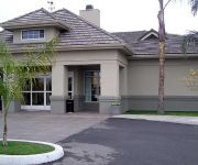
Homewood Suites by Hilton Bakersfield
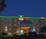
Holiday Inn Express BAKERSFIELD
TRAVELODGE BAKERSFIELD
TownePlace Suites Bakersfield West
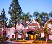
Residence Inn Bakersfield
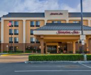
Hampton Inn Bakersfield-Central
Four Points by Sheraton Bakersfield
Motel 6 Bakersfield CA
VAGABOND INN BAKERSFIELD SOUTH
GuestHouse International Inn & Suites - Bakersfield
Videos from this area
These are videos related to the place based on their proximity to this place.
Stanton Optical – Bakersfield, CA | Eyeglasses, Contacts, FREE Eye Exam | {City} Optometrist
Shopping for glasses can be very expensive, but at Stanton Optical in Bakersfield, CA you can get 2 pairs of eyeglasses for $69 PLUS a FREE Eye Exam. With the money I saved at Stanton Optical...
The Famous Milt's neon sign on Hwy 99 in Bakersfield
Milt's Coffee Shop in Bakersfield, California. This famous Milt's neon sign has been a happy sight for locals and tourists who travel the busy Hwy 99 through the great city of Bakersfield....
Via Venezia Guide Part 1
Beginners guide to using the Via Venezia Espresso machine, and espresso in general. **PLEASE NOTE!!** I recorded this video for my mom who lives in a different city, it's "Wordy" for a reason....
Super 8 Hotel Bakersfield / Central CA
Visit : http://www.super8bakersfield.com If you are looking for affordable rooms at Hotel near Bakersfield Convention Center CA then go for Super 8 Bakersfield, California Hotel. Hotel features...
Stockdale Counrty Club
For more details click here: http://www.visualtour.com/showvt.asp?t=2649312 204 Vista Verde Way Bakersfield, CA 93309 $425000, 3 bed, 2.0 bath, 2458 SF, MLS# 21114011 SHORT SALE!
Rupsa's Dance Performance during 2015 Republic Day Celebrations
Choreographer: Priyanka Saha Grand Masti Team: Rupsa Daripa,Nipun Sharma, Piya Malik, Ritish Gulati, Angel Singh, Maya Bhalla, Idhikashini Nagalingham, Satyam Sharma IASJV 2015 Republic ...
Michael and Donna in the back yard
Michael and Donna in the back yard, Bakersfield, California. Original file: 2011-07-01 Michael at home-01A.mov.
Prosecion de san pedro teyuca 6/30/11 #4
Perdon si se mueve mucho el video pero esque habia muchas piedras!!...lol no pero espero y les guste=) me hubiese gustado en juntar todos los videos y hacer una pelicula mejor pero por cuestiones.
Vehicle Theft in Bakersfield, CA - May 8, 2008
This is one of the videos from the hotel security camera. Statistics show that vehicle thefts in Bakersfield have risen 90% since 1999. Why is that people?
Videos provided by Youtube are under the copyright of their owners.
Attractions and noteworthy things
Distances are based on the centre of the city/town and sightseeing location. This list contains brief abstracts about monuments, holiday activities, national parcs, museums, organisations and more from the area as well as interesting facts about the region itself. Where available, you'll find the corresponding homepage. Otherwise the related wikipedia article.
Stockdale High School (Bakersfield, California)
Stockdale High School is an American senior high school located in Bakersfield, California. Its athletics teams are known as the Stockdale Mustangs and the school colors are black and silver. Stockdale High School first opened in 1991. Now in its 22nd year, with approximately 2,556 students enrolled, has an API of 831, and Stockdale has earned a reputation in the community and around the state as a school that meets the needs of all students.
Icardo Center
Icardo Center is a 3,800-seat multi-purpose arena in Bakersfield, California. It is home to the California State University, Bakersfield, men's basketball (although some games are played in nearby Rabobank Arena), women's basketball, women's volleyball and wrestling teams.
Hardt Field
Hardt Field, also known in development as the Roadrunner Baseball Complex, is a baseball stadium in Bakersfield, California, United States. It is the home field of the Cal State Bakersfield Roadrunners baseball team. The stadium is located in the south-west section of the campus of Cal State Bakersfield.
Rio Bravo (former settlement), California
Rio Bravo (also, Panama and Old Panama) is a former settlement in Kern County, California. It was located on the railroad 2 miles north of Panama. Rio Bravo was a Mexican settlement established in 1849. It took its name from the Spanish name for the Kern River Rio Bravo de San Felipe. Later Rio Bravo was called Panama, and after that name was applied to the current place, as Old Panama. The application of the name Panama was descriptive of the location as low, swampy, and plagued by mosquitos.
Stockdale Country Club
Stockdale Country Club is an 18-hole private golf course located on a plot of unincorporated Kern County land that is surrounded by Bakersfield, California. The course is 6,410 yards on flat terrain, designed by Lloyd Tevis. It opened in 1925. The club has reciprocating privileges to all private clubs in the Greater Bakersfield area.
Seven Oaks Country Club
Seven Oaks Country Club is a private golf course in Bakersfield, California. The course has 27 holes (three 9-hole courses), with a total length of 10,592. The golf course was designed by Robert Muir Graves, and is a championship course. Between 1992 and 1993, the golf course hosted the Bakersfield Open, a PGA national tournament. The golf course opened in 1991 with 18 holes. It was the center of the Seven Oaks residential development.
Independence High School (Bakersfield, California)
Independence High School is a public, co-educational high school located in Bakersfield, California. Its athletics teams are known as the Independence Falcons and the school colors are maroon and silver. Independence High School had their first class in 2008, with the first graduating class in 2011, however the first all Falcon graduating class will be graduating in 2012.
Stine Canal
Stine Canal is an irrigation canal in Kern County, California. It originates from the Carrier Canal adjacent to SR 99 (Golden State Freeway). It terminates at a reservoir on Bear Mountain Boulevard, just east of Gosford Road. From the diversion, the canal travels south, following North Stine Road. After passing Stockdale Highway, North Stine Road becomes Stine Road. Around Ming Avenue, both the road and the canal turns southwest.


