Safety Score: 2,7 of 5.0 based on data from 9 authorites. Meaning we advice caution when travelling to United States.
Travel warnings are updated daily. Source: Travel Warning United States. Last Update: 2024-08-13 08:21:03
Touring El Rita
El Rita in Kern County (California) is a town located in United States about 2,284 mi (or 3,675 km) west of Washington DC, the country's capital place.
Time in El Rita is now 08:22 AM (Monday). The local timezone is named America / Los Angeles with an UTC offset of -8 hours. We know of 10 airports nearby El Rita, of which 4 are larger airports. The closest airport in United States is Meadows Field in a distance of 32 mi (or 51 km), North-West. Besides the airports, there are other travel options available (check left side).
Also, if you like the game of golf, there are several options within driving distance. Need some hints on where to stay? We compiled a list of available hotels close to the map centre further down the page.
Being here already, you might want to pay a visit to some of the following locations: Bakersfield, Ventura, Los Angeles, Visalia and Santa Barbara. To further explore this place, just scroll down and browse the available info.
Local weather forecast
Todays Local Weather Conditions & Forecast: 4°C / 39 °F
| Morning Temperature | 2°C / 35 °F |
| Evening Temperature | 2°C / 36 °F |
| Night Temperature | -0°C / 31 °F |
| Chance of rainfall | 0% |
| Air Humidity | 79% |
| Air Pressure | 1018 hPa |
| Wind Speed | Fresh Breeze with 16 km/h (10 mph) from East |
| Cloud Conditions | Broken clouds, covering 62% of sky |
| General Conditions | Broken clouds |
Monday, 18th of November 2024
8°C (47 °F)
5°C (41 °F)
Overcast clouds, gentle breeze.
Tuesday, 19th of November 2024
14°C (57 °F)
8°C (47 °F)
Sky is clear, gentle breeze, clear sky.
Wednesday, 20th of November 2024
15°C (60 °F)
10°C (50 °F)
Few clouds, light breeze.
Hotels and Places to Stay
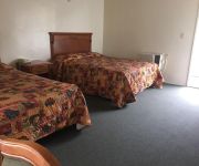
Golden Hills Motel
Videos from this area
These are videos related to the place based on their proximity to this place.
Keene Kaboodle
From the archives: over ten minutes of ATSF and SP railroading at Keene, California. These are the clips that failed to make the cut for the DVD, but are well worth sharing. As you'll see from...
-Tehachapi- CA Railfanning 1
Yep...., I rode the southwest chief across the country to California JUST to get awesome railfanning footage for you guys! A series of videos from the most famous railroading areas in the...
Several Trains Through Woodford HD
Watch in High Definition! To close out the second day of the Tehachapi trip, we headed back to Woodford to watch trains there for a couple hours. We ended up seeing some pretty decent action...
BNSF Coil Train Meets Union Pacific Intermodal at Woodford HD
Watch in High Definition! Before closing out our three day railfanning trip and heading home, my friend and I stayed for one more train meet in Tehachapi. This time, we chased the Union Pacific...
Tehachapi Loop - BNSF Freight Action - Video # 8 Bealville to the Loop
Jan 12th, 2007 - From a dead stop at Bealville, this big BNSF freighter pulls uphill to the Tehachapi Loop. After Bealville, we drive up Hwy 58( sure, at the speed limit) and stop at Keene...
Union Pacific Stack Train at Woodford MOW Spur HD
Watch in High Definition! On the second day in Tehachapi during our trip last month, my friend and I began by heading down to Woodford. Our first train of the day was this long Union Pacific...
Two Eastbound Trains in Woodford HD
Watch in High Definition! For the final day of the spring break trip with my friend, we headed up to Tehachapi Pass to watch trains. As we passed through Mojave, we were forced to take a...
Union Pacific Manifest Through Woodford in the Pouring Rain HD
Watch in High Definition! The things that railfans will do to see trains! Before we started making our way south again, we decided to wait at Woodford to see one more train. We soon heard the...
BNSF 4399 Leads a Stack Train Through Woodford HD
Watch in High Definition! After seeing the train at Tunnel 2, we started to make our way back towards Mojave. Along the way, we stopped in Woodford to watch yet another northbound train pass...
BNSF 7069 Leads a Z-Train Through Woodford HD
Watch in High Definition! After seeing the trains in Mojave, we headed up to Tehachapi in search for more trains. We continued heading north until we found another southbound train. We stopped...
Videos provided by Youtube are under the copyright of their owners.
Attractions and noteworthy things
Distances are based on the centre of the city/town and sightseeing location. This list contains brief abstracts about monuments, holiday activities, national parcs, museums, organisations and more from the area as well as interesting facts about the region itself. Where available, you'll find the corresponding homepage. Otherwise the related wikipedia article.
Keene, California
Keene (formerly, Wells) is a census-designated place (CDP) in Kern County, California in the foothills of the Tehachapi Mountains at the southern extreme of the San Joaquin Valley. Keene is located 8.5 miles northwest of Tehachapi, at an elevation of 2602 feet (793 m). The population was 431 at the 2010 census, up from 339 at the 2000 census.
Tehachapi Loop
The Tehachapi Loop is a .73-mile long 'spiral', or helix, on the Union Pacific Railroad line through Tehachapi Pass, of the Tehachapi Mountains in Kern County, south-central California. The line connects Bakersfield and the San Joaquin Valley to Mojave in the Mojave Desert.


