Safety Score: 2,7 of 5.0 based on data from 9 authorites. Meaning we advice caution when travelling to United States.
Travel warnings are updated daily. Source: Travel Warning United States. Last Update: 2024-08-13 08:21:03
Delve into Bannister
Bannister in Kern County (California) is a city located in United States about 2,312 mi (or 3,720 km) west of Washington DC, the country's capital town.
Current time in Bannister is now 12:38 AM (Monday). The local timezone is named America / Los Angeles with an UTC offset of -8 hours. We know of 12 airports closer to Bannister, of which 4 are larger airports. The closest airport in United States is Meadows Field in a distance of 12 mi (or 19 km), North. Besides the airports, there are other travel options available (check left side).
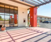
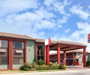
Also, if you like playing golf, there are some options within driving distance. In need of a room? We compiled a list of available hotels close to the map centre further down the page.
Since you are here already, you might want to pay a visit to some of the following locations: Bakersfield, Ventura, Santa Barbara, Visalia and Hanford. To further explore this place, just scroll down and browse the available info.
Local weather forecast
Todays Local Weather Conditions & Forecast: 12°C / 54 °F
| Morning Temperature | 9°C / 48 °F |
| Evening Temperature | 11°C / 51 °F |
| Night Temperature | 7°C / 45 °F |
| Chance of rainfall | 0% |
| Air Humidity | 43% |
| Air Pressure | 1020 hPa |
| Wind Speed | Moderate breeze with 9 km/h (6 mph) from South-East |
| Cloud Conditions | Overcast clouds, covering 100% of sky |
| General Conditions | Overcast clouds |
Monday, 18th of November 2024
12°C (53 °F)
8°C (46 °F)
Overcast clouds, light breeze.
Tuesday, 19th of November 2024
15°C (60 °F)
11°C (53 °F)
Overcast clouds, light breeze.
Wednesday, 20th of November 2024
17°C (62 °F)
12°C (54 °F)
Broken clouds, calm.
Hotels and Places to Stay
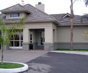
Homewood Suites by Hilton Bakersfield
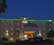
Holiday Inn Express BAKERSFIELD
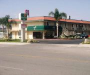
VAGABOND INN BAKERSFIELD SOUTH
SUPER 8 BAKERSFIELD SOUTH CA
MOTEL 6 BAKERSFIELD SOUTH
HOWARD JOHNSON INN - BAKERSFIE
GuestHouse International Inn & Suites - Bakersfield
CA Bakersfield Country Inn & Suites By Carlson
Econo Lodge near Bakersfield Fairgrounds
RAMADA LIMITED BAKERSFIELD CEN
Videos from this area
These are videos related to the place based on their proximity to this place.
The Famous Milt's neon sign on Hwy 99 in Bakersfield
Milt's Coffee Shop in Bakersfield, California. This famous Milt's neon sign has been a happy sight for locals and tourists who travel the busy Hwy 99 through the great city of Bakersfield....
Michael and Donna in the back yard
Michael and Donna in the back yard, Bakersfield, California. Original file: 2011-07-01 Michael at home-01A.mov.
Prosecion de san pedro teyuca 6/30/11 #4
Perdon si se mueve mucho el video pero esque habia muchas piedras!!...lol no pero espero y les guste=) me hubiese gustado en juntar todos los videos y hacer una pelicula mejor pero por cuestiones.
Kirtan by Bhai Harmohan Singh Zakhmi Jatha - 042912
Vaisakhi Celebrations at Guru Nanak Mission Sikh Center, Bakersfield, CA.
Kirtan by Bhai Balwinder Singh Barwala Jatha
Vaisakhi 2012 Celebrations at Guru Nanak Mission Sikh Center, Bakersfield from April 27 to April 29, 2012.
The Villas at Seven Oaks! Gated Community!
For more details click here: http://www.visualtour.com/showvt.asp?t=2985234 1813 Embarcadero Lane Bakersfield, CA 93311 $495000, 3 bed, 2.5 bath, 2478 SF, MLS# 21301670 Gated privacy, luxury ...
Seven Oaks Spanish Villa on Golf Course!
For more details click here: http://www.visualtour.com/showvt.asp?t=2453238 3004 Cormier Drive Bakersfield, CA 93311 $799000, 4 bed, 3.5 bath, 3925 SF, MLS# 21104610 Seven Oaks on golf...
Group X 2012
CSU Bakersfield's Student Recreation Center gives an exclusive look at the various Group X classes offered this Winter quarter.
Pacific Palisades CA DUI Lawyer 310-919-4883 Best DUI Attorney Pacific Palisades LA Beach Cities
Pacific Palisades DUI Lawyer 310-919-4883 Best DUI Attorney West LA Beach Cities. Have you recently been arrested for DUI in Pacific palisades? Are you looki...
Videos provided by Youtube are under the copyright of their owners.
Attractions and noteworthy things
Distances are based on the centre of the city/town and sightseeing location. This list contains brief abstracts about monuments, holiday activities, national parcs, museums, organisations and more from the area as well as interesting facts about the region itself. Where available, you'll find the corresponding homepage. Otherwise the related wikipedia article.
Ridgeview High School (Bakersfield, California)
Artwell, California
Artwell is a former settlement in Kern County, California. It was located on the railroad 2.5 miles south of Bannister.
Bakersfield Sports Village
Bakersfield Sports Village is a 170-acre tournament style sporting complex located in Bakersfield, California. Phase 1 (which was completed in 2011) contains 8 soccer fields. When fully constructed, it will have 16 soccer fields, 10 baseball fields, 4 football fields, and an indoor gymnasium. There will also be a large stadium which can be configured for either soccer or football. Surrounding facilities will include recreational park with a large lake, and two retail shopping areas.
Independence High School (Bakersfield, California)
Independence High School is a public, co-educational high school located in Bakersfield, California. Its athletics teams are known as the Independence Falcons and the school colors are maroon and silver. Independence High School had their first class in 2008, with the first graduating class in 2011, however the first all Falcon graduating class will be graduating in 2012.
Stine Canal
Stine Canal is an irrigation canal in Kern County, California. It originates from the Carrier Canal adjacent to SR 99 (Golden State Freeway). It terminates at a reservoir on Bear Mountain Boulevard, just east of Gosford Road. From the diversion, the canal travels south, following North Stine Road. After passing Stockdale Highway, North Stine Road becomes Stine Road. Around Ming Avenue, both the road and the canal turns southwest.


