Safety Score: 2,7 of 5.0 based on data from 9 authorites. Meaning we advice caution when travelling to United States.
Travel warnings are updated daily. Source: Travel Warning United States. Last Update: 2024-08-13 08:21:03
Touring Algoso
Algoso in Kern County (California) is a town located in United States about 2,300 mi (or 3,702 km) west of Washington DC, the country's capital place.
Time in Algoso is now 01:53 AM (Monday). The local timezone is named America / Los Angeles with an UTC offset of -8 hours. We know of 10 airports nearby Algoso, of which 3 are larger airports. The closest airport in United States is Meadows Field in a distance of 9 mi (or 15 km), North-West. Besides the airports, there are other travel options available (check left side).
Also, if you like the game of golf, there are several options within driving distance. Need some hints on where to stay? We compiled a list of available hotels close to the map centre further down the page.
Being here already, you might want to pay a visit to some of the following locations: Bakersfield, Visalia, Ventura, Hanford and Santa Barbara. To further explore this place, just scroll down and browse the available info.
Local weather forecast
Todays Local Weather Conditions & Forecast: 11°C / 52 °F
| Morning Temperature | 9°C / 49 °F |
| Evening Temperature | 11°C / 52 °F |
| Night Temperature | 11°C / 53 °F |
| Chance of rainfall | 1% |
| Air Humidity | 56% |
| Air Pressure | 1023 hPa |
| Wind Speed | Gentle Breeze with 6 km/h (4 mph) from South-East |
| Cloud Conditions | Overcast clouds, covering 100% of sky |
| General Conditions | Light rain |
Monday, 25th of November 2024
13°C (56 °F)
12°C (54 °F)
Moderate rain, moderate breeze, overcast clouds.
Tuesday, 26th of November 2024
12°C (54 °F)
12°C (54 °F)
Moderate rain, light breeze, overcast clouds.
Wednesday, 27th of November 2024
13°C (56 °F)
13°C (56 °F)
Overcast clouds, light breeze.
Hotels and Places to Stay
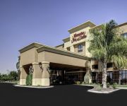
Hampton Inn and Suites-Bakersfield-Hwy 58 CA
BEST WESTERN PLUS HILL HOUSE
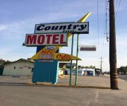
Country Inn Motel
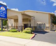
Americas Best Value Inn
MOTEL 6 BAKERSFIELD EAST
Quality Inn & Suites near Downtown Bakersfield
Videos from this area
These are videos related to the place based on their proximity to this place.
EBHS Varsity Basketball 2014 Introduction
East Bakersfield High School Basketball Introduction Varsity Team, 2014 Created by: Alan Heredia & Gabriel Elias Team: Jimmy Benavente Fatai Eke Jacob Hernandez Lamont Jones Brogan McGraw.
DEL VALLE Vs SAN JULIAN - LIGA SOCCER DEL VALLE BAKERSFIELD, CA
DEL VALLE Vs SAN JULIAN - LIGA SOCCER DEL VALLE BAKERSFIELD, CA BELLE TERRACE PARK.
Railfanning Kern Junction 12/22/2009: Short Southbound UP IOALB
The daily IOALB (Oakland to Long Beach) heads through Kern Junction after a crew change in Bakersfield. The two SD70M's will reach the Tehachapi loop about 40 miles up the track.
Railfanning Kern Junction 12/22/2009: BNSF Hopper Train With Ex-C&NW Unit
This BNSF hopper train switches onto the BNSF at Kern Junction. The BNSF Bakersfield Yard is no more than three miles ahead. Power Up-Front: 3 Dash 9-44CWs (3rd unit is an ex-CNW AC4400CW).
Railfanning Kern Junction 12/22/2009: BNSF Intermodal Rumbles Toward Tehachapi
A BNSF Stacktrain passes through Kern Junction In Bakersfield just 5-10 minutes after we got there. It is going south on its way to Tehachapi. Power: ES44DC Dash 9-44CW ES44DC Dash 9-44CW.
Spanish Hacienda at Bakersfield Country Club!
For more details click here: http://www.visualtour.com/showvt.asp?t=3162459 3616 Claremont Drive Bakersfield, CA 93306 $1150000, 6 bed, 4.5 bath, 5315 SF ...
2007 Chrysler Town & Country Used Cars Bakersfield CA
http://www.alohaautosales.com This 2007 Chrysler Town & Country is available from Aloha Auto Sales. For details, call us at 661-871-2025.
CARRIER CANAL (Bakersfield, California) part 2
The Carrier Canal is an aqueduct in Bakersfield, California that conveys water from the Kern River to several other smaller canals operated by the City of Bakersfield, and the Kern Delta Water...
Two Trains in the Edison and Magunden Area HD
Watch in High Definition! After seeing a couple trains in Bealville earlier, we headed down towards Bakersfield. We stopped in Edison where many produce packing houses and railroad spurs...
Edison Brick Repair / 20 % OFF / Call Shafran 310-295-1960
Edison Brick Repair www.ShafranConstruction.com 310-295-1960 Choose the #1 Company in Edison and Los Angeles for your next brick repair project: CSLB certified, we bring affordable prices...
Videos provided by Youtube are under the copyright of their owners.
Attractions and noteworthy things
Distances are based on the centre of the city/town and sightseeing location. This list contains brief abstracts about monuments, holiday activities, national parcs, museums, organisations and more from the area as well as interesting facts about the region itself. Where available, you'll find the corresponding homepage. Otherwise the related wikipedia article.
Mesa Marin Raceway
Mesa Marin Raceway was half-mile (0.8 km) oval speedway located in Bakersfield, California and hosted the NASCAR Camping World Truck Series from 1995 and 2003. The track was owned and operated by Gary Collins. In 2005, the track was demolished after an ownership change to developers. A replacement track, co-owned between Dan Smith and James Vernon, is currently under construction.
Highland High School (Bakersfield, California)
Highland provides technology-based instruction across the curriculum. Highland just completed its sixth year of a full six-year term of accreditation and will be visited this year. Advanced Placement (AP) and Honors classes are offered for juniors and seniors in English, calculus, statistics, math analysis, advanced algebra, Spanish, U.S. History, government/economics, chemistry, and physics.
KERI
KERI (1410 AM "Faith & Family 1410 AM") is a radio station broadcasting a Christian radio format. Licensed to Bakersfield, California, USA. The station is currently owned by American General Media.
Foothill High School (Bakersfield, California)
Their Speech and Debate team won the State Championship (small schools) in 2004. In 2003, Foothill had the league record of sending 7 students to the National Championships. Their FFA Advanced Parliamentary Procedure Team won a National Championship at the National FFA Convention in October 2007. In 2010 the We The People team made it to state for the first time in their We the People History.
KUZZ
KUZZ and KUZZ-FM are American radio stations licensed to serve Bakersfield, California, USA. The stations are owned by Buck Owens Production Company (which is controlled by the estate of the late Buck Owens) and the licenses are held by Owens One Company Inc. They broadcast a simulcast country music format to the inland central California region.
Bakersfield Country Club
Bakersfield Country Club is an 18-hole private golf course located in Bakersfield, California. The course is 6,819 yards on hilly terrain, designed by William P. Bell. Being located in the foothills of northeast Bakersfield makes this one of the few courses within Kern County that is naturally hilly. The club has reciprocating privileges to all private golf clubs in the Greater Bakersfield area.


