Safety Score: 2,7 of 5.0 based on data from 9 authorites. Meaning we advice caution when travelling to United States.
Travel warnings are updated daily. Source: Travel Warning United States. Last Update: 2024-08-13 08:21:03
Explore Pilot Hill
Pilot Hill in El Dorado County (California) is located in United States about 2,342 mi (or 3,769 km) west of Washington DC, the country's capital.
Local time in Pilot Hill is now 01:25 PM (Tuesday). The local timezone is named America / Los Angeles with an UTC offset of -8 hours. We know of 9 airports in the wider vicinity of Pilot Hill, of which 3 are larger airports. The closest airport in United States is Sacramento International Airport in a distance of 33 mi (or 52 km), West. Besides the airports, there are other travel options available (check left side).
Also, if you like golfing, there are multiple options in driving distance. We found 2 points of interest in the vicinity of this place. If you need a place to sleep, we compiled a list of available hotels close to the map centre further down the page.
Depending on your travel schedule, you might want to pay a visit to some of the following locations: Auburn, Placerville, Nevada City, Jackson and Sacramento. To further explore this place, just scroll down and browse the available info.
Local weather forecast
Todays Local Weather Conditions & Forecast: 18°C / 65 °F
| Morning Temperature | 10°C / 50 °F |
| Evening Temperature | 14°C / 58 °F |
| Night Temperature | 13°C / 55 °F |
| Chance of rainfall | 0% |
| Air Humidity | 34% |
| Air Pressure | 1018 hPa |
| Wind Speed | Gentle Breeze with 7 km/h (5 mph) from South |
| Cloud Conditions | Few clouds, covering 12% of sky |
| General Conditions | Few clouds |
Tuesday, 5th of November 2024
20°C (68 °F)
9°C (48 °F)
Sky is clear, gentle breeze, clear sky.
Wednesday, 6th of November 2024
18°C (65 °F)
10°C (50 °F)
Sky is clear, light breeze, clear sky.
Thursday, 7th of November 2024
18°C (64 °F)
11°C (52 °F)
Sky is clear, light breeze, clear sky.
Hotels and Places to Stay
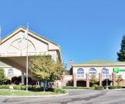
Holiday Inn AUBURN
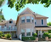
Park Victorian
POWERS MANSION
EDEN VALE INN
Videos from this area
These are videos related to the place based on their proximity to this place.
Auburn City Fire
Video of an early morning fire that destroyed several historic buildings in Old Town Auburn.
Auburn California Courthouse - By Drone
WATCH IN HD! - A short film of the Auburn Ca. Courthouse and Museum shot from the air by UAV pilot Jim Bowers. Equipment: DJI Phantom Drone. GoPro Hero3 Camera. Fatshark FPV. Enjoy, please.
Gold Panning at the Gold Country
Carson signed up to do some volunteer work at the Gold Country Museum. He's a real live gold panner and wanted to show people how to pan for gold. This video was shot in the Gold Country Museum ...
NCGS Smartville Complex Field Trip by Dr. Eldridge M. Moores Stop 10 (part 2 of 2)
Stop 9 - wrapup discussion at American River Overlook, Auburn Dam NORTHERN CALIFORNIA GEOLOGICAL SOCIETY FIELD TRIP - Saturday, September 18, 2010, "GEOLOGY AND TECTONICS ...
TRT-909 Gantry Shuttles Bloomers Cut In Auburn
HQ, use Full Screen. At Bloomers Cut in the Auburn Calif area on the UP Railroad Roseville Subdivision. The shuttles can be seen moving new concrete ties to the TRT-909 and also moving the...
NCGS Smartville Complex Field Trip by Dr. Eldridge M. Moores Stop 10 (part 1 of 2)
Stop 9 - wrapup discussion at American River Overlook, Auburn Dam NORTHERN CALIFORNIA GEOLOGICAL SOCIETY FIELD TRIP - Saturday, September 18, 2010, "GEOLOGY AND TECTONICS ...
Harlem Shake Downtown Auburn CA
Random group of kids dancing in downtown Auburn, and they kept playing replay on harlem shake. Wanting to do a harlem shake video I couldnt think of any better way than to join them.
TRT-909 at Auburn Calif track #1 Rail and Tie Replacement Part 2
Replacing rails and ties today in Auburn on the Roseville Sub. A short video shot from a hill above the tracks today. Best seen in full screen.
Videos provided by Youtube are under the copyright of their owners.
Attractions and noteworthy things
Distances are based on the centre of the city/town and sightseeing location. This list contains brief abstracts about monuments, holiday activities, national parcs, museums, organisations and more from the area as well as interesting facts about the region itself. Where available, you'll find the corresponding homepage. Otherwise the related wikipedia article.
KAHI
KAHI is a radio station broadcasting an Oldies music format. Licensed to Auburn, California, USA, the station serves the Sacramento area. The station is currently owned by Ihr Educational Broadcasting. It broadcasts locally-produced programming, Oakland Athletics baseball, Sacramento Kings basketball, San Jose Sharks hockey, Sierra Junior College and local high school football. When not carrying live broadcasts, KAHI has carries nationally-syndicated talk radio shows.
KHYL
KHYL is a Rhythmic Adult Contemporary serving the Sacramento, California area and broadcasts at 101.1 FM. They are owned by Clear Channel Communications and is licensed to Auburn, California. The station's direction is mostly focused on a variety of (hence the "V"-brand) R&B and Old School product but also play current Rhythmic/R&B fare as well, thus it leans Urban Oldies.
Pilot Hill, California
Pilot Hill (formerly, Centerville, Pilothill, and Pittsfield) is an unincorporated community in El Dorado County, California. It is located 13 miles west-northwest of Placerville, at an elevation of 1175 feet (358 m). In 1849, mining commenced at Pilot Hill. Originally, Centerville, Pilot Hill, and Pittsfield were separate nearby mining camps that unified under the name Centerville. The post office came in 1854 and bestowed the name Pilot Hill.
Site of California's First Grange Hall
The Site of California's First Grange Hall, also known as Pilot Hill Grange Hall No. 1, is a historic site that has been designated a California Historical Landmark. It is the site of California's first Grange Hall, Pilot Hill Grange Hall No. 1. The organization was founded in 1870; the building was completed in 1889. It is California Historical Landmark number 551. The approximate location is {{#invoke:Coordinates|coord}}{{#coordinates:38|50|38.12|N|121|0|53.94|W|region:US |primary |name= }}.


