Safety Score: 2,7 of 5.0 based on data from 9 authorites. Meaning we advice caution when travelling to United States.
Travel warnings are updated daily. Source: Travel Warning United States. Last Update: 2024-08-13 08:21:03
Delve into El Dorado
El Dorado in El Dorado County (California) is located in United States about 2,336 mi (or 3,760 km) west of Washington DC, the country's capital town.
Current time in El Dorado is now 08:40 PM (Thursday). The local timezone is named America / Los Angeles with an UTC offset of -8 hours. We know of 11 airports close to El Dorado, of which 5 are larger airports. The closest airport in United States is Sacramento International Airport in a distance of 40 mi (or 65 km), West. Besides the airports, there are other travel options available (check left side).
Also, if you like playing golf, there are some options within driving distance. We encountered 2 points of interest near this location. If you need a hotel, we compiled a list of available hotels close to the map centre further down the page.
While being here, you might want to pay a visit to some of the following locations: Placerville, Auburn, Jackson, San Andreas and Nevada City. To further explore this place, just scroll down and browse the available info.
Local weather forecast
Todays Local Weather Conditions & Forecast: 12°C / 54 °F
| Morning Temperature | 15°C / 58 °F |
| Evening Temperature | 11°C / 52 °F |
| Night Temperature | 10°C / 51 °F |
| Chance of rainfall | 51% |
| Air Humidity | 82% |
| Air Pressure | 1016 hPa |
| Wind Speed | Moderate breeze with 11 km/h (7 mph) from North-West |
| Cloud Conditions | Overcast clouds, covering 100% of sky |
| General Conditions | Heavy intensity rain |
Friday, 22nd of November 2024
10°C (51 °F)
6°C (42 °F)
Heavy intensity rain, gentle breeze, overcast clouds.
Saturday, 23rd of November 2024
7°C (44 °F)
8°C (46 °F)
Moderate rain, gentle breeze, overcast clouds.
Sunday, 24th of November 2024
9°C (48 °F)
8°C (47 °F)
Light rain, light breeze, overcast clouds.
Hotels and Places to Stay
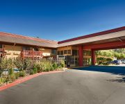
BW PLUS PLACERVILLE INN
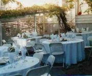
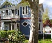
Glen Morey Country House B & B Inn
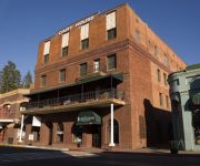
Historic Cary House Hotel
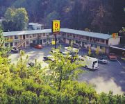
National 9 Inn Placerville
ALBERT SHAFSKY HOUSE BED AND BREAKFAST
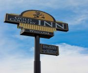
GOLD COUNTRY INN
Videos from this area
These are videos related to the place based on their proximity to this place.
Classic Placerville Speedway Stock Car Racing
Watch as Mark Treat #57 rides the back stretch wall like a quarter-pipe, runs the high groove, and battles with Placerville Speedway stock car legends such as Kevin Wirth #00 and Dan Brown Jr. #5x.
Honda Automotive Service Placerville - 1-530-783-1233
Honda Automotive Service Placerville at Hangtown Affordable Auto Repair 1-530-783-1233 has been in the Placerville area since 2010 offering quality auto repair and service. We offer honest...
On-board 28x Sprintcar at Placerville Speedway in HD!
Ride with Billy Strange in the 28x 360 Sprintcar during REDHAWK Casino championship racing point night #4 at Placerville Speedway Including the crash at the end of the night. 4/24/10. Filmed...
dutch holland demolition derby placerville 2010: classic 1957 Lincoln wrecked
My friend and I drove an hour and paid $25 dollars to see a derby with only five cars in it. Dutch Holland Presents tried making a small car count interesting with a little car race before...
KWS 2012 Highlights Round 13 at the Placerville Speedway - June 30
King of the West Sprint Car Series - Highlight Reel from the Placerville Speedway on June 30, 2012. With all the Crashes, Spills and Winnings you need. The Thirteenth race of the 2012 season...
Placerville, California to Calgary, Alberta - GOPRO
Returning back home after a Jeep trip to the Rubicon Trail in California. Decided to shoot a photo every 30 seconds during our 2500 km drive. 3227 photos total. - Shot with a GoPro Hero2...
KWS 2012 Highlights Round 3 at the Placerville Speedway - April 28
King of the West Sprint Car Series - Highlight Reel From the Placerville Speedway on April 28, 2012. With all the Crashes, Spills and Winnings you need. Third race of the 2012 season with...
El Dorado Country Fair 2013 Hay Bucking Contest!
While attending the El Dorado County Fair this year, a friend roped me into doing something I have never done competetively before and had not intended to do when I came to spend time at the...
A Wet State #41: Weber Creek
A great day on Weber Creek in Placerville Ca. Flow was ~2.7 feet on the bridge gauge. For more information, please see www.awetstate.com.
Fitness Solutions (Diamond Springs, CA.)
A promotional video for Fitness Solutions located in Diamond Springs, CA. The video shows workouts, training, personal trainers, equipment, and testimonials. CREW Director, DP: Nicholas Garcia...
Videos provided by Youtube are under the copyright of their owners.
Attractions and noteworthy things
Distances are based on the centre of the city/town and sightseeing location. This list contains brief abstracts about monuments, holiday activities, national parcs, museums, organisations and more from the area as well as interesting facts about the region itself. Where available, you'll find the corresponding homepage. Otherwise the related wikipedia article.
El Dorado, California
El Dorado (Spanish for The golden; formerly Eldorado, Mud Spring, and Mud Springs), not to be confused with the nearby El Dorado Hills, is an unincorporated community in El Dorado County, California. It is located 4 miles southwest of Placerville, at an elevation of 1608 feet (490 m). The population was 4,096 at the 2000 census. The town is registered as California Historical Landmark #486. The ZIP code is 95623. The community is inside area code 530.
Independence High School (Diamond Springs, California)
Independence High School (IHS) is a continuation school offered as an alternative option for students who are at risk of not graduating from their traditional comprehensive high school, utilizing greater flexibility in instruction and smaller class sizes. IHS is located in Diamond Springs, California and is a member of the El Dorado Union High School District (EDUHSD). {{#invoke:Coordinates|coord}}{{#coordinates:38|41|38|N|120|49|18|W|region:US-CA_type:edu_source:GNIS |primary |name= }}
Deer Park, El Dorado County, California
Deer Park is an unincorporated community in El Dorado County, California. It lies at an elevation of 1755 feet (535 m).
Kingsville, California
Kingsville (formerly, Kingville) is an unincorporated community in El Dorado County, California. It is located 5 miles southwest of Placerville, at an elevation of 1532 feet (467 m).
Onchomo, California
Onchomo is a former Maidu settlement in El Dorado County, California. It was located 5 miles south of Placerville; the site is now covered by El Dorado (formerly, Mud Springs).
Perks Corner, California
Perks Corner is an unincorporated community in El Dorado County, California. It is located 2.5 miles west-southwest of Placerville, at an elevation of 1762 feet (537 m).
Cummings, El Dorado County, California
Cummings is a former settlement in El Dorado County, California. It was located on the Southern Pacific Railroad 2 miles west of El Dorado.
Aurum City, California
Aurum City is a former settlement in El Dorado County, California. It was located 2 miles southeast of El Dorado. A post office operated at Aurum City from 1852 to 1853. "Aurum" is the Latin word for gold.


