Safety Score: 2,7 of 5.0 based on data from 9 authorites. Meaning we advice caution when travelling to United States.
Travel warnings are updated daily. Source: Travel Warning United States. Last Update: 2024-08-13 08:21:03
Explore Camp Richardson
Camp Richardson in El Dorado County (California) is located in United States about 2,290 mi (or 3,685 km) west of Washington DC, the country's capital.
Local time in Camp Richardson is now 06:38 AM (Thursday). The local timezone is named America / Los Angeles with an UTC offset of -8 hours. We know of 11 airports in the wider vicinity of Camp Richardson, of which 5 are larger airports. The closest airport in United States is Lake Tahoe Airport in a distance of 4 mi (or 6 km), South-East. Besides the airports, there are other travel options available (check left side).
There is one Unesco world heritage site nearby. It's Yosemite National Park in a distance of 121 mi (or 195 km), South-East. Also, if you like golfing, there are multiple options in driving distance. We found 6 points of interest in the vicinity of this place. If you need a place to sleep, we compiled a list of available hotels close to the map centre further down the page.
Depending on your travel schedule, you might want to pay a visit to some of the following locations: Minden, Carson City, Virginia City, Reno and Placerville. To further explore this place, just scroll down and browse the available info.
Local weather forecast
Todays Local Weather Conditions & Forecast: 5°C / 41 °F
| Morning Temperature | 4°C / 39 °F |
| Evening Temperature | 4°C / 39 °F |
| Night Temperature | 4°C / 40 °F |
| Chance of rainfall | 20% |
| Air Humidity | 95% |
| Air Pressure | 1019 hPa |
| Wind Speed | Moderate breeze with 11 km/h (7 mph) from North-East |
| Cloud Conditions | Overcast clouds, covering 100% of sky |
| General Conditions | Rain and snow |
Thursday, 21st of November 2024
3°C (38 °F)
5°C (40 °F)
Rain and snow, fresh breeze, overcast clouds.
Friday, 22nd of November 2024
1°C (34 °F)
-2°C (28 °F)
Rain and snow, strong breeze, overcast clouds.
Saturday, 23rd of November 2024
2°C (35 °F)
-1°C (31 °F)
Heavy snow, strong breeze, overcast clouds.
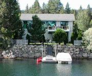
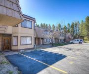
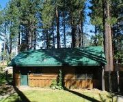
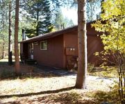
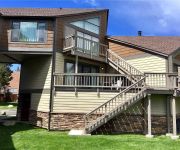
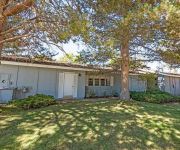
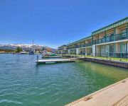
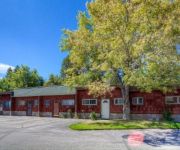
Hotels and Places to Stay
1873 Venice Drive by RedAwning
Remodeled Condo in Tahoe Keys Complex by RedAwning
Cedar Pines Resort
673 San Francisco Avenue by RedAwning
Sky Meadows Court by RedAwning
Tahoe Keys Condo by RedAwning
2073 Traverse Court by RedAwning
Tahoe Marina Shores 132 By RedAwning
Tahoe Keys Studio Condo with Private Hot Tub by RedAwning
One Level Townhouse in Exclusive Tahoe Keys by RedAwning
Videos from this area
These are videos related to the place based on their proximity to this place.
Guinness Book of World Records, Bike Parade, 5_17_2012, South Lake Tahoe California
World Record, Bike Parade, 5_17_2012, south lake tahoe, winning, bicycle, biking, bike jump, mt. bike, cruiser, costumes, parade, festival, slow rollers, cruisin, lake tahoe, boating, recreation,...
Carl Young Teaches Me The Dynamics of a South Lake Tahoe Thunderstorm
This video memory is from one of the final days I was able to spend with a very dear friend of mine. Carl Young was an amazing person and is deeply missed.
Tahoe Keys, South Lake Tahoe, CA Final 2010 real estate update
check us out at http://laketahoerealestateblog.com for more fun and information about South Lake Tahoe. The Tahoe Keys is one of Lake Tahoe's most desired and coveted neighborhoods. ...
Lake Tahoe Al Tahoe Neighborhood Chokecherry Tree Timelapse
Lake Tahoe Chokecherry Tree Time lapse, Al Tahoe Neighborhood Chokecherry Tree Time-lapse Bloom, Spring Bloom, Tahoe Spring, Tahoepropertyforsale.com, lake property, Landscaping, Nature ...
South Lake Tahoe neighborhoods: Y Area Final 2010
check out http://laketahoerealestateblog.com for more fun and information about South Lake Tahoe. The Y Area is a small, older neighborhood offering market e...
Coyote hunting in our back yard.
Some real snow finally arrived today. One of our local coyotes was looking for a meal. He was just a few yards from the house, but moved out further when he heard the door open. He was still...
Tahoe Keys Vacation Rentals
The Tahoe Keys is a unique waterfront community situated on the south shore of Lake Tahoe. An ideal vacation spot because of it's location, amenities, and a variety of quality vacation rental...
Tahoe Keys Resort
Overview of the Tahoe Keys marina community and the boating lifestyle of Lake Tahoe. http://www.tahoevacationguide.com/
Our boat slip in the Tahoe Keys
Check out http://laketahoerealestateblog.com for more on Lake Tahoe and The Tahoe Keys. We keep our boat at a friend's house, which is about ten minutes by boat to Lake Tahoe proper. ...
Videos provided by Youtube are under the copyright of their owners.
Attractions and noteworthy things
Distances are based on the centre of the city/town and sightseeing location. This list contains brief abstracts about monuments, holiday activities, national parcs, museums, organisations and more from the area as well as interesting facts about the region itself. Where available, you'll find the corresponding homepage. Otherwise the related wikipedia article.
Fallen Leaf Lake (California)
Fallen Leaf Lake is about one mile south of the much larger Lake Tahoe, near the California-Nevada state border. It is approximately aligned north-to-south and oval in shape, measuring approximately 2.9 miles (4.6 km) on the long axis and 0.9 miles (1.4 km) on the short axis. The lake was created by at least two glaciers which traveled northward down the Glen Alpine Valley. If the glacier had continued instead of stopping, Fallen Leaf Lake would be a bay similar to nearby Emerald Bay.
Spring Creek, California
Spring Creek is an unincorporated community in El Dorado County, California. It lies at an elevation of 6339 feet (1932 m).
South Tahoe High School
South Tahoe High School (STHS) is a public secondary school in South Lake Tahoe, California that is part of the Lake Tahoe Unified School District. The school mascot is the Viking, and the school's colors are blue and gold. South Tahoe High School has an average attendance of 1,300 students and features an open-air campus. In 2004, the school underwent a massive renovation which featured the installation of heated sidewalks and a renovation of the offices.
Camp Richardson, California
Camp Richardson is an unincorporated community in El Dorado County, California. It lies at an elevation of 6250 feet (1905 m). A post office operated at Camp Richardson from 1927 to 1973, with a closure from 1964 to 1965. The place is named after its first postmaster, Alonzo L. Richardson.
Kiva Beach, California
Kiva Beach is an unincorporated community in El Dorado County, California. It lies at an elevation of 6240 feet (1902 m).
Lake Valley, California
Lake Valley (formerly, Bigler Lake Valley) is an unincorporated community in El Dorado County, California. It extends for 8 miles along the Upper Truckee River from Lake Tahoe to Meyers, at an elevation of 6207 feet (1892 m). The place was founded in or before 1853.
Tahoe Keys, California
Tahoe Keys is a former unincorporated community in El Dorado County, California, now incorporated in South Lake Tahoe. It lies at an elevation of 6240 feet (1902 m). Built in the 1960s, the community consists of over 1500 homes adjacent to a series of canals. Its construction destroyed half of the Upper Truckee Marsh, the primary filter for river water entering the lake, and has since been called the most environmentally damaging intrusion on lakeshore in Lake Tahoe's human history.
Tallac Village, California
Tallac Village is an unincorporated community in El Dorado County, California. It lies at an elevation of 6263 feet (1909 m).


