Safety Score: 2,7 of 5.0 based on data from 9 authorites. Meaning we advice caution when travelling to United States.
Travel warnings are updated daily. Source: Travel Warning United States. Last Update: 2024-08-13 08:21:03
Discover Brandon Corner
Brandon Corner in El Dorado County (California) is a city in United States about 2,342 mi (or 3,770 km) west of Washington DC, the country's capital city.
Local time in Brandon Corner is now 02:19 AM (Friday). The local timezone is named America / Los Angeles with an UTC offset of -8 hours. We know of 10 airports in the vicinity of Brandon Corner, of which 4 are larger airports. The closest airport in United States is Sacramento International Airport in a distance of 36 mi (or 58 km), West. Besides the airports, there are other travel options available (check left side).
Also, if you like golfing, there are a few options in driving distance. We discovered 2 points of interest in the vicinity of this place. Looking for a place to stay? we compiled a list of available hotels close to the map centre further down the page.
When in this area, you might want to pay a visit to some of the following locations: Placerville, Jackson, Auburn, San Andreas and Sacramento. To further explore this place, just scroll down and browse the available info.
Local weather forecast
Todays Local Weather Conditions & Forecast: 12°C / 54 °F
| Morning Temperature | 13°C / 56 °F |
| Evening Temperature | 11°C / 52 °F |
| Night Temperature | 11°C / 51 °F |
| Chance of rainfall | 52% |
| Air Humidity | 80% |
| Air Pressure | 1015 hPa |
| Wind Speed | Moderate breeze with 10 km/h (6 mph) from North-West |
| Cloud Conditions | Overcast clouds, covering 100% of sky |
| General Conditions | Heavy intensity rain |
Friday, 22nd of November 2024
11°C (52 °F)
6°C (43 °F)
Heavy intensity rain, gentle breeze, overcast clouds.
Saturday, 23rd of November 2024
7°C (45 °F)
8°C (46 °F)
Moderate rain, gentle breeze, overcast clouds.
Sunday, 24th of November 2024
9°C (49 °F)
8°C (47 °F)
Light rain, light breeze, overcast clouds.
Hotels and Places to Stay
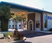
MOTEL 6 CAMERON PARK
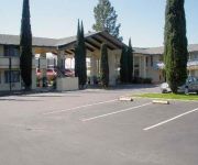
Quality Inn & Suites Cameron Park
Videos from this area
These are videos related to the place based on their proximity to this place.
N6NA 145.25 MHz FM Repeater near Shingle Springs, California
The River City Amateur Radio Communications Society owns and operates the N6NA 145.25 MHz FM repeater, located east of Sacramento, California in the foothills near Shingle Springs at 2000 feet...
Bed Bug Spraying in Cameron Park CA 916-226-4836 Bed Bug Bites
Visit http://pestcontrolcameronpark.com/ Bed Bug Treatments by Official Pest Control in Cameron Park CA 916-226-4836 Free Bed Bug Inspection Serving Northern California since 2000 with over...
Official Pest Control 916-226-4836 Cameron Park CA, Spider, Wasp and Bee Control
Visit: http://pestcontrolcameronpark.com/ Pest Control 916-226-4836 Cameron Park CA Official 95670 Pest Control Serving Sacramento County California Since 2000. Pest control company, ant control, ...
Cameron Park CA Synthetic Putting Greens 916-214-7888
http://www.sacramentoartificialgrass.com Call Us Today 916-214-7888 Build a true-to-size or miniature backyard putting green or putting course in your very own backyard. Our putting greens...
Pest Management Insect Control 916-226-4836 Cameron Park CA, Pest Exterminator
Visit: http://pestcontrolcameronpark.com/ Pest Control 916-226-4836 Cameron Park CA 95682 Serving Shingle Springs El Dorado County California Since 2000. Pest control company, ant control,...
Upholstery Cleaning 916-405-0075 Furniture Cleaners Cameron Park CA
Visit: http://www.ourbestcarpetcleaning.com/ Furniture Cleaning 916-405-0075 Kleen Express Upholstery Cleaning Cameron Park CA A professional furniture cleaning company can remove dirt spills...
Missing Man Formation for Bob McKay
April 2nd 2015. RV aircraft do a missing man pass at Cameron Park, California, for Bob McKay. The number two RV pulled up and turned toward the setting sun. Bob had owned and flown an RV-6....
SCPL - April 12 Shift Happens Reverend Dr. Pattie Weber
This morning, we look at some commonly held beliefs about ourselves and our world. Then, by applying a singular, focused Spiritual Truth to each of them, we will shift out of each belief into...
SCPL - March 22 Tapping Into The Realm of Possibilities Rev. Dr. Pattie Weber
According to Thomas Troward's only student, Genevieve Behrend, we all have access to an Invisible Power which immediately taps us into the realm of possibilities. We have already explored...
SCPL - April 5 Rose Petal Ceremony SCPL Ministers
April 2015 Theme - “Ascending through Grace” On this powerful Easter morning, we will take a deep dive into the essence of Grace and find that it has the power to heal and transcend all...
Videos provided by Youtube are under the copyright of their owners.
Attractions and noteworthy things
Distances are based on the centre of the city/town and sightseeing location. This list contains brief abstracts about monuments, holiday activities, national parcs, museums, organisations and more from the area as well as interesting facts about the region itself. Where available, you'll find the corresponding homepage. Otherwise the related wikipedia article.
Brandon Corner, California
Brandon Corner (formerly, Brandons) is an unincorporated community in El Dorado County, California. It is located 3 miles northeast of Latrobe, at an elevation of 748 feet (228 m).
Brela, California
Brela is an unincorporated community in El Dorado County, California. It is located on the Southern Pacific Railroad 1.5 miles northeast of Latrobe, at an elevation of 988 feet (301 m).
Bullard, California
For the place formerly with this name in Fresno County, see Figarden, California.
Dugan, California
Dugan (formerly, Bullard-Dugan) is an unincorporated community in El Dorado County, California. It is located on the Southern Pacific Railroad 3.25 miles north-northeast of Latrobe, at an elevation of 1135 feet (346 m).
Flonellis, California
Flonellis is an unincorporated community in El Dorado County, California. It is located on the Southern Pacific Railroad 1 mile northeast of Latrobe, at an elevation of 948 feet (289 m).
Shrub, California
Shrub is an unincorporated community in El Dorado County, California. It is located on the Southern Pacific Railroad 2.5 miles north-northeast of Latrobe, at an elevation of 1043 feet (318 m).


