Safety Score: 2,7 of 5.0 based on data from 9 authorites. Meaning we advice caution when travelling to United States.
Travel warnings are updated daily. Source: Travel Warning United States. Last Update: 2024-08-13 08:21:03
Discover Stege
Stege in Contra Costa County (California) is a city in United States about 2,427 mi (or 3,907 km) west of Washington DC, the country's capital city.
Local time in Stege is now 04:15 PM (Thursday). The local timezone is named America / Los Angeles with an UTC offset of -8 hours. We know of 8 airports in the vicinity of Stege, of which 4 are larger airports. The closest airport in United States is Metropolitan Oakland International Airport in a distance of 15 mi (or 24 km), South-East. Besides the airports, there are other travel options available (check left side).
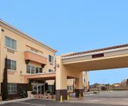
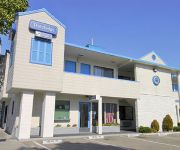
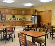
Also, if you like golfing, there are a few options in driving distance. We discovered 10 points of interest in the vicinity of this place. Looking for a place to stay? we compiled a list of available hotels close to the map centre further down the page.
When in this area, you might want to pay a visit to some of the following locations: Oakland, San Francisco, San Rafael, Martinez and Napa. To further explore this place, just scroll down and browse the available info.
Local weather forecast
Todays Local Weather Conditions & Forecast: 15°C / 59 °F
| Morning Temperature | 16°C / 60 °F |
| Evening Temperature | 14°C / 58 °F |
| Night Temperature | 14°C / 57 °F |
| Chance of rainfall | 27% |
| Air Humidity | 86% |
| Air Pressure | 1014 hPa |
| Wind Speed | Fresh Breeze with 13 km/h (8 mph) from North |
| Cloud Conditions | Overcast clouds, covering 100% of sky |
| General Conditions | Heavy intensity rain |
Friday, 22nd of November 2024
14°C (56 °F)
11°C (52 °F)
Moderate rain, gentle breeze, clear sky.
Saturday, 23rd of November 2024
10°C (50 °F)
10°C (49 °F)
Light rain, gentle breeze, overcast clouds.
Sunday, 24th of November 2024
12°C (54 °F)
12°C (54 °F)
Light rain, moderate breeze, overcast clouds.
Hotels and Places to Stay
DoubleTree by Hilton Berkeley Marina
Barkissimo classic yacht hotel
Holiday Inn Express & Suites SAN PABLO - RICHMOND AREA
La Quinta Inn Berkeley
Holiday Inn Express & Suites BERKELEY
Courtyard Richmond Berkeley
HOTEL SHATTUCK PLAZA
TRAVELODGE BERKELEY
Sens Hotel & Vanne Bistro Berkeley
SureStay Plus Hotel By Best Western Point Richmond
Videos from this area
These are videos related to the place based on their proximity to this place.
BNSF Baretable at Stege Jct, Richmond, Ca
BNSF 4670 EB baretable makes it's way from the UP Martinez Sub at Stege onto the Waterside Drill track and onto the rails of the Richmond Pacific.
Honda of El Cerrito - Al Despertar
Our latest episode on Al Despertar with Silvia Garcia, Sales Consultant Excellente', Honda of El Cerrito. Venga a vernos hoy!
Steven Norman Long Sundown Off the Grid El Cerrito 10.22.14
I am not sure how many times that I have seen this guy perform. Each time that I have seen him perform it gets better and better. I enjoy seeing Steven Norman Long perform at an Off the Grid...
ALD Segment Honda El Cerrito 11 04 2014
Al Despertar and Honda of El Cerrito continue their successful business-partnership.
Laura Benitez at Off the Grid El Cerrito June 18, 2014
First time I ever seen Laura Benitez perform at Off the Grid without her Heartache Sister Michele Kappel-Stone. She did a great job. Still kept the crowd entertain. Note: Claudio from Off...
House move in El Cerrito, Ca
Fisher Brothers move 1100 square-foot house in El Cerrito, California. Michael De La Paz owner/developer.
UNIVISION and Honda of El Cerrito - President's Award Winner
Honda of El Cerrito is the only Bay Area Honda dealership to be awarded this prestigious Honda award.
Playland Not At The Beach EL CERRITO, CA
Playland Not At The Beach EL CERRITO, CA http://local.sfgate.com/b23445917/Playland+Not+At+The+Beach?type= Theme parks, Scavenger hunt, Amusement parks, Team building, Corporate team ...
Videos provided by Youtube are under the copyright of their owners.
Attractions and noteworthy things
Distances are based on the centre of the city/town and sightseeing location. This list contains brief abstracts about monuments, holiday activities, national parcs, museums, organisations and more from the area as well as interesting facts about the region itself. Where available, you'll find the corresponding homepage. Otherwise the related wikipedia article.
El Cerrito del Norte (BART station)
El Cerrito del Norte, frequently shorterned to del Norte, is one of two BART stations in El Cerrito, California, just east of the Cutting Boulevard interchange of Interstate 80 parallel to San Pablo Avenue and the Ohlone Greenway straddling the Richmond border. Del Norte opened to revenue service on January 29, 1973 as part of the original BART system. The station serves as the de facto end of line for the Richmond line as it is the northernmost station along the congested I-80 corridor.
Campus Bay, Richmond, California
Campus Bay is an 87-acre property in the city of Richmond, California located off Interstate 580 (California), and situated between the San Francisco Bay, the Richmond Annex, and Point Isabel neighborhoods. The area receives its name from its proximity to the UC Berkeley Richmond Field Station.
John F. Kennedy High School (Richmond, California)
John F. Kennedy High School is a secondary school located in Richmond, California, as part of the West Contra Costa Unified School District. The school's mascot is the Bald Eagle, the school's athletic teams are known as the "Eagles," and the school colors are red and white. The current principal, as of 2010, is Ms. Roxanne Brown-Garcia. There are approximately 1,047 students attending the school.
Baxter Creek
Baxter Creek or Stege Creek (also archaically Bishop Creek), is a three-branch creek in Richmond and El Cerrito, California, United States forming the Baxter Creek watershed. The creek has three sources and flows from the Berkeley Hills to Stege Marsh and the San Francisco Bay. The Baxter Creek watershed at-large has 10 sources. The creek has been largely culverted over the years since the Rancho San Pablo and the subdivided Bishop Ranch, then known as Bishop Creek, were urbanized.
Playland-Not-At-The-Beach
Playland-Not-At-The-Beach is a non-profit, family-oriented museum in El Cerrito, California celebrating America's bygone amusements, operated entirely by volunteers. The museum's 25 exhibits have specific emphasis on the attractions that once existed at Playland at the Beach and the Sutro Baths & Museum.
Fluvius Innominatus
Fluvius Innominatus or Central Creek is a creek in Richmond and El Cerrito, California in western Contra Costa County. There is one main source and a secondary unnamed tributary. The creek drains into Hoffman Marsh and then flows into the bay through Point Isabel Regional Shoreline's Hoffman Channel. However before the area was developed and as early as 1899 the creek had 11 sources which stretched far higher into the Berkeley Hills.
Hoffman Channel
\\For the stream in San Mateo County, see Hoffman Creek. Hoffman Channel is a waterway in Richmond, California connecting San Francisco Bay with Hoffman Marsh and Fluvius Innominatus creek which drain directly into the channel. The channel is part of Point Isabel Regional Shoreline, the largest dog park in the United States and serves a swimming are for these animals. Hoffman Channel is adjacent to Point Isabel promontory and was formerly a sandy beach on its south shore.
Stege Marsh
Stege Marsh also known as the South Richmond Marshes is a polluted tidal marshland wetlands area in Richmond, California in western Contra Costa County.
Richmond Inner Harbor
Richmond Inner Harbor is a deepwater body of water in Richmond, California. The harbor lies between Ferry Point and Point Isabel, between the mainland and Brooks Island in western Contra Costa County along the East Bay's northern East Shore. The harbor provides excellent protection as it lies protected by Brooks Island an extensive breakwater inside the already protected San Francisco Bay.
Hoffman Marsh
Hoffman Marsh is a wetlands on San Francisco Bay in Richmond, California. The marsh has been protected within Eastshore State Park, and adjacent to Point Isabel Regional Shoreline. The marsh is an important nesting ground for wildfowl and stopping ground on the Pacific Flyway, as it is one of only a handful of undestroyed wetlands in the Bay Area. It borders Point Isabel Regional Shoreline and Interstate 80.
Stege, California
Stege, founded in 1876, was an unincorporated community in western Contra Costa County. California, The town has now been annexed and absorbed by the cities of Richmond and El Cerrito, California. It was located on the Southern Pacific Railroad 1.5 miles south-southeast of downtown Richmond, at an elevation of 23 feet (7 m). The site is now located in the area known as the Richmond Annex, at coordinates: {{#invoke:Coordinates|coord}}{{#coordinates:37|55|00|N|122|19|38|W| | |name= }}.


