Safety Score: 2,7 of 5.0 based on data from 9 authorites. Meaning we advice caution when travelling to United States.
Travel warnings are updated daily. Source: Travel Warning United States. Last Update: 2024-08-13 08:21:03
Explore Nortonville
Nortonville in Contra Costa County (California) is located in United States about 2,403 mi (or 3,868 km) west of Washington DC, the country's capital.
Local time in Nortonville is now 02:50 PM (Thursday). The local timezone is named America / Los Angeles with an UTC offset of -8 hours. We know of 8 airports in the wider vicinity of Nortonville, of which 4 are larger airports. The closest airport in United States is Metropolitan Oakland International Airport in a distance of 25 mi (or 40 km), South-West. Besides the airports, there are other travel options available (check left side).
Also, if you like golfing, there are multiple options in driving distance. We found 10 points of interest in the vicinity of this place. If you need a place to sleep, we compiled a list of available hotels close to the map centre further down the page.
Depending on your travel schedule, you might want to pay a visit to some of the following locations: Martinez, Fairfield, Oakland, Napa and San Francisco. To further explore this place, just scroll down and browse the available info.
Local weather forecast
Todays Local Weather Conditions & Forecast: 18°C / 64 °F
| Morning Temperature | 15°C / 59 °F |
| Evening Temperature | 16°C / 62 °F |
| Night Temperature | 15°C / 60 °F |
| Chance of rainfall | 1% |
| Air Humidity | 61% |
| Air Pressure | 1018 hPa |
| Wind Speed | Moderate breeze with 10 km/h (6 mph) from North |
| Cloud Conditions | Overcast clouds, covering 100% of sky |
| General Conditions | Light rain |
Thursday, 21st of November 2024
16°C (61 °F)
14°C (57 °F)
Heavy intensity rain, gentle breeze, overcast clouds.
Friday, 22nd of November 2024
14°C (58 °F)
10°C (50 °F)
Moderate rain, gentle breeze, few clouds.
Saturday, 23rd of November 2024
9°C (48 °F)
10°C (51 °F)
Moderate rain, light breeze, overcast clouds.
Hotels and Places to Stay
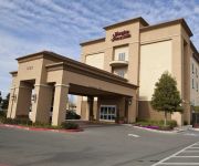
Hampton Inn - Suites Pittsburg
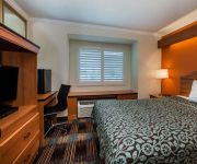
Days Inn And Suites Antioch
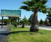
Americas Best Value Inn - Antioch / Bay Area
Economy Inn Antioch
Antioch Executive Inn
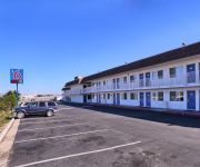
MOTEL 6 PITTSBURG
RAMADA ANTIOCH
DAYS INN CONCORD
Videos from this area
These are videos related to the place based on their proximity to this place.
Clayton CA Roof Repair | Pacific Coast Roofing Service
A recent job in Clayton CA where we repaired some broken tiles and performed some preventive maintenance to ensure the roof will be trouble free for years to come! www.pacificcoastroof.com.
Wheel Repair Clayton (510) 868-2799
http://wheelrepaireastbay.net (510) 868-2799 The rim repair is generally executed during wheel repair Clayton CA. This implies that, it needs to be done throughout the method of wheel repair...
Plumber in Clayton CA 925-521-8435 Sewer & Drain Cleaning
Plumber in Clayton CA 925-521-8435 Sewer & Drain Cleaning http://preferredplumbinganddrain.com/ Clayton CA Preferred Plumbing We are the plumbing, sewer, drain repair and replacement ...
clayton home values custom 4 bedroom 3½ bath REO on large lot
http://goo.gl/qNb3uP Call Dwight at 925-270-7568 for Private Open House Info - Bank Owned, Custom Features, Private Street, Large 4 Bedroom 3.5 Baths Close to Downtown Park only 10 minutes ...
Good Day for a Dog (Slo-Mo with the GoPro Hero3)
Shot entirely with a GoPro Hero3 at 240fps (720x480) - we follow Halona the Belgian Shepherd in the car to the local dog park where she frolics with some friends and plays in the water before...
Videos provided by Youtube are under the copyright of their owners.
Attractions and noteworthy things
Distances are based on the centre of the city/town and sightseeing location. This list contains brief abstracts about monuments, holiday activities, national parcs, museums, organisations and more from the area as well as interesting facts about the region itself. Where available, you'll find the corresponding homepage. Otherwise the related wikipedia article.
Nortonville, California
Nortonville is a former settlement in Contra Costa County, California. It was located on Kirker Creek 5.5 miles north-northeast of Mount Diablo, at an elevation of 801 feet (244 m). It is now a ghost town.
Somersville, California
Somersville (also, Sommerville and Summerville) is an unincorporated ghost town in eastern Contra Costa County, California. It is located 6 miles north-northeast of Mount Diablo, at an elevation of 741 feet (226 m). Somersville was founded in the 1850s by gold miners. The town is no longer populated and is within the boundaries of the East Bay Regional Park District's Black Diamond Mines Regional Park.
Stewartville, California
Stewartville was an unincorporated place in eastern Contra Costa County, California that is now a ghost town. It was located 6 miles northeast of Mount Diablo, at an elevation of 558 feet (170 m). It was a mining town for the nearby coal mines. A post office operated at Stewartville from 1882 to 1902. The place was named for William Stewart, coal mine owner.
Acelanus, California
Acelanus is a former settlement in Contra Costa County, California. It was located 7 miles northwest of Alamo. A post office operated at Acelanus from 1854 to 1855.


