Safety Score: 2,7 of 5.0 based on data from 9 authorites. Meaning we advice caution when travelling to United States.
Travel warnings are updated daily. Source: Travel Warning United States. Last Update: 2024-08-13 08:21:03
Delve into Eckley
Eckley in Contra Costa County (California) is located in United States about 2,418 mi (or 3,892 km) west of Washington DC, the country's capital town.
Current time in Eckley is now 01:08 PM (Tuesday). The local timezone is named America / Los Angeles with an UTC offset of -8 hours. We know of 8 airports close to Eckley, of which 4 are larger airports. The closest airport in United States is Metropolitan Oakland International Airport in a distance of 23 mi (or 37 km), South. Besides the airports, there are other travel options available (check left side).
Also, if you like playing golf, there are some options within driving distance. We encountered 10 points of interest near this location. If you need a hotel, we compiled a list of available hotels close to the map centre further down the page.
While being here, you might want to pay a visit to some of the following locations: Martinez, Fairfield, Napa, Oakland and San Rafael. To further explore this place, just scroll down and browse the available info.
Local weather forecast
Todays Local Weather Conditions & Forecast: 18°C / 64 °F
| Morning Temperature | 13°C / 55 °F |
| Evening Temperature | 18°C / 65 °F |
| Night Temperature | 16°C / 61 °F |
| Chance of rainfall | 0% |
| Air Humidity | 40% |
| Air Pressure | 1019 hPa |
| Wind Speed | Light breeze with 3 km/h (2 mph) from South-East |
| Cloud Conditions | Overcast clouds, covering 100% of sky |
| General Conditions | Overcast clouds |
Tuesday, 5th of November 2024
19°C (66 °F)
15°C (60 °F)
Overcast clouds, moderate breeze.
Wednesday, 6th of November 2024
17°C (63 °F)
15°C (59 °F)
Sky is clear, light breeze, clear sky.
Thursday, 7th of November 2024
17°C (62 °F)
15°C (59 °F)
Sky is clear, light breeze, clear sky.
Hotels and Places to Stay
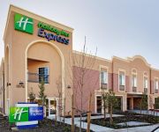
Holiday Inn Express BENICIA
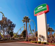
Courtyard Vallejo Napa Valley
Motel 7
BW PLUS HERITAGE INN
Regency Inn
Travelodge Vallejo
Quality Inn near Six Flags Discovery Kingdom-Napa Valley
MOTEL 6 VALLEJO
SUPER 8 MARTINEZ
Quality Inn Martinez
Videos from this area
These are videos related to the place based on their proximity to this place.
Benicia Middle School Wrestling 1/28/14
Benicia Vikings Wrestling | Benicia Middle School | Benicia, CA Head Coach Japheth Aquino.
Tara Othman - Benicia Middle School Wrestling 1/28/14
BMS Vikings Wrestling | Benicia Middle School | Benicia, CA January 28, 2014.
Benicia Middle School Wrestling 1/28/14
Benicia Vikings Wrestling | Benicia Middle School | Benicia, CA.
Jewels Ko - Benicia Middle School Wrestling (10/29/14)
Benicia Middle School Vikings Wrestling | Benicia, CA Diablo Valley League | Folkstyle Wrestling Head Coach Japheth Aquino | BMS Vikings http://www.beniciawrestling.org/benicia-middle-school.html.
Jian Perseveranda (Benicia) vs Albany (10/29/14) Match 3
Benicia Middle School Vikings Wrestling | Benicia, CA Albany Middle School | Diablo Valley League | Folkstyle Wrestling Head Coach Japheth Aquino | BMS Vikings ...
Jewelina Ko (Benicia) vs Albany Middle School Wrestling (10/29/14)
Benicia Middle School Vikings Wrestling | Benicia, CA Diablo Valley League | Albany Middle School | Folkstyle Wrestling Head Coach Japheth Aquino | BMS Vikings ...
Benicia Middle School Wrestling 1/28/14
Benicia Vikings Wrestling | Benicia Middle School | Benicia, CA.
Benicia Middle School Wrestling 1/28/14
Benicia Vikings Wrestling | Benicia Middle School | Benicia, CA.
Benicia Middle School Wrestling 1/28/14
Benicia Vikings Wrestling | Benicia Middle School | Benicia, CA.
Jian Perseveranda - Benicia Middle School Wrestling 1/28/14
Benicia Vikings Wrestling | Benicia Middle School | Benicia, CA Folkstyle Wrestling | Diablo Valley League.
Videos provided by Youtube are under the copyright of their owners.
Attractions and noteworthy things
Distances are based on the centre of the city/town and sightseeing location. This list contains brief abstracts about monuments, holiday activities, national parcs, museums, organisations and more from the area as well as interesting facts about the region itself. Where available, you'll find the corresponding homepage. Otherwise the related wikipedia article.
Carquinez Strait
The Carquinez Strait is a narrow tidal strait in northern California. It is part of the tidal estuary of the Sacramento and the San Joaquin rivers as they drain into the San Francisco Bay. The strait connects Suisun Bay, which receives the waters of the combined rivers, with San Pablo Bay, a northern extension of the San Francisco Bay. In 1985, an errant humpback whale swam up the Carquinez Strait as far as Rio Vista.
Carquinez Bridge
The Carquinez Bridge refers to parallel bridges spanning the Carquinez Strait, forming part of Interstate 80 between Crockett and Vallejo, California. The name originally referred to a single cantilever bridge built in 1927, helping to form a direct route between San Francisco and Sacramento. A second parallel cantilever bridge was completed in 1958 to deal with the increased traffic.
John Swett High School
John Swett High School is located in Crockett, California, USA, and serves the communities of Crockett, Port Costa, Rodeo, and the Foxboro area of Hercules. It is named after John Swett, former California Superintendent of Public Instruction, elected in 1863. John Swett High School was established in 1927.
Carquinez Strait Light
Carquinez Strait Lighthouse is a lighthouse in California, United States. It is originally approximately 20 miles inland from the mouth of the San Francisco Bay near Vallejo, California.
Carquinez Strait Regional Shoreline
Carquinez Strait Regional Shoreline is a regional park that is part of the East Bay Regional Parks system. It is located on the shores of the San Pablo Bay and stretches east from the city of Crockett, CA on the west through Port Costa, CA to Martinez, CA {{#invoke:Coordinates|coord}}{{#coordinates:38.0493652|N|122.193023|W|region:US-CA_type:landmark_dim:4km|||| |primary |name= }}
Eckley, California
Eckley was a city in Contra Costa County, California, which served as a ferry landing for crossings of the Carquinez Strait prior to the construction of the Carquinez Bridge. It lay on the Southern Pacific Railroad 4.5 miles northwest of Martinez, at an elevation of 10 feet (3 m). The townspeople were very active in the sport of baseball and about a dozen company teams were supported.
Valona, California
Valona is an unincorporated community in Contra Costa County, California, United States. It is located in the bluffs above Crockett, 5.5 miles west-northwest of Martinez, at an elevation of 62 feet (19 m), the similar village of Selby is located nearby. The ZIP Code is 94525. The community is inside area code 510.
Crolona Heights, California
Crolona Heights is an unincorporated community in Contra Costa County, California. It lies at an elevation of 89 feet (27 m).


