Safety Score: 2,7 of 5.0 based on data from 9 authorites. Meaning we advice caution when travelling to United States.
Travel warnings are updated daily. Source: Travel Warning United States. Last Update: 2024-08-13 08:21:03
Discover Eastport
Eastport in Contra Costa County (California) is a city in United States about 2,421 mi (or 3,897 km) west of Washington DC, the country's capital city.
Local time in Eastport is now 10:49 AM (Thursday). The local timezone is named America / Los Angeles with an UTC offset of -8 hours. We know of 8 airports in the vicinity of Eastport, of which 4 are larger airports. The closest airport in United States is Metropolitan Oakland International Airport in a distance of 9 mi (or 14 km), South. Besides the airports, there are other travel options available (check left side).
Also, if you like golfing, there are a few options in driving distance. We discovered 10 points of interest in the vicinity of this place. Looking for a place to stay? we compiled a list of available hotels close to the map centre further down the page.
When in this area, you might want to pay a visit to some of the following locations: Oakland, Martinez, San Francisco, Redwood City and San Rafael. To further explore this place, just scroll down and browse the available info.
Local weather forecast
Todays Local Weather Conditions & Forecast: 16°C / 61 °F
| Morning Temperature | 14°C / 57 °F |
| Evening Temperature | 15°C / 60 °F |
| Night Temperature | 14°C / 58 °F |
| Chance of rainfall | 5% |
| Air Humidity | 71% |
| Air Pressure | 1019 hPa |
| Wind Speed | Fresh Breeze with 15 km/h (9 mph) from North |
| Cloud Conditions | Overcast clouds, covering 100% of sky |
| General Conditions | Moderate rain |
Thursday, 21st of November 2024
15°C (58 °F)
14°C (56 °F)
Heavy intensity rain, moderate breeze, overcast clouds.
Friday, 22nd of November 2024
13°C (56 °F)
10°C (50 °F)
Moderate rain, gentle breeze, clear sky.
Saturday, 23rd of November 2024
9°C (48 °F)
9°C (49 °F)
Moderate rain, gentle breeze, overcast clouds.
Hotels and Places to Stay
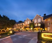
Lafayette Park Hotel and Spa
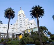
Claremont Club and Spa A Fairmont Hotel
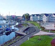
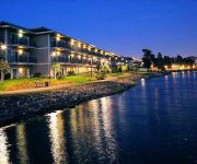
Homewood Suites by Hilton - Oakland Waterfront
Graduate Berkeley
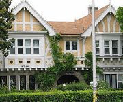
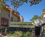
Rose Garden Inn
Rose Garden Inn
BEST WESTERN PLUS BAYSIDE HTL
EXECUTIVE INN AND SUITES EMBARCADERO
Civic Center Lodge
Easton Hall
Videos from this area
These are videos related to the place based on their proximity to this place.
All About Lamorinda
'About Lamorinda' Lamorinda is located in the central part of Contra Costa County. The central part of the county is a valley traversed by Interstate 680 and Highway 24. The towns east of...
Redwood Regional Park from Graham Trail 1
This is a short video I recorded during my recent 8.8 mile hike at Redwood Regional Park in the Oakland, CA hills. It was a beautiful day in the neighborhood.
Redwood Creek, Redwood Regional Park, Oakland
Just a brief shot of Redwood Creek trinkling through Redwood Regional Park in the Oakland Hills.
Orinda Chiropractic & Laser Center - Short | Orinda, CA
http://www.OrindaChiropractic.com - Call us today at (925) 254-4040. At Orinda Chiropractic Center, we specialize in treating ankles, feet, and shoulders through Chiropractic. In addition our...
Residential Electrician - Electrical Contractors In Orinda CA 94563 - Call 925-401-7130
http://gotwattselectric.com/ Call Now for Free Estimate 925-401-7130 Got Watts Electric are the premier residential electrician in Orinda CA. GWE is a locally owned company that focuses on...
Orinda Dentist - Virginia H. Ellis DDS
Dr. Virginia H. Ellis DDS, is a dentist in Orinda CA who serves patients in Orinda, Moraga, Lafayette, Alamo, Rossmoor, Walnut Creek, Berkley, Albany, Oakland Hills, Piedmont, Claremont, Montclair....
Car Title Loans Orinda ☎ (510) 281 5970
http://eastbaycartitleloans.com/ Car Title Loans in Orinda made easy & quick as 123! Call Car Title Loans Orinda Now at (510) 281 5970 and get a loan with gr...
Mara Construction Orinda, CA
Mara Construction Orinda, CA http://local.sfgate.com/b17924295/Mara+Construction?type= dependable contractors,general contractor, home additions, kitchen rem...
Videos provided by Youtube are under the copyright of their owners.
Attractions and noteworthy things
Distances are based on the centre of the city/town and sightseeing location. This list contains brief abstracts about monuments, holiday activities, national parcs, museums, organisations and more from the area as well as interesting facts about the region itself. Where available, you'll find the corresponding homepage. Otherwise the related wikipedia article.
Canyon, California
Canyon (formerly, Sequoya) is an unincorporated community in Contra Costa County, California situated between Oakland and Moraga in the San Francisco Bay Area. The community is named for its location in the upper canyon of San Leandro Creek along the eastern slope of the Berkeley Hills. It lies at an elevation of 1142 feet (348 m). The community is mainly traversed by Pinehurst Road and Canyon Road.
Montclair, Oakland, California
Montclair (also known as the Montclair District or Montclair Village) is an affluent hillside/canyon neighborhood of Oakland, California. Montclair is located in the Oakland Hills east of Piedmont in a canyon formed by the Hayward Fault. Although there is no formal definition of the neighborhood, the general boundaries are Highway 24 to the north, the city of Piedmont border to the west of Highway 13, Skyline Boulevard to the east, and Joaquin Miller Road to the south.
Chabot Space and Science Center
Chabot Space and Science Center, located in Oakland, California, is a hands-on center featuring interactive exhibits, a digital planetarium, a large screen theater, hands-on activities and three powerful telescopes. The Center is the continuation and expansion of a public observatory that has served San Francisco Bay Area schools and citizens with astronomy and science education programs since 1883.
Piedmont Pines, Oakland, California
Piedmont Pines is a residential district in Oakland, California. It is generally bounded by Highway 13 (the Warren Freeway) to the west, Shepherd Canyon Rd. to the north, Skyline Dr. to the east, and Joaquin Miller Park to the south. Two Oakland public schools are included in the area, Montera Middle School and Joaquin Miller Elementary School. There is no business section in Piedmont Pines.
Huckleberry Botanic Regional Preserve
Huckleberry Botanic Regional Preserve is a 241 acres regional park and nature reserve in the eastern San Francisco Bay Area, in Alameda and Contra Costa Counties, Northern California. It is a park within the East Bay Regional Parks District system. The Preserve is named after the California Huckleberry (Vaccinium ovatum) which grows abundantly within its habitat.
Roberts Regional Recreation Area
Roberts Regional Recreation Area is a regional park located in Oakland, CA that is part of the East Bay Regional Parks system.
Oakland Hills, Oakland, California
Oakland Hills is an informal term used to indicate the city neighborhoods lying within the eastern portion of Oakland, California.
Glorietta, Orinda, California
Glorietta is a former unincorporated community now annexed to Orinda in Contra Costa County, California. It lies at an elevation of 597 feet (182 m).


