Safety Score: 2,7 of 5.0 based on data from 9 authorites. Meaning we advice caution when travelling to United States.
Travel warnings are updated daily. Source: Travel Warning United States. Last Update: 2024-08-13 08:21:03
Discover Claremont
The district Claremont of in Contra Costa County (California) is a district in United States about 2,422 mi west of Washington DC, the country's capital city.
Looking for a place to stay? we compiled a list of available hotels close to the map centre further down the page.
When in this area, you might want to pay a visit to some of the following locations: Oakland, Martinez, San Francisco, San Rafael and Fairfield. To further explore this place, just scroll down and browse the available info.
Local weather forecast
Todays Local Weather Conditions & Forecast: 12°C / 54 °F
| Morning Temperature | 9°C / 49 °F |
| Evening Temperature | 12°C / 53 °F |
| Night Temperature | 9°C / 48 °F |
| Chance of rainfall | 0% |
| Air Humidity | 42% |
| Air Pressure | 1022 hPa |
| Wind Speed | Moderate breeze with 11 km/h (7 mph) from East |
| Cloud Conditions | Clear sky, covering 8% of sky |
| General Conditions | Sky is clear |
Tuesday, 19th of November 2024
11°C (53 °F)
11°C (52 °F)
Overcast clouds, gentle breeze.
Wednesday, 20th of November 2024
13°C (56 °F)
13°C (55 °F)
Light rain, fresh breeze, overcast clouds.
Thursday, 21st of November 2024
12°C (54 °F)
13°C (56 °F)
Overcast clouds, gentle breeze.
Hotels and Places to Stay
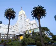
Claremont Club and Spa A Fairmont Hotel
Holiday Inn Express & Suites BERKELEY
Rose Garden Inn
Rose Garden Inn
HOTEL SHATTUCK PLAZA
TRAVELODGE BERKELEY
Graduate Berkeley
Piedmont Place
Bayview Motel
Bay Bridge Inn
Videos from this area
These are videos related to the place based on their proximity to this place.
Orinda Chiropractic & Laser Center - Short | Orinda, CA
http://www.OrindaChiropractic.com - Call us today at (925) 254-4040. At Orinda Chiropractic Center, we specialize in treating ankles, feet, and shoulders through Chiropractic. In addition our...
Orinda Chiropractic Center - Short | Orinda, CA
http://orindachiropractic.com/ - Call us today at (925) 254-4040. At Orinda Chiropractic Center, we specialize in treating ankles, feet, and shoulders through Chiropractic. In addition our...
Residential Electrician - Electrical Contractors In Orinda CA 94563 - Call 925-401-7130
http://gotwattselectric.com/ Call Now for Free Estimate 925-401-7130 Got Watts Electric are the premier residential electrician in Orinda CA. GWE is a locally owned company that focuses on...
Welcome to Orinda Chiropractic Center - Orinda, CA
http://orindachiropractic.com/ - Call us today at (925) 254-4040. At Orinda Chiropractic Center, we are committed to providing the best quality patient care available. We specialize in treating...
Orinda Dentist - Virginia H. Ellis DDS
Dr. Virginia H. Ellis DDS, is a dentist in Orinda CA who serves patients in Orinda, Moraga, Lafayette, Alamo, Rossmoor, Walnut Creek, Berkley, Albany, Oakland Hills, Piedmont, Claremont, Montclair....
Contra Costa Certified Farmers' Market: Orinda
www.cccfm.org Open every Saturday from 9am until 1pm in Orinda, CA on Orinda Way near Orinda Village - Season is from May 2 through November 21. Celebrating 27 years in Contra Costa County!
109 Bear Ridge Trail Orinda, California 94563
4 Bedrooms, 2.5 Bathrooms 109 Bear Ridge Trail Orinda, California 94563 Offered at 1895000 Presented By: Laina Wood Casillas, CPRES 855.334.HOME (4663) laina@apr.com www.
Bart Train Fire at Orinda Station 10/23/2013 Full Coverage
Smoke appears beneath Bart car 372. Passengers were first evacuated off the train at the Orinda station after being informed that one of the cars was smoking. Once evacuated on the platform,...
Browse the Treasures at Hilton House in Orinda, CA.
A walk through the Hilton House Design/Consign & Estate Liquidations, Inc. two showrooms located at 21 Orinda Way, Orinda, CA 94563. Phone 925-254-1113. Visit our website at http://www.
Car Title Loans Orinda ☎ (510) 281 5970
http://eastbaycartitleloans.com/ Car Title Loans in Orinda made easy & quick as 123! Call Car Title Loans Orinda Now at (510) 281 5970 and get a loan with gr...
Videos provided by Youtube are under the copyright of their owners.
Attractions and noteworthy things
Distances are based on the centre of the city/town and sightseeing location. This list contains brief abstracts about monuments, holiday activities, national parcs, museums, organisations and more from the area as well as interesting facts about the region itself. Where available, you'll find the corresponding homepage. Otherwise the related wikipedia article.
Oakland firestorm of 1991
The Oakland firestorm of 1991 was a large urban conflagration that occurred on the hillsides of northern Oakland, California, and southeastern Berkeley on Sunday October 20, 1991. The fire has also been called the Oakland hills firestorm, the East Bay Hills Fire, and the Tunnel Fire (because of its origin above the west portal of the Caldecott Tunnel) in Oakland. The fire ultimately killed 25 people and injured 150 others.
Tilden Regional Park
Tilden Regional Park, also known as "Tilden", is a 2,079-acre regional park in the East Bay, part of the San Francisco Bay Area in California. It is situated between the Berkeley Hills and San Pablo Ridge. Tilden Regional Park was named in honor of Charles Lee Tilden, a Bay Area attorney and businessman who purchased much of the land in order to preserve remaining wilderness areas for public enjoyment. Tilden also served on the first Board of Directors of the East Bay Regional Park District.
Mathematical Sciences Research Institute
The Mathematical Sciences Research Institute (MSRI), founded in 1982, is an independent nonprofit mathematical research institution whose funding sources include the National Science Foundation, foundations, corporations, and more than 90 universities and institutions. The Institute is located on the University of California, Berkeley campus, close to Grizzly Peak, on the hills overlooking Berkeley. MSRI was founded in 1982 by Shiing-Shen Chern, Calvin Moore, and Isadore M. Singer.
KPFA
KPFA is a listener-funded progressive talk radio and music radio station located in Berkeley, California, broadcasting to the San Francisco Bay Area. KPFA airs public news, public affairs, talk, and music programming. The station signed on-the-air April 15, 1949, as the first Pacifica station. The aims of the station are to promote cultural diversity, promote pluralistic cultural expression, contribute to a lasting understanding between individuals of all nations, races, creeds and colours.
Claremont Canyon Regional Preserve
Claremont Canyon Regional Preserve is a small regional park mainly located in the city of Oakland, California, and administered by the East Bay Regional Park District. The park is named for the canyon in which it's situated, Claremont Canyon, out of which Claremont Creek flows on its way to its confluence with Temescal Creek. Originally, the canyon was named "Harwood's Canyon", then "Telegraph Canyon". The name was changed to Claremont by a developer of the nearby Claremont district.
Lawrence Hall of Science
The Lawrence Hall of Science is a public science center that offers hands-on science exhibits, designs curriculum, aids professional development, and offers after school science resources to students of all ages. The Hall was established in 1968 in honor of Ernest Orlando Lawrence, the University of California's first Nobel laureate. The Hall is located in the hills above the University of California, Berkeley campus.
Caldecott Tunnel
The Caldecott Tunnel is a three-bore highway tunnel through the Berkeley Hills between Oakland, California and Orinda, California.
Caldecott Tunnel fire
The Caldecott Tunnel fire killed seven people in the north tube of the Caldecott Tunnel, on State Route 24 between Oakland and Orinda in the US state of California just after midnight on 7 April 1982. It is one of the few major tunnel fires involving a cargo normally considered to be highly flammable, namely gasoline. At the time of the accident, the Caldecott tunnel complex consisted of three tubes (or "bores") side-by-side, each 0.7 mi long .
Regional Parks Botanic Garden
The Regional Parks Botanic Garden is a 10 acre (4 hectare) botanical garden located in Tilden Regional Park in the Berkeley Hills, east of Berkeley, California, in the United States. It showcases California native plants, and is open to the public in daylight hours every day of the year except New Year's Day, Thanksgiving, and Christmas. The Garden was founded on January 1, 1940.
University of California Botanical Garden
The University of California Botanical Garden is a 34 acre (13.7 ha) botanical garden located on the University of California, Berkeley campus, in Strawberry Canyon. The Garden is in the Berkeley Hills, with views overlooking the San Francisco Bay. It is one of the most diverse plant collections in the United States, and famous for its large number of rare and endangered species.
KALX
KALX is an FM radio station that broadcasts from the University of California, Berkeley in Berkeley, California. KALX, a community- and student-run radio station licensed to the University of California, Berkeley, broadcasts in stereo with 500 watts of power. The station employs three full-time paid staff members, but is largely run by its nearly 300 volunteers, including Berkeley students and other members of the local community.
Orinda (BART station)
Orinda is a Bay Area Rapid Transit station in Orinda, California. The station has an island platform in the center median of State Route 24. The station is east of the Caldecott Tunnel. Service at this station began on May 21, 1973, following the completion of the Berkeley Hills Tunnel, which connects it to Rockridge Station. This station is in BART District 1 and is represented by Gail Murray who is also current BART President.
Space Sciences Laboratory
The Space Sciences Laboratory (SSL) is an Organized Research Unit of the University of California, Berkeley. It is located in the Berkeley Hills above the university campus. It has developed and continues to develop many projects in the space sciences.
Redwood Valley Railway
The Redwood Valley Railway is a ridable miniature railroad in Tilden Regional Park near Berkeley, California. It was established in 1952 by Erich Thomsen, and has expanded to 1.25 miles of track and over 160,000 passengers a year. The railroad uses 5" scale model live steam locomotives on a 15 narrow gauge track. Rides last approximately 12 minutes. As of September 2011, tickets for adults and children are $3 (children under 2 years old ride free). A five-ride ticket costs $12.
Claremont Resort
The Claremont Hotel Club & Spa is a historic hotel at the foot of Claremont Canyon in the Oakland Hills. The location provides scenic views of San Francisco Bay. The hotel building is entirely in Oakland, adjacent to the Berkeley border. The Claremont has 279 guest rooms, a 20,000-square-foot spa, 10 tennis courts, and 22 acres of landscaped gardens. Romantic stories tell that it was once won in a checkers game.
Lake Temescal
Lake Temescal is a small reservoir in the northeastern hills section of Oakland, California. It is the centerpiece of Temescal Regional Park (originally, Lake Temescal Regional Park). It is part of the greater East Bay Regional Park District.
Temescal Regional Park
Temescal Regional Park, formerly Lake Temescal Regional Park, is an East Bay Regional Park District (EBRPD) regional park in Oakland, California. The park has Lake Temescal as its main attraction in addition to trails, picnic sites, forest, and wildlife.
Bentley School
Bentley School is a private co-educational college preparatory day school. The Bentley school's lower and middle school campus (K-8) is located in the Oakland Hills and the high school (9-12) campus is located in Lafayette, California. History and Governance Bentley School was established in Berkeley in 1920. In 1969 the School was incorporated as a non-profit corporation. The School moved to the existing campus in Oakland in the fall of 1970, and purchased the campus in Lafayette in 1997.
Briones Reservoir
Briones Reservoir is an open cut terminal water storage reservoir owned and operated by the East Bay Municipal Utility District (EBMUD). It is located in the hills northeast of Orinda, California. It is formed by Briones Dam, an earthen dam completed in 1964. The reservoir is the largest of EBMUD’s five East Bay terminal reservoirs with a total capacity of 60,510 acre·ft, and it has a total watershed of 8.59 square miles (22 km²).
Lake El Toyonal
Lake El Toyonal is a small lake in Contra Costa County, California in an unincorporated area of parklands between Orinda and Berkeley.
Briones Valley
The Briones Valley is a major geological feature of Contra Costa County, California and runs between Mount Diablo and the county seat of Martinez. Also it is the seat of many riparian watersheds, especially of Alhambra Creek. {{#invoke:Coordinates|coord}}{{#coordinates:37|54|50|N|122|12|30|W|type:landmark_region:US-CA_source:GNIS |primary |name= }}
Holden High School (California)
Holden High School is a private, non-profit school. Founded in 1969, it is accredited by the Western Association of Schools and Colleges and its diplomas are recognized by the State of California. The students are from all over the Bay Area, and reported to reflect the Bay Area's diversity.
Glorietta, Orinda, California
Glorietta is a former unincorporated community now annexed to Orinda in Contra Costa County, California. It lies at an elevation of 597 feet (182 m).
Rancho El Sobrante
Rancho El Sobrante was a 20,565-acre Mexican land grant in present day Contra Costa County, California given in 1841 by Governor Juan Alvarado to Juan Jose Castro and Victor Castro. The name means "left over " in Spanish—the grant's boundaries were determined by the boundaries of the surrounding grants: San Antonio, San Pablo, El Pinole, La Boca de la Cañada del Pinole, Acalanes, and La Laguna de los Palos Colorados. This grant included the area between present day El Sobrante and Orinda.
Levine-Fricke Field
Levine-Fricke Field is a college softball stadium in Berkeley, California, on the campus of the University of California. Opened in 1995, it is the home field of the California Golden Bears of the Pac-12, with a seating capacity of 1,204. Levine-Fricke Field is located in the Strawberry Canyon just east of California Memorial Stadium and Witter Rugby Field.


