Safety Score: 2,7 of 5.0 based on data from 9 authorites. Meaning we advice caution when travelling to United States.
Travel warnings are updated daily. Source: Travel Warning United States. Last Update: 2024-08-13 08:21:03
Delve into Red Apple
Red Apple in Calaveras County (California) is located in United States about 2,321 mi (or 3,735 km) west of Washington DC, the country's capital town.
Current time in Red Apple is now 11:00 AM (Monday). The local timezone is named America / Los Angeles with an UTC offset of -8 hours. We know of 11 airports close to Red Apple, of which 5 are larger airports. The closest airport in United States is Oakdale Airport in a distance of 37 mi (or 60 km), South-West. Besides the airports, there are other travel options available (check left side).
Also, if you like playing golf, there are some options within driving distance. If you need a hotel, we compiled a list of available hotels close to the map centre further down the page.
While being here, you might want to pay a visit to some of the following locations: Sonora, San Andreas, Jackson, Placerville and Mariposa. To further explore this place, just scroll down and browse the available info.
Local weather forecast
Todays Local Weather Conditions & Forecast: 4°C / 40 °F
| Morning Temperature | 2°C / 36 °F |
| Evening Temperature | 6°C / 43 °F |
| Night Temperature | 6°C / 43 °F |
| Chance of rainfall | 10% |
| Air Humidity | 95% |
| Air Pressure | 1021 hPa |
| Wind Speed | Gentle Breeze with 7 km/h (4 mph) from West |
| Cloud Conditions | Overcast clouds, covering 100% of sky |
| General Conditions | Rain and snow |
Monday, 25th of November 2024
7°C (44 °F)
4°C (40 °F)
Moderate rain, light breeze, overcast clouds.
Tuesday, 26th of November 2024
11°C (51 °F)
2°C (35 °F)
Few clouds, gentle breeze.
Wednesday, 27th of November 2024
11°C (52 °F)
3°C (37 °F)
Few clouds, gentle breeze.
Hotels and Places to Stay
DUNBAR HOUSE 1880
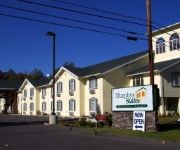
Murphys Suites
Murphys Inn Motel
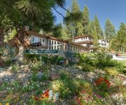
ARNOLD TIMBERLINE LODGE
MOUNTAIN RETREAT RESORT-ARNOLD
Videos from this area
These are videos related to the place based on their proximity to this place.
Angels Camp, CA Trip with family Video Part 4
In this 4th video, shows our first morning, and the drive to Calavaras Big Trees State Park.
Northern Flicker, Woodpecker
Photographed at my neighbor's house in Arnold, California. This Flicker followed her home from a walk, then stayed on the deck to be hand fed and handled. Very unusual. We cannot figure if...
Prototype II - #6 - THE DAY OF THE TENTACLE !
Give one Weazel super human powers, helpless soldiers and zombies or people to destroy, grab some popcorn and enjoy the ride! Weazel SMASH ! Facebook: http://www.facebook.com/LGG.Weazel ...
Candy Rock Swimming Hole
Me and My friend Kate enjoying the outdoors! making these little adventure videos are fun. Many many more to come.
Murphys Irish Day 2015
Each year on the third Saturday in March, Murphys CA shuts down Main Street and prepares to celebrate like only the Irish can.
Videos provided by Youtube are under the copyright of their owners.
Attractions and noteworthy things
Distances are based on the centre of the city/town and sightseeing location. This list contains brief abstracts about monuments, holiday activities, national parcs, museums, organisations and more from the area as well as interesting facts about the region itself. Where available, you'll find the corresponding homepage. Otherwise the related wikipedia article.
Hanford Hill, California
Hanford Hill (formerly, Hanford Hill Acres) is an unincorporated community in Calaveras County, California. It lies at an elevation of 3284 feet (1001 m).
Hathaway Pines, California
Hathaway Pines is an unincorporated community in Calaveras County, California, 8 km (5 mi) south of Arnold and 20 km (12.5 mi) northeast of Angels Camp. It lies at an elevation of 3323 feet (1013 m). Hathaway Pines' post office was established in 1943; it has the zip code 95233. The place's name honors Robert B. Hathaway, a vacation resort promoter who became the first postmaster.
Hathaways Mountain Pines, California
Hathaways Mountain Pines (formerly, Hathaway's Mountain Pines) is an unincorporated community in Calaveras County, California. It lies at an elevation of 3448 feet (1051 m).
Indian Hills, California
Indian Hills is an unincorporated community in Calaveras County, California. It lies at an elevation of 3153 feet (961 m).
Ponderosa Park, California
Ponderosa Park is an unincorporated community in Calaveras County, California. It lies at an elevation of 3379 feet (1030 m).
Red Apple, California
Red Apple is an unincorporated community in Calaveras County, California. It lies at an elevation of 3235 feet (986 m).
Sunset Point, California
Sunset Point is an unincorporated community in Calaveras County, California. It lies at an elevation of 3419 feet (1042 m).
Timber Trails, California
Timber Trails is an unincorporated community in Calaveras County, California. It lies at an elevation of 3615 feet (1102 m).


