Safety Score: 2,7 of 5.0 based on data from 9 authorites. Meaning we advice caution when travelling to United States.
Travel warnings are updated daily. Source: Travel Warning United States. Last Update: 2024-08-13 08:21:03
Touring Oroville Junction
Oroville Junction in Butte County (California) is a town located in United States about 2,364 mi (or 3,805 km) west of Washington DC, the country's capital place.
Time in Oroville Junction is now 04:32 AM (Monday). The local timezone is named America / Los Angeles with an UTC offset of -8 hours. We know of 11 airports nearby Oroville Junction, of which 5 are larger airports. The closest airport in United States is Gansner Field in a distance of 48 mi (or 77 km), North-East. Besides the airports, there are other travel options available (check left side).
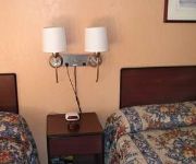
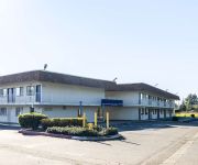
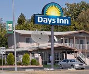
Also, if you like the game of golf, there are several options within driving distance. We collected 1 points of interest near this location. Need some hints on where to stay? We compiled a list of available hotels close to the map centre further down the page.
Being here already, you might want to pay a visit to some of the following locations: Oroville, Marysville, Yuba City, Colusa and Willows. To further explore this place, just scroll down and browse the available info.
Local weather forecast
Todays Local Weather Conditions & Forecast: 12°C / 53 °F
| Morning Temperature | 5°C / 40 °F |
| Evening Temperature | 8°C / 47 °F |
| Night Temperature | 5°C / 41 °F |
| Chance of rainfall | 0% |
| Air Humidity | 48% |
| Air Pressure | 1021 hPa |
| Wind Speed | Gentle Breeze with 6 km/h (4 mph) from South-West |
| Cloud Conditions | Clear sky, covering 0% of sky |
| General Conditions | Light rain |
Monday, 18th of November 2024
11°C (52 °F)
11°C (51 °F)
Broken clouds, moderate breeze.
Tuesday, 19th of November 2024
11°C (52 °F)
9°C (48 °F)
Moderate rain, moderate breeze, overcast clouds.
Wednesday, 20th of November 2024
9°C (48 °F)
11°C (52 °F)
Moderate rain, gentle breeze, overcast clouds.
Hotels and Places to Stay
SUNSET INN
Holiday Inn Express & Suites OROVILLE LAKE
VILLA COURT INN OROVILLE
MOTEL 6 OROVILLE
SUPER 8 CENTRAL
DAYS INN OROVILLE - 4956
AMERICAS BEST VALUE INN
Videos from this area
These are videos related to the place based on their proximity to this place.
2014 Lake Oroville Bass Fishing On Memorial Weekend
LIKE & SUBSCRIBE FOR MORE VIDEOS!! For business inquiries Email me at [JamesJacksonVids@yahoo.com] A chill day bass fishing on lake oroville with the fam, this was my 2nd day back from LA.
Oroville Skatepark BMX & Skate Montage
This video took 3 days to shoot, I Filmed Harley Stenholm/Chaz Paul & they filmed all my skate clips. A couple weeks after i put this video out i broke my foot at the park, ever since then i haven't g.
South Oroville Railroad - Update 2
South Oroville Railroad is a HO scale layout. I had the building built just for the Railroad. It is 25' x 40'. The Railroad is designed for operations in mind. The track will be code 83 on...
Oro Dam Auto Center Oroville, CA Auto Dealership
Welcome to Oro Dam Auto Center serving Oroville, CA Welcome to the Youtube Video of Oro Dam Auto Center, your local Chevrolet, Toyota, Buick, Dodge, Ford, GMC, Hyundai, Jeep, Kia, and ...
Mortgage , Oroville CA : Opportunities with Elite Realty Services
http://ersbdr.com/ Robert Do, President ~ Elite Realty Services talks about opportunities in Real Estate Mortgage!
Annular Solar Eclipse 2012 -- Oroville, California
Annular solar eclipse, also know as a "ring of fire eclipse" slide show that took place May 20, 2012. Photographed through a Meade ETX-90 spotting scope and Seymour Solar Telescope Filter...
Youth Football | River Valley vs. Oroville (Coach Game Film Sample)
Northern California Federation of Youth Football River Valley Falcons vs. Oroville Rhinos October 1, 2011 | Harrison Stadium, Oroville, Ca Division: MIDGET.
Oroville - The Hike to Feather Falls - Glidecam HD 2000
Nature video filmed in Oroville, CA and Feather Falls, one of the tallest waterfalls in North America This video was shot with the Nikon D5100 with an 18-105 mm lens f 3.5 All the smooth...
Salmon Spawing at Oroville Dam
Video of Salmon going up Fish Ladder to Oroville Fish Hatchery at the Oroville Dam in Oroville, California. Sorry for the shaky video! Recorded on HTC MyTouch 4G.
Videos provided by Youtube are under the copyright of their owners.
Attractions and noteworthy things
Distances are based on the centre of the city/town and sightseeing location. This list contains brief abstracts about monuments, holiday activities, national parcs, museums, organisations and more from the area as well as interesting facts about the region itself. Where available, you'll find the corresponding homepage. Otherwise the related wikipedia article.
Oroville Municipal Airport
Oroville Municipal Airport is a public airport located 3 miles (5 km) southwest of the city of Oroville in Butte County, California, USA.
Lorraine, California
Lorraine is a former settlement in Butte County, California. , it is now inundated by the Thermalito Afterbay reservoir. It lay at an elevation of 138 feet (42 m). Lorraine still appeared on maps as of 1952. It was located 5 miles north-northeast of Biggs on the Sacramento Northern Railroad.
Oroville Junction, California
Oroville Junction (formerly, Tres Vias) is an unincorporated community in Butte County, California. It is located 5 miles west of Oroville on the abandoned right of way of the Sacramento Northern Railroad, at an elevation of 164 feet (50 m).
Shippee, California
Shippee (formerly, Shippee Road) is an unincorporated community in Butte County, California. It lies at an elevation of 131 feet (40 m). It is 7.5 miles west-northwest of Oroville on the Sacramento Northern Railroad and the Northern Electric Railroad.
Sugarloaf Mountain (Butte County, California)
Sugarloaf is the name of two summits in Butte County, California, United States: Sugarloaf Peak rises to about 550 feet above mean sea level at {{#invoke:Coordinates|coord}}{{#coordinates:39|31|50|N|121|36|59|W|type:mountain_region:US-CA_source:GNIS | |name= }} near Oroville, California.


