Safety Score: 2,7 of 5.0 based on data from 9 authorites. Meaning we advice caution when travelling to United States.
Travel warnings are updated daily. Source: Travel Warning United States. Last Update: 2024-08-13 08:21:03
Discover Allen
Allen in Amador County (California) is a city in United States about 2,299 mi (or 3,699 km) west of Washington DC, the country's capital city.
Local time in Allen is now 11:38 AM (Tuesday). The local timezone is named America / Los Angeles with an UTC offset of -8 hours. We know of 11 airports in the vicinity of Allen, of which 5 are larger airports. The closest airport in United States is Lake Tahoe Airport in a distance of 20 mi (or 32 km), North. Besides the airports, there are other travel options available (check left side).
There is one Unesco world heritage site nearby. It's Yosemite National Park in a distance of 111 mi (or 178 km), South-East. Also, if you like golfing, there are a few options in driving distance. We discovered 6 points of interest in the vicinity of this place. Looking for a place to stay? we compiled a list of available hotels close to the map centre further down the page.
When in this area, you might want to pay a visit to some of the following locations: Minden, Carson City, Sonora, Placerville and San Andreas. To further explore this place, just scroll down and browse the available info.
Local weather forecast
Todays Local Weather Conditions & Forecast: 11°C / 51 °F
| Morning Temperature | 3°C / 37 °F |
| Evening Temperature | 6°C / 42 °F |
| Night Temperature | 0°C / 33 °F |
| Chance of rainfall | 0% |
| Air Humidity | 29% |
| Air Pressure | 1017 hPa |
| Wind Speed | Gentle Breeze with 7 km/h (4 mph) from West |
| Cloud Conditions | Scattered clouds, covering 30% of sky |
| General Conditions | Scattered clouds |
Tuesday, 5th of November 2024
2°C (36 °F)
-2°C (28 °F)
Sky is clear, moderate breeze, clear sky.
Wednesday, 6th of November 2024
10°C (50 °F)
4°C (40 °F)
Sky is clear, light breeze, clear sky.
Thursday, 7th of November 2024
13°C (56 °F)
6°C (43 °F)
Sky is clear, light breeze, clear sky.
Hotels and Places to Stay
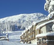
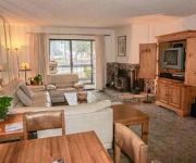
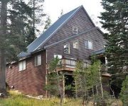
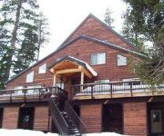
Kirkwood Resort
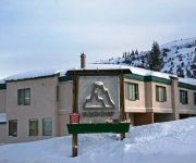
Base Camp 19 by RedAwning
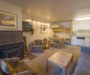
Base Camp 20 by RedAwning
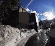
Base Camp 45 by RedAwning
Base Camp 39 by RedAwning
West Meadows Flying Wedge Duplex South by RedAwning
West Meadows Flying Wedge Duplex North by RedAwning
Videos from this area
These are videos related to the place based on their proximity to this place.
Tragedy Springs Snow Camping
Troop 260's snow camping and dog sledding outing on Highway 88 near Silver Lake, California. 2005.
Skulls and Crossbones Kirkwood Ski Resort The Wall... They put those signs there for a reason!!!
A day at Kirkwood, living on the edge! "The Wall" is about half ay through the video and was a good 65-70 degree drop off... Hearts were racing and adrenaline was flowing!
My Mountain: Kirkwood
Former ski racer Jim Reilly knows exactly when the snow is coming at Kirkwood Mountain, just south of Lake Tahoe. The Monterey, California resident can watch a storm blow in over his house...
Snowboard - Kirkwood - 01/17/2015
Tahoe is melting and loosing snow... -- Oooh YEAH!!! ... AH NOO!!! -- Dude! ... I'm gonna push you...
Rahlves Banzai kirkwood 2011
Banzai tour kirkwood stop feb 5 2011 Qualifying round horrible time of 1:23:36 Gnarliest race ever, started at top of the wall and continued down eagle bowl. next stop will be at Sugar...
Kirkwood Cat Skiing at Martin Point 2013
Cat Skiing at Kirkwood in Tahoe - This is at Martin Point on March 9, 2013 immediately following a huge storm! Lots of powder!
back rodeo gone wrong at kirkwood snowboarding
christian hunsberger gets bucked off the lip with a premature spin off his heels, for some reason he's always more excited when he crashes and we are able to get it on film. film: @theprofessor...
Kirkwood Zip Line: Winter Snow Zip with Zip Tahoe
Our family trip to Kirkwood's winter zip line canopy tour. Shows all six zip lines and suspension bridges starting at the top of the Timber Creek chairlift.
Really fast run on Cold Shoulder - Kirkwood 12/29
Emerson, Adrian, Eddie, and I flash down "Cold Shoulder", a steep groomed Black Diamond at Kirkwood.
Videos provided by Youtube are under the copyright of their owners.
Attractions and noteworthy things
Distances are based on the centre of the city/town and sightseeing location. This list contains brief abstracts about monuments, holiday activities, national parcs, museums, organisations and more from the area as well as interesting facts about the region itself. Where available, you'll find the corresponding homepage. Otherwise the related wikipedia article.
Allen, California
Allen is an unincorporated community in Amador County, California. It is located on the Bear River, at an elevation of 8,113 feet (2,473 m).
Tragedy Spring, California
Tragedy Spring is a former settlement in Amador County, California. It was named after an incident on June 27, 1848, in which three Mormon men (Daniel Browett, Ezrah H. Allen, and Henderson Cox) were killed by Native Americans and their bodies burned. The names of the men are carved on a large tree by a spring in this location. It lies at an elevation of 7907 feet (2410 m). It was still on maps as of 1956.


