Safety Score: 2,7 of 5.0 based on data from 9 authorites. Meaning we advice caution when travelling to United States.
Travel warnings are updated daily. Source: Travel Warning United States. Last Update: 2024-08-13 08:21:03
Discover Sharfter
The district Sharfter of in Alameda County (California) is a district in United States about 2,425 mi west of Washington DC, the country's capital city.
Looking for a place to stay? we compiled a list of available hotels close to the map centre further down the page.
When in this area, you might want to pay a visit to some of the following locations: Oakland, San Francisco, Martinez, San Rafael and Redwood City. To further explore this place, just scroll down and browse the available info.
Local weather forecast
Todays Local Weather Conditions & Forecast: 16°C / 61 °F
| Morning Temperature | 15°C / 58 °F |
| Evening Temperature | 16°C / 61 °F |
| Night Temperature | 15°C / 58 °F |
| Chance of rainfall | 6% |
| Air Humidity | 75% |
| Air Pressure | 1019 hPa |
| Wind Speed | Fresh Breeze with 17 km/h (11 mph) from North |
| Cloud Conditions | Overcast clouds, covering 100% of sky |
| General Conditions | Moderate rain |
Friday, 22nd of November 2024
15°C (59 °F)
14°C (57 °F)
Heavy intensity rain, moderate breeze, overcast clouds.
Saturday, 23rd of November 2024
14°C (57 °F)
11°C (52 °F)
Moderate rain, gentle breeze, clear sky.
Sunday, 24th of November 2024
10°C (50 °F)
10°C (50 °F)
Moderate rain, gentle breeze, overcast clouds.
Hotels and Places to Stay
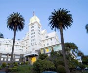
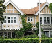
Claremont Club and Spa A Fairmont Hotel
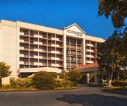
Four Points by Sheraton San Francisco Bay Bridge
Courtyard Oakland Emeryville
TRAVELODGE BERKELEY
HOTEL SHATTUCK PLAZA
Graduate Berkeley
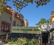
Rose Garden Inn
Rose Garden Inn
Travel Inn
Easton Hall
Videos from this area
These are videos related to the place based on their proximity to this place.
Best Pet Care Options from Holistic Veterinary Care Oakland California
Best Pet Care Options from Holistic Veterinary Care Oakland California http://www.HolisticVetCare.com 4382 Piedmont Ave Oakland CA 510-339-2600.
Youtube Video Workshop at Oakland City Hall
Want to learn how to use Youtube for Business? Watch this video and then attend the free workshop at Oakland City Hall on 11/21/13. This workshop is titled Building an Online Presence Seminar...
Piedmont Avenue Consulting Marketing Strategies with David Mitroff, Ph.D.
It's as simple as Puppy Dogs and Ice Cream! David Mitroff reviews Marketing Strategies including Traditional Marketing / Selling versus Engagement Marketing / Selling. Today we can use Social...
Event Marketing - David Mitroff from Piedmont Avenue Consulting
Please don't come to my event :-) How to use Event Marketing for Search Engine Optimization (SEO) and to drive traffic to your website. Leveraging events for Passive Marketing and Active Marketing...
Oakland-Piedmont to San Jose commute
This is the morning commute from Oakland-Piedmont to Silicon Valley. Except the opening and closing seconds, I evenly time-lapsed the footage at 32x speed, to better indicate the congestion...
FBC at CSO Holiday Showcase
Funk Beyond Control (FBC) performing at Culture Shock Oakland Holiday Hip-Hop Showcase at Oakland Technical High School on December 7, 2013.
FBC Adults The Adults at CSO Holiday Showcase
Funk Beyond Control (FBC) Adults performing "The Adults" at Culture Shock Oakland Holiday Hip-Hop Showcase at Oakland Technical High School on December 7, 2013.
429 Jerome Ave. Piedmont, C.A. 94610
http://429jerome.com/ Square Footage Mostly Level Lot 5994+/- Living Space: 1429+/- Features 2+ Bedrooms & 1+ Bathrooms Hardwood & Tile Floors Kitchen w/Br...
Videos provided by Youtube are under the copyright of their owners.
Attractions and noteworthy things
Distances are based on the centre of the city/town and sightseeing location. This list contains brief abstracts about monuments, holiday activities, national parcs, museums, organisations and more from the area as well as interesting facts about the region itself. Where available, you'll find the corresponding homepage. Otherwise the related wikipedia article.
California College of the Arts
California College of the Arts (formerly California College of Arts and Crafts), founded in 1907, is known for its broad, interdisciplinary programs in art, design, architecture, and writing. It has two campuses, one in Oakland and one in San Francisco, California, USA.
Piedmont Avenue (Oakland, California)
The Piedmont Avenue neighborhood is a district in North Oakland, California. It is named for Piedmont Avenue, the main commercial street of the district. The neighborhood is bounded by Broadway on the west, Oakland Avenue and City of Piedmont (a separate municipality, an enclave within Oakland) on the East, the Mountain View Cemetery on the north, and the MacArthur Freeway (Interstate 580) on the south.
Rockridge (BART station)
Rockridge is a Bay Area Rapid Transit station located in the Rockridge District of Oakland, California. The station has an island platform in the center median of State Route 24 at College Avenue west of the Caldecott Tunnel. Service at this station began on May 21, 1973, following the completion of the Berkeley Hills Tunnel, which connects it to Orinda Station. This station is in BART District 3 and is represented by Bob Franklin.
MacArthur (BART station)
MacArthur is a rapid transit station on three lines of the Bay Area Rapid Transit (BART) system in Oakland, California. It is the largest station in the BART system, being the only one with four platform tracks in regular use.
Rockridge, Oakland, California
Rockridge is a residential neighborhood and commercial district in Oakland, California. Rockridge is generally defined as the area east of Telegraph Avenue, south of the Berkeley city limits, west of the Oakland hills and north of the intersection of Pleasant Valley Avenue/51st Street and Broadway. It is known for being one of the wealthiest areas of Oakland. Rockridge was listed by Money Magazine in 2002 as one of the "best places to live". It lies at an elevation of 187 feet (57 m).
Oakland Technical High School
Oakland Technical High School, known locally as Oakland Tech, or just simply "Tech", is a public high school in Oakland, California, and is operated under the jurisdiction of the Oakland Unified School District.
California Green Archives
The California Green Archives and special collections was formally established in 2000. Its goal is to identify, collect, preserve, and make available records of the Green movement and Green party to green activists, scholars, writers, historians, and journalists, and for posterity. The collection began in 1991 when volunteer archivist Hank Chapot accepted the task of collecting pertinent information from party activities.
Idora Park
This article deals with Idora Park of Oakland, California. For another park of the same name, see Idora Park, Youngstown. Idora Park was a 17.5-acre Victorian era trolley park in north Oakland, California constructed in 1904 on the site of an informal park setting called Ayala Park on the north banks of Temescal Creek. Idora Park was leased by the Ingersoll Pleasure and Amusement Park Company that ran several eastern pleasure parks.
Temescal, Oakland, California
Temescal is one of the oldest neighborhoods in Oakland, California, located in North Oakland, and centered around Telegraph Avenue. The neighborhood derives its name from Temescal Creek, one of the most significant watercourses found in Oakland. The neighborhood's boundaries have changed substantially over time and have often been considered differently by different groups of people.
South Berkeley, Berkeley, California
South Berkeley is a neighborhood in the city of Berkeley, California. It extends roughly from Dwight Way to the city’s border with Oakland, between Telegraph Avenue in the east and either Sacramento Street or San Pablo Avenue in the west. It lies at an elevation of 102 feet (31 m).
Escuela Bilingüe Internacional
Escuela Bilingüe Internacional, founded in 2006, is a private dual language Spanish-English school serving students ages 3 through eighth grade in Oakland, California.
North Oakland, Oakland, California
North Oakland is an area in Oakland, California, bordered by West Oakland, downtown Oakland, Oakland Hills and the adjacent cities of Berkeley, Emeryville and Piedmont. Annexed to Oakland in 1897, it is known as the birthplace of the Black Panther Party and is the childhood home of both Dr. Huey P. Newton and Bobby Seale. Some areas of North Oakland have seen major gentrification.
Rockridge Market Hall
Rockridge Market Hall is a market hall in Rockridge, part of Oakland, California that contains nine stores including a caterer, a pasta shop, a flower shop, a winery, a produce shop, a coffee shop, a fish shop, a butcher shop and a bakery. The mall is right next to the Rockridge BART station. The neighborhood where it is located is also noted for its large concentration of upscale and gourmet retail and food establishments.
IMusicast
iMusicast was a music venue in Oakland, California. Established in August 1999, It was among the first venues of any sort to offer exclusive live streaming video performances of headlining music acts on the internet. The business formally ceased operation on October 29, 2005. The building at Telegraph & 55th now has the space converted for office use and it is occupied by a bakery and a design firm.
Children's Hospital Oakland
Children's Hospital Oakland, full name Children’s Hospital & Research Center Oakland, is a children's hospital in Oakland, California. It is the only independent children’s hospital in the northern part of the state and is designated a Level I pediatric trauma center.
Bushrod Park, Oakland, California
The Bushrod Park neighborhood in North Oakland, Oakland, California is an area surrounding its namesake park, and bounded by Martin Luther King, Jr. Way to the west, Claremont Avenue to the east, Highway 24 to the south, and the Berkeley border to the north. It borders the neighborhoods of Sante Fe to the west, Fairview Park to the east, and Temescal and Shafter to the south and southeast, respectively.
Longfellow, Oakland, California
Longfellow is a neighborhood of North Oakland, California. It is bounded by Temescal Creek to the north, State Route 24 to the east, Interstate 580 to the south, and Adeline Street to the west.
J. Mora Moss House
J. Mora Moss House is a boldly romantic Carpenter Gothic style Victorian home located within Mosswood Park in Oakland, California.
Mosswood Park
Mosswood Park is an 11-acre public park in Oakland, California, located on W MacArthur Boulevard between Webster Street and Broadway. The address is 3612 Webster St. It is managed by the city's Department of Parks and Recreation. It contains a community recreation center as well as extensive grassy lawns, picnic areas, children's play equipment, dog runs, tennis and basketball courts, and baseball fields.
Chapel of the Chimes (Oakland, California)
Chapel of the Chimes was founded in 1909 as a crematory and columbarium in Oakland, California. The present building dates largely from a 1928 redevelopment based on the designs of the architect Julia Morgan. The Moorish- and Gothic-inspired interior is a maze of small rooms featuring ornate stonework, statues, gardens, fountains and mosaics. The name "chapel" refers primarily to the style of interior design, as it is not a traditional cemetery chapel building.
Peralta Elementary School, Oakland, California
Peralta Elementary School is a designated arts anchor school in the Oakland Unified School District. It was established over 100 years ago as a one-room schoolhouse, and today has over 250 students in 12 classrooms (K–5th). The school has a tradition of family involvement and activism that stretches back to the 19th century. In 2006, Peralta was one of six schools in California where African-American students scored an API that exceeded 800 on the state STAR test.
Fentons Creamery
Fentons Creamery is a historic ice cream parlor and restaurant located on Piedmont Avenue in Oakland, California, USA. It opened in 1894 on the corner of 41st and Howe streets before moving to its present location in 1961, a few blocks away. Fentons was then destroyed by an arson fire in 2001. The arsonists claimed the owner of Fentons encouraged them to start the firehttp://www. sfgate. com/bayarea/article/2-year-sentences-in-Fentons-arson-case-2-year-2653946. php.
Bay Area Technology School
The Bay Area Technology School (BayTech) is a public charter school located in Oakland, California. BayTech is a college prep middle and high school which serves 6th through 12th grade students from the East Bay Region. BayTech was established in 2004 by Willow Education Foundation.
Saint Mary Cemetery (Oakland, California)
Saint Mary Cemetery (often called Saint Mary's Cemetery) is a Catholic cemetery in Oakland, California, adjacent to Mountain View Cemetery.
Oakland Medical Center
Oakland Medical Center also known as Kaiser Oakland was the first Kaiser Permanente hospital, and opened in 1950. It was the first modern Health maintenance organization (HMO) hospital after the experiment of using an HMO model was found to be successful among the 90,000 Richmond Kaiser Shipyards workers in the Richmond, California, Field Hospital. It is a large modern hospital with multiple towers located in the city's North Oakland quarter.


