Safety Score: 2,7 of 5.0 based on data from 9 authorites. Meaning we advice caution when travelling to United States.
Travel warnings are updated daily. Source: Travel Warning United States. Last Update: 2024-08-13 08:21:03
Explore Alameda Point
The district Alameda Point of Oakland in Alameda County (California) is located in United States about 2,429 mi west of Washington DC, the country's capital.
If you need a place to sleep, we compiled a list of available hotels close to the map centre further down the page.
Depending on your travel schedule, you might want to pay a visit to some of the following locations: San Francisco, San Rafael, Martinez, Redwood City and Napa. To further explore this place, just scroll down and browse the available info.
Local weather forecast
Todays Local Weather Conditions & Forecast: 13°C / 55 °F
| Morning Temperature | 11°C / 51 °F |
| Evening Temperature | 12°C / 53 °F |
| Night Temperature | 10°C / 50 °F |
| Chance of rainfall | 0% |
| Air Humidity | 44% |
| Air Pressure | 1022 hPa |
| Wind Speed | Fresh Breeze with 13 km/h (8 mph) from South-East |
| Cloud Conditions | Clear sky, covering 7% of sky |
| General Conditions | Sky is clear |
Tuesday, 19th of November 2024
11°C (53 °F)
12°C (54 °F)
Overcast clouds, gentle breeze.
Wednesday, 20th of November 2024
14°C (57 °F)
14°C (57 °F)
Light rain, fresh breeze, overcast clouds.
Thursday, 21st of November 2024
13°C (55 °F)
14°C (57 °F)
Overcast clouds, moderate breeze.
Hotels and Places to Stay
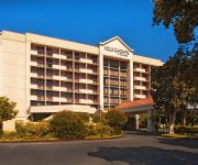
Four Points by Sheraton San Francisco Bay Bridge
Oakland Marriott City Center
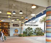
Waterfront Hotel
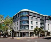
Courtyard Oakland Downtown
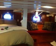
Barkissimo classic yacht hotel
Hilton Garden Inn San Francisco-Oakland Bay Bridge
Courtyard Oakland Emeryville
HAWTHORN SUITES BY WYNDHAM OAK
THE WASHINGTON INN
Nights Inn Motel
Videos from this area
These are videos related to the place based on their proximity to this place.
CHOW Tour Oakland: Unpretentious Street Food
Way before people sold crème brûlée on the sidewalk, there was great street food thriving in Oakland that didn't involve tweeting or "liking" on Facebook.
Noothgrush (live) @ 1-2-3-4 Go! Records Oakland 2015.4.12 (full set) sludge \m/
Noothgrush's full set live at 1-2-3-4 Go! Records on Saturday April 11, 2015; sludge from Oakland. Songs in order: "Useless", "Oil Removed", "Draize", "Diseased Mammal", "Humandemic", "Starvation",.
Hawthorn Suites By Wyndham-Oakland/Alameda
See why Hawthorn Suites By Wyndham is Alameda's best hotel. View our curb appeal, lavish lobby, inviting dining room, amenity equipped guestrooms, relaxing spa and fitness center and everything...
Bike Oakland: Fresh Peralta
Riding from American Steel Studios in West Oakland to the Emeryville Home Depot along the newly paved and striped bike lane on Peralta St north of Grand.
Bike Oakland: Waiting for the light, Mandela, Peralta
Stuck trying to trigger the light to get onto Mandela Parkway at the West Oakland BART station, what is that, 3 cycles? Then up Mandela Parkway and switching after Grand to the FRESHLY paved...
Walking Spud Clamshell Dredge
Njord, the ancient god of sea, seafarers, wind and fertility. Manson Construction Co. derrick barge D.B. "NJORD" is a 55 cubic yard clamshell dredge with a walking spud. Fertility? Oh, well....
Bike Oakland: Sunrise Commute to Uptown
Riding from the West Oakland BART station to Uptown in Oakland.
Bike Oakland: Sunset AmSteel to BART
A sunset ride from American Steel Studios to West Oakland BART.
Bike Oakland: Night Drizzle with the Oculus
First night ride with my new Oculus light from Barry Beams. From 20th and Telegraph, west on 18th St to Mandela Parkway to West Oakland BART. Second part of the commute is at http://youtu.be/Bzo6.
Bike Oakland: West Oakland BART to Uptown
Commute from the West Oakland BART station to Oakland primarily via Mandela Parkway and 17th St.
Videos provided by Youtube are under the copyright of their owners.
Attractions and noteworthy things
Distances are based on the centre of the city/town and sightseeing location. This list contains brief abstracts about monuments, holiday activities, national parcs, museums, organisations and more from the area as well as interesting facts about the region itself. Where available, you'll find the corresponding homepage. Otherwise the related wikipedia article.
USS Hornet (CV-12)
USS Hornet (CV/CVA/CVS-12) is a United States Navy aircraft carrier of the Essex class. Construction started in August 1942; she was originally named USS Kearsarge, but was renamed in honor of the USS Hornet (CV-8), which was lost in October 1942, becoming the eighth ship to bear the name. Hornet was commissioned in November 1943, and after three months of training joined the U.S. forces in the Pacific War.
Transbay Tube
The Transbay Tube is an underwater tube which carries Bay Area Rapid Transit's four transbay lines under San Francisco Bay between the cities of San Francisco and Oakland in California. The tube is 3.6 miles (5.8 km) long; including the approaches from the nearest stations (one of which is underground), it totals 6 miles (9 km) in length. It has a maximum depth of 135 feet (41 m) below sea level.
Naval Air Station Alameda
Naval Air Station Alameda (NAS Alameda) was a United States Navy Naval Air Station in Alameda, California, on San Francisco Bay. NAS Alameda had two runways: 07-25 (8,000×200 ft) (2,438×61 m) and 13–31 (7,200×200 ft) (2,195×61 m). Two helicopter pads and a control tower were also part of the facilities.
West Oakland (BART station)
West Oakland is a Bay Area Rapid Transit station in the neighborhood of West Oakland in Oakland. It has two elevated side platforms, and is located near the eastern end of the Transbay Tube. This is the last stop before entering the Transbay Tube into San Francisco, and all trains except those of the Richmond - Fremont line pass through this station. Since late 2005 parking commuters at this station pay $5 per day.
West Oakland, Oakland, California
West Oakland is a neighborhood situated in the northwestern corner of Oakland, California along the waterfront near the Port of Oakland and San Francisco – Oakland Bay Bridge. It lies at an elevation of 13 feet (4 m).
Encinal High School
Encinal High School is a public coeducational high school serving grades 9-12. It is located in Alameda, California and is part of the Alameda Unified School District.
Oakland Long Wharf
The Oakland Long Wharf, later known as the Oakland Pier or the SP Mole was a massive railroad wharf and ferry pier in Oakland, California. It was located at the foot of Seventh Street. The pier began as a smaller landing called Gibbon's Wharf extending from Gibbons Point, later renamed Oakland Point, westward into San Francisco Bay. In 1868 the Central Pacific Railroad acquired this pier which it renamed the Oakland Long Wharf and immediately began extending and improving.
Oakland Estuary
The Oakland Estuary is the strait separating the cities of Oakland and Alameda, California, in the San Francisco Bay Area. On its western end it connects to San Francisco Bay, while its eastern end connects to San Leandro Bay.
Alameda Community Learning Center
The Alameda Community Learning Center (ACLC), formerly Arthur Andersen Community Learning Center, is a 6th-12th grade charter school located in Alameda, CA, sharing a campus with Encinal High School. We are a 21st century school with computer and two rooms full with computer. ACLC also has a tech team who fixes computers dally.
Naval Supply Depot, Oakland
Naval Supply Depot, Oakland was a supply facility operated by the U.S. Navy in Oakland, California. During World War II, it was a major source of supplies and war materials for ships operating in the Pacific. The Depot had its origin in 1940 when the Navy bought 500 acres of wetlands from the city of Oakland for $1.00. The Navy reclaimed the land and populated it with large warehouses. It opened on December 15, 1941, and quickly began a decades-long expansion.
Alameda Point, Alameda, California
Alameda Point is the name given to the lands of the former Naval Air Station Alameda in the City of Alameda, California. Alameda Point consists of 1,560 acres of land area at the western end of the island of Alameda. Most of the land was reclaimed from the San Francisco Bay. NAS Alameda was identified for closure under the Base Realignment and Closure (BRAC) Program in 1993, and ceased operation in April 1997.
Middle Harbor Shoreline Park
Middle Harbor Shoreline Park http://www. ebparks. org/parks/midlhar. htm lies west of downtown Oakland, California mostly on land formerly occupied by the Oakland Naval Supply Depot. The portion adjacent to the Port of Oakland which includes Port View Park was originally part of the Oakland Pier or Mole, the massive western terminus of the Southern Pacific Railroad. The interlocking tower from the railroad's pier has been moved and partially restored as a small commemorative museum.
Bay Area School of Enterprise
The Bay Area School of Enterprise, also known as BASE, is a charter high school founded in 2001 in Alameda, California. It is the first youth-created charter high school in the United States. It was created by 10 youth and 2 adults working in the afterschool program HOME Project to create a school for non traditional students. BASE is a public charter school in the Alameda Unified School District.
Oakland Point, Oakland, California
Oakland Point, in Oakland, California, USA, was the name of a small promontory on the eastern shore of San Francisco Bay located in the vicinity of what is now the Port of Oakland shipping terminal. Oakland Point was previously known as Gibbon's Point, named for an early American settler who constructed a small wharf there.
AMCO Chemical
AMCO Chemical was a chemical distribution company located in Oakland, California. The land the company operated on is designated as a U.S. Environmental Protection Agency (EPA) Superfund cleanup site. AMCO operated from the 1960s until 1989. Chemicals were brought to the company in rail tank cars. The contents were off-loaded into 55-gallon drums which were stored on the lot until the chemicals were transferred into smaller containers for re-sale.
USS Hornet Museum
The USS Hornet Museum is a museum ship in Alameda, California, USA. It is composed of the USS Hornet (CV-12) aircraft carrier, exhibits from the NASA Apollo moon exploration missions, and several retired aircraft from the Second World War and the transonic and early supersonic jet propulsion period. A number of compartments contain exhibits concerning contemporary carriers that are supported by related associations.
Lower Bottoms, Oakland, California
The Lower Bottoms (also known as The Bottoms) is the informal name of a neighborhood in West Oakland in Oakland, California. The neighborhood boundaries are Mandela Parkway to the east, 7th Street to the south, West Grand Avenue to the north, and the former Oakland Army Base to the west. It includes the "central station development" of the former 16th Street Train Station, which served as a film location for the 2005 film Rent and Vallejo rapper E-40's "Tell Me When to Go" video.
The Crucible (arts education center)
The Crucible is a nonprofit industrial arts school in Oakland, California. Established in Berkeley in 1999, the institute was moved to its present location in 2003. The mission of The Crucible is to foster a collaboration of Arts, Industry and Community. Through training in the fine and industrial arts, The Crucible promotes creative expression, reuse of materials, and innovative design while serving as an accessible arts venue for the general public.
Alameda Mole
The Alameda Mole was a facility, no longer existing, that served as a transit and transportation artery for ferries landing in the San Francisco East Bay. It was located on the West end of Alameda (the end facing San Francisco), and later became part of the Alameda Naval Air Station. It was one of three neighboring moles, the others were the Oakland Mole and the WP Mole (Western Pacific).
Campbell Village Court, Oakland, California
The Campbell Village Court housing projects are a series of complexes located in the Campbell Village part of the Lower Bottoms area of West Oakland California. Campbell Village Court is bound by Willow Street to the west, Campbell Street to the east, 10th street to the north, and 8th street to the south. It is not far from the abandoned 16th Street Train Station and the Mandela Parkway.
Village Bottoms
The Village Bottoms is a historic cultural district in the predominantly Black neighborhood of West Oakland, California. Its current revitalization and cultural arts renaissance is being catalyzed by artist/cultural worker Marcel Diallo and a neighborhood of young, black artists including Githinji wa Mbire, Eesuu Orundide, letitia ntofon, and rappers Boots Riley of The Coup, Zumbi of Zion I and Adimu Madyun of rap group Hairdooo.
Island High School
Island High School is a public coeducational high school serving grades 9-12. It is located in Alameda, California and is part of the Alameda Unified School District. Island High only admits students that are at least sixteen years old.
Campbell Village, Oakland, California
Campbell Village is a neighborhood of Oakland, California in Alameda County, California. It lies at an elevation of 16 feet (5 m). Campbell Village is the site of the Campbell Village Court housing projects.
Peralta Villa, Oakland, California
Peralta Villa is a neighborhood in Oakland in Alameda County, California. It lies at an elevation of 20 feet (6 m). It was formerly an unincorporated community.
Woodstock, Alameda, California
Woodstock is a neighborhood in Alameda in Alameda County, California. It lies at an elevation of 13 feet (4 m). It was one of the original three settlements on Alameda island out of which the city of Alameda was formed in 1853.


