Safety Score: 2,7 of 5.0 based on data from 9 authorites. Meaning we advice caution when travelling to United States.
Travel warnings are updated daily. Source: Travel Warning United States. Last Update: 2024-08-13 08:21:03
Explore Fruitvale
Fruitvale in Alameda County (California) is located in United States about 2,424 mi (or 3,902 km) west of Washington DC, the country's capital.
Local time in Fruitvale is now 09:21 PM (Saturday). The local timezone is named America / Los Angeles with an UTC offset of -8 hours. We know of 8 airports in the wider vicinity of Fruitvale, of which 4 are larger airports. The closest airport in United States is Metropolitan Oakland International Airport in a distance of 4 mi (or 7 km), South. Besides the airports, there are other travel options available (check left side).
Also, if you like golfing, there are multiple options in driving distance. We found 10 points of interest in the vicinity of this place. If you need a place to sleep, we compiled a list of available hotels close to the map centre further down the page.
Depending on your travel schedule, you might want to pay a visit to some of the following locations: Oakland, San Francisco, Martinez, Redwood City and San Rafael. To further explore this place, just scroll down and browse the available info.
Local weather forecast
Todays Local Weather Conditions & Forecast: 14°C / 57 °F
| Morning Temperature | 10°C / 50 °F |
| Evening Temperature | 13°C / 56 °F |
| Night Temperature | 12°C / 54 °F |
| Chance of rainfall | 0% |
| Air Humidity | 64% |
| Air Pressure | 1018 hPa |
| Wind Speed | Gentle Breeze with 6 km/h (3 mph) from North-West |
| Cloud Conditions | Few clouds, covering 10% of sky |
| General Conditions | Sky is clear |
Sunday, 24th of November 2024
15°C (59 °F)
12°C (54 °F)
Light rain, gentle breeze, overcast clouds.
Monday, 25th of November 2024
12°C (54 °F)
11°C (52 °F)
Light rain, light breeze, overcast clouds.
Tuesday, 26th of November 2024
11°C (52 °F)
10°C (49 °F)
Overcast clouds, light breeze.
Hotels and Places to Stay
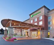
Holiday Inn & Suites OAKLAND - AIRPORT
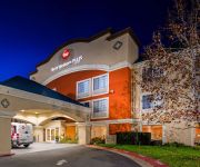
BW PLUS AIRPORT INN AND SUITES
EXECUTIVE INN AND SUITES EMBARCADERO
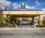
Comfort Inn & Suites Oakland
BEST WESTERN PLUS BAYSIDE HTL
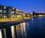
Homewood Suites by Hilton - Oakland Waterfront
THE CORAL REEF INN AND SUITES
La Quinta Inn and Suites Oakland Airport Coliseum
The Empyrean Towers
DAYS HOTEL OAKLAND AIRPORT-COL
Videos from this area
These are videos related to the place based on their proximity to this place.
Gamer Dave Visits the Pacific Pinball Museum in Alameda, CA
I made a day trip out of driving to the Pacific Pinball Museum in Alameda, CA. Let's see what they have! http://pacificpinball.org/
high street drawbridge. alameda/oakland california.
the bridge opens. a boat passes through. the bridge closes again.
Roofing Alameda (510) 210-0272
Roofing Alameda CA - Alameda Roofing Roofing Contractor Alameda Call (510) 210-0272 For Service We specialize in roofing Alameda CA. We are licensed and insured and only care about ...
Solar Panels Alameda (866) 858-7346
Solar Panels Alameda CA - Solar Panel Installation Alameda If you are looking for solar panel installation in Solar Panels Alameda California then you have found the right place. Benefits...
Fruitvale Draw Bridge in Alameda, CA
Draw Bridge between Alameda and Oakland, California at Fruitvale Avenue. This is one of three draw bridges that lead into town. There Is also a tunnel on the north end that goes under the...
Best way to commute in Alameda
Saw this on my way to work this afternoon. This is the second time I see something like this in the same area. I love this island.
Patten Mission Promo
A quick video promo for Patten University and Patten Academy's Summer 2010 Mission trip to Latin America. Director: Rodrigo Alfaro Camera: Gavin Bunton (using a Flip MinoHD) Editing & Animation...
House Cleaning Services Oakland
House cleaning services and maid service in Oakland, Alameda, Albany, Berkeley, Castro Valley, Dublin, El Cerrito, Emeryville, Fremont, Hayward, Moraga, Oakland, Orinda, Piedmont,...
Pure-Ecstasy Performing Just Imagination Cover
Pure-Ecstasy Performing Just My Imagination by the temptations at Oakland City Center, check out their website at www.pure-ecstasy.com I am not affiliated with them.
080531 CASA Boca Jrs. '95 vs. Bay Oaks Bombers, 1st Half
NorCal Spring League u12g Premier Oakland, California May 31, 2008.
Videos provided by Youtube are under the copyright of their owners.
Attractions and noteworthy things
Distances are based on the centre of the city/town and sightseeing location. This list contains brief abstracts about monuments, holiday activities, national parcs, museums, organisations and more from the area as well as interesting facts about the region itself. Where available, you'll find the corresponding homepage. Otherwise the related wikipedia article.
Fruitvale (BART station)
Fruitvale is a Bay Area Rapid Transit station located in the Fruitvale District of Oakland. The station consists of two elevated side platforms with the concourse mezzanine at ground level. The redevelopment of the immediate station area from a parking lot to a mixed-use "transit village" has served as a model for transit-oriented development planning elsewhere in the Bay Area. Service at this station began on September 11, 1972. Alameda Bicycle operates a bike station here.
Fruitvale, Oakland, California
Fruitvale (formerly, Brays and Fruit Vale) is a neighborhood in east Oakland, California, in the United States. It is located about two miles southeast of Lake Merritt and is home to Oakland's largest Latino population, with Latinos comprising 49.5% of Fruitvale's population http://www. neighborhoodlink. com/zip/94601. Fruitvale's ZIP code is 94601. It lies at an elevation of 49 feet (15 m).
Fremont Federation of High Schools
Fremont High School, is a high school in Oakland, California. It was formerly a group of smaller high schools located on the same campus and known as Fremont Federation of High Schools. Part of the Oakland Unified School District, and located at 4610 Foothill Blvd since 1905, the school was split into four smaller autonomous schools in 2003.
St. Elizabeth High School (Oakland, California)
St. Elizabeth High School is a private, Roman Catholic high school in Oakland, California, established in 1921 by the Franciscan Friars. It is located in the Roman Catholic Diocese of Oakland. http://www. stliz-hs. org/
Fruitvale Bridge
The Fruitvale Bridge is a small drawbridge that crosses the Oakland Estuary. It links the cities of Oakland and Alameda.
Patten University
Patten University is a private for-profit institution of higher education in Oakland, California. Originally, founded in 1944 by Bebe Patten as the Oakland Bible Institute and affiliated with the Christian Evangelical Churches of America, it was acquired in 2012 by the UniversityNow and became a secular for-profit institution. Patten University is accredited by the Western Association of Schools and Colleges (WASC) and authorized by the California State Board of Education.
International Boulevard, Oakland, California
International Boulevard is a street in Oakland, California, formerly known as East 14th Street, that changes names while stretching from suburban Hayward (where it is known as Mission Boulevard and as such, also runs through Union City, Fremont, and eventually the city of San Jose), through San Leandro (where it retained the original name of East 14th after the name was changed inside the Oakland city limits in 1996), and East Oakland (known since 1996 as International).
Melrose, Oakland, California
Melrose is a neighborhood in Oakland in Alameda County, California. It lies at an elevation of 39 feet (12 m).
Allendale, Fremont, California
Allendale is a neighborhood of Fremont in Alameda County, California. It was formerly an unincorporated community. It lies at an elevation of 154 feet (47 m).
Fernside, Alameda, California
Fernside is a neighborhood of Alameda in Alameda County, California. It lies at an elevation of 13 feet (4 m). It was formerly an unincorporated community.
Allendale, Oakland, California
Allendale is a former settlement in Alameda County, California now annexed to Oakland. It was located 1.5 miles northeast of Fruitvale. A post office opened in 1903 and by 1908 was a branch of the Oakland post office. Allendale was named for Charles E. Allen, a real estate broker. The commercial district of Allendale is located along 38th Avenue up and down from where it crosses Allendale Avenue. Allendale Elementary School is located there.
High Street Bridge
The High Street Bridge is a double-leaf bascule drawbridge spanning 296 feet of the Oakland Estuary in the San Francisco Bay Area. It links the cities of Oakland and Alameda. The bridge is opened approximately 1400 times a year. The bridge carries an average of 26,000 vehicles per year. The bridge was built when the Oakland Estuary was trenched, converting Alameda from a peninsula to an island. The High Street bridge is one of the four bridges that allow access to Alameda.


