Safety Score: 2,7 of 5.0 based on data from 9 authorites. Meaning we advice caution when travelling to United States.
Travel warnings are updated daily. Source: Travel Warning United States. Last Update: 2024-08-13 08:21:03
Discover Cleveland Heights
The district Cleveland Heights of in Alameda County (California) is a district in United States about 2,425 mi west of Washington DC, the country's capital city.
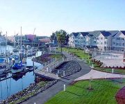
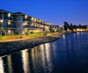
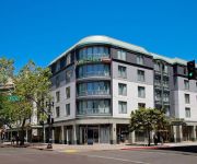
Looking for a place to stay? we compiled a list of available hotels close to the map centre further down the page.
When in this area, you might want to pay a visit to some of the following locations: Oakland, San Francisco, Martinez, Redwood City and San Rafael. To further explore this place, just scroll down and browse the available info.
Local weather forecast
Todays Local Weather Conditions & Forecast: 17°C / 63 °F
| Morning Temperature | 12°C / 54 °F |
| Evening Temperature | 16°C / 60 °F |
| Night Temperature | 15°C / 59 °F |
| Chance of rainfall | 0% |
| Air Humidity | 52% |
| Air Pressure | 1019 hPa |
| Wind Speed | Gentle Breeze with 6 km/h (4 mph) from East |
| Cloud Conditions | Overcast clouds, covering 100% of sky |
| General Conditions | Overcast clouds |
Wednesday, 6th of November 2024
18°C (64 °F)
15°C (58 °F)
Broken clouds, fresh breeze.
Thursday, 7th of November 2024
18°C (64 °F)
14°C (57 °F)
Sky is clear, light breeze, clear sky.
Friday, 8th of November 2024
17°C (62 °F)
14°C (57 °F)
Sky is clear, light breeze, clear sky.
Hotels and Places to Stay
Oakland Marriott City Center
Homewood Suites by Hilton - Oakland Waterfront
BEST WESTERN PLUS BAYSIDE HTL
EXECUTIVE INN AND SUITES EMBARCADERO
THE WASHINGTON INN
Courtyard Oakland Downtown
Bay Bridge Inn
Z Hotel Jack London Square
Jack London Inn
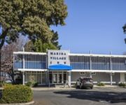
Marina Village Inn
Videos from this area
These are videos related to the place based on their proximity to this place.
ART MURMUR - Oakland, California - July 1, 2011. Telegraph Ave. and 23rd street.
ART MURMUR - Oakland, California - July 1, 2011. Telegraph Ave. and 23rd street. Writer Mark wasserman http://www.youtube.com/watch?v=3Xke9zLs8jY and artist, producer, designer Heather ...
Let's help uplift and inspire Oakland.
http://www.odalc.org/donate - "One thing about Oakland, there is a lot of good people... but there are still things that we need to work on. Let's not vandalize our community, let's help uplift...
Disclosing Tablets Staining of Plaque | Lake Merritt Dental, Oakland, CA
Disclosing tablets stain plaque to help you identify where plaque accumulation has occurred, and helps you target your brushing to rid of them. Lake Merritt Dental is a one stop whole oral...
Oakland Sewer Testing | Oakland Sewer Certificate Test Plumbers
Oakland sewer testing http://www.bayareasewers.com/oakland-sewer-test.htm is now required because of the Oakland sewer lateral ordinance which makes Oakland sewer testing required. If you...
Oakland Digital : Digital Literacy. Opportunity. Tech Inclusion.
http://www.odalc.org/donate - Oakland Digital Arts & Literacy Center's work is bridging the digital literacy and opportunity divide. DIGITAL LITERACY: “Oakland Digital's is extremely...
HiMY SYeD -- Governor Jerry Brown, Love Our Lake Day, Lake Merritt, Oakland, Sunday June 9 2013
himy syed -- Governor Jerry Brown, Love Our Lake Day, Lake Merritt, Oakland, Sunday June 9 2013 http://oaklandwiki.org/love_our_lake_day http://oaklandwiki.o...
Atari 2600 DKews Donkey Kong Hack
Make a new video now: http://img.atariguide.com/runtime.php?rom=DKews+%28Donkey+Kong+Hack%29 - Atari 2600 DKews Donkey Kong Hack - http://www.AtariGuide.com/ Visit us for more info on ...
Atari 2600 Donkey Kong 2 Donkey Kong Hack 2005 Fred Quimby
Make a new video now: http://img.atariguide.com/runtime.php?rom=Donkey+Kong+2+%28Donkey+Kong+Hack%29+%282005%29+%28Fred+Quimby%29 - Atari 2600 Donkey Kong 2 Donkey Kong ...
Youtube Video Workshop at Oakland City Hall
Want to learn how to use Youtube for Business? Watch this video and then attend the free workshop at Oakland City Hall on 11/21/13. This workshop is titled Building an Online Presence Seminar...
Piedmont Avenue Consulting Marketing Strategies with David Mitroff, Ph.D.
It's as simple as Puppy Dogs and Ice Cream! David Mitroff reviews Marketing Strategies including Traditional Marketing / Selling versus Engagement Marketing / Selling. Today we can use Social...
Videos provided by Youtube are under the copyright of their owners.
Attractions and noteworthy things
Distances are based on the centre of the city/town and sightseeing location. This list contains brief abstracts about monuments, holiday activities, national parcs, museums, organisations and more from the area as well as interesting facts about the region itself. Where available, you'll find the corresponding homepage. Otherwise the related wikipedia article.
Lake Merritt
Lake Merritt is a large tidal lagoon that lies just east of downtown Oakland, California. It is surrounded by parkland and city neighborhoods. A popular 3.1 mile (5 km) walking and jogging path runs along its perimeter. It is historically significant as the United States' first official wildlife refuge, designated in 1870.
Children's Fairyland
Children's Fairyland, U.S.A. is the first theme park in the United States created to cater to families with young children. Located in Oakland, California on the shore of Lake Merritt, Fairyland includes 10 acres (40,000 m) of play sets, small rides, and animals. The park is also home to the Open Storybook Puppet Theater, the oldest continuously operating puppet theater in the United States. Children's Fairyland was the first three-dimensional storybook theme park in the U.S.
Frank Youell Field
Frank Youell Field was a football stadium that stood in Oakland, California. It was the home of the Oakland Raiders from 1962 to 1965. The stadium, which was essentially a temporary home while Oakland-Alameda County Coliseum was being built, sat 22,000 and cost $400,000 to build. The facility was named for Francis J. Youell (1883-1967), an Oakland undertaker owner of the Chapel of the Oaks, Oakland City Councilman, and sports booster.
Laney College
Laney College is a community college located in Oakland, California, next to the Lake Merritt BART station and the Kaiser Convention Center. Laney is the largest of the four colleges of the Peralta Community College District which serves northern Alameda County. Laney College originally opened in 1953 as Oakland City College, at the former University High School campus (which operated from 1923 to 1948).
Cathedral of Christ the Light
The Cathedral of Christ the Light and also called the Oakland Cathedral, is the cathedral of the Roman Catholic Diocese of Oakland in Oakland, California. It is the seat of the Bishop of Oakland. Christ the Light, the first cathedral built in the 21st century, replaces the Cathedral of Saint Francis de Sales, irreparably damaged in the Loma Prieta earthquake of 1989.
Oakland Unified School District
Oakland Unified School District is a public education school district which operates about 100 elementary schools (K-5), middle schools (6-8), and high schools (9-12) in Oakland, California.
Grand Lake, Oakland, California
Grand Lake, or the Grand Lake District, is a neighborhood of Oakland, California. The neighborhood is located near the northeast corner of Lake Merritt, where Grand and Lakeshore Avenues pass under Interstate 580. It borders Adams Point to the west, Trestle Glen to the east, and Piedmont to the north. It lies at an elevation of 52 feet (16 m). There are two shopping areas in the Grand Lake District: Grand Avenue, between Piedmont and Adams Point, the larger of the two.
Brooklyn, California
Brooklyn is a former city in Alameda County, California, now annexed to Oakland, California. Brooklyn first formed from the amalgamation in 1856 of two settlements, the sites of which are both now within the city limits of Oakland: San Antonio and Clinton. The name Brooklyn commemorated the ship that had brought Mormon settlers to California in 1846. In 1870, Brooklyn absorbed the nearby town of Lynn, which housed a footwear industry, and incorporated as a city.
Grand Lake Theater
The Grand Lake Theater is a historic movie palace located at 3200 Grand Avenue and Lake Park Avenue in the Grand Lake neighborhood of Oakland, California in the United States of America.
Adams Point, Oakland, California
Adams Point is a neighborhood of Oakland, California. It is located on the northern shore of Lake Merritt, directly adjacent to Downtown Oakland and the Grand Lake district. It is a triangle bounded by Grand Avenue on the south, Harrison Street on the northwest, and the MacArthur Freeway on the northeast. It lies at an elevation of 79 feet (24 m).
Kaiser Convention Center
The Kaiser Convention Center is a historic, publicly owned multi-purpose arena in Oakland, California. The facility includes a 5,492-seat arena, a large theater, and a large ballroom. The building is #27 on the list of Oakland Historic Landmarks.
Trestle Glen, Oakland, California
Trestle Glen is a neighborhood in Oakland, California. It is located east of Lakeshore Avenue, a shopping street which it shares with the Grand Lake District. It lies at an elevation of 144 feet (44 m). The streets are laid out in the curvilinear pattern of early 20th century garden suburbs. Many of the houses are nestled in the surrounding hills, and were built shortly before The Great Depression.
California's 13th congressional district
California's 13th congressional district is a congressional district in the U.S. state of California. Barbara Lee, a Democrat, has represented this district since January 2013. Currently, the 13th district consists of the western portion of Alameda County. Cities in the district include Alameda, Albany, Berkeley, Emeryville, Oakland, Piedmont, and San Leandro.
Peralta Community College District
The Peralta Community College District is the community college district serving northern Alameda County, California. The district operates four community colleges: Berkeley City College, Laney College and Merritt College in Oakland, and College of Alameda. From 1968 to 1988, non-contiguous Plumas County was part of the district, and Feather River College was operated by the district. Plumas County and Feather River College are now the Feather River Community College District.
St Pauls Episcopal School
St. Paul's Episcopal School is an independent coeducational K-8 school in Oakland, across the bay from San Francisco, California. St. Paul's Episcopal School is a separate, independent entity that builds on the progressive tradition of St. Paul's Episcopal Church in Oakland since its founding in 1871. St. Paul's School was founded in 1975 by Rev. Canon David R. Forbes - who was the founding headmaster of San Francisco's Cathedral School for Boys - and Rev. Donald W. Seaton.
Oakland High School (Oakland, California)
Oakland Senior High School (also known as O-High and OHS) is a public high school in California. Established in 1869, it is the oldest high school in Oakland, California and the sixth oldest high school in the state.
Oakland Public Library
The Oakland Public Library is the public library in Oakland, California. Opened in 1878, the Oakland Public Library currently serves the city of Oakland, along with some neighboring smaller cities including Emeryville and Piedmont. The Oakland Public Library has the largest collection of any public library in the East Bay, featuring approximately 1.5 million items.
Morcom Rose Garden
The Morcom Rose Garden (formerly the Morcom Amphitheater of Roses) is located in a residential neighborhood in Oakland, California, near the Piedmont border. The exact address is 700 Jean St. , Oakland, CA 94610. The Rose Garden was constructed in 1932 as a project of the Works Progress Administration. It was named in honor of former Oakland mayor Fred N. Morcom. As well as thousands of roses, the garden features winding walkways, a reflecting pool, and a cascading fountain.
Highland Hospital (Oakland, California)
Highland Hospital is a public hospital located in Alameda County, Oakland, California. It is operated by the Alameda County Medical Center. It is the primary trauma center and county hospital in Alameda County. It is a Level II trauma center since 1985.
San Antonio, Oakland, California
San Antonio is a large district in Oakland, California, encompassing the land east of Lake Merritt to Sausal Creek. It is one of the most diverse areas of the city. It takes its name from Rancho San Antonio, the name of the land as granted to Luís María Peralta by the last Spanish governor of California.
Splash Pad Park
Splash Pad Park is the name of several parks containing a splash pad. The original is in Oakland, California, along Lake Park Ave, between Grand Ave and Lakeshore Ave, and north of the 580 Freeway. The Phoenix Zoo also has a Splash Pad Park at its location off Interstate 10 in Arizona between the 101 and the 303.
Civic Center, Oakland, California
Oakland's Civic Center neighborhood is a residential and public building district on the east side of Oakland's Central Business District. Its borders are roughly Downtown and Harrison Street to the west, the East Lake Neighborhood and Lakeshore Avenue to the east, the Lakeside Apartments District and 14th Street to the North, and Chinatown and 11th Street to the South.
Clinton, Oakland, California
Clinton is a neighborhood in Oakland, Alameda County, California. It lies at an elevation of 36 feet . Clinton started when brothers named Patten leased land on the east side of the San Antonio Slough from Vincent Peralta in 1850, and joined with others to found the town in 1852. Clinton and San Antonio joined in 1856 to form a new town called Brooklyn, named after the ship that had brought Mormon settlers to California in 1846.
East Bay Chinese School
East Bay Chinese School, is a non-profit, Chinese heritage school located in Oakland, California. It offers classes in Standard Mandarin and Chinese culture. It began offering classes in 1981. The school's classes are held at Westlake Middle School. The school has grown from a student body of 26 in 1981 to over 450 students. Classes are held on Saturday mornings for 32 weeks during the school year.
Alameda County Medical Center
Alameda County Medical Center (ACMC) is a medical organization operated by Alameda County, California. It operates hospitals and primary care medical clinics within the county. In March 2013, they announced a name change to Alameda Health System.


