Safety Score: 2,7 of 5.0 based on data from 9 authorites. Meaning we advice caution when travelling to United States.
Travel warnings are updated daily. Source: Travel Warning United States. Last Update: 2024-08-13 08:21:03
Delve into Melrose
The district Melrose of Alameda in Alameda County (California) is a district located in United States about 2,424 mi west of Washington DC, the country's capital town.
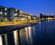
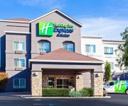
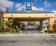
In need of a room? We compiled a list of available hotels close to the map centre further down the page.
Since you are here already, you might want to pay a visit to some of the following locations: Oakland, San Francisco, Martinez, Redwood City and San Rafael. To further explore this place, just scroll down and browse the available info.
Local weather forecast
Todays Local Weather Conditions & Forecast: 14°C / 57 °F
| Morning Temperature | 10°C / 50 °F |
| Evening Temperature | 13°C / 56 °F |
| Night Temperature | 12°C / 54 °F |
| Chance of rainfall | 0% |
| Air Humidity | 64% |
| Air Pressure | 1018 hPa |
| Wind Speed | Gentle Breeze with 6 km/h (3 mph) from North-West |
| Cloud Conditions | Few clouds, covering 10% of sky |
| General Conditions | Sky is clear |
Monday, 25th of November 2024
15°C (59 °F)
12°C (54 °F)
Light rain, gentle breeze, overcast clouds.
Tuesday, 26th of November 2024
12°C (54 °F)
11°C (52 °F)
Light rain, light breeze, overcast clouds.
Wednesday, 27th of November 2024
11°C (52 °F)
10°C (49 °F)
Overcast clouds, light breeze.
Hotels and Places to Stay
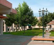
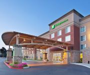
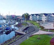
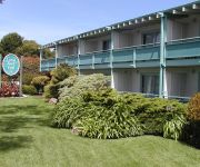
Hilton Oakland Airport
Courtyard Oakland Airport
Holiday Inn & Suites OAKLAND - AIRPORT
Homewood Suites by Hilton - Oakland Waterfront
THE CORAL REEF INN AND SUITES
BEST WESTERN PLUS BAYSIDE HTL
La Quinta Inn and Suites Oakland Airport Coliseum
EXECUTIVE INN AND SUITES EMBARCADERO
Holiday Inn Express & Suites OAKLAND-AIRPORT
Comfort Inn & Suites Oakland
Videos from this area
These are videos related to the place based on their proximity to this place.
high street drawbridge. alameda/oakland california.
the bridge opens. a boat passes through. the bridge closes again.
Oakland Raiders host Miami Dolphins - 11/28/10
Dolphins at Raiders 2010 Raider Nation Videocast - Episode #62 Filmed at the Oakland Coliseum, November 28, 2010 prior to the game. Raider Greg chats with Raiders fans and Visiting Dolphins...
Golden State Warriors 2014-2015 Open Practice Player Introductions
The following players are introduced: Leandro Barbosa, Harrison Barnes, Andrew Bogut, Aaron Craft, Stephen Curry, Festus Ezeli, Draymond Green, Justin Holiday, Andre Iguodala, Jason Kapono,...
JaMarcus Russell Jersey Burned in Oakland by Unhappy Australian Raider Fan
Raider Nation Videocast - Episode #59 JaMarcus Russell Jersey Burned in Oakland by Unhappy Australian Raider Fan "RaiderWilde" Oscar, or "RaiderWilde" as he is called, is a long-time...
Warriors Jr Jam Squad - Game 29
Golden State Warriors Jr. Jam Squad - Game #29 (Oklahoma City Thunder) 2010-11 season.
House Cleaning Services Oakland
House cleaning services and maid service in Oakland, Alameda, Albany, Berkeley, Castro Valley, Dublin, El Cerrito, Emeryville, Fremont, Hayward, Moraga, Oakland, Orinda, Piedmont,...
Pure-Ecstasy Performing Just Imagination Cover
Pure-Ecstasy Performing Just My Imagination by the temptations at Oakland City Center, check out their website at www.pure-ecstasy.com I am not affiliated with them.
Warriors basketball game half time performance with Dublin High school cheerleaders and their dads!
Dublin High and Fallon Middle cheer dads perform halftime routine for sold out Warriors game vs. Sacramento Kings 2012. Dublin Rocks!
Zebras at Animal Open House; Ringling Bros. & Barnum & Bailey; 09/10/11 - 3pm show
some zebras, shot with Sony Bloggie 3D.
080531 CASA Boca Jrs. '95 vs. Bay Oaks Bombers, 1st Half
NorCal Spring League u12g Premier Oakland, California May 31, 2008.
Videos provided by Youtube are under the copyright of their owners.
Attractions and noteworthy things
Distances are based on the centre of the city/town and sightseeing location. This list contains brief abstracts about monuments, holiday activities, national parcs, museums, organisations and more from the area as well as interesting facts about the region itself. Where available, you'll find the corresponding homepage. Otherwise the related wikipedia article.
O.co Coliseum
O. co Coliseum – also known as Oakland–Alameda County Coliseum, and commonly Oakland Coliseum or The Coliseum; and formerly known as Network Associates Coliseum, McAfee Coliseum, and Overstock. com Coliseum – is a multi-purpose stadium, located in Oakland, California, USA, in the Coliseum Industrial area. It is the only remaining multi-purpose stadium left to serve as a full-time home to both a Major League Baseball team and a National Football League team.
Mills College
Mills College is an independent liberal arts and sciences college in the San Francisco Bay Area. Originally founded in 1852 as a young ladies' seminary in Benicia, California, Mills became the first women's college west of the Rockies. Currently, Mills is an undergraduate women's college in Oakland, California, with graduate programs for women and men. The college offers more than 40 undergraduate majors and 23 graduate degrees and certificates. In 2011, U.S.
Oracle Arena
The Oracle (originally Oakland-Alameda County Coliseum Arena, formally The Arena in Oakland and Oakland Arena and commonly Oakland Coliseum Arena, Oracle Arena, The New Arena and The O) is an indoor arena, in Oakland, California, located in the Coliseum Industrial area. It was originally constructed as the Oakland-Alameda County Coliseum Arena (part of the combined complex that includes the multipurpose outdoor stadium now known as O. co Coliseum) in 1966.
East Oakland, Oakland, California
East Oakland is the southeastern portion of Oakland, California, and takes up the largest portion of the city's land area. It stretches between Lake Merritt in the northwest and San Leandro in the southeast. Many areas of East Oakland have been plagued by high crime in the postwar period and are known for violence and drug activity.
Fruitvale (BART station)
Fruitvale is a Bay Area Rapid Transit station located in the Fruitvale District of Oakland. The station consists of two elevated side platforms with the concourse mezzanine at ground level. The redevelopment of the immediate station area from a parking lot to a mixed-use "transit village" has served as a model for transit-oriented development planning elsewhere in the Bay Area. Service at this station began on September 11, 1972. Alameda Bicycle operates a bike station here.
Seminary, Oakland, California
Seminary is a neighborhood in the East Oakland section of Oakland, California. It is located just north of the Elmhurst neighborhood. Seminary's ZIP code is 94605. It is best known for its close proximity to Mills College. Seminary is named after Mills College. The main street running through the neighborhood, today's Seminary Avenue, was the main route from the bayshore to the college, which was known at the time as "The Young Ladies' Seminary".
Fruitvale, Oakland, California
Fruitvale (formerly, Brays and Fruit Vale) is a neighborhood in east Oakland, California, in the United States. It is located about two miles southeast of Lake Merritt and is home to Oakland's largest Latino population, with Latinos comprising 49.5% of Fruitvale's population http://www. neighborhoodlink. com/zip/94601. Fruitvale's ZIP code is 94601. It lies at an elevation of 49 feet (15 m).
Maxwell Park, Oakland, California
Maxwell Park is a neighborhood in Oakland, California located in the foothills of Oakland and is known for its close knit community (made up largely of middle-class professionals) and relatively low crime rate. It is geographically bordered by MacArthur Blvd, High Street, Trask Steet, Foothill Blvd, and 55th Avenue and is adjacent to Mills College, I-580, Brookdale Park, and the Fairfax neighborhood.
Fremont Federation of High Schools
Fremont High School, is a high school in Oakland, California. It was formerly a group of smaller high schools located on the same campus and known as Fremont Federation of High Schools. Part of the Oakland Unified School District, and located at 4610 Foothill Blvd since 1905, the school was split into four smaller autonomous schools in 2003.
Oakland Coliseum Station
The Oakland Coliseum Station is a complex of two stations of two public transit providers that are within 600 feet of each other: Amtrak Capitol Corridor's Oakland Coliseum station and Bay Area Rapid Transit (BART)'s Coliseum/Oakland Airport (OAK) station. They are located in East Oakland, and are connected to each other, and to the O. co Coliseum and the Oracle Arena by a pedestrian bridge.
Unity High School (Oakland, California)
Oakland's Unity High School (Unity) is an independent charter high school serving all students in Oakland, California. The school opened in the fall (autumn) of 2003 and currently enrolls about 210 ninth to twelfth grade students. The principal is Sam Brewer and the assistant principal is Daniel Zarazua.
Damon Marsh
The Damon Marsh is a tidal wetland at the northern edge of San Leandro Bay in Oakland, California, USA. There is a paved 0.84-mile long shoreline trail along the waterfront to allow visual access to the San Leandro Bay and through the marsh itself. One end of this trailhead lies at Damon Slough. Access to the marsh is via the Hegenberger Road exit of Interstate 880.
St. Elizabeth High School (Oakland, California)
St. Elizabeth High School is a private, Roman Catholic high school in Oakland, California, established in 1921 by the Franciscan Friars. It is located in the Roman Catholic Diocese of Oakland. http://www. stliz-hs. org/
San Leandro Bay
San Leandro Bay is a body of water in the San Francisco Bay. It is connected to the Oakland Estuary today, but was originally separated by land which formerly connected Alameda with Oakland. It is located along the east of the Oakland International Airport and Bay Farm Island. The principal stream which flows into San Leandro Bay is San Leandro Creek. Damon Marsh is located there.
Patten University
Patten University is a private for-profit institution of higher education in Oakland, California. Originally, founded in 1944 by Bebe Patten as the Oakland Bible Institute and affiliated with the Christian Evangelical Churches of America, it was acquired in 2012 by the UniversityNow and became a secular for-profit institution. Patten University is accredited by the Western Association of Schools and Colleges (WASC) and authorized by the California State Board of Education.
International Boulevard, Oakland, California
International Boulevard is a street in Oakland, California, formerly known as East 14th Street, that changes names while stretching from suburban Hayward (where it is known as Mission Boulevard and as such, also runs through Union City, Fremont, and eventually the city of San Jose), through San Leandro (where it retained the original name of East 14th after the name was changed inside the Oakland city limits in 1996), and East Oakland (known since 1996 as International).
Lockwood Gardens, Oakland, California
Lockwood Gardens, is a neighborhood and housing project located in East Oakland, California, on 65th and International Boulevard. Carolyn Wilson, a former clerk with the Oakland Housing Authority, is serving a jail sentence for moving people to the top of the long public housing waiting list after accepting bribes for Lockwood Gardens. The neighborhood lies at an elevation of 25 feet (6 m). Lockwood is also known as the "6-5 Vill" (Village), and is one half of the "Vill.
California Concordia College
California Concordia College existed in Oakland, California from 1906 until 1973. Among the presidents of California Concordia College was Johann Theodore Gotthold Brohm Jr. Even though it no longer exists it does receive some recognition by Concordia University Irvine. This is also the location of its old academic records. {{#invoke:Coordinates|coord}}{{#coordinates:37|46|21|N|122|10|57|W|region:US-CA_type:edu_source:gnis |primary |name= }}
Havenscourt, Oakland, California
Havenscourt is a neighborhood of Oakland in Alameda County, California. It lies at an elevation of 49 feet (15 m).
Melrose, Oakland, California
Melrose is a neighborhood in Oakland in Alameda County, California. It lies at an elevation of 39 feet (12 m).
Allendale, Fremont, California
Allendale is a neighborhood of Fremont in Alameda County, California. It was formerly an unincorporated community. It lies at an elevation of 154 feet (47 m).
Fernside, Alameda, California
Fernside is a neighborhood of Alameda in Alameda County, California. It lies at an elevation of 13 feet (4 m). It was formerly an unincorporated community.
Seminary Park, Oakland, California
Seminary Park is a neighborhood in Oakland in Alameda County, California. It lies at an elevation of 79 feet (24 m). It is centered on Seminary Avenue adjacent to Mills College.
Allendale, Oakland, California
Allendale is a former settlement in Alameda County, California now annexed to Oakland. It was located 1.5 miles northeast of Fruitvale. A post office opened in 1903 and by 1908 was a branch of the Oakland post office. Allendale was named for Charles E. Allen, a real estate broker. The commercial district of Allendale is located along 38th Avenue up and down from where it crosses Allendale Avenue. Allendale Elementary School is located there.
High Street Bridge
The High Street Bridge is a double-leaf bascule drawbridge spanning 296 feet of the Oakland Estuary in the San Francisco Bay Area. It links the cities of Oakland and Alameda. The bridge is opened approximately 1400 times a year. The bridge carries an average of 26,000 vehicles per year. The bridge was built when the Oakland Estuary was trenched, converting Alameda from a peninsula to an island. The High Street bridge is one of the four bridges that allow access to Alameda.


