Safety Score: 2,7 of 5.0 based on data from 9 authorites. Meaning we advice caution when travelling to United States.
Travel warnings are updated daily. Source: Travel Warning United States. Last Update: 2024-08-13 08:21:03
Touring Acorn
The district Acorn of in Alameda County (California) is a subburb located in United States about 2,427 mi west of Washington DC, the country's capital place.
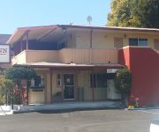
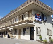
Need some hints on where to stay? We compiled a list of available hotels close to the map centre further down the page.
Being here already, you might want to pay a visit to some of the following locations: Oakland, San Francisco, Martinez, San Rafael and Redwood City. To further explore this place, just scroll down and browse the available info.
Local weather forecast
Todays Local Weather Conditions & Forecast: 13°C / 55 °F
| Morning Temperature | 11°C / 51 °F |
| Evening Temperature | 12°C / 53 °F |
| Night Temperature | 10°C / 50 °F |
| Chance of rainfall | 0% |
| Air Humidity | 44% |
| Air Pressure | 1022 hPa |
| Wind Speed | Fresh Breeze with 13 km/h (8 mph) from South-East |
| Cloud Conditions | Clear sky, covering 7% of sky |
| General Conditions | Sky is clear |
Tuesday, 19th of November 2024
11°C (53 °F)
12°C (54 °F)
Overcast clouds, gentle breeze.
Wednesday, 20th of November 2024
14°C (57 °F)
14°C (57 °F)
Light rain, fresh breeze, overcast clouds.
Thursday, 21st of November 2024
13°C (55 °F)
14°C (57 °F)
Overcast clouds, moderate breeze.
Hotels and Places to Stay
Oakland Marriott City Center
HAWTHORN SUITES BY WYNDHAM OAK
THE WASHINGTON INN
Waterfront Hotel
Courtyard Oakland Downtown
Courtyard Oakland Emeryville
Travel Inn
M B Motor Inn
Bay Bridge Inn
Bayview Motel
Videos from this area
These are videos related to the place based on their proximity to this place.
Amtrak California Trains at Jack London Square in Oakland (Street Running)
In Oakland near Jack London Square heavy rail tracks run in the middle of a quite busy commercial street (Embarcadero) over a stretch of four blocks. Amtrak (and also some freight trains) use...
Oakland Office Space - Office Space for Rent, Virtual Office, Meeting Rooms, Conference Rooms
http://www.pbcoffices.com/locations/oakland.html - Our Pacific Business Centers Oakland office space is strategically located across from the City Center in Downtown Oakland. We offer Full-Time...
[HD] UP 1989 Rio Grande-KMNOA, Jack London Oakland CA 3/15/15
[HD] Union Pacific 1989, the Rio Grande heritage unit, was the DPU on the KMNOA (intermodal train, Marion AR to Oakland CA) seen at Jack London Square, Oakland, California on March 15, 2015....
Bandaloop Performs on Oakland City Hall Building
Bandaloop performs on the face of Oakland Civic Center during the 2104 Art And soul Festival.
Bike Oakland: Fresh Peralta
Riding from American Steel Studios in West Oakland to the Emeryville Home Depot along the newly paved and striped bike lane on Peralta St north of Grand.
Bike Oakland: Waiting for the light, Mandela, Peralta
Stuck trying to trigger the light to get onto Mandela Parkway at the West Oakland BART station, what is that, 3 cycles? Then up Mandela Parkway and switching after Grand to the FRESHLY paved...
Bike Oakland: Sunrise Commute to Uptown
Riding from the West Oakland BART station to Uptown in Oakland.
Bike Oakland: Sunset AmSteel to BART
A sunset ride from American Steel Studios to West Oakland BART.
Bike Oakland: Night Drizzle with the Oculus
First night ride with my new Oculus light from Barry Beams. From 20th and Telegraph, west on 18th St to Mandela Parkway to West Oakland BART. Second part of the commute is at http://youtu.be/Bzo6.
Bike Oakland: West Oakland BART to Uptown
Commute from the West Oakland BART station to Oakland primarily via Mandela Parkway and 17th St.
Videos provided by Youtube are under the copyright of their owners.
Attractions and noteworthy things
Distances are based on the centre of the city/town and sightseeing location. This list contains brief abstracts about monuments, holiday activities, national parcs, museums, organisations and more from the area as well as interesting facts about the region itself. Where available, you'll find the corresponding homepage. Otherwise the related wikipedia article.
Oakland, California
Oakland, located in the U.S. state of California, is a major West Coast port city and the busiest port for San Francisco Bay and all Northern California. It is the third largest city in the San Francisco Bay Area, the eighth-largest city in the state, and the 47th-largest city in the U.S. with a population of 390,724. Incorporated in 1852, Oakland is the county seat of Alameda County.
Port of Oakland
The Port of Oakland is the first major port on the Pacific Coast of the United States to build terminals for container ships. It is now the fifth busiest container port in the United States, behind Long Beach, Los Angeles, Newark, and Savannah. Development of an intermodal container handling system in 2002 culminated over a decade of planning and construction to produce a high volume cargo facility that positions the Port of Oakland for further expansion of the West Coast freight market share.
McClymonds High School
McClymonds High School is a public high school in the West Oakland neighborhood of Oakland, California, USA. In addition to being the third oldest high school in Oakland, it is the larger of the two high schools in West Oakland (the other being Bunche High School), and the only high school in West Oakland operated by the Oakland Unified School District.
West Oakland (BART station)
West Oakland is a Bay Area Rapid Transit station in the neighborhood of West Oakland in Oakland. It has two elevated side platforms, and is located near the eastern end of the Transbay Tube. This is the last stop before entering the Transbay Tube into San Francisco, and all trains except those of the Richmond - Fremont line pass through this station. Since late 2005 parking commuters at this station pay $5 per day.
West Oakland, Oakland, California
West Oakland is a neighborhood situated in the northwestern corner of Oakland, California along the waterfront near the Port of Oakland and San Francisco – Oakland Bay Bridge. It lies at an elevation of 13 feet (4 m).
Oakland City Center
Oakland City Center is an office and shopping and hotel complex in Downtown Oakland, California. The complex is the product of a redevelopment project begun in the late 1950s. It covers twelve city blocks between Broadway on the east, Martin Luther King Jr. Way. on the west, 14th Street on the north side of the complex and the Oakland Convention Center and Marriott Hotel extend south to 10th Street. An hourly parking garage is located beneath the complex's shopping mall.
Old Oakland
Old Oakland, formally known as the Old Oakland Historic District, is a historic district in downtown Oakland, California. The area is located on the northwest side of Broadway, between the City Center complex and the Jack London Square district, and across Broadway from Chinatown. The Old Oakland district was the "original" downtown Oakland during the 1860s after Central Pacific Railroad constructed a terminus on 7th Street.
Cypress Street Viaduct
The Cypress Street Viaduct, often referred to as the Cypress Structure, was a 1.6 mile long, raised two-tier, multi-lane (four lanes per deck) freeway constructed of reinforced concrete that was originally part of the Nimitz Freeway in Oakland, California. It replaced an earlier single-deck viaduct constructed in the 1930s as one of the approaches to the San Francisco – Oakland Bay Bridge. It was located along Cypress Street between 7th Street and Interstate 80 in the West Oakland neighborhood.
16th Street Station (Oakland)
The 16th Street Station is one of three original train stations that served Oakland, California at the start of the 20th century. The building was designed by architect Jarvis Hunt who was a preeminent train station architect at that time and the facility opened in 1912. For many decades, the 16th Street Station was a major railroad station of the Southern Pacific railroad in Oakland as well as local commuter services such as the East Bay Electric Lines via elevated platforms.
Jack London District, Oakland, California
The Jack London District also called the Loft District is a neighborhood of Oakland, California that occupies the region south of the Nimitz Freeway (Interstate 880) along The Embarcadero between Adeline and Lake Merritt Channel. It includes and surrounds the Jack London Square shopping and tourist area, as well as the Warehouse District north of the Oakland Amtrak Station. The area has a long history of industrial and warehouse land use.
McClymonds Educational Complex
McClymonds Educational Complex was the collective name of the two small high schools occupying the building of McClymonds High School, operated by the Oakland Unified School District from August 2005 to 2010. As of 2010, the complex has returned to being a single high school, McClymonds High School.
Clorox Building
The Clorox Building is a 24-storey, 100.6 m skyscraper in the City Center complex of downtown Oakland, California. The building was completed in 1976, and designed by Cesar Pelli when he worked with Gruen Associates now based in Los Angeles. The Oakland-based Clorox Company is headquartered in the building.
St. Mary's Gardens
St. Mary's Gardens is an Oakland, California elderly housing facility noted for its airy, open design and innovative use of low-cost plywood. The building was designed by Thomas J. Caulfield of Peters, Clayberg, and Caulfield. The design received a national Honor Award from the American Institute of Architects in 1981.
AMCO Chemical
AMCO Chemical was a chemical distribution company located in Oakland, California. The land the company operated on is designated as a U.S. Environmental Protection Agency (EPA) Superfund cleanup site. AMCO operated from the 1960s until 1989. Chemicals were brought to the company in rail tank cars. The contents were off-loaded into 55-gallon drums which were stored on the lot until the chemicals were transferred into smaller containers for re-sale.
Lower Bottoms, Oakland, California
The Lower Bottoms (also known as The Bottoms) is the informal name of a neighborhood in West Oakland in Oakland, California. The neighborhood boundaries are Mandela Parkway to the east, 7th Street to the south, West Grand Avenue to the north, and the former Oakland Army Base to the west. It includes the "central station development" of the former 16th Street Train Station, which served as a film location for the 2005 film Rent and Vallejo rapper E-40's "Tell Me When to Go" video.
Acorn, Oakland, California
Acorn or Acorn Projects are a series of housing projects in the Acorn Redevelopment Project Area or the Acorn neighborhood of West Oakland. Located in West Oakland, California, this complex is known as the spot where Black Panther Party Leader Huey P. Newton was killed. Acorn, or "The Corns" as local residents call them, consists of a wide variety of public housing.
The Crucible (arts education center)
The Crucible is a nonprofit industrial arts school in Oakland, California. Established in Berkeley in 1999, the institute was moved to its present location in 2003. The mission of The Crucible is to foster a collaboration of Arts, Industry and Community. Through training in the fine and industrial arts, The Crucible promotes creative expression, reuse of materials, and innovative design while serving as an accessible arts venue for the general public.
Yoshi's (jazz club)
Yoshi's is the preeminent jazz club of the San Francisco Bay Area. Started as a Japanese restaurant in Berkeley by Yoshi Akiba, a World War II war orphan, (who came to the United States to study dance, art, and dance therapy), and her friends Kaz Kajimura and Hiroyuki Hori, the club soon moved to a larger space on Claremont Avenue in Oakland, California and began to feature live jazz music. It eventually gained a reputation as one of the most significant jazz venues on the West Coast.
Campbell Village Court, Oakland, California
The Campbell Village Court housing projects are a series of complexes located in the Campbell Village part of the Lower Bottoms area of West Oakland California. Campbell Village Court is bound by Willow Street to the west, Campbell Street to the east, 10th street to the north, and 8th street to the south. It is not far from the abandoned 16th Street Train Station and the Mandela Parkway.
Cypress Village, Oakland, California
The Cypress Village housing projects are a series of housing complexes stretching from 10th Street to 14th Street and Kirkham Way. Cypress is located in between the Acorn neighborhood and Lower Bottoms neighborhood in West Oakland. Cypress Village is one of the three housing projects in West Oakland, along with the Campbell Village Court and the Acorn Projects. Cypress Village was built by the Oakland Housing Authority after World War II, when many African-Americans began to migrate to Oakland.
Village Bottoms
The Village Bottoms is a historic cultural district in the predominantly Black neighborhood of West Oakland, California. Its current revitalization and cultural arts renaissance is being catalyzed by artist/cultural worker Marcel Diallo and a neighborhood of young, black artists including Githinji wa Mbire, Eesuu Orundide, letitia ntofon, and rappers Boots Riley of The Coup, Zumbi of Zion I and Adimu Madyun of rap group Hairdooo.
Campbell Village, Oakland, California
Campbell Village is a neighborhood of Oakland, California in Alameda County, California. It lies at an elevation of 16 feet (5 m). Campbell Village is the site of the Campbell Village Court housing projects.
Peralta Villa, Oakland, California
Peralta Villa is a neighborhood in Oakland in Alameda County, California. It lies at an elevation of 20 feet (6 m). It was formerly an unincorporated community.
KSFN
KSFN is a radio station broadcasting a Chinese format. Licensed to Piedmont, California, the station serves the San Francisco Bay Area. The station is currently owned by Mapleton Communications.
555 City Center
555 City Center is a 20-storey, 85 m skyscraper in the City Center complex of downtown Oakland, California. The building was completed in 2002, and designed by Korth Sunseri Hagey Architects of San Francisco for the Shorenstein Company.







!['[HD] UP 1989 Rio Grande-KMNOA, Jack London Oakland CA 3/15/15' preview picture of video '[HD] UP 1989 Rio Grande-KMNOA, Jack London Oakland CA 3/15/15'](https://img.youtube.com/vi/dpR6X2Tn3IY/mqdefault.jpg)


