Safety Score: 2,7 of 5.0 based on data from 9 authorites. Meaning we advice caution when travelling to United States.
Travel warnings are updated daily. Source: Travel Warning United States. Last Update: 2024-08-13 08:21:03
Discover Cholla Mobile Home Park
Cholla Mobile Home Park in Navajo County (Arizona) is a place in United States about 1,848 mi (or 2,974 km) west of Washington DC, the country's capital city.
Current time in Cholla Mobile Home Park is now 06:55 AM (Tuesday). The local timezone is named America / Phoenix with an UTC offset of -7 hours. We know of 8 airports near Cholla Mobile Home Park, of which one is a larger airport. The closest airport in United States is Holbrook Municipal Airport in a distance of 10 mi (or 16 km), East. Besides the airports, there are other travel options available (check left side).
There is one Unesco world heritage site nearby. It's Grand Canyon National Park in a distance of 119 mi (or 192 km), North-West. Also, if you like playing golf, there is an option about 10 mi (or 16 km). away. If you need a hotel, we compiled a list of available hotels close to the map centre further down the page.
While being here, you might want to pay a visit to some of the following locations: Holbrook, Saint Johns, Flagstaff, Globe and Gallup. To further explore this place, just scroll down and browse the available info.
Local weather forecast
Todays Local Weather Conditions & Forecast: 13°C / 55 °F
| Morning Temperature | 3°C / 37 °F |
| Evening Temperature | 12°C / 53 °F |
| Night Temperature | 8°C / 47 °F |
| Chance of rainfall | 0% |
| Air Humidity | 22% |
| Air Pressure | 1011 hPa |
| Wind Speed | Moderate breeze with 11 km/h (7 mph) from North-East |
| Cloud Conditions | Overcast clouds, covering 87% of sky |
| General Conditions | Overcast clouds |
Tuesday, 5th of November 2024
4°C (38 °F)
3°C (38 °F)
Rain and snow, moderate breeze, overcast clouds.
Wednesday, 6th of November 2024
2°C (35 °F)
0°C (33 °F)
Rain and snow, moderate breeze, overcast clouds.
Thursday, 7th of November 2024
4°C (40 °F)
3°C (38 °F)
Sky is clear, light breeze, clear sky.
Hotels and Places to Stay
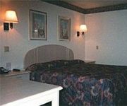
Winslow - Days Inn
Videos from this area
These are videos related to the place based on their proximity to this place.
20120331_061036 Sunrise near Holbrook.mp4
Driving a 1975 International Loadstar 1700 dump truck from Las Vegas to Missouri. Sun rise near Holbrook AZ.
Friday Night Live
Friday Night Live! 23 March 2018 To contact me by e-mail; palerider50@gmail.com PaleriderTV Podcast https://anchor.fm/paleridertv Tubebuddy affiliate ...
Videos provided by Youtube are under the copyright of their owners.
Attractions and noteworthy things
Distances are based on the centre of the city/town and sightseeing location. This list contains brief abstracts about monuments, holiday activities, national parcs, museums, organisations and more from the area as well as interesting facts about the region itself. Where available, you'll find the corresponding homepage. Otherwise the related wikipedia article.
Joseph City, Arizona
Joseph City (elevation 5,000 ft) is an unincorporated community located in Navajo County, Arizona, United States. It is located on Interstate 40 about eighty miles east of Flagstaff and about thirty-five miles west of Petrified Forest National Park. In 2010, there were 1,386 inhabitants. It is the site of the Jack Rabbit Trading Post, a famous Route 66 landmark.


