Safety Score: 2,7 of 5.0 based on data from 9 authorites. Meaning we advice caution when travelling to United States.
Travel warnings are updated daily. Source: Travel Warning United States. Last Update: 2024-08-13 08:21:03
Discover LeChee
LeChee in Coconino County (Arizona) with it's 1,443 citizens is a city in United States about 1,870 mi (or 3,009 km) west of Washington DC, the country's capital city.
Local time in LeChee is now 11:28 AM (Tuesday). The local timezone is named America / Phoenix with an UTC offset of -7 hours. We know of 8 airports in the vicinity of LeChee, of which one is a larger airport. The closest airport in United States is Holbrook Municipal Airport in a distance of 35 mi (or 57 km), East. Besides the airports, there are other travel options available (check left side).
There is one Unesco world heritage site nearby. It's Grand Canyon National Park in a distance of 98 mi (or 158 km), North-West. Looking for a place to stay? we compiled a list of available hotels close to the map centre further down the page.
When in this area, you might want to pay a visit to some of the following locations: Holbrook, Flagstaff, Saint Johns, Globe and Prescott. To further explore this place, just scroll down and browse the available info.
Local weather forecast
Todays Local Weather Conditions & Forecast: 11°C / 52 °F
| Morning Temperature | -1°C / 30 °F |
| Evening Temperature | 9°C / 49 °F |
| Night Temperature | 6°C / 43 °F |
| Chance of rainfall | 0% |
| Air Humidity | 23% |
| Air Pressure | 1023 hPa |
| Wind Speed | Light breeze with 5 km/h (3 mph) from South-East |
| Cloud Conditions | Clear sky, covering 0% of sky |
| General Conditions | Sky is clear |
Tuesday, 3rd of December 2024
11°C (51 °F)
7°C (44 °F)
Few clouds, light breeze.
Wednesday, 4th of December 2024
11°C (51 °F)
7°C (44 °F)
Scattered clouds, light breeze.
Thursday, 5th of December 2024
10°C (50 °F)
6°C (43 °F)
Sky is clear, light breeze, clear sky.
Hotels and Places to Stay
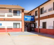
Rodeway Inn Winslow
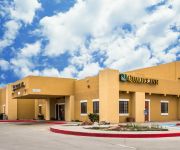
Quality Inn Winslow
Econo Lodge Winslow
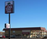
OAK TREE INN WINSLOW
THE LODGE
MOTEL 10
MOTEL 6 WINSLOW
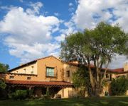
LA POSADA HOTEL
BEST WESTERN PLUS WINSLOW INN
Videos from this area
These are videos related to the place based on their proximity to this place.
Desert Flight: A Climbing Mom's Vacation
prAna Ambassadors Carrie Cooper and Jacinda Hunter escape the heat of the summer, the stress of work, the craziness of motherhood and run away to a climbing oasis. Learn more at www.
BNSF, La Posada, Winslow, AZ, September 2010
La Posada is a Harvey Houses designed by Mary Colter. She called La Posada her favorite as she had a free hand in its design. After years of use by the RR for storage and offices, the property...
Cratera do Meteoro (Cratera de Barringer)- Winslow
A Cratera do Meteoro está localizada perto de Winslow, no Arizona (EUA). A cratera tem mais de um quilômetro de diâmetro e 200 metros de profundidade. Foi formada há aproximadamente 50...
Zombie Bag #2 - Winslow, AZ
One more item is added to the Zombie Apocalypse Survival Bag. Everyone who gets pierced at ANOMALY between now and the airing of the last episode of AMC's The Walking Dead (3rd Season) will.
Westbound BNSF pushers on oilcan train @ Winslow AZ
Westbound BNSF pushers on oilcan train heading West out of Winslow AZ yard after crew change.
winslow day camp cub scouts
This is winslow cub scouts at their day camp. Which was a bike rodeo. 7 different pack were in attendanc on old route 66 distric.
benedicat tibi dominus
I wrote this for our daughter, Allison in honor of her high school graduation. Performed by the Winslow high school choir, directed by Kaye Ricks. "The LORD bless you and keep you; the LORD...
KCS Locomotive
A KCS locomotive bringing up the rear of a BNSF freight leaving Winslow, Az going west bound.
Videos provided by Youtube are under the copyright of their owners.
Attractions and noteworthy things
Distances are based on the centre of the city/town and sightseeing location. This list contains brief abstracts about monuments, holiday activities, national parcs, museums, organisations and more from the area as well as interesting facts about the region itself. Where available, you'll find the corresponding homepage. Otherwise the related wikipedia article.
Winslow West, Arizona
Winslow West is a census-designated place (CDP) in Coconino and Navajo counties in the U.S. state of Arizona. The population was 438 at the 2010 census. The entire community is off-reservation trust land belonging to the Hopi tribe. It lies just west of the city of Winslow, and more than 50 km south of the main Hopi reservation.
Winslow-Lindbergh Regional Airport
Winslow-Lindbergh Regional Airport is a city-owned public-use airport located one nautical mile (1.85 km) west of the central business district of Winslow, a city in Navajo County, Arizona, United States. The airport is included in the FAA's National Plan of Integrated Airport Systems for 2009–2013, which categorizes it as a general aviation facility. The U.S. Forest Service operates a firefighting Air Tanker base here.
KINO
KINO (1230 AM, "Route 66 Radio") is a radio station licensed to serve Winslow, Arizona, USA. The station is owned by Sunflower Communications, Inc. It airs a Country music format. Other programing consists of local news, weather and sports. Especially popular are live broadcasts of Winslow High School Bulldog Sports The station was assigned the KINO call letters by the Federal Communications Commission.


