Safety Score: 2,7 of 5.0 based on data from 9 authorites. Meaning we advice caution when travelling to United States.
Travel warnings are updated daily. Source: Travel Warning United States. Last Update: 2024-08-13 08:21:03
Delve into Dunaway Farms
The district Dunaway Farms of Calliston in Shelby County (Alabama) is a subburb in United States about 672 mi south-west of Washington DC, the country's capital town.
If you need a hotel, we compiled a list of available hotels close to the map centre further down the page.
While being here, you might want to pay a visit to some of the following locations: Birmingham, Columbiana, Centreville, Clanton and Jasper. To further explore this place, just scroll down and browse the available info.
Local weather forecast
Todays Local Weather Conditions & Forecast: 13°C / 56 °F
| Morning Temperature | 6°C / 42 °F |
| Evening Temperature | 9°C / 49 °F |
| Night Temperature | 6°C / 42 °F |
| Chance of rainfall | 0% |
| Air Humidity | 31% |
| Air Pressure | 1017 hPa |
| Wind Speed | Moderate breeze with 11 km/h (7 mph) from South-East |
| Cloud Conditions | Clear sky, covering 0% of sky |
| General Conditions | Sky is clear |
Friday, 22nd of November 2024
10°C (49 °F)
5°C (40 °F)
Sky is clear, gentle breeze, clear sky.
Saturday, 23rd of November 2024
13°C (56 °F)
7°C (45 °F)
Sky is clear, light breeze, clear sky.
Sunday, 24th of November 2024
18°C (64 °F)
10°C (50 °F)
Sky is clear, light breeze, clear sky.
Hotels and Places to Stay
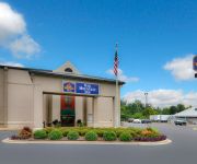
BW PLUS OAK MOUNTAIN INN
Fairfield Inn & Suites Birmingham Pelham/I-65
Hampton Inn - Suites Birmingham-Pelham -I-65-
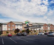
Holiday Inn Express BIRMINGHAM SOUTH - PELHAM
Candlewood Suites ALABASTER
Value Place Pelham
Holiday Inn Express & Suites ALABASTER
MICROTEL COTTONDALE TUSCALOOSA
Comfort Suites Pelham
Sleep Inn Pelham
Videos from this area
These are videos related to the place based on their proximity to this place.
Minecraft Pocket Edition PE 0.10.4 - Lifeboat Survival Games Alaskan Village
Again I try to redeem myself on the Lifeboat survival games server. I have a reputation for sucking at PVP, but hopefully I can change things this time.
Buck Creek Waterfall in Helena @ Papa Saia's
Davidson dam waterfall on Buck Creek which is a tributary to the Cahaba River located in Helena, AL.
Helena Flood March 2010
Ths Video is what is left of the Helena Water falls after the March Floods in Helena, Alabama http://www.helena-alabama.org.
Minecraft Pocket Edition PE 0.10.4 - Lifeboat Survival Games Alaskan Village
Today I try to redeem myself on the Lifeboat survival games server. I have a reputation for sucking at PVP, but hopefully I can change things this time.
Helena Snow Aerial Video Jan 2014
A brief video of aerial video at Helena High School on Jan 29th 2014.
April 7, 2014 Helena Flood in Old Town
From Helena's Old Town. Helena, AL flooding near the spillway.
Winn Dixie Parking Lot in Helena
Watching clouds in the Parking Lot in Helena, Alabama http://www.helena-alabama.org.
Videos provided by Youtube are under the copyright of their owners.
Attractions and noteworthy things
Distances are based on the centre of the city/town and sightseeing location. This list contains brief abstracts about monuments, holiday activities, national parcs, museums, organisations and more from the area as well as interesting facts about the region itself. Where available, you'll find the corresponding homepage. Otherwise the related wikipedia article.
Helena, Alabama
Helena is a city in Jefferson and Shelby Counties in the U.S. state of Alabama. Helena is considered a suburb of Birmingham and part of the Birmingham-Hoover Metropolitan Area. It is also one of three cities, along with Alabaster and Pelham, that make up the area known as "North Shelby" or "North Shelby County". As of the 2010 census the population was 16,793.
Alabaster, Alabama
Alabaster is a city and southern suburb of Birmingham in Shelby County, Alabama, United States. At the 2010 census the population was 30,352. According to the 2011 U.S. Census estimates, the city had a population of 30,799. Alabaster is still a growing population. Alabaster was ranked number 85 on Money Magazine's 100 Best Places To Live in 2009. http://money. cnn. com/magazines/moneymag/bplive/2009/snapshots/PL0100820. html
Pelham, Alabama
Pelham is a city and suburb of Birmingham in Shelby County, Alabama, United States. At the 2000 census the population was 14,369, but has grown to 21,352 recorded by the 2010 census. It was named for famed Confederate American Civil War officer John Pelham. An F2 tornado damaged business buildings in Pelham along with Indian Springs, Helena, and Inverness on Palm Sunday, March 27, 1994.
New Charter University
New Charter University is a private, accredited online university headquartered in San Francisco, California. New Charter University offers Associate, Bachelor's and Master's degrees in business, public policy and administration, and criminal justice. The university's courses are online and self-paced, meaning students can attend school when convenient and learn according to their own pace and personal learning style.
Riverchase Galleria
Riverchase Galleria, locally known as The Galleria, is a large super–regional shopping mall in the Birmingham suburb of Hoover, Alabama. It is the 43rd largest shopping mall in the United States. It is managed and partially owned by General Growth Properties and is Alabama's largest enclosed shopping center with 1,570,000 square feet of total retail floor area.
Robert Trent Jones Golf Trail
The Robert Trent Jones Golf Trail is a collection of championship caliber golf courses, designed by Robert Trent Jones, Sr. , distributed across the state of Alabama, as part of investments by the Retirement Systems of Alabama. The Trail started with 378 holes at eight sites throughout the state, but has grown to 468 holes at eleven sites. The concept was created and executed by Dr. David Bronner, CEO of the Retirement Systems of Alabama.
Hoover Metropolitan Stadium
Hoover Metropolitan Stadium (The Hoover Met), formerly known as Regions Park, is a minor league baseball park located in the Birmingham, Alabama, USA, suburb of Hoover. It was home of the Birmingham Barons of the Southern League from 1988 to 2012, replacing historic Rickwood Field in Birmingham. The stadium also serves as the home for the SEC Baseball Tournament, as well as the primary home for Hoover High School football.
Pelham Civic Center
Pelham Civic Complex is a 5,000-seat multi-purpose arena in Pelham, Alabama. It features two NHL size ice skating rinks with a holding capacity of 500 skaters, a skating school, ice skating birthday party rooms, and a multi-purpose banquet area. Its hockey capacity is 3,500; the arena has 17,000 square feet of floor space. It is the only public ice skating rink in the Birmingham, Alabama area.
Siluria, Alabama
Siluria is a community located in Shelby County, Alabama in the Birmingham-Hoover Metropolitan Area. It was the home of a large cotton mill and company-built mill village which began operations in 1896 and finally closed in 1979. The community has been annexed by the city of Alabaster. It's named for the Silurian geological period because of rocks found there.
Indian Springs School
Indian Springs School is a private school that includes grades eight through twelve with both boarding and day students. It is at the base of Oak Mountain, in Indian Springs Village, Shelby County, Alabama, United States.
Shelby County Airport, Alabama
Shelby County Airport is a public use airport located four nautical miles (7 km) southeast of the central business district of Alabaster, a city in Shelby County, Alabama, United States. It is owned by the Shelby County Commission. The airport is situated in the city of Calera, Alabama. This airport is included in the FAA's National Plan of Integrated Airport Systems for 2011–2015 and 2009–2013, both of which categorized it as a general aviation facility.
Bessemer Airport
Bessemer Airport is a city-owned public-use airport located three nautical miles (6 km) southeast of the central business district of Bessemer, a city in Jefferson County, Alabama, United States. According to the FAA's National Plan of Integrated Airport Systems for 2009–2013, it is categorized as a reliever airport for the Birmingham-Shuttlesworth International Airport. Although many U.S.
Hoover High School (Alabama)
This school takes its name from the city, which was named after founder William Hoover and not the former U.S. president. Hoover High School 280px Location 1000 Buccaneer DriveHoover, Alabama, USA Information Type Public Established 1994 Principal Don Hulin Faculty 208 Grades 9-12 Enrollment 2592 Campus Suburban Color(s) Orange, Black & White Mascot Buccaneers Hoover High School is a public high school in Hoover, Alabama, USA, serving grades 9-12.
Alabama's 6th congressional district
Alabama's 6th congressional district is a U.S. congressional district in Alabama, which elects a representative to the United States House of Representatives. It encompasses the counties of Chilton, Bibb and Shelby. It also includes parts of St. Clair County, Jefferson, Tuscaloosa, and Coosa counties. It almost surrounds the entire city of Birmingham, Alabama. It is currently represented by Republican Spencer Bachus.
Alabama Wildlife Center
The Alabama Wildlife Center is a wildlife rehabilitation center located in Oak Mountain State Park in Pelham, Alabama. It is the oldest and largest such center in the state. The center treats injured or orphaned wildlife from the greater Birmingham area and birds of prey from across the state. It treats approximately 2,500 animals each year.
Verizon Wireless Music Center (Pelham, Alabama)
Verizon Wireless Music Center (originally Oak Mountain Amphitheatre) is an outdoor amphitheater, owned by Live Nation, located in Pelham, Alabama, a few miles south of Birmingham. It is the largest outdoor music venue in Alabama. It is unusual in that it features three tiers of reserved seating, with no general admission seating area. John Mayer performed and recorded his show here, on September 12, 2002, which was later released as a CD/DVD, entitled Any Given Thursday.
Pelham High School
Pelham High School is a public high school located in Pelham, Alabama. Part of the Shelby County School System, Pelham was built in 1973 and opened in 1974. The school's mascot is "Paws" the Panther, and its colors are Forest Green and Vegas Gold.
WQCR
WQCR (1500 AM, "La 10 Q") is a radio station licensed to serve Alabaster, Alabama, USA. The station is owned by Rivera Communications, LLC. WQCR broadcasts a Regional Mexican music format to the Birmingham, Alabama, area. This station, WJHX, and WZGX comprise the "La 10 Q" radio network that covers central Alabama, north Alabama, and central Tennessee.
Riverchase Middle School
Riverchase Middle School is a public middle school located in Shelby County, Alabama. Approximately 1100 students attend between grades six through eight under principal Charles Smith.
Brock Gap
Brock Gap (variant Brock’s Gap) is a natural pass across Shades Mountain in Hoover, Alabama, most notable as being the location used by the South & North Railroad (S&N) to reach the Birmingham area in the late 19th century from the mineral deposits to the south, spurring economic development in the area.
Hillsboro Trail
The Hillsboro Trail is a rail trail in Alabama. The 12 feet wide trail extends 1.9 miles along the former roadbed of the Helena & Blocton branch line of Louisville & Nashville Railroad subsidiary Birmingham Mineral Railroad.
Thompson High School
Thompson High School is located in the city of Alabaster, Alabama. It is part of the Shelby County School District. The school mascot is the Warriors. The colors are red, white, and black. Thompson has approximately 1800 students. It participates in 6A level sports in Alabama. The mission of Thompson High School is to provide a safe learning environment that facilitates the instruction of students to empower them to reach their fullest potential academically, technologically, and individually.
Colonial Promenade Alabaster
The Colonial Promenade Alabaster is a lifestyle center that opened in 2005 and is located in Alabaster, Alabama, United States. The 1,000,000-square-foot shopping center is the largest in Shelby County and it was developed by Colonial Properties Trust. It was at the center of a nationally publicized controversy over the use of eminent domain to facilitate private commercial development.
Ryan, Alabama
Ryan is a populated place in Shelby County, Alabama, United States. The name was collected by the United States Geological Survey between 1976 and 1980, and entered into the Geographic Names Information System on September 4, 1980.
Evangel Christian School (Alabama)
is a state-registered K–12 church school in Alabaster, Alabama, USA, founded in 2004, with the purpose of providibg Christian education. Evangel Christian School operates under the legal and spiritual oversight of Evangel Church, PCA, as a Board-directed ministry. Athletics Colors: navy and silver. Nickname: Lightning. The purpose of the Evangel Christian School Athletic Program is to provide a challenging and enjoyable sports environment for our students that is distinctively Christian.


