Safety Score: 2,7 of 5.0 based on data from 9 authorites. Meaning we advice caution when travelling to United States.
Travel warnings are updated daily. Source: Travel Warning United States. Last Update: 2024-08-13 08:21:03
Discover Pine Orchard
The district Pine Orchard of Pell City in Saint Clair County (Alabama) is a district in United States about 632 mi south-west of Washington DC, the country's capital city.
Looking for a place to stay? we compiled a list of available hotels close to the map centre further down the page.
When in this area, you might want to pay a visit to some of the following locations: Talladega, Oneonta, Anniston, Columbiana and Gadsden. To further explore this place, just scroll down and browse the available info.
Local weather forecast
Todays Local Weather Conditions & Forecast: 13°C / 55 °F
| Morning Temperature | 5°C / 41 °F |
| Evening Temperature | 8°C / 47 °F |
| Night Temperature | 5°C / 41 °F |
| Chance of rainfall | 0% |
| Air Humidity | 30% |
| Air Pressure | 1016 hPa |
| Wind Speed | Moderate breeze with 11 km/h (7 mph) from East |
| Cloud Conditions | Clear sky, covering 0% of sky |
| General Conditions | Sky is clear |
Friday, 22nd of November 2024
10°C (49 °F)
5°C (41 °F)
Sky is clear, gentle breeze, clear sky.
Saturday, 23rd of November 2024
13°C (55 °F)
7°C (44 °F)
Sky is clear, light breeze, clear sky.
Sunday, 24th of November 2024
17°C (63 °F)
9°C (49 °F)
Sky is clear, light breeze, clear sky.
Hotels and Places to Stay
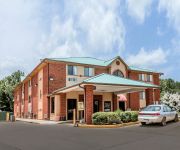
Holiday Inn Express & Suites PELL CITY
Hampton Inn Pell City
Quality Inn Pell City
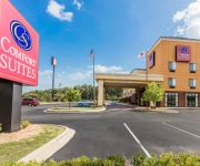
Comfort Suites Pell City
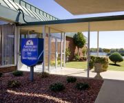
AMERICAS BEST VALUE INN
Videos from this area
These are videos related to the place based on their proximity to this place.
575 DEER TRACE RD, Pell City, AL 35125
575 DEER TRACE RD Pell City, AL Chad Camp Lovejoy Realty http://www.realestatebook.com/homes/listing/101-3002512925/refer=FP42A Seller will consider renting!...
Chase Robinson- Pell City v. Oxford 03172015 Batting - Triple
Chase Robinson, Junior @ Pell City High School - Hitting a Triple at the Pell City v Oxford Area Game March 17, 2015.
330 SEQUOYAH RD, PELL CITY, AL Presented by Josh Vernon.
Click to see more: http://www.searchallproperties.com/listings/2039187/330-SEQUOYAH-RD-PELL-CITY-AL/auto?reqpage=video 330 SEQUOYAH RD PELL CITY, AL 35128 Co...
1524 Martin Street South Pell City AL
http://myhzm.com/70503 This great opportunity is priceless The business offers a body shop with all the equipment remaining, paint booth, roll up doors, customer waiting room, fenced area,...
Pell City AL 3 BD/2 1/2 BA
http://myhzm.com/67385 If you love privacy and a peaceful setting in the middle of town you are going to love this house This four sided brick home is loc...
Pell City AL 3 BD/2 BA
http://myhzm.com/64841 If you want the country life, this is the house for you Sitting on 3 acres between Odenville and Pell City It has an interior that ...
Pell City AL BD/ BA
http://myhzm.com/45037 Perfect building lot in Mountain Crest Estates Incredible Views of the mountains with lots of hardwood trees on gently sloping lot ...
2015 Millcreek Warm Up Race Womens 12+ B/C Moto 1-Nicole Voorhees
Nicole Voorhees riding a 2015 Ktm 250f at Millcreek Mx in Pell City Alabama for the "Warm Up" race before the national. This was my first race on a 250f and I had a lot of fun!
Videos provided by Youtube are under the copyright of their owners.
Attractions and noteworthy things
Distances are based on the centre of the city/town and sightseeing location. This list contains brief abstracts about monuments, holiday activities, national parcs, museums, organisations and more from the area as well as interesting facts about the region itself. Where available, you'll find the corresponding homepage. Otherwise the related wikipedia article.
Branchville, Alabama
Branchville is a town in St. Clair County, Alabama in the United States. As of the 2000 census, the population of the town is 825.
Odenville, Alabama
Odenville is a town in St. Clair County, Alabama, United States. At the 2000 census the population was 1,131.
Ragland, Alabama
Ragland is a town in St. Clair County, Alabama, United States southeast of Ashville. At the 2000 census the population was 1,918. It is part of the Birmingham-Hoover-Cullman Combined Statistical Area. An F4 tornado struck from the southwest on Palm Sunday, March 27, 1994 at 10:55 a.m. At 11:27 a.m. , the National Weather Service of Birmingham issued a tornado warning for northern Calhoun, southeastern Etowah, and southern Cherokee counties.
Riverside, Alabama
Riverside is a town in St. Clair County, Alabama, United States. At the 2000 census the population was 1,564.
Lincoln, Alabama
Lincoln is a city in Talladega County, Alabama, United States. At the 2010 census the population was 6,266. It was named for Major General Benjamin Lincoln, who served in the American Army during the Revolutionary War.
Battle of Talladega
The Battle of Talladega was a battle fought between the Tennessee militia and the Red Stick Creek Indians during the Creek War, in the vicinity of the present-day county and city of Talladega, Alabama.
Logan Martin Lake
Logan Martin Lake is located in east central Alabama on the Coosa River approximately 30 miles east of Birmingham, Alabama. This 17,000-acre Coosa River reservoir was built in 1965 by Alabama Power Company. The lake, nicknamed Lake of a Thousand Coves by locals, has 275 miles of shoreline along its 48.5-mile length sandwiched between Logan Martin Dam on the south and Neely Henry Dam on the north. The depth of the lake is 35 to 110 feet with only five feet average water level variance.
Pell City High School
Pell City High School Established 1912 School type Public Principal Helene Bettinger Location Pell City, Alabama, USA District Pell City Grades: 9-12 Enrollment 1200+ Faculty 100 Nickname Panthers Colors black and gold Campus 1300 Cogswell Ave, Pell City, AL 35125 Website http://www. pellcityhigh. net
Talladega College
Talladega College, located in Talladega, Alabama, is a private, liberal arts college. It holds the distinction as Alabama's oldest private historically black college. As of 2009 the school received full SACS accreditation.
St. Clair County Airport
St. Clair County Airport is a public use airport located three nautical miles (6 km) southeast of the central business district of Pell City, in St. Clair County, Alabama, United States. It is owned by the St. Clair County Airport Authority. According to the FAA's National Plan of Integrated Airport Systems for 2009–2013, it is categorized as a reliever airport. for the Birmingham-Shuttlesworth International Airport.
WFHK
WFHK is a radio station licensed to serve the community of Pell City, Alabama, USA. The station broadcasts to the greater Birmingham, Alabama, area. The station is owned by Stocks Broadcasting, Inc. WFHK airs a Country music format and features programming from ABC Radio.
WPPT
WPPT was an American radio station formerly licensed to serve the community of Talladega, Alabama. The station, established in 1945, was last owned by Birmingham Christian Radio, Inc. Due to transmitter damage caused by a lightning strike, WNUZ was temporarily off the air from August 2008 through August 2009.
Minden, Alabama
Minden is a ghost town in Calhoun County, Alabama, United States. It possessed a post office from 1878 to 1879.
WOIL-LP
WOIL-LP is a low-power television station in Talladega, Alabama, broadcasting locally on UHF channel 47 as an affiliate of Daystar.
St. Clair County, Alabama
St. Clair County is a county of the U.S. state of Alabama. It is a part of the Birmingham–Hoover–Cullman Combined Statistical Area. Its name is in honor of General Arthur St. Clair, who came to America from Scotland as an officer in the British Army in the French and Indian War where he victoriously fought against the French in such notable British victories as the siege of Louisburg, Nova Scotia and the Battle of the Plains of Abraham.
Alabama Institute for the Deaf and Blind
The Alabama Institute for Deaf and Blind (AIDB) is a school for people with blindness and/or deafness operated by the U. S. State of Alabama in the city of Talladega. The current institution includes the Alabama School for the Deaf, the Alabama School for the Blind, and the Helen Keller School, named for Alabamian Helen Keller, which serves children who are both deaf and blind. The E. H.
WKRE
WKRE (88.1 FM, "Revocation Radio") is an American non-commercial educational radio station licensed to serve the community of Argo, Alabama. The station, established in 2011, is owned and operated by TBTA Ministries.
Federal Correctional Institution, Talladega
The Federal Correctional Institution (FCI Talladega) is a medium-security United States federal prison for male inmates in Alabama. It is operated by the Federal Bureau of Prisons, a division of the United States United States Department of Justice. The facility also includes an adjacent minimum-security satellite camp that also houses male offenders. FCI Talladega is located approximately 50 miles from Birmingham, Alabama and 100 miles from Atlanta, Georgia.


